Welcome to Geotech!

GER Series 2D Ground Penetrating Radar


PRODUCT PARAMETERS
Description
 Abstract
GER Series 2D Ground Penetrating Radar is one portable, intelligent, high performance and full digitalize ground penetrating radar main machine, compatible GER T whole series antennas, support most of the GPS equipment, stable and reliable complete Chinese collect system which based on Windows system are in accordance with operating habits of field operators, it has advantages at easy to carry, simple operation, better data quality and high collect efficiency, etc, widely applied in tunnel engineering, road engineering, water conservancy engineering, bridge engineering, civil engineering, military and archaeology areas.
Applications

● Tunnel engineering:Lining, laying quality inspection, outstrip early report, inverted arch quality inspection, etc
● Road engineering:Structure layer thickness inspection, cracks inspection and roadbed fail and harm inspection, etc
● Water conservancy engineering:Water source research, ice layer detection and water bottom structure detection, etc
● Bridge engineering:Concrete iron fix position, steel twist wire fix position, concrete fail and harm inspection, etc
● Civil engineering:Pipeline fix position, road cavity inspection and road structure inspection, etc
● Geology survey:Rock melt detection, frozen earth detection and stratum form detection, etc
● Military:UXO detection, underground defense works detection and life detection, etc
● Archaeology:Historic ruins detection imaging and guide digging etc
Features
● Intelligent host, automatically identifies antenna type and configures radar parameters.
● Saves original data and has the function of restoring on-site data.
● Supports external GPS to add geographic coordinate information to radar data.
● Digital signal transmission is used between the host and the antenna, with strong anti-interference ability and high data signal-to-noise ratio.
Detailed description
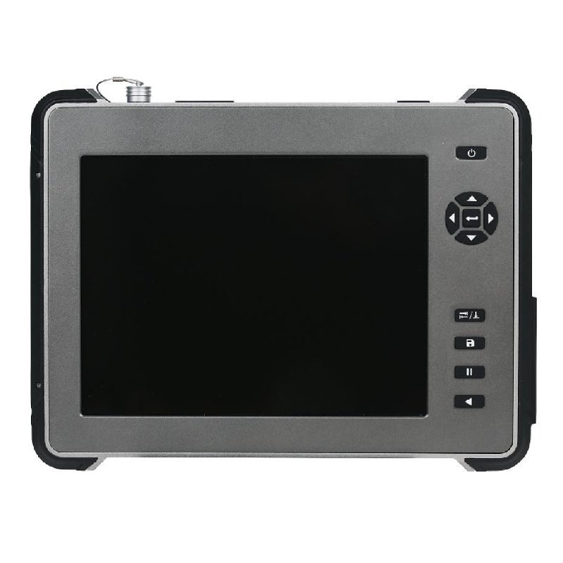
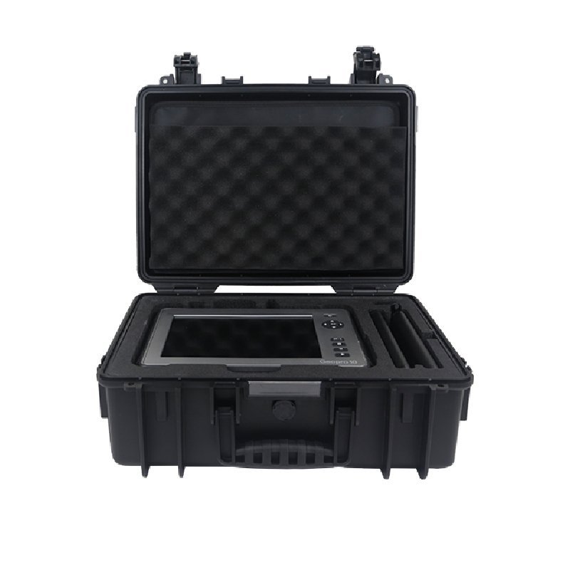
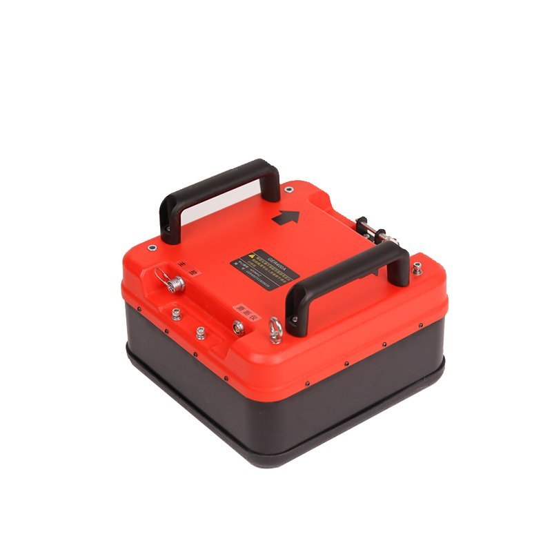
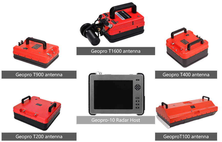
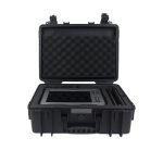
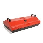
GER 10 is the mainframe of the entire General Ground Penetrating Radar. When used in combination with antennas of different specifications, it can meet the different needs of users in a variety of detection scenarios. The antennas we provide are diverse in type, fully functional, and cover a wide frequency range, with a center frequency covering 35MHz to 2500MHz.
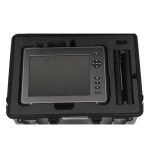
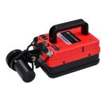
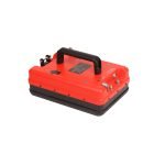
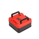
(一)GER 10 radar main machine
Radar index
| Item | Parameters |
| Antenna | Compatible GER T whole series antennas |
| Channel quantity | 1 channel |
| Memory space | 128G |
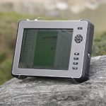
| Indicator | 10.4”, 1024×768 pixel resolution ratio, 32 bytes color LED display screen |
| GPS | (Series RS232), support GPGGA data format |
| Display mode | False color, gray level, stacking wave and color stacking wave |
| Power supply | Interior install lithium battery(NI2040) |
| Power consume | 20W |
| Continue working time | 5 hours(actual working time relate to working temperature, antenna types and cable length) |
Data collecting
| Item | Parameters |
| Data format | SRD |
| Modulus adapter bytes | 16 bit |
| The max scanning speed | 512 scanning/s(sampling points number is 512) |
| Sampling points number | 256, 512, 1024, 2048, 4096, 8192 |
| The max launch frequency | 800kHz |
| Collecting mode | Time mode, distance mode and point measure mode |
| Time window range | 1~8000ns |
| Gain range | -10dB~160dB |
| Gain adjustment point quantity | 9 points |
| Real time process function | Correct zero dqgveviation, FIR filtering wave, IIR filtering wave, background eliminate, ever among ways, data overlying |
Exterior installed terminal
| Item | Parameters |
| Data transmission | USB 3.0 |
| GPS | Series (RS232) |
| Main control | 8 needles aviation socket |
Machine index
| Item | Parameters |
| Volume | 314mm×238mm×64mm |
| Weight | 3kg (without battery) |
Environment index
| Item | Parameters |
| Working temperature | -20℃~+50℃ |
| Storage temperature | -40℃~+60℃ |
| Working humidity | <95%, not condensate |
| Protection level | IP65 |
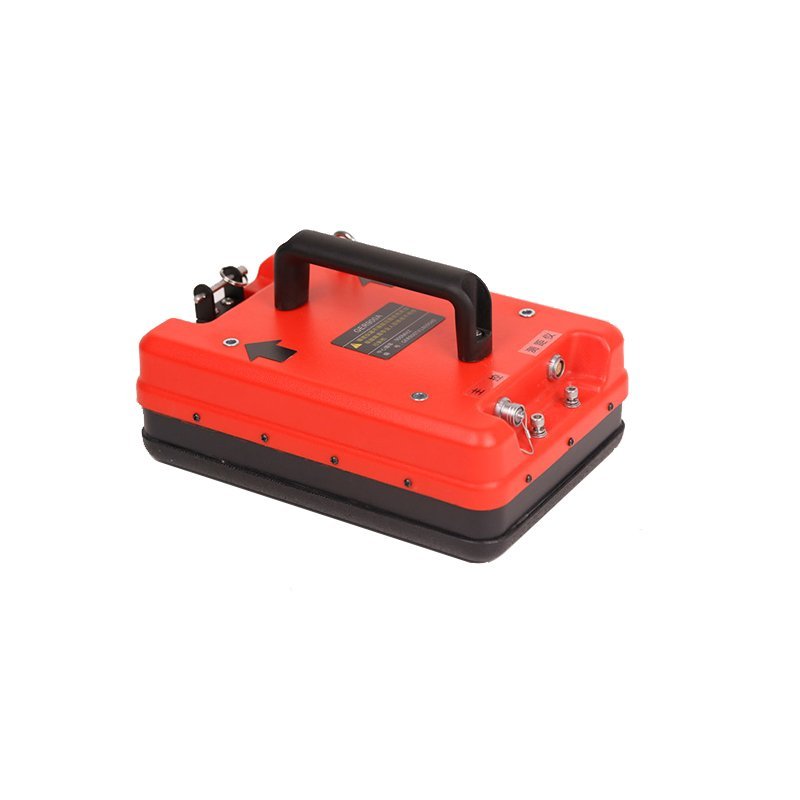
(二)Radar T-series antenna
GER T2500 ground coupling antenna
Application areas:Building structure detection, road surface layer detection and bridge engineering, etc.
| Volume | 250mm×170mm×150mm | Weight | 1.3kg |
| Center frequency | 2500MHz | The max launch frequency | 400kHz |
| Depth range | 0.1~0.3m | Coupling method | Ground coupling |
GER T1600 ground coupling antenna
Application areas:Building structure detection, road surface layer detection and bridge engineering, etc.
| Volume | 250mm×170mm×150mm | Weight | 1.3kg |
| Center frequency | 1600MHz | The max launch frequency | 400kHz |
| Depth range | 0.2~0.5m | Coupling method | Ground coupling |
GER T900 ground coupling antenna
Application areas:Tunnel lining, laying quality inspection, roadbed fail and harm inspection, building structure detection, etc
| Volume | 316mm×216mm×170mm | Weight | 2.3kg |
| Center frequency | 900MHz | The max launch frequency | 400kHz |
| Depth range | 0.5~1.5m | Coupling method | Ground coupling |
GER T400 ground coupling antenna
Application areas:Tunnel lining, laying quality inspection, roadbed fail and harm inspection, city pipeline detection, water source and hydroelectricity engineering, etc.
| Volume | 316mm×316mm×230mm | Weight | 3.6kg |
| Center frequency | 400MHz | The max launch frequency | 400kHz |
| Depth range | 1~4m | Coupling method | Ground coupling |
GER T200 ground coupling antenna
Application areas:Tunnel lining, laying quality inspection, inverted arch quality inspection, city pipeline detection, water source and hydroelectricity engineering, roadbed fail and harm inspection, building structure detection, ground survey etc.
| Volume | 500mm×500mm×230mm | Weight | 6.4kg |
| Center frequency | 200MHz | The max launch frequency | 400kHz |
| Depth range | 1~4m | Coupling method | Ground coupling |
GER T100 ground coupling antenna
Application areas:Tunnel geology outstrip early report, mineral survey, water source and hydroelectricity engineering, etc.
| Volume | 980mm×560mm×320mm | Weight | 13.6kg |
| Center frequency | 100MHz | The max launch frequency | 100MHz |
| Depth range | 1~30m | Coupling method | Ground coupling |
(三)Ground penetrating radar data process explain software
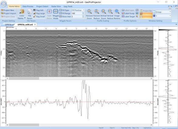
GER series ground penetrating radar data process explain software GER Projectoris one syn data process software which aim at GER series common ground penetrating radar, able to process the operations like data transmit, data loading, data display and data process the ground penetrating radar data which collected by GER series products and international main other formats ground penetrating radar data, convenient for user find the abnormal information in the radar data and generate the follow report documents which are in accordance with national standards, this is one important tool for GER series ground penetrating radar data process and analyse. The whole interface of software shown as the picture:
Function
The software divided into “Menu column”, “Engineering column and source manager column”, “Radar section area”, “Amplitude curve, layer thickness curve, abnormal distribute diagram output column”, “Single way column” and “Status column”, total 6 display areas, finish the syn analyse the radar data through check the content in each area. The main function of this software as below:
| Item | Parameters |
| Document management | Open, close and save, data split and merge, data format transmit, bitmap output, batch process |
| Homepage menu | Engineering setting, document parameter, stacking wave shape, section rooming, section edit, window method |
| Data process | Section process, data standard, zero pint gain, data filtering wave, high grade process |
| Engineering detection | Layer position detection, abnormal detection, target detection |
| Section imaging | Assembly data, data process |
| Convenient tools | Help file, edition instruction, common tools |
Features
- Project-Based Data Orchestration
- Aggregate multi-phase survey data per project, auto-generate time-series comparisons for road subsidence/pipeline aging analysis
- 80% faster data retrieval vs. traditional folder systems
- 3D Visualization Powerhouse
- Pseudocolor mapping: Precisely outline bedrock/void boundaries (e.g., 2m-diameter void at 3m depth)
- Color-stacked wave algorithm: Enhances low-frequency antenna data clarity, resolves sand-clay layers at 50m depth
- 40% higher imaging efficiency than industry average
- No-Code Intelligent Processing
- 20+ built-in international algorithms (ASTM/GB50021), dual-mode operation (3-step simple mode & professional mode)
- Batch processing: Auto-analyze 100+ GPR datasets in one click, 5x faster night-shift efficiency
- ISO-Standard Report Generator
- Auto-detect layer thickness (error ≤0.5cm) and defect zones, supports manual refinement
- Built-in [Urban Road Code] templates, generate 3D-report in 10min, cut 80% paperwork
Cases
(一)Road application cases
Adopt GER T900 antenna process quick detection at distance about 6cm aim at concrete structure road’s high damping characteristic road, able to continue and quickly detect the concrete thickness in the concrete road and defaults, process whole evaluation at concrete road. Also can adopt this method to detect the road structure layerand deep roadbed, obtain the structure layer thickness and defaults of road.


(二)Tunnel application cases
Ground penetrating radar as one main scientific instrument of tunnel engineering inspection, widely applied in the geology outstrip early report, lining, laying quality inspection, inverted arch quality inspection and the lining, laying harm inspection (empty, cavity and not density) during operation. The ground penetrating radar not only can improve the safety factor of tunnel engineering inspection, but also validly guarantee the scientific and reliable of tunnel engineering inspection data, very important performance in the tunnel engineering inspection application.
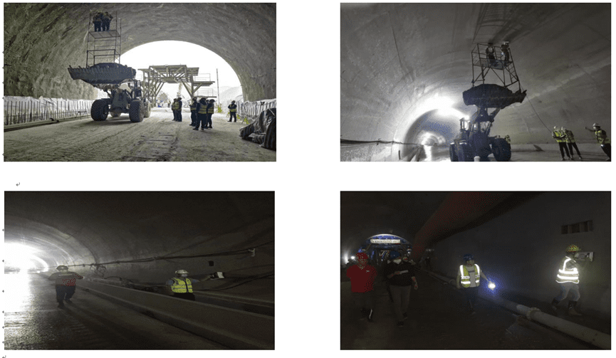
1、Initial support inspection
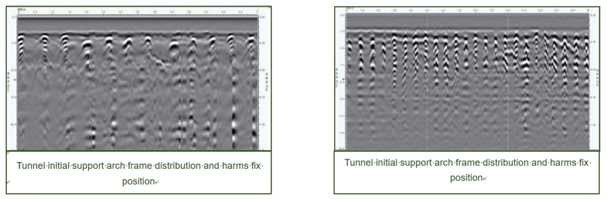
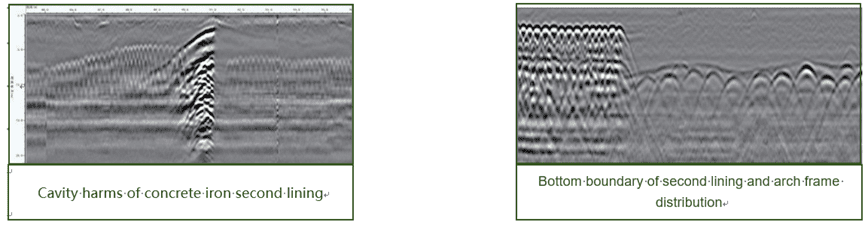
2、Second lining inspection
Use 900MHz and 400MHz antenna can inspect the second lining of concrete iron second lining and harms in the concrete iron second lining (empty, cavity and not solid) and lining, laying thickness.
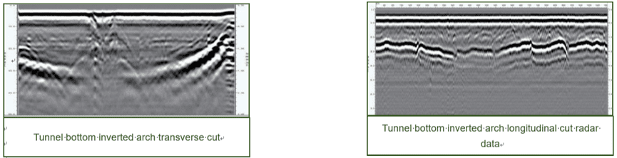
3、Inverted arch
Use GER T400 and GER T200 antenna can inspect the thickness of inverted arch concrete and concrete not solid.
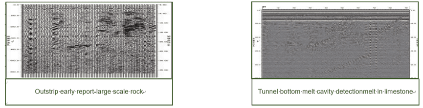
4、Outstrip early rep
Use 100MHz antenna at point detection and big depth overlap mode can valid detect the geology harms like rock melt, broken layer and crack which at the front of tunnel face.
5、ridge and building structure

FAQ
In gravity exploration (SI), what is the unit of gravity? How to convert gravity units between SI and CGS?
What are gravitational field and gravitational potential?
What is the normal gravity field of the earth? What are the rules for the change of the normal gravity field with latitude and altitude?
What is the relationship between gravitational field strength and gravitational acceleration?
What is gravity exploration?