Welcome to Geotech!

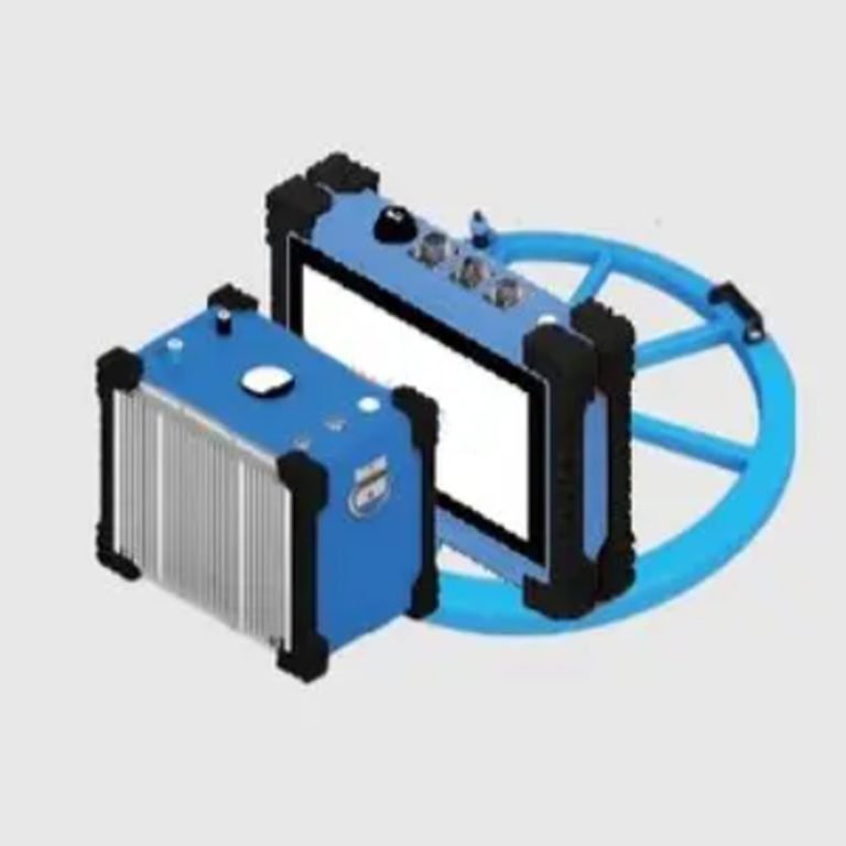
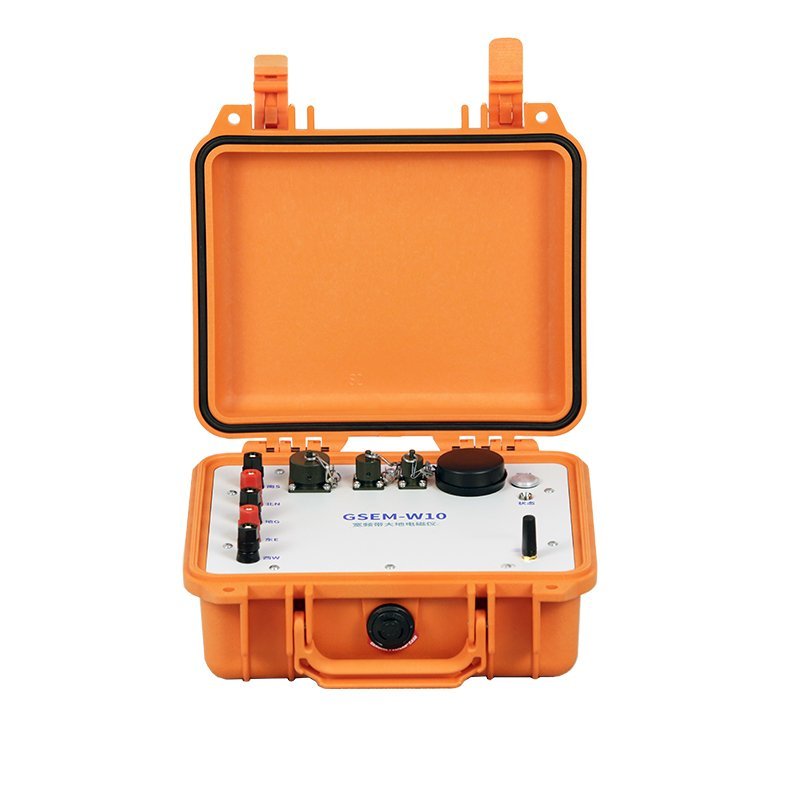
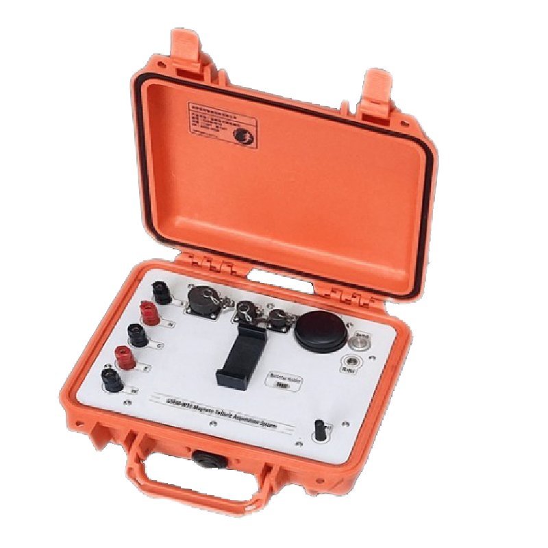
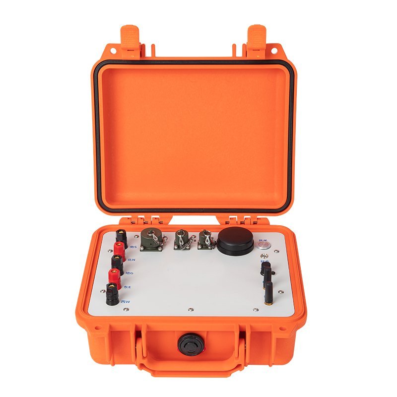
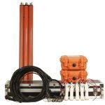
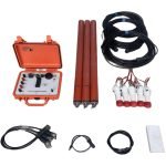
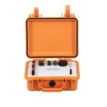
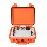
GSEM-W10 Magneto-telluric Acquisition System


PRODUCT PARAMETERS
Description
GSEM-W10 Magneto-telluric (MT) Acquisition System
 Abstract
The GSEM Magneto-telluric (MT) Acquisition System is using the latest power and electronic circuit technology, it has the advantages of high precision, low power consumption, strong anti-interference, light equipment and long networking distance. GSEM series collection station can be compatible with various external sensors, carry out MT, AMT, CSAMT and other methods, and use the configured long-distance wireless sensor technology to realize site self-organizing network and distributed construction in mountainous areas, and can complete large-scale construction at a very low cost 2D and 3D exploration.

Applications
● Exploration of metal minerals (copper, gold, silver, lead, zinc, molybdenum, tungsten, tin, antimony, etc.).
● Exploration of non-metallic minerals (graphite, pyrite, salt mine, phosphate mine, etc.).
● Exploration of groundwater, geothermal, etc.
● Exploration of karst, goaf, landslide, etc.
● Exploration of oil and gas.
● Basic research on volcanoes, earthquakes, microbial activities, bird reef evolution, etc.
● Basic research on geological structure, crustal evolution, etc.
Function
● Full waveform array acquisition of magnetotelluric signals.
● Fast parallel calculation of impedance estimation.
● Time series analysis.
● Spectrum and correlation analysis.
● Analysis of instrument host and magnetic rod response.
● Checkpoint and consistency error calculation.
● Data quality statistics.
● Curve book printing.
Features
● Low Power Consumption
With a 20000mAh light 5V output Power Bank support working 2days MT survey
Only 2.5W with 3 sensors
● Low background Noise
3nV/sqrt(Hz) @ 1000Hz AMT
5nV/sqrt(Hz)@ 1Hz MT
● IoT long distance communication
With ZigBee technology, It support 1.6km communication
● AI Impedance estimate
Through the AI learning of much data, the supporting software can realize the automatic adjustment of expert level impedance data
● High Power transmitter
Transmitter 10kw(1000V/10A),50kw(1000V/50A))
Full-wave Current Record
Parallelable Rectifier Source (10A,up to 200A)
● Fit for all kinds of Magnetic Sensors
Fit for Phoenix Serial Magnetic Sensors
Detailed description
(一)Why we want to develop new generation IoT MT device ?
Previous MT device problem as following:
- The use of battery power supply (V5-2000, ADU-07, etc.), heavy instruments, construction labor intensity, construction in mountainous areas of low production efficiency
- The use of built-in battery power (Aether), often can not pass the aviation safety inspection, the cargo cycle is long
- One operator can control only one instrument, and large-scale construction is costly
- MT impedance estimation also requires manual knitting points and smooth, low production efficiency
IoT MT device Goal and Idea :
- The device power supply by wide-spread 5V power Bank,It was easy transport by Air
- Based on the ZigBee Tech, a single operator can control more than 200 MT device
- Using the latest low noise amplifier and ADC, the instrument noise is controlled lower 5nV/sqrt(Hz)
- Adopt DSP real-time processing, real-time 50/60Hz multi-notch, multi-band data real-time output
- MT impedance estimation based on artificial intelligence can output MT impedance data of expert-level points directly
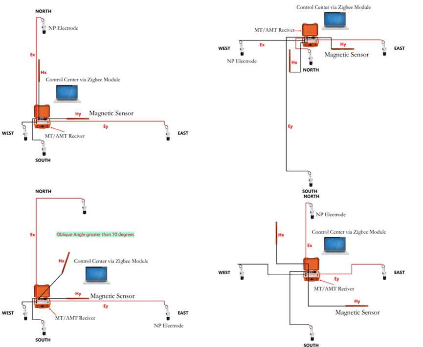
(二)Layout The GSEM system supports audio magnetotelluric (AMT), MT or LMT and controlled source audio magnetotelluric (CSAMT) observations. The AMT and MT or LMT observations generally adopt a cross-shaped device, and the CSAMT observation device of controlled source audio magnetotelluric.

Specifications
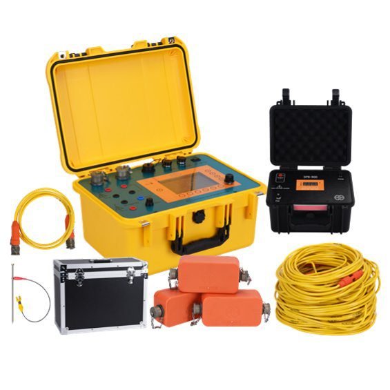
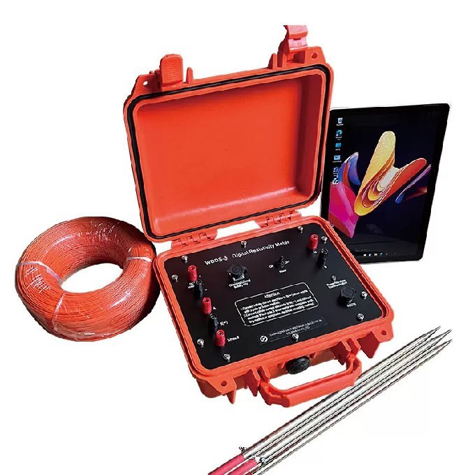
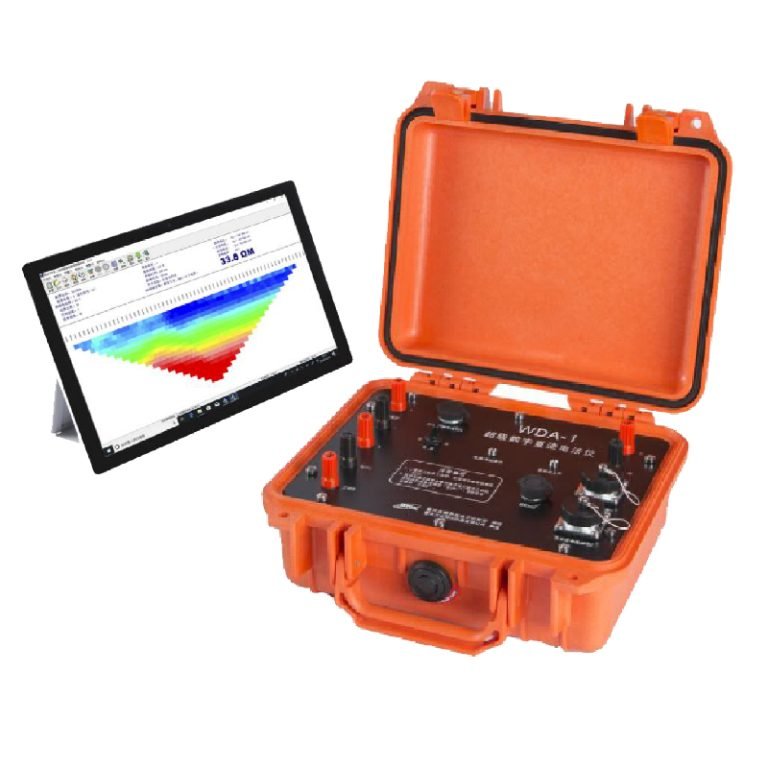
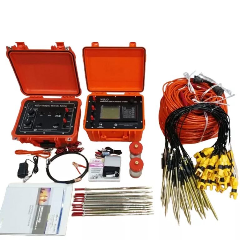
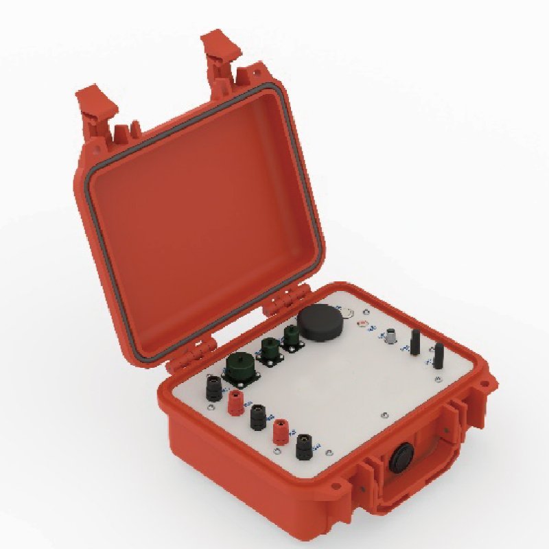
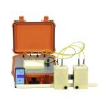
1. Receiver(AMT&MT Host)
| Item | AMT host | MT host |
| Number of channels | 5(Ex、Ey、Hx、Hy、Hz) | 5(Ex、Ey、Hx、Hy、Hz) |
| Bandwidth | 1Hz ~ 10kHz | DC~1kHz |
| Gain | 0.1,1,3,9 optional | MT mode 0.1,1,16, 64 |
| GPS synchronization accuracy | 30ns | 30ns |
| ADC bit number | 32-bits | 32-bits |
| Total dynamic range | 160dB | 160dB |
| Single-machine power consumption | <2.5W | <2.5W |
| Sampling frequency | 150Hz/ 2400Hz/ 24000Hz | 15Hz/ 150Hz/ 2400Hz |
| Acquisition method | Parallel collection of 3 frequency bands, supporting real-time digital filtering | Parallel collection of 3 frequency bands, supporting real-time digital filtering |
| Connection | Support Ethernet and WiFi measurement and control | Support Ethernet and WiFi measurement and control |
| Power supply | Supports universal power bank power supply | Supports universal power bank power supply |
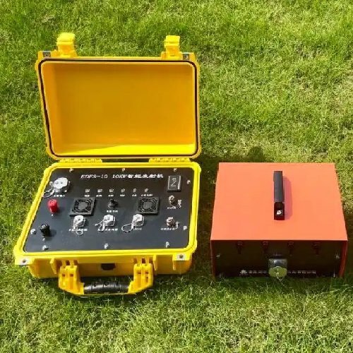
2. Transmitter
| Item | Parameters |
| Max Voltage | 1000V(2000V,3000V,4000V,Optional need serial connect) |
| Max Current | 3~250A Optional |
| Composite | Support Serial and Parallel |
| Frequency | 1/8192-8192Hz |
| Transmitter Wave | Programmable Support Time Domain and Frequency Domain |
| GPS Sync Accuracy | +30ns |
| Connect | Wi-Fi, ZigBee(max to 1.6km),Internet |
| Operating Temperature | -40℃~60℃ |
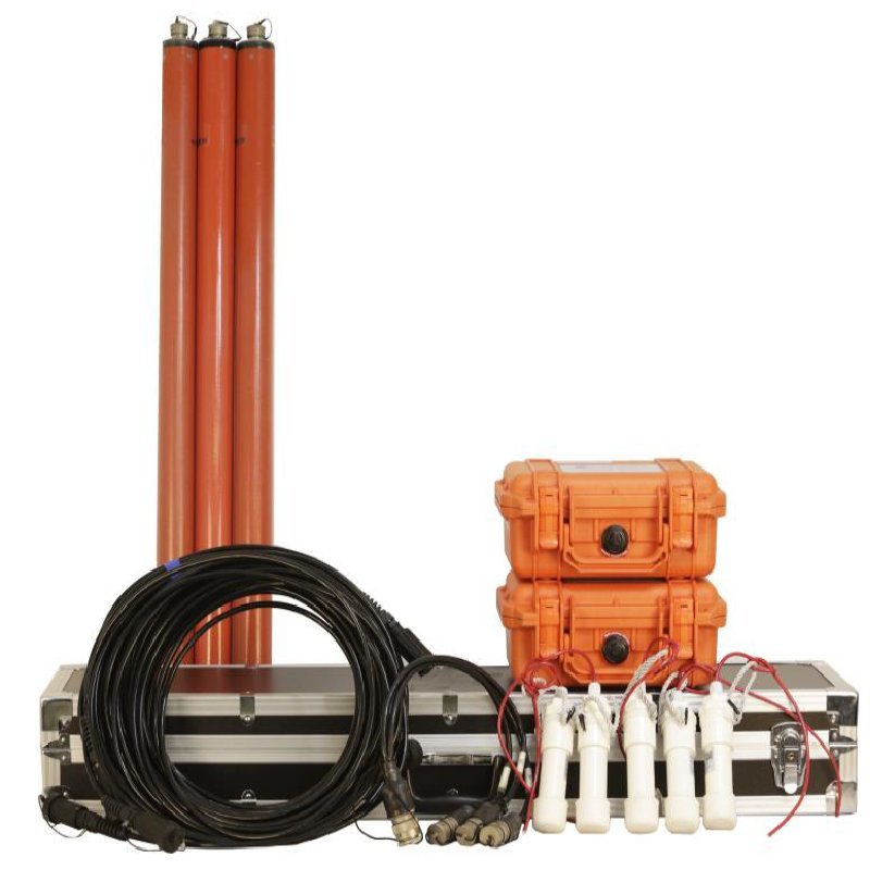
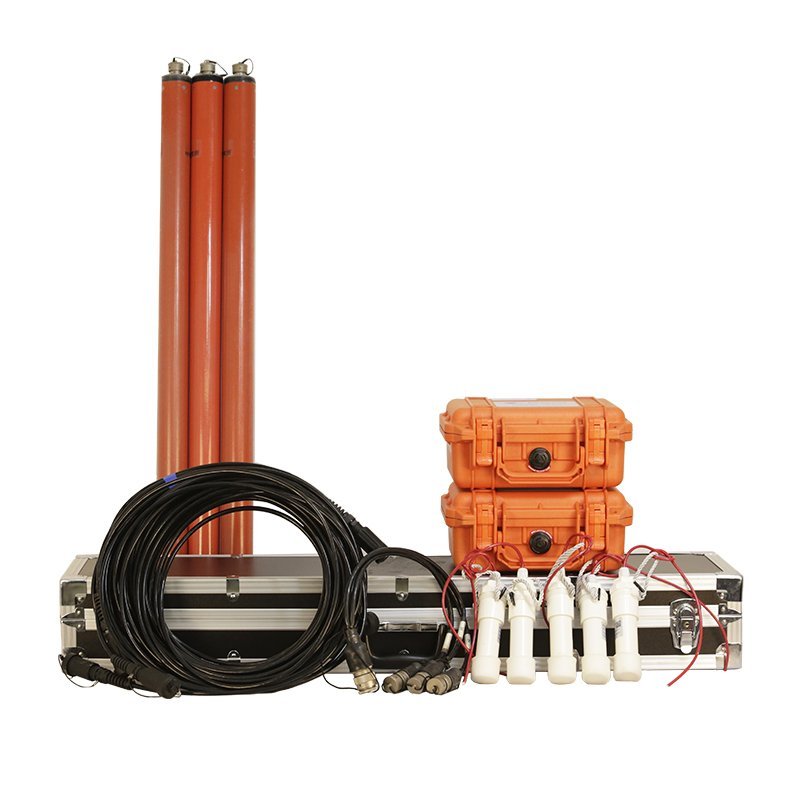
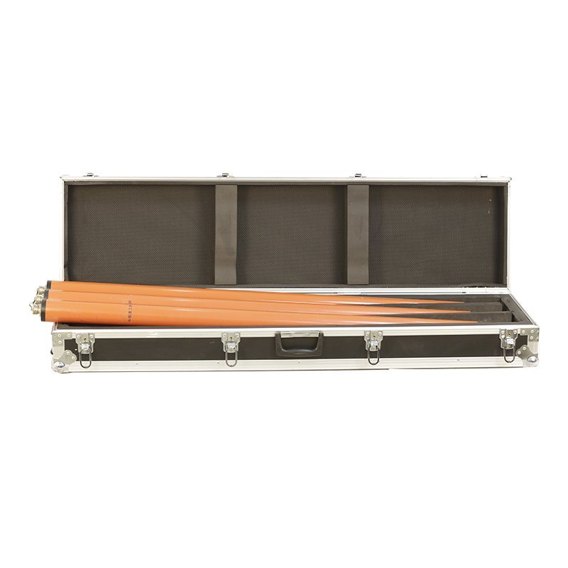
3、MT/AMT broadband magnetic rod CMS-01& CMS-04
| Item | CMS-01 | CMS-04 |
| Frequency range | 0.0001 Hz~10 kHz | 0.1 Hz~20 kHz |
| Output sensitivity | 0.2 V /(nTxHz) f≤4 Hz 0.8 V /nT f≥4 Hz | 0.001 V /(nTxHz) f≤20 Hz 0.02 V/nT f≥20 Hz |
| Weight | 8.5 kg | 3.0 kg |
| Dimensions | length 1250 mm, diameter 75 mm | length 760 mm, diame ter 63 mm |
| Power consumption | 800 mW | 800 mW |
| Working temperature | -35°C~70°C | -35°C~70°C |
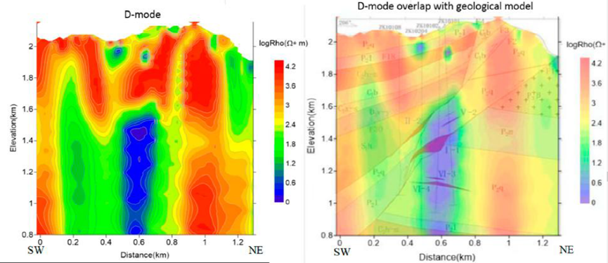
Case study
AMT survey (Pb-Zn deposit)
2D inversion models of AMT data resolved by TE mode,TM mode, and D mode, obtained by ZondMT2D focused inversion and the overlap of the D- mode model with the geological model from Figure 3b. TE mode RMS =18.1%.TM mode RMS=9.7%. D-mode RMS=9.1%.
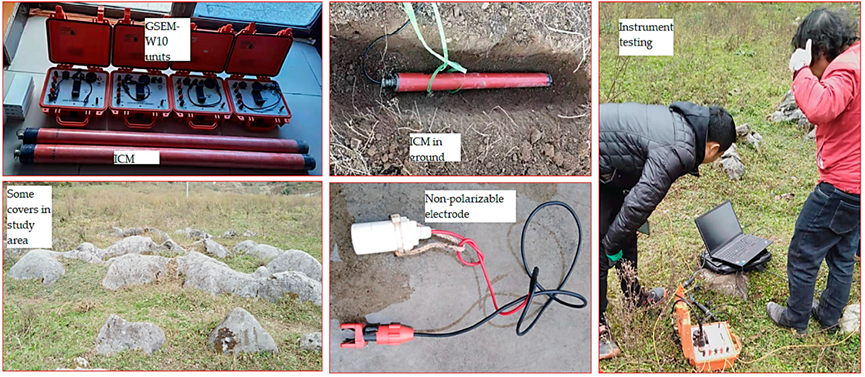

Details provided by: Geotech, Leo.Li
To view the entire detailed introduction, please visit the following link.
FAQ
In gravity exploration (SI), what is the unit of gravity? How to convert gravity units between SI and CGS?
What are gravitational field and gravitational potential?
What is the normal gravity field of the earth? What are the rules for the change of the normal gravity field with latitude and altitude?
What is the relationship between gravitational field strength and gravitational acceleration?
What is gravity exploration?