Welcome to Geotech!

Breakthrough in Deep-Layer Detection: High-Precision Application of JPMG Proton Magnetometer for Magnetic Anomaly Detection in 50m Overburden Layers
1. Introduction
With accelerated urbanization and increasing resource exploration depths, magnetic anomaly detection in shallow overburdens has gained significance in environmental geology, urban geological surveys, mineral exploration, engineering investigations, and archaeological prospecting. Traditional magnetometers face challenges in detection depth, resolution, and anti-interference capabilities. To address these needs, Geotech Instrument Co., Ltd. introduces the JPMG Proton Magnetometer, providing high-precision solutions for magnetic anomaly detection within 50m overburden layers.

2. Overview of Magnetic Exploration Technology
2.1 Genesis of Magnetic Anomalies
Magnetic minerals (e.g., magnetite, hematite, titanomagnetite) exhibit varying magnetization intensities under Earth’s magnetic field, causing local magnetic variations (“magnetic anomalies”). In 50m overburden environments, these signals are typically attenuated by surface disturbances, EM interference, and anthropogenic factors, complicating detection.
2.2 Challenges in Overburden Magnetic Survey
• Surface interference (structural steel, pipelines)
• Topographic effects on data consistency
• Weak signals requiring high-sensitivity magnetometers
• Balancing detection precision with spatial resolution
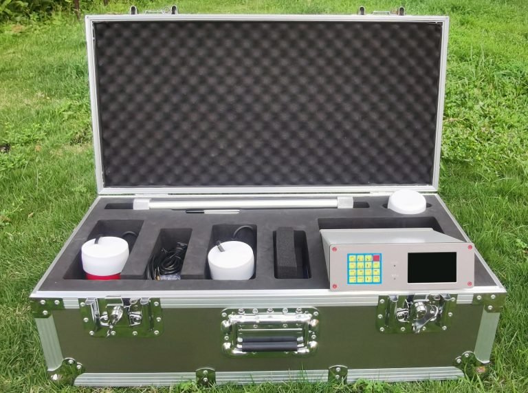
3. Technical Advantages of JPMG Proton Magnetometer
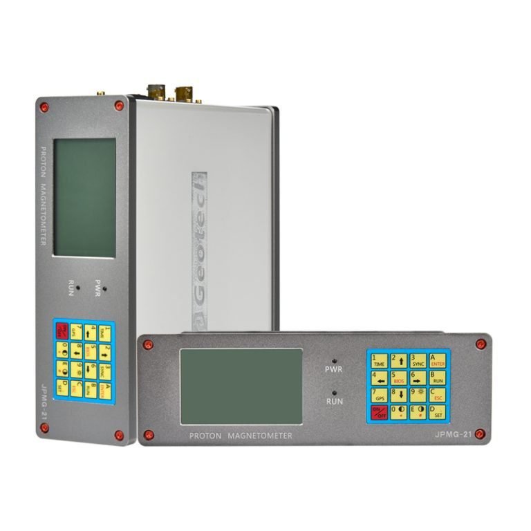
3.1 Operating Principle
Utilizing nuclear magnetic resonance (NMR) technology, JPMG measures magnetic flux density through hydrogen proton precession frequency in geomagnetic fields, achieving ±0.1nT accuracy – the most stable absolute magnetometer currently available.
3.2 Core Technical Specifications
| Parameter | Specification |
|---|---|
| Measurement Range | 20,000-100,000 nT |
| Accuracy | ±0.1nT |
| Noise Suppression | <0.05nT |
| Sampling Rate | Up to 10Hz |
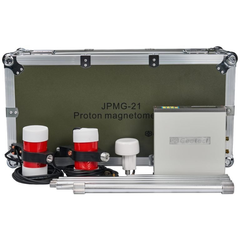
| Probe Cable Length | >30m extension |
| Power Supply | Rechargeable Li-ion battery (>30h operation) |
3.3 Deep Overburden Detection Performance
Maintains reliable anomaly identification in complex geological conditions (soft soil, weathered crust, fill materials) through:
• Digital filtering + AGC technology for noise suppression
• Temperature-stable operation for prolonged surveys
• Integrated GPS navigation and auto-positioning system
4. Typical Application Cases
Case 1: Urban Pipeline Avoidance Survey
Background: Pre-construction survey for Metro Line 2 in East China coastal city requiring non-destructive detection of subsurface structures (<50m depth).
Implementation:
- 5m line spacing with 1m station intervals
- GPS-synchronized positioning
Results: - Identified buried pipelines and steel pile foundations
- 3D anomaly mapping guided construction planning
Case 2: Shallow-buried Iron Ore Delineation
Background: Weathered gravel overburden (30-50m) in North China concealing potential iron deposits.
Method:
- 2m×0.5m grid survey with Geosoft data processing
Verification: - Drilling confirmed ore bodies matching magnetic anomalies
- Enhanced SNR compared to conventional magnetometers
5. Engineering Value Across Applications
| Application | Value Proposition |
|---|---|
| Mineral Exploration | Ore boundary delineation, reducing drilling costs |
| Engineering Geology | Subsurface structure identification |
| Environmental Geology | Illegal waste disposal detection |
| Archaeology | Cultural relic localization |
6. Competitive Analysis
| Parameter | JPMG | Competitor X | Advantage |
|---|---|---|---|
| Accuracy | ±0.1nT | ±0.2nT | Superior resolution |
| Sampling Rate | 0.5s/point | 1s/point | Faster scanning |
| Interface | Chinese GUI | English LCD | Localization advantage |
| Price | Moderate | High | Cost-effectiveness |
7. Integrated Exploration & Future Trends
7.1 Multi-method Integration
- ERT/IP for comprehensive geoelectrical-magnetic imaging
- Seismic reflection for structural interface analysis
7.2 Intelligent Platform Integration
- UAV-mounted aerial magnetic surveys
- Cloud-based data synchronization
- Multi-sensor fusion (LiDAR/hyperspectral)
7.3 Technical Evolution
- Enhanced sensitivity (<0.05nT)
- AI-driven anomaly recognition
- Environmentally-friendly field operations
8. Conclusion
The JPMG Proton Magnetometer demonstrates exceptional performance in 50m overburden environments through its high-precision measurement, anti-interference capabilities, and intelligent data management. As geological exploration enters the era of AI and unmanned operations, JPMG’s platform compatibility positions it as a next-generation solution for multi-scenario applications.