Welcome to Geotech!

Industry News
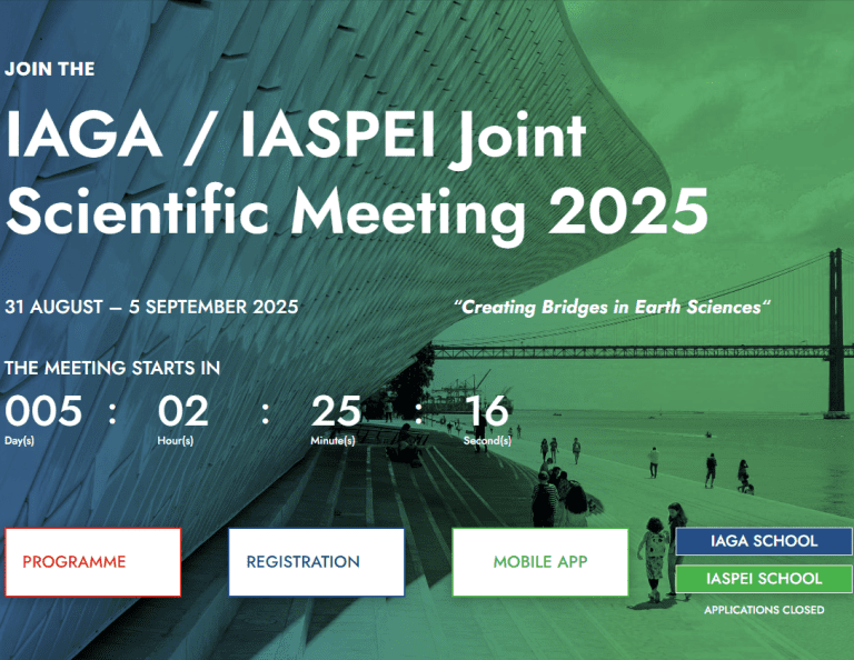
IAGA/IASPEI 2025: Geotech’s Proton Magnetometer, Seismic Nodal
TIPS:At IAGA/IASPEI 2025, Electrical Resistivity Tomography (ERT) and proton magnetometer technologies drive breakthroughs in solid Earth research. Geotech’s AI-optimized ERT systems and quantum-enhanced proton magnetometers enable high-resolution mapping of critical mineral deposits…
AGU25 Annual Meeting: Geotech’s Geophysical Tools Fit Global Earth Science Goals
TIPS:The AGU 2025 Fall Meeting, held Dec 9-13 in San Francisco, is the world’s top earth science event, and Geotech’s tools align with its key trends. Geotech’s proton magnetometer stands out for…
PDAC 2026 Convention: Geotech’s Tools Align with Mining Geophysics
TIPS:At PDAC 2026, Electrical Resistivity Tomography (ERT) and proton magnetometer technologies take center stage. Geotech’s AI-driven ERT systems and quantum-enhanced proton magnetometers redefine mineral exploration efficiency. These innovations align with Canada’s critical…
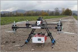
Application Breakthroughs of Magnetometers in Airborne Geophysical Exploration
ITPS:In the realm of airborne geophysical exploration, the magnetometer plays a pivotal role. This instrument, especially the proton magnetometer, has witnessed remarkable application breakthroughs. Magnetometers are used for high – altitude magnetic…
Geotech GPR and ERT Technologies: Revolutionizing Geological Exploration and Environmental Protection
In an era where global demand for geological exploration and environmental protection is surging, Geotech stands at the forefront of technological innovation with its advanced Ground Penetrating Radar (GPR) and Electrical Resistivity…
Proton magnetometer vs. optical pump magnetometer: multiple dimensions reveal the logic of selecting high-sensitivity detection equipment
In geological exploration, high – sensitivity magnetometers play a crucial role in resource detection. Proton and optical pump magnetometers, as two main types, have their respective advantages. This article compares them across…
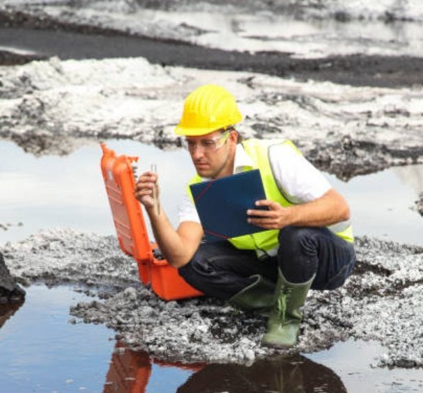
USGS Awards $25 Million to State Geological Surveys for Mine Waste Projects, Geophysical Technologies Aid in Mineral Exploration and Environmental Protection
The U.S. Geological Survey (USGS) recently announced a $25 million funding award to support state geological surveys and mine waste management projects. This funding initiative is aimed at assisting state governments in…
USGS Releases New Dataset on Santiam River Underwater Topography, Geophysical Technologies Aid in Aquatic Ecosystem Restoration
The U.S. Geological Survey (USGS) recently released a detailed dataset of the Santiam River’s underwater topography. This new dataset not only supports aquatic ecosystem restoration but also demonstrates how precise underwater topography…
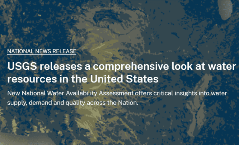
USGS Water Resources Assessment: Advanced Geophysical Exploration Technology Transforms Water Management
Ⅰ. Core Findings of the USGS Assessment The latest USGS research reveals that multiple regions across the United States face dual pressures of declining groundwater reserves and deteriorating water quality. Based on five…
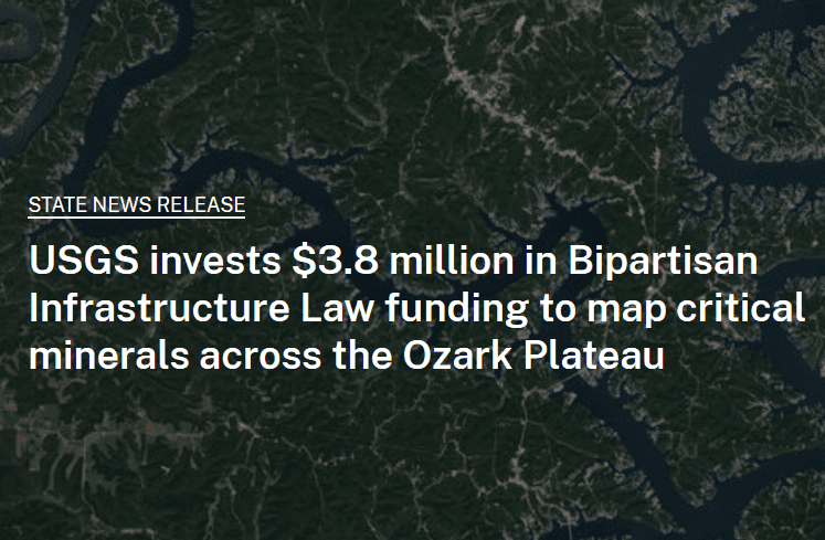
USGS Invests $38 Million to Support Critical Mineral Mapping, Geophysical Technologies Enhance Exploration Efficiency
The U.S. Geological Survey (USGS) recently announced an investment of $3.8 million through the Bipartisan Infrastructure Law to map critical minerals across the Ozark Plateau. This initiative, part of the USGS Earth…
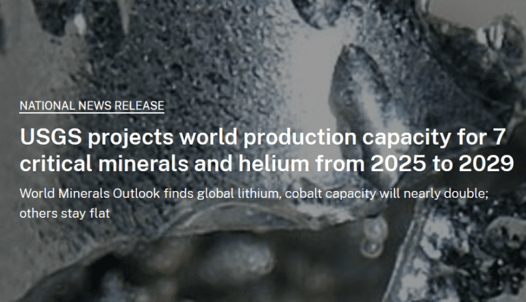
USGS Projects Global Critical Mineral Production Capacity, Geophysical Technologies Play Key Role in Mineral Exploration
Recently, the U.S. Geological Survey (USGS) released a report on the projected global production capacity of seven critical minerals, including rare earth metals, lithium, cobalt, and others. The report indicates that these…
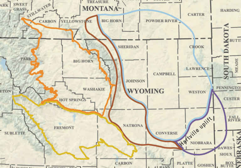
USGS Releases Assessment of Undiscovered Oil and Gas Resources in Wyoming, Geophysical Exploration Technologies Provide Critical Support
Recently, the U.S. Geological Survey (USGS) released a report on the undiscovered oil and gas resources in Wyoming, estimating the potential reserves in the region. This report highlights the latest advancements in…