Welcome to Geotech!

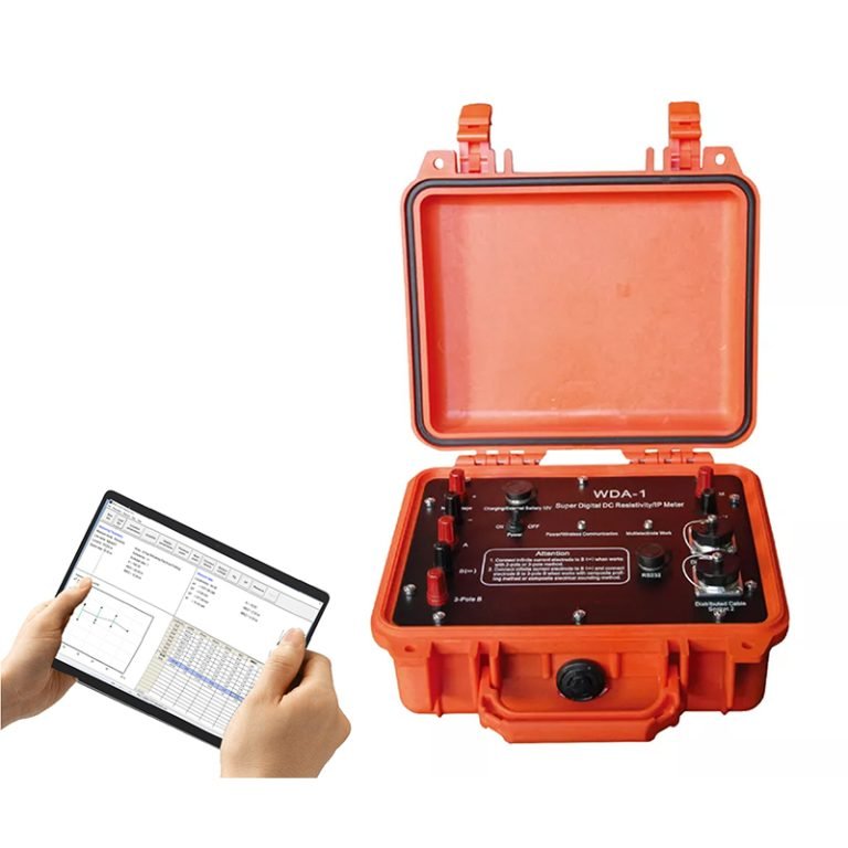
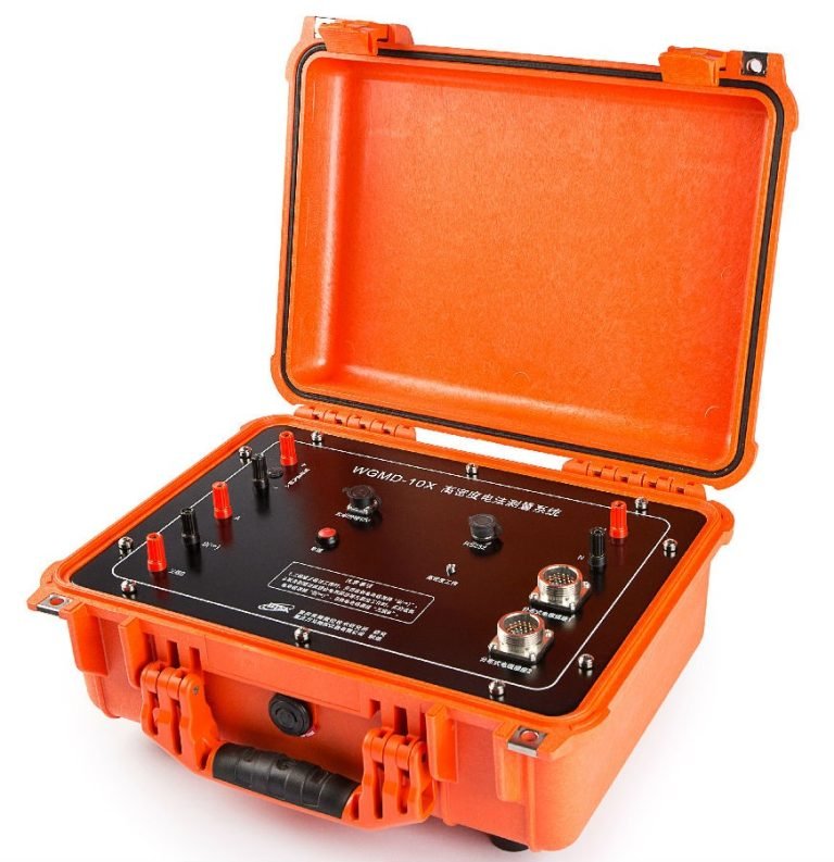
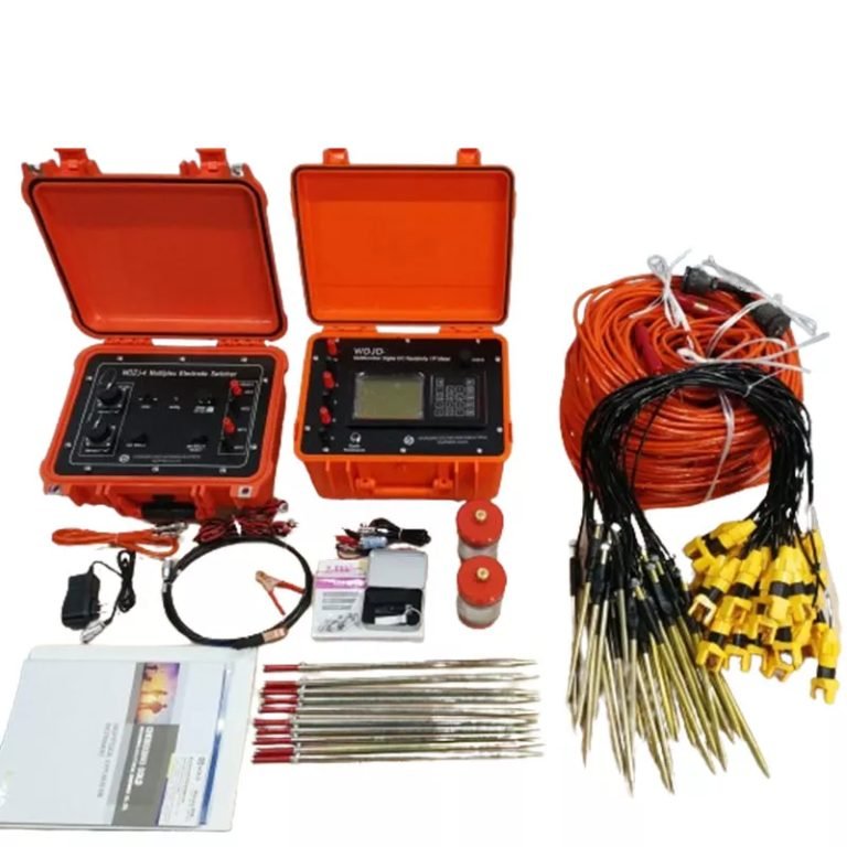
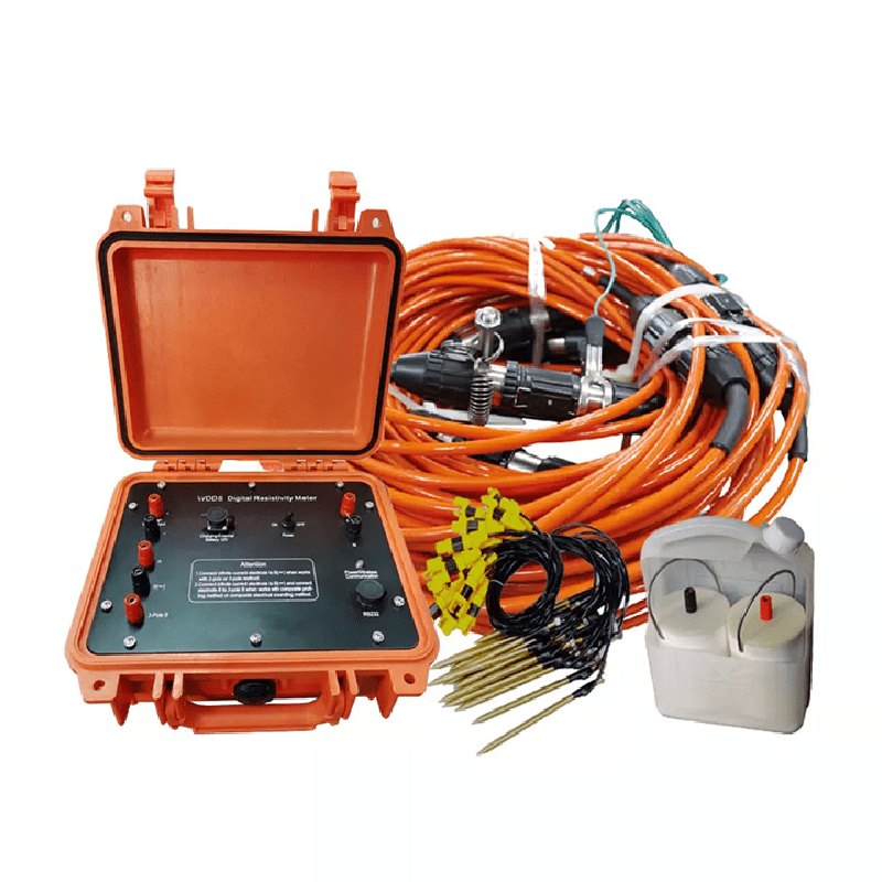
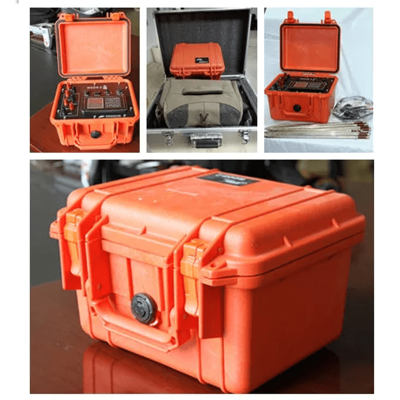
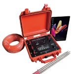
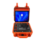
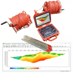
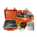
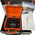
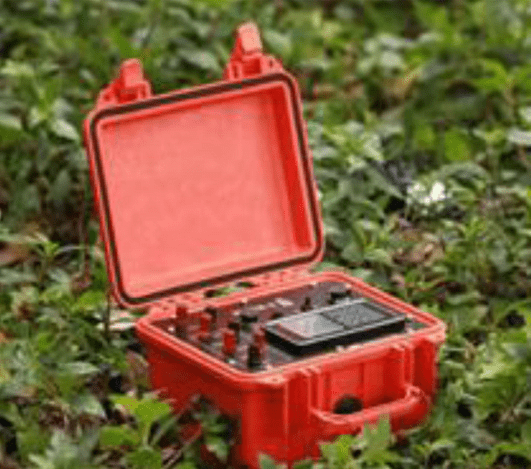
WDDS-3C Digital Resistivity Meter


PRODUCT PARAMETERS
Description
 Abstract
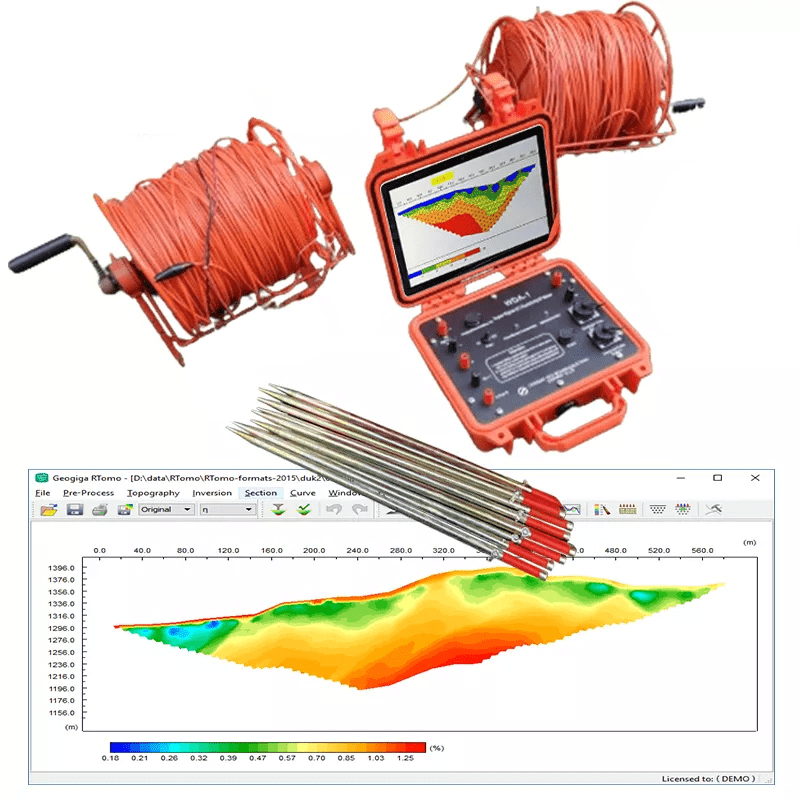
The WDDS-3C digital resistivity meter is an advanced DC resistivity equipment. It incorporates 32-bit microcontroller technology and 24-bit A/D technology, making it a cutting-edge solution for resistivity surveys. This versatile instrument is suitable for various applications including mineral resource detection, geophysical exploration in urban areas, railway and bridge inspections, hydrology, engineering geology, and geothermal prospecting. It enables precise detection of metal and nonmetal resources, groundwater exploration, fault identification in dam bases and flood protection levees, and more.
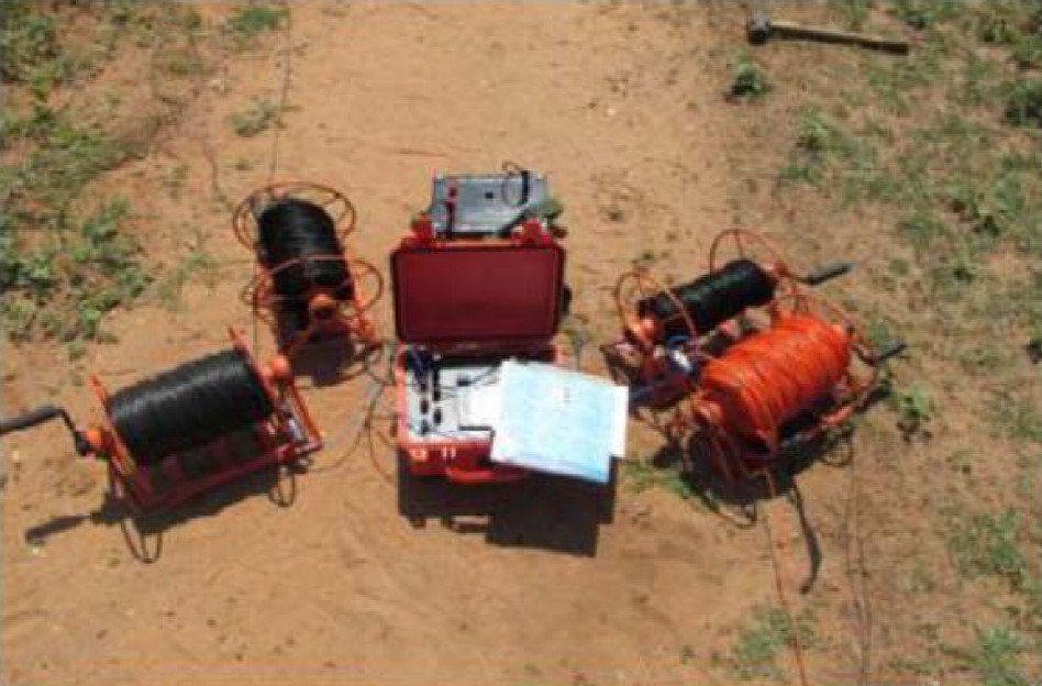
Working principle
The electrical resistivity method is an active geophysical technique. It employs an artificial source which is introduced into the ground though a pair of electrodes. The procedure involves measurement of potential difference between other two electrodes in the vicinity of current flow. Apparent resistivity is calculated by using the potential difference for the interpretation. These electrodes by which current is introduced into the ground are called Current electrodes and electrodes between which the potential difference is measured are called Potential electrodes.
Applications
● Metal and nonmetal mineral resources detection
● City geophysical exploration, railway and bridge inspection and so on
● Hydrology and engineering geology as seeking for ground water, inspecting dam base and flood protection levee for incipient faults
● Geothermal prospecting
Features
● Tuursmitter and receiver designed in one unit.
● Large power up to 6000W, 50V wide voltage input range.
● Automatic compensation of self-potential, drift and electrode polarization .
● Monitoring the dynamic variation of MN electrode potential through inspecting its ground resistance.
● Receiver supports transient over-voltage protection; transmitter supports overvoltage, over-current and AB open-circuit protections.
● Internal 12V lithum battery for 20 hours contiously work.
● Communicated by USB port.
● Store measuring data for more than 150,000 times.
● Measuring data includs voltage, current, resistivity, relative error, SP, array constant, measuring point and so on.
Specifications
Receiving section
| Item | Parameters |
| Voltage channel | ±50V, ±0.2% ±1LSB, 24-bit A/D |
| Maximum sampling resolution of voltage | 0.01μV |
| Input impedance | ≥50MΩ |
| SP compensation range | ±10V |
| Current channel | 5A, ±0.2% ±1LSB, 24-bit A/D |
| Maximum sampling resolution of current | 0.02μA |
| Suppression | ≥80dB for 50Hz industrial frequency (common mode interference or differential mode interference) |
Transmitter
| Item | Parameters |
| Transmit power | 6000W |
| Power supply voltage | ±1200V (2400Vp-p) |
| Power supply current | ±5A (7Ap-p) |
| Power supply pulse waveform | Duty cycle is 1:1, bipolar |
Other parameters
| Item | Parameters |
| Instrument power source | Built-in 7.4V and 48V lithium battery (or external 12V power supply) |
| Mainframe interface | A, B, M, N, DC high voltage, external battery, charger, Bluetooth, and USB |
| Built-in high-voltage power supply | Max current: 300mA, voltage options: 50V, 100V, 150V, 200V |
| Working temperature | -10℃ ~ +50℃, 95% RH |
| Storage temperature | -20℃ ~ +60℃ |
| Weight | ≤5.7 Kg |
| Dimensions (L×W×H) | 350mm x 270mm x 200mm |
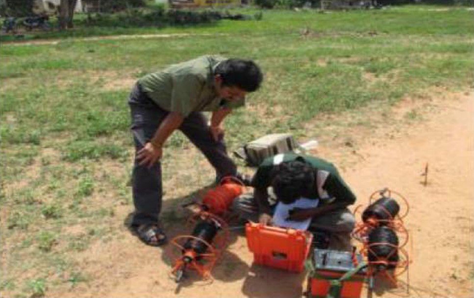
Case Study
Electrical Resistivity Imaging Method for Evaluate Estuarine Impace on Groundwater Salinization in Pondicherry Coastal Aquifers

FAQ
In gravity exploration (SI), what is the unit of gravity? How to convert gravity units between SI and CGS?
What are gravitational field and gravitational potential?
What is the normal gravity field of the earth? What are the rules for the change of the normal gravity field with latitude and altitude?
What is the relationship between gravitational field strength and gravitational acceleration?
What is gravity exploration?