Welcome to Geotech!

Leading Resource & Environmental Exploration with Geophysical Technologies
Pioneering Geophysical Solutions for a Sustainable Future
As a high-tech enterprise integrating geophysical exploration and engineering geophysical equipment sales with technical services, Geotech Instrument Co., Ltd. is reshaping the boundaries of the industry under the mission of “Precision Exploration for a Greener Planet”. Our official website (https://geotechcn.net/) showcases a comprehensive product matrix covering electrical, magnetic, seismic, radar, and logging series, from electrical exploration instruments and magnetic prospecting devices to seismographs, geological radars, and borehole logging equipment—each embodying the philosophy of “Exploring Depths, Empowering Future Resources”.
Innovative Product Portfolio: Solving Geophysical Challenges Across Dimensions
1. Electromagnetic & Magnetic Exploration: High-Precision Subsurface Signal Capture
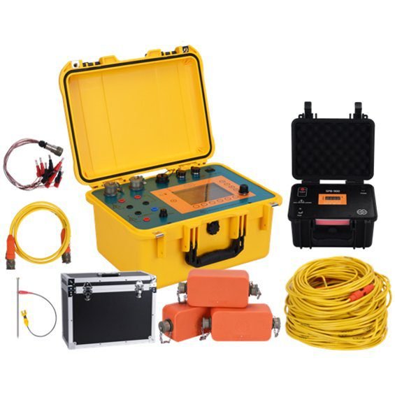
- Magneto-Telluric (MT) Acquisition System: Equipped with advanced electromagnetic technology, this system penetrates complex geological layers to invert subsurface structures precisely, ideal for mineral resource survey and deep geological studies. Its anti-interference design ensures data stability in high electromagnetic noise environments, proven in multiple metal ore exploration projects domestically and internationally.
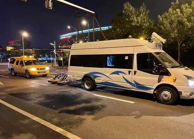
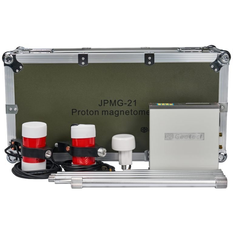
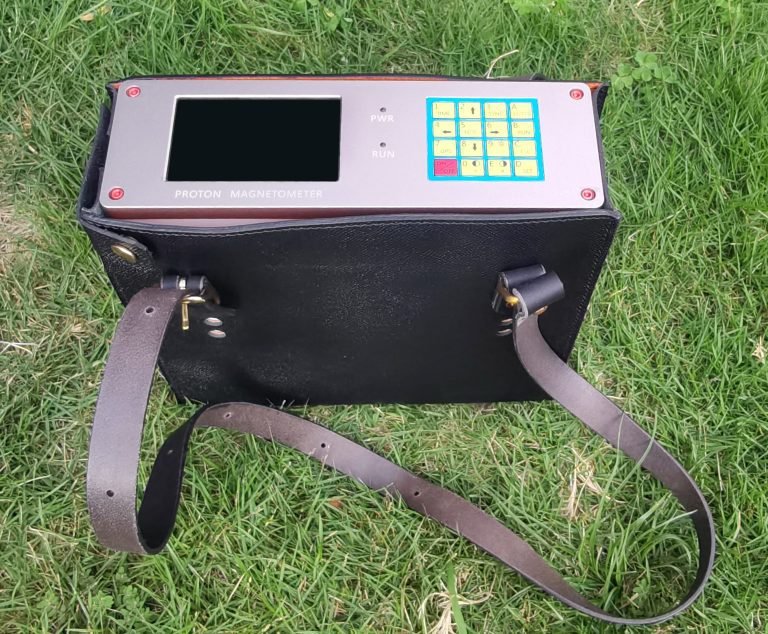
- JPMG Series Proton Magnetometers: Featuring OCXO (Oven-Controlled Crystal Oscillator) technology, these magnetometers achieve “zero temperature drift” in geomagnetic surveys, breaking the efficiency deadlock with 3-second fast sampling. In 50m overburden magnetic anomaly detection, the series delivers ±0.5nT measurement accuracy, assisting geological teams in locating concealed ore bodies and fault zones, with technical achievements documented in the White Paper on 50-meter Overburden Magnetic Anomaly Detection.
2. Seismic & Nodal Exploration: Revolutionizing 2D to 3D Surveys
- GE-ANT Series Seismic Nodal Instruments: With wireless nodal design, these instruments eliminate cable constraints, supporting high-density 3D seismic exploration. They excel in oilfield reservoir description and engineering geological surveys—e.g., the GE-ANT-3C 3-component nodal unit synchronizes P-wave and S-wave data collection, providing multi-dimensional support for lithology identification and seismic hazard assessment.
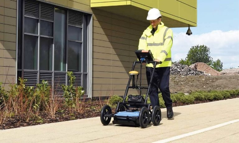
3. Geological Radar & Logging Equipment: Fine-scale Subsurface “CT Imaging”
- High-Frequency Ground Penetrating Radar (GPR) Systems: Combined with UWB antenna technology, these systems achieve centimeter-level resolution for underground voids, pipeline mapping, and archaeological targets, playing a critical role in urban geotechnical surveys and emergency rescue.
- Borehole Camera Systems: High-definition probes transmit real-time downhole images, visually displaying core fractures and karst development, providing visual basis for water well construction and mine support design.
Technical Advantages: Redefining Industry Standards with “Four Highs”
- High Performance: Cutting-Edge Technology Drives Innovation
All products incorporate industrial-grade components and proprietary algorithms—e.g., adaptive filtering in MT systems and proton precession optimization in magnetometers—ensuring stable operation in extreme temperatures (-40℃~70℃) and complex terrains, with technical indicators matching international benchmarks. - High Cost-Effectiveness: Making Advanced Exploration Accessible
Adhering to the philosophy of “Technical Inclusivity”, we optimize costs through large-scale production and supply chain management, pricing core equipment (e.g., electromagnetic and seismic instruments) at 60%~70% of international brands, while offering customized solutions for budget-conscious exploration teams. - High Reliability: End-to-End Quality Control
From raw material procurement (e.g., military-grade sensors) to factory testing (72-hour aging tests, vibration/shock trials), we strictly follow ISO9001 quality management. The JPMG magnetometer, for instance, boasts an MTBF (Mean Time Between Failures) exceeding 10,000 hours, proven in high-altitude projects in Xinjiang and Tibet. - High Responsiveness: Full-Cycle Technical Support
Our professional team—comprising geology, geophysics, and electronics engineers—provides end-to-end services: pre-sales solution design, on-site operation training, and 24/7 after-sales support. For overseas projects, multilingual technical documentation and remote debugging systems ensure barrier-free usage globally.
Applications: From Resource Development to Environmental Stewardship
In mineral exploration, our MT-magnetometer combination helped identify a 100,000-ton lithium deposit in Inner Mongolia, supporting new energy industries. In water resource surveys, electrical and radar technologies collaboratively located subsurface aquifers in arid regions of Southwest China, solving drinking water shortages for 10,000 people. For environmental monitoring, our conductive contaminant plume detection has provided precise targets for chemical park remediation, with cases recognized by USGS as “Model of Geophysical Technologies in Environmental Protection”. Other applications include emergency rescue (post-earthquake void detection), engineering investigation (high-speed rail subgrade stability), and archaeological excavation (non-destructive tomb mapping).
Industry Insights: Geophysics Driving Global Resource Strategy
According to USGS reports, global lithium and cobalt production capacity will nearly double by 2025–2029, with geophysical exploration serving as the “eyes” of resource development. Geotech invests in deep exploration R&D—e.g., ultra-deep electromagnetic methods (detection beyond 1,000m) and 3D seismic full-waveform inversion—preparing for frontiers like deep-sea minerals and shale gas. Committed to carbon neutrality, we integrate environmental geophysics (e.g., landfill leakage monitoring) to safeguard ecosystems through technology.
Partner with Us: Unlock the Potential of Geophysical Exploration
Whether you’re a mining company, research institution, or construction firm, Geotech offers one-stop solutions from equipment selection to data interpretation. Visit https://geotechcn.net/ or call +86 15815513204 to explore the earth’s mysteries with precision technology and empower a sustainable future together.