Welcome to Geotech!

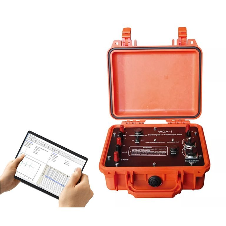
GIM-1 Single-channel Intelligent Resistivity & IP Meter


PRODUCT PARAMETERS
Description
GIM-1 Single-channel Intelligent Resistivity & IP Meter丨High Density Resistivity Tester
 Abstract
GIM Series DC Electrical System is a new generation of high-density electrical system developed by Geotech based on many years of research and production of advanced electrical instruments, combined with the latest electronic technology. It integrates transmission and reception functions, has natural potential measurement function, 1D / 2D / 3D resistivity & induced polarization function.
The size and weight of the system are significantly reduced, and the main technical indicators and functions are ahead of similar instruments in the world, and it can work perfectly in various complex field environments.
The system can be widely used in metal and non-metal mineral resource exploration, urban geophysical exploration, railway bridge exploration, etc. It is also used in hydrological and engineering geological exploration such as finding groundwater, determining the location of hidden dangers in reservoir dam foundations and flood control embankments, and can also be used for geothermal exploration.

Electrical Principle
Principle
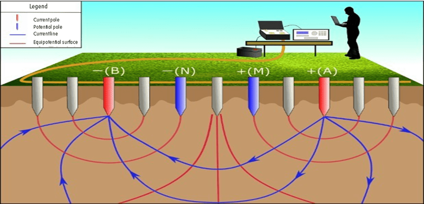
Measuring device
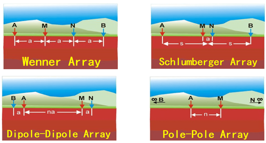
GIM includes Wenner arrangement (α), dipole arrangement (β), differential arrangement (γ), tripole arrangement (A), tripole arrangement (B), AM arrangement, dipole-dipole arrangement, Schlumberger arrangement (α2), Wenner-Schlumberg arrangement, edge gradient and custom device
High-density electrical measurement method
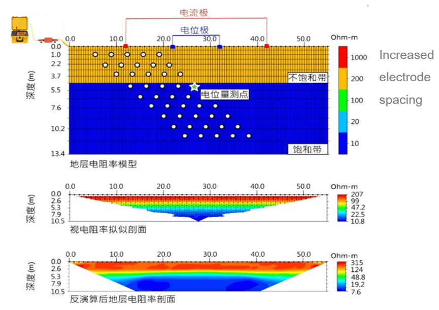
Automatic and continuous measurement with one pole arrangement, integrating bathymetry and profiling methods, and can combine multiple devices with multiple pole distances at the same time.
Function
Multifunctional Integrated Design
- Dual-mode resistivity and induced polarization (IP) measurements with self-potential compensation, supporting 1D/2D/3D/4D exploration.
- Built-in 12 standard arrays (Wenner, Schlumberger, dipole-dipole, etc.) and customizable configurations for complex geological challenges.
High Precision & Robust Adaptability
- 24-bit A/D conversion, ±48 V wide voltage range, current/voltage accuracy of 0.3% ±1 μA/μV.
- IP67 waterproof rating, operational at -20°C to +60°C. Titanium alloy electrodes support 100-meter underwater detection for extreme environments.
Intelligent Expansion & Efficient Acquisition
- Unlimited survey line expansion via bidirectional cascading controllers. Rolling measurement (2D/3D) improves efficiency by 50%+.
- 12-channel synchronous acquisition enables parallel multi-array measurements, capturing multi-electrode data in a single transmission.
Full-Scenario Coverage
- Patented segmented distributed cabling system compatible with ground/cross-hole/borehole-surface/waterborne surveys. Customizable 5-10m cable spacing.
- 3200W high-power transmission (1200V/6A) achieves 1500m penetration depth for resource exploration and engineering surveys.
Smart Software Ecosystem
- Real-time waveform monitoring, 20-time-window IP analysis, script programming, and Excel data import.
- Preprocessing system exports TXT/Excel/DAT/URF formats, compatible with mainstream inversion software.
Modular Engineering Solutions
- Custom components: SPB900 Intelligent Power Supply (850Wh Li-ion), IP-dedicated cables, borehole junction boxes, etc.
- Proven in complex scenarios: pollution monitoring (landfill sites), subsea exploration (mineral lake sediments), tunnel void detection.
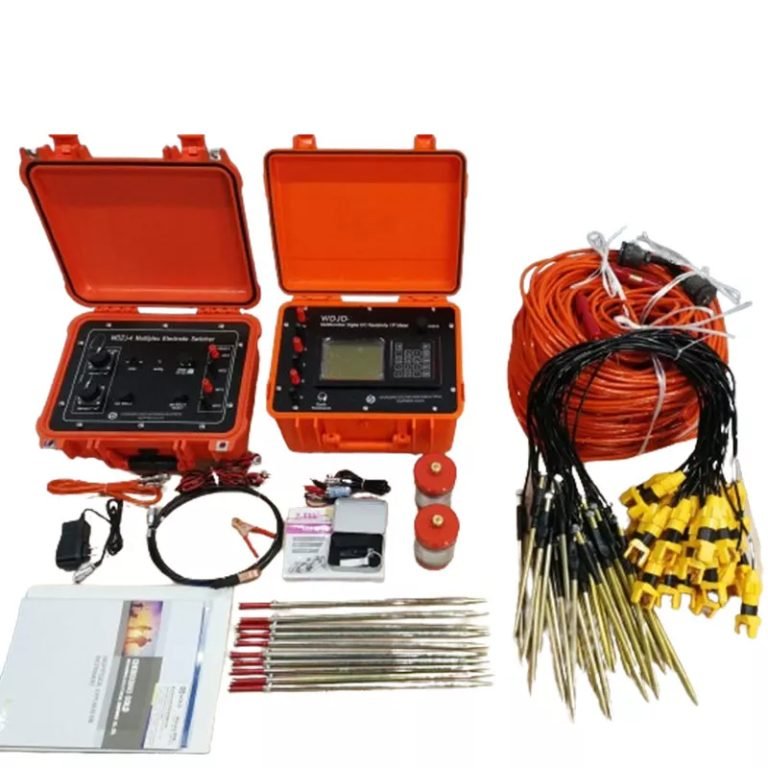
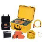
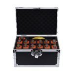
GIM Component Introduction
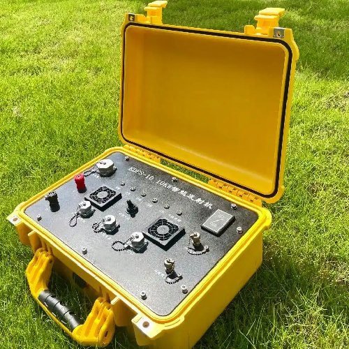
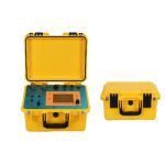
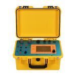
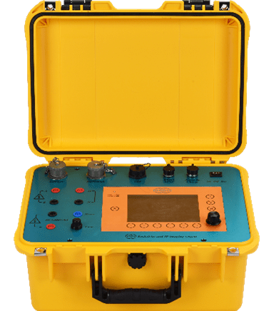
System Host
The GIM host integrates the functions of transmission and reception, and has the functions of natural potential measurement, one-dimensional/two-dimensional/three-dimensional resistivity & induced polarization.
| Receiving part | |
| Number of channels | 1, 5, 10 |
| Waveform recording | Full waveform recording of current and potential |
| Self-compensation | ±10V (automatic tracking compensation of full range) |
| Number of manual iterations | 1~250 times |
| Number of automatic iterations | 1~10 times |
| Voltage accuracy | 0.3%±1uV |
| Current accuracy | 0.3%±1uA |
| Measurement voltage range | ±48V |
| Power frequency interference | ≥120dB |
| A/D conversion bit | 24 bits |
| Transmitter | |
| Pulse width | 1s, 2s, 4s, 8s, 16s, 32s, 64s |
| Pulse type | Square wave 0+0- |
| Maximum transmission power | 3200W |
| Maximum transmission current | 6A |
| Maximum transmission voltage | 1200V |
| Input impedance | ≥200MΩ |
| Protection | Sealing, overcurrent, overvoltage, short circuit, high temperature |
| Other parameters | |
| Working temperature: | -10℃~50℃ |
| Working humidity: | ≤95% |
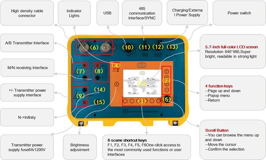
| Display: | 5.7-inch full-color LCD, 640*480 |
| LCD brightness: | 1200cd/m2, visible in sunlight |
| Weight: | 6KG |
| Storage temperature | -20℃~+60℃ |
| Built-in battery: | 16.8V/15.6AH lithium battery |
| External power supply: | DC9~16V |
| Storage capacity: | 16GB |
| Charger voltage | 120~250VAC (50HZ/60HZ) |
| Waterproof grade | IP67 |
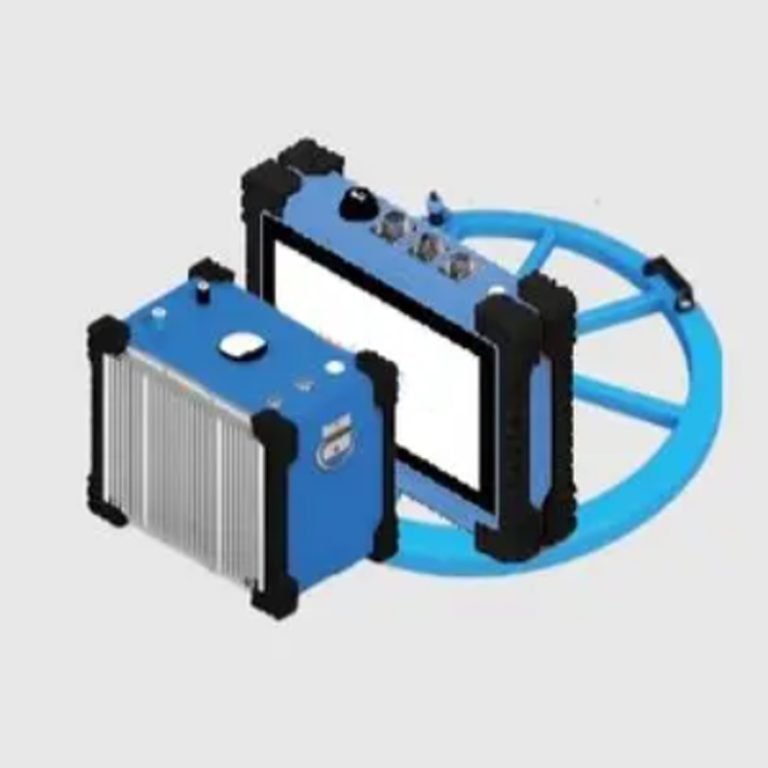
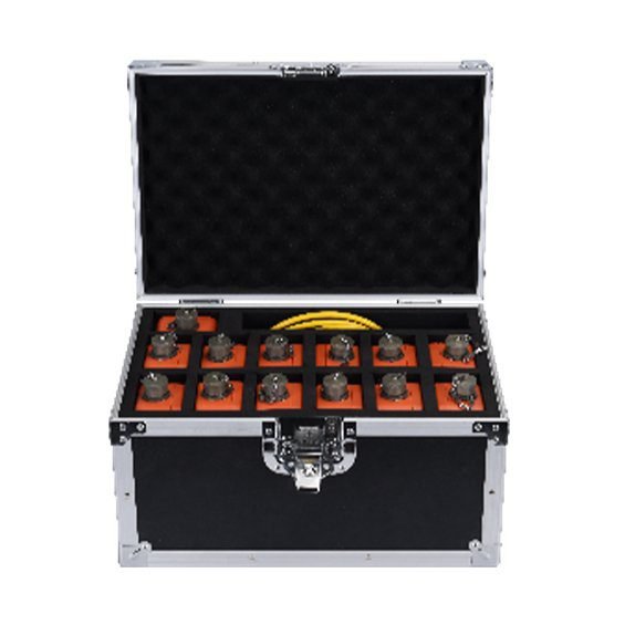
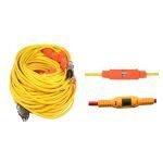
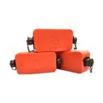
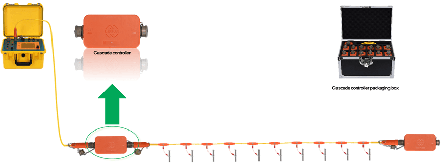
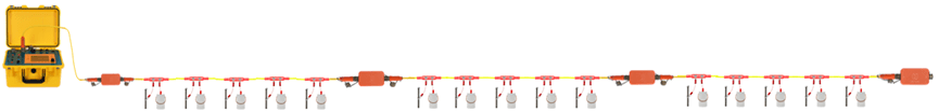
Bidirectional Cascade Controller
- The bidirectional cascade controller is used in two-dimensional or three-dimensional high-density electrical measurement, which is equivalent to a repeater and converter, and is mainly used to switch electrodes.
- The controller is divided into two ends, the end marked with “HOST” is the head end, and the end marked with “END” is the tail end.
| Standard weight | 400g |
| Protection level | IP66 |
| Operating temperature | -10℃~+50℃ |
| Storage temperature | -30℃~+60℃ |
| Dimension | L150*W82.3*H62mm |
| Shell material | PC material |
Large cable

- Each large cable consists of 10 cables, and the cables are connected by cascade controllers.
- The large cable has a spacing of 5 meters and 10 meters, and the spacing can also be customized according to customer needs。
- Both ends of the cable are male, non-directional, and both ends need to be connected to a bidirectional intelligent cascade controller when in use.
- The overall injection molding process is adopted, and the waterproof performance can adapt to various Simple structure, no electrical parts, high reliability and low replacement cost
| Material | Copper core wire, outer sheath is TPU material |
| Standard weight | CB10-5:5.5Fg ; CB10-10: 9Fg |
| Maximum current resistance | 2A |
| Maximum withstand voltage | 800V |
| Tensile strength | 100Fg |
| Protection level | IP66 |
| Operating temperature | -20℃~+60℃ |
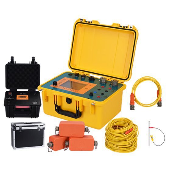
Power Supply
The SPB900 power box uses imported ternary lithium batteries as raw materials, can achieve multi-level voltage switching, and has a power supply capacity of up to 850WH.
| Output gear voltage | 50V/100V/150V/300V/OFF |
| Maximum output current | 3A |
| Maximum battery capacity | 850WH |
| Weight | 6kg |
| Shell material | PC Material |
| Dimension | 357(L)*293(W)*193(H)mm |
| Battery Type | Ternary lithium battery |
| Operating temperature | -10℃-50℃ |
Connection
SPB900 power supply box supports multiple units connected in series. The connection method is as follows.

Single channel Configuration
| Model | High Density Resistivity System | High Density IP System | customization |
| Power | 3200W, 800V*2A | 3200W, 800V*4A | 3200W, 800V*4A |
| Self-powered | √ | √ | |
| Conventional electrical method | √ | √ | |
| 2D resistivity | √ | √ | |
| 2D IP | √ | ||
| 3D Resistivity | √ | ||
| 4D Resistivity | √ |
*GIM-1 High-density Resistivity System: 2D and 3D high-density resistivity imaging system, adopts unique segmented centralized distributed wiring method, can infinitely extend the length of the measuring line, and includes 1D side depth, 2D and 3D resistivity.
*GIM-1 High-density IP System: 2D and 3D high-density resistivity and IP imaging system, adopts unique segmented centralized distributed wiring method, can replace all the above models in terms of function, and adopts double-tap IP cable.
Applications
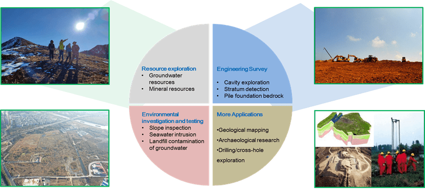
Resource exploration
- Groundwater resources
- Mineral resources
Engineering Survey
- Cavity exploration
- Stratum detection
- Pile foundation bedrock
Environmental investigation and testing
- Slope inspection
- Seawater intrusion
- Landfill contamination of groundwater
More Applications
- Geological mapping
- Archaeological research
- Drilling/cross-hole exploration
Case Studies
Case 1: Site contaminant detection
Underground pollution investigation at a site


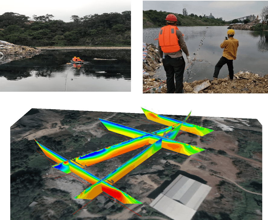
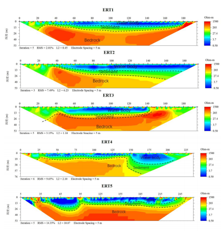
Case 2: High-density resistivity detection on water
Detection of water and sediment thickness in an abandoned mine lake
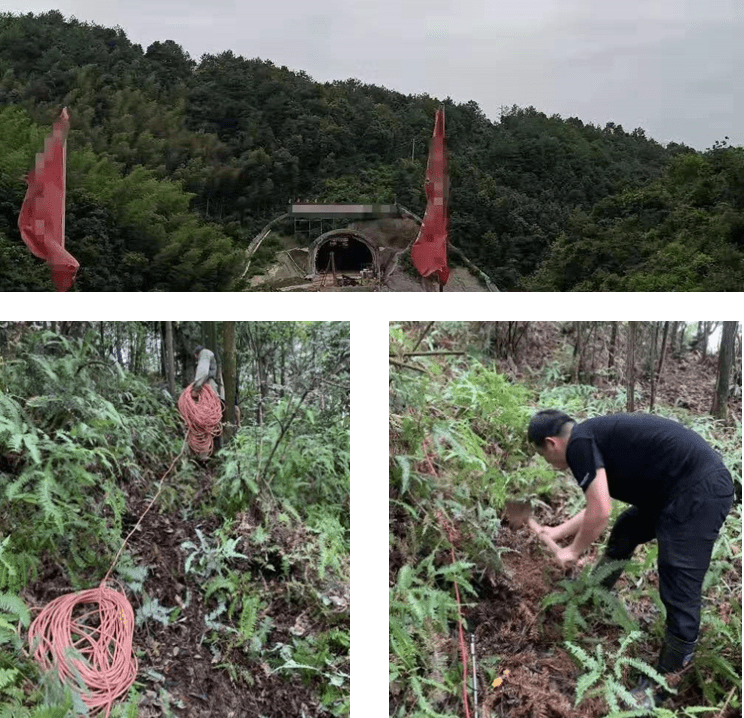
Case 3: Goaf and cavity detection
Identify the goaf or voids in the upper mountain and in front of the tunnel face.

Details provided by: Geotech, Leo.Li
To view the entire detailed introduction, please visit the following link.
FAQ
In gravity exploration (SI), what is the unit of gravity? How to convert gravity units between SI and CGS?
What are gravitational field and gravitational potential?
What is the normal gravity field of the earth? What are the rules for the change of the normal gravity field with latitude and altitude?
What is the relationship between gravitational field strength and gravitational acceleration?
What is gravity exploration?