Welcome to Geotech!

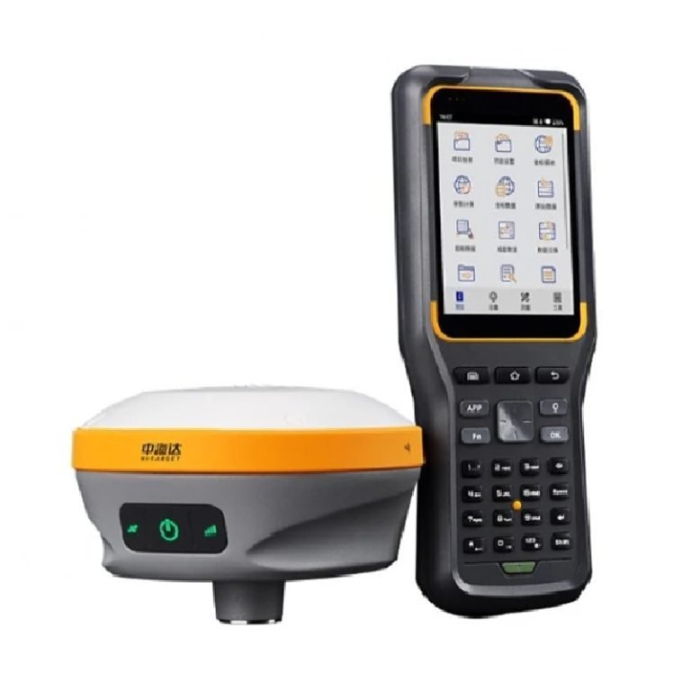
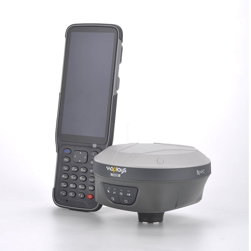
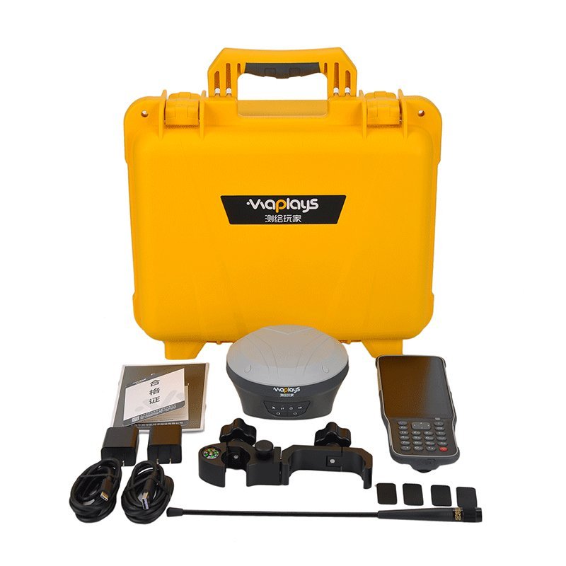
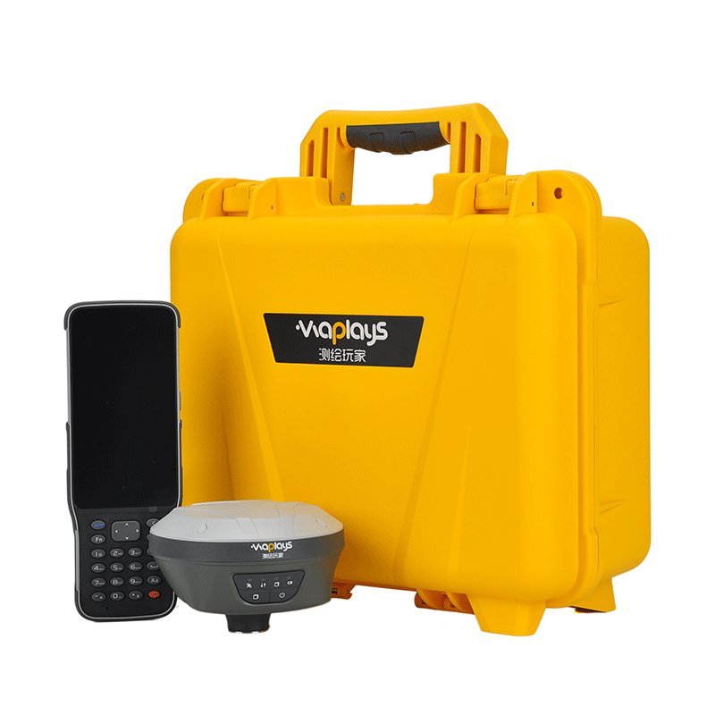
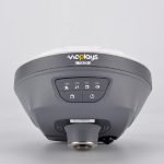
S10 GNSS RTK System


PRODUCT PARAMETERS
Description
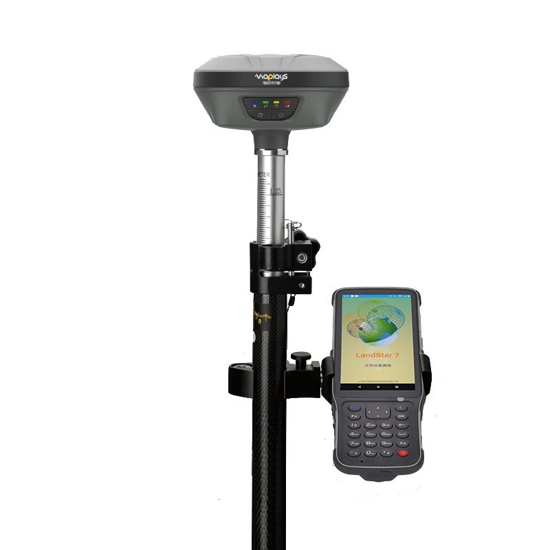
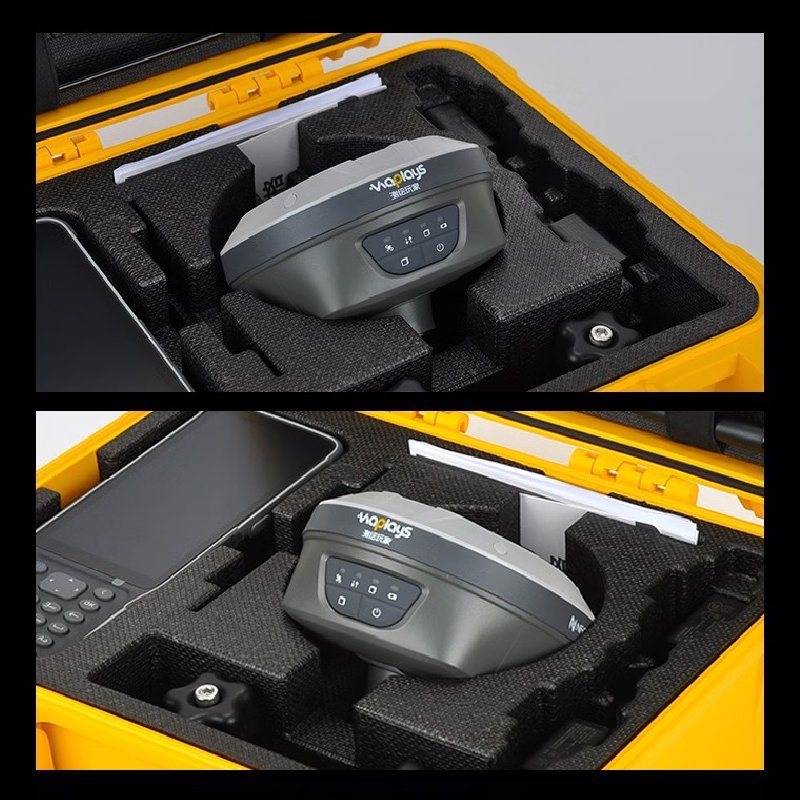
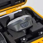
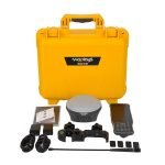
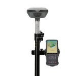
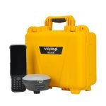
S10 GNSS RTK System POCKET GNSS+IMU RECEIVER
 Abstract
The S10 GNSS receiver removes barriers to portability without sacrificing performance. Featuring full GNSS technology, it offers best-in-class GNSS signal tracking even in a harsh environment, enabling GNSS surveying beyond usual constraints. The S10 GNSS incorporates the latest innovations such as an inertial module providing automatic pole-tilt compensation in a very compact design.
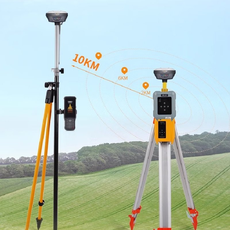
Connected to a GNSS RTK network via CHCNAV LandStar field software, or combined with the iBase GNSS receiver, the S10 GNSS is a highly productive rover for surveying and stakeout in any topographic, mapping or construction site applications.
Features


THE ULTIMATE POCKET GNSS IMU RECEIVER
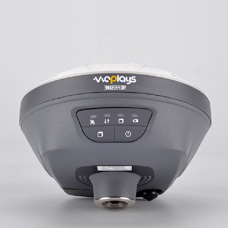
The S10’s magnesium alloy design makes it one of the lightest receivers in its class: only 0.73 kg including battery. The S10 is more than 40% lighter than a typical GNSS receiver, making it more convenient to carry, use and operate without fatigue. The S10 GNSS is a concentrate of technology that fits into your hands and delivers maximum GNSS survey productivity.
BEST-IN-CLASS SIGNAL TRACKING
The integrated advanced 624-channel GNSS technology takes advantage of GPS,Glonass Galileo and BeiDou, in particular the latest BeiDou lll signal, and provides robust dataquality at all times. The S10 extends GNSS surveying capabilities while maintainingcentimeter-level survey-grade accuracy,GNSS surveying has never been more efficient.
REMOVE THE BARRIERS TO INTENSIVE USE
The integrated high-capacity intelligent Li-ion battery provides up to 15 hours operation in the field. Full-day projects can be easily completed without worrying about a power outage. Thebuilt-in USB-C is extremely convenient for charging the S10,using standard smartphone chargers or extemal power banks.
THE POWER OF GNSS+IMU RTK TECHNOLOGY
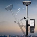
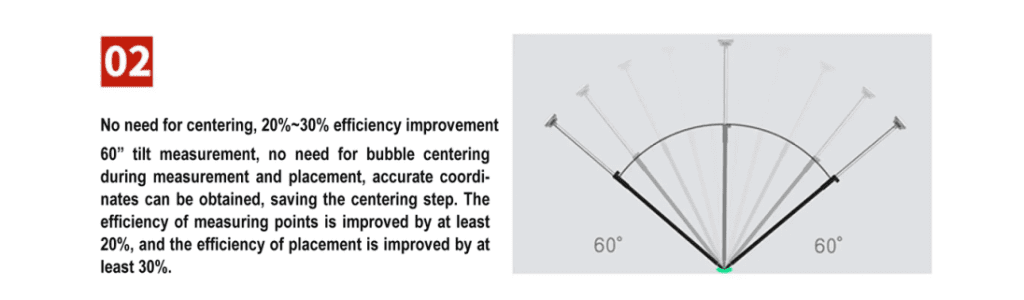
The S10 compensates for up to 45° tilt of the survey range pole, eliminating the challenges associated with surveying concealed or unsafe points to reach,The S10 GNSS makes work safer and more efficient, lt increases the efficiency of point measurements by20% and stakeout surveys by up to 30%,GNSS surveyingis madeeasier: no more need to be focused on perfect range pole levelling.
GNSS SURVEYING,THE WAY YOU WORK
The S10 is designed as a perfect GNSS measurement tool that adapts to the way you work.lt seamlessly connects to RTK GNSS networks via any Android controller or smarphone with Landstar field data collection software. When working on a site with a loca UHF GNSS station,the S10 can be easily switched to UHF mode using its internal modem. Combined with CHCNAV’s iBase GNSS station,GNSS RTK surveying truly achieves the next level of operational expenence.
Working principle
RTK technology uses the differential method of real-time processing of the carrier phase observations of two measurement stations to send the carrier phase collected by the base station to the user receiver for differential coordinate calculation. Its system consists of a base station, a mobile station, data transmission equipment, an antenna system, and control software and processing algorithms. The base station receives satellite signals and calculates error data, and the mobile station corrects its position by receiving differential data from the base station. The data transmission equipment ensures real-time transmission of information.
Applications
● Coordinate measurement
● Area measurement
● Topographic measurement
● Straight line surveying and road surveying
● Electric power surveying
● Building surveying
● Garden surveying
● Distance surveying
● Earthwork surveying
Parameters
GNSS Perorrance
| Item | Parameters |
| Channels | 624 channels Powered by CHCNAV iStar GNSS tracking technology |
| GPS | L1,L2,L5 |
| GLONASS | L1,L2 |
| Galileo | E1.E5a,E5b |
| BeiDou | B1,B2,B3 |
| QZSS | L1,L2,L5 |
GNSS Accuracies
| Item | Parameters |
| Real time kinematics(RTK) | Horizontal: 8 mm + 1ppm RMS Vertical:15 mm+ 1 ppm RMS Initialization time:< 10 s Initialization reliability:>99.9% |
| Post -processing kinematics (PPK) | Horizontal:3mm+1 ppm RMS Vertical: 5 mm+1 ppm RMS |
| Post-processing static | Horizontal: 2.5 mm+ 0.5 ppm RMS Vertical: 5 mm+0.5 ppm RMS |
| Code differential | Horizontal: 0.4m RMS Vertical:0.8m RMS |
| Autonomous | Horizontal:1m RMS Vertical: 1.5m RMS |
| Positioning rate | 1 Hz,5 Hz and 10 Hz |
| Time to first fix | Coldstart:<45 s Hot start:< 30 s Signalre-acquisition:<2 s |
| RTK tilt -compensation | Additional horizontal pole-tilt uncertainty typically less than 10 mm +0.7 mm/°tilt |
Hardware
| Item | Parameters |
| Size(L×W×H) | 119 mmx 119 mmx 85 mm(4.7 in x 4.7 in x 3.3 in) |
| Weight | 0.73 kg (1.60 lb) |
| Environment | Operating:-40’C to +65°C(-40°Fto +149°F) Storage:-40°C to +85°C(-40°F to +185°F) |
| Humidity | 100% condensation |
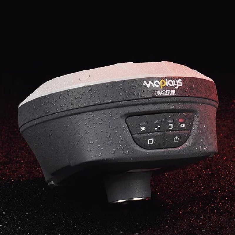
| Ingress protection | IP67 waterproof and dustproof, protected from temporary immersion to depth 1m |
| Shock | Survive a 2-meter pole drop |
| Tilt sensor | Calibration -free lMU for pole -tilt compensation. lmmune to magnetic disturbances |
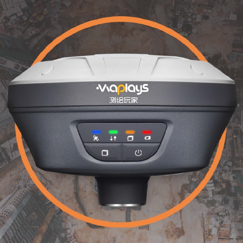
| Front panel | 4 LED |
Certifications
| Item | Parameters |
| Wi-Fi | 802.11 b/gin, access point mode |
| Bluetooth | V4.1 |
| Others | NFC |
| Ports | 1 xUSB Type-C port (data download, charging, firmware update) 1 x UHF antenna port (TNC female) |
| UHF radio | Standard Internal Rx:430-470 MHZ Protocol: CHC, Transparent, TT450 Linkrate:9600bps/19200 bps |
| Data formats | RTCM2.x, RTCM3.x,CMR input/output HCN, HRC, RINEX2.11,3.02 NMEA0183 output |
| Data storage | 8 GB internal memory |
FAQ
In gravity exploration (SI), what is the unit of gravity? How to convert gravity units between SI and CGS?
What are gravitational field and gravitational potential?
What is the normal gravity field of the earth? What are the rules for the change of the normal gravity field with latitude and altitude?
What is the relationship between gravitational field strength and gravitational acceleration?
What is gravity exploration?