Welcome to Geotech!

3D Borehole Imaging System丨Intelligent High-Definition Panoramic Borehole Camera


PRODUCT PARAMETERS
Description
 Abstract
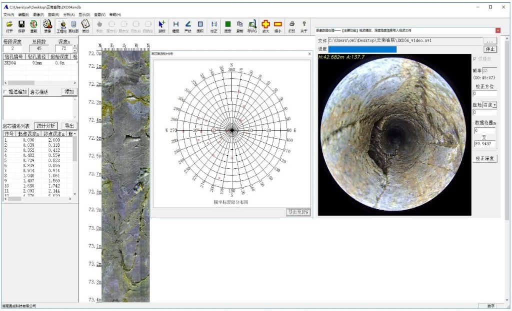
The intelligent high-definition 3D borehole imaging system integrates an advanced open-lens probe with a combined LED light source and precision motorized hoisting mechanism. This system delivers accurate lithology identification, geological structure investigation, soft mud interlayer detection, fault and fracture zone mapping, and groundwater migration monitoring. In geotechnical engineering, it supports reinforced concrete inspection, concrete quality assessment, auxiliary geotechnical testing, geological hazard monitoring and prediction, underground instrument installation guidance, subsurface pipeline detection, and tunnel excavation reconnaissance.
Working principle
Under visible-light illumination, the borehole camera captures high-resolution images of the casing inner wall and open borehole surface. The probe’s onboard electronics amplify the optical signal and convert it into a frequency-modulated pulse signal. This signal transmits to the surface receiver via single-core or multi-core cable, where it undergoes amplification and digital decoding to reproduce a real-time image identical to the downhole camera’s view.
Applications
● Concrete Quality Control
Inspect pouring quality and evaluate grouting treatment effectiveness
● Geological Hazard Monitoring
Detect and track landslides, subsidence, and ground instability
● Underground Installation Guidance
Direct instrument and sensor placement in boreholes
● Pipeline and Tunnel Inspection
Detect subsurface pipelines and perform advance tunnel reconnaissance
● Lithology and Structure Mapping
Identify rock types, geological structures, and weak argillaceous interlayers
● Fracture Network Characterization
Detect faults, fissures, and broken zones
● Hydrogeological Assessment
Observe groundwater activity and support geomechanical testing
● Resource Exploration
Support coal seam evaluation, oil well inspection, and mineral deposit assessment
Features
360° Panoramic Imaging
The probe employs a 360° panoramic HD ultra-low-light camera. The front end features an open-design toughened glass hemispherical dome, enabling full circumferential imaging of the borehole wall without blind spots.
Ultra-HD True-Color Imaging
Standard 5-megapixel high-definition lens delivers photorealistic digital color reproduction at 1:1 scale. Images maintain clarity at full magnification with crack resolution down to 0.01 mm.
Seamless Image Stitching + Video Recording
Advanced intelligent image unwrapping algorithms generate seamless cylindrical borehole wall panoramas during probe ascent or descent. The system simultaneously records downhole forward-looking video, with both datasets available for real-time playback and archival storage.
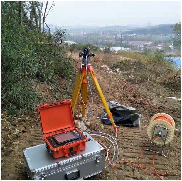
Automated Probe Deployment
A precision stepper motor drives the cable drum at constant speed, eliminating image jitter and depth errors associated with manual hoisting. This ensures consistent data quality across the entire logged interval.
3D High-Precision Attitude Sensor
An integrated high-precision electronic compass and triaxial sensor module achieves ±0.1° angular accuracy. The system supports vertical, inclined, and horizontal borehole orientations with real-time probe attitude indication.
Intelligent Data Management Software
The digital core library replaces physical core samples, eliminating the logistical challenges of core retrieval, transportation, storage, and long-term management. High-definition borehole wall imagery serves as a permanent geological record accessible for reanalysis at any time.
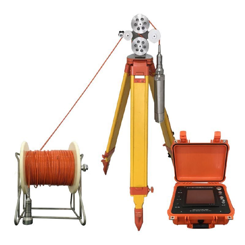
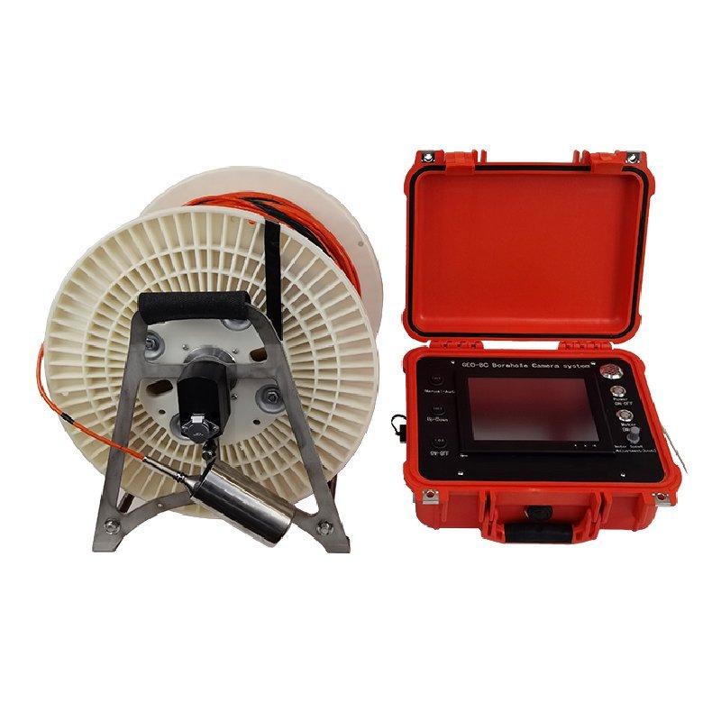
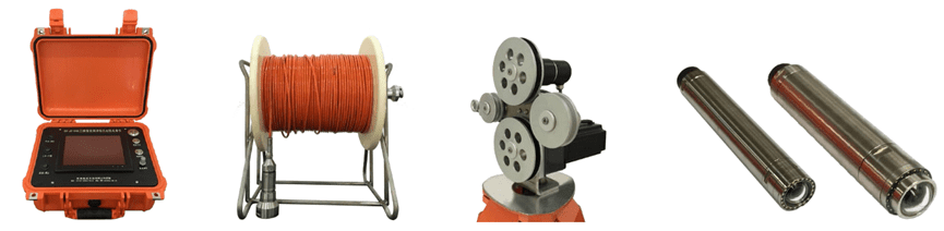
Configuration
Specifications
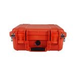
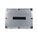
System Configuration
| Component | Description |
|---|---|
| Surface Control Unit | Industrial-grade multimedia processing workstation |
| User Interface | Touchscreen display + tactile button controls |
| Display | 8.4-inch TFT LCD |
| Storage | 128 GB high-speed solid-state drive |
| Acquisition Rate | Up to 60 frames per second |
| Output Resolution | >2048 × 2048 pixels |
| Acquisition Modes | Real-time image mosaicking, real-time video recording, or simultaneous image + video capture |
| Host Dimensions | 350 × 300 × 150 mm |
| Host Weight | 3.5 kg |
Probe Specifications
| Parameter | Specification |
|---|---|
| Lens Type | 360° panoramic lens |
| Camera Housing | Open-design hemispherical explosion-proof glass dome; tool-free disassembly and replacement |
| Resolution | 2–10 megapixels (configurable) |
| Diameter | Ø50 mm, Ø63 mm (custom diameters available) |
| Hoisting Mechanism | Constant-speed electric drive |
| Lifting Speed | 0.5–3.0 m/min (adjustable) |
| Maximum Cable Length | 100–1,500 m (customizable) |
| Depth Encoder Accuracy | 0.1 mm |
| Illumination | Open-design waterproof LED ring array; shadow-free, uniform lighting with no dead angles |
| 3D Attitude Sensor | Real-time probe orientation for vertical, horizontal, and inclined boreholes |
| Cable | Custom lightweight cable; <2 kg per 100 m; tensile strength >200 kg |
| Measurement Accuracy | Crack detection: 0.1 mm; Azimuth: ±0.1° |
| Battery Endurance | 8 hours continuous operation |
Cases
FAQ
In gravity exploration (SI), what is the unit of gravity? How to convert gravity units between SI and CGS?
① In SI, it is m·s-2, and one percent of it is the international unit abbreviation g.u.;
② Conversion between SI and CGS: 1g.u.=10-1 mGal
What are gravitational field and gravitational potential?
Gravitational field: The space around the earth with gravity is called the gravitational field.
Gravitational potential: The gravitational potential W in the gravitational field is equal to the work done by a particle of unit mass moving from infinity to that point.
What is the normal gravity field of the earth? What are the rules for the change of the normal gravity field with latitude and altitude?
① The normal gravity field of the earth: Assuming that the earth is a rotating ellipsoid (reference plane), the surface is glossy, the internal density is uniform, or it is distributed in concentric layers, the density of each layer is uniform, and the deviation of the shape of the ellipsoid from the geoid is very small, then the gravity field generated by the earth is the normal gravity field.
② The normal gravity value is only related to the latitude, the smallest at the equator and the largest at the poles, with a difference of about 50,000 g.u.; the rate of change of the normal gravity value with latitude is the largest at 45° latitude, and zero at the equator and the poles; the normal gravity value decreases with increasing altitude, and its rate of change is -3.086 g.u.. The main feature of the long-term change is the "westward drift" of the geomagnetic elements, both the dipole field and the non-dipole field drift westward, and have a global nature.
What is the relationship between gravitational field strength and gravitational acceleration?
The gravitational field strength is equal to the gravitational acceleration in both numerical and dimensional terms, and the two are in the same direction. In gravity exploration, all references to gravity refer to gravitational acceleration. The gravitational field strength at a point in space is equal to the gravitational acceleration at that point.
What is gravity exploration?
Gravity exploration is an exploration method that is based on the density difference of rocks and ores. Since density difference will cause local changes in the normal gravity field of the earth (i.e. gravity anomaly), it is used to solve geological problems by observing and studying gravity anomalies.