Welcome to Geotech!
-1.png)


NAFEM Near Surface FEM System | UAV-Mounted | 7-Frequency | RTK 1cm

PRODUCT PARAMETERS
Description
 Overview
 Overview
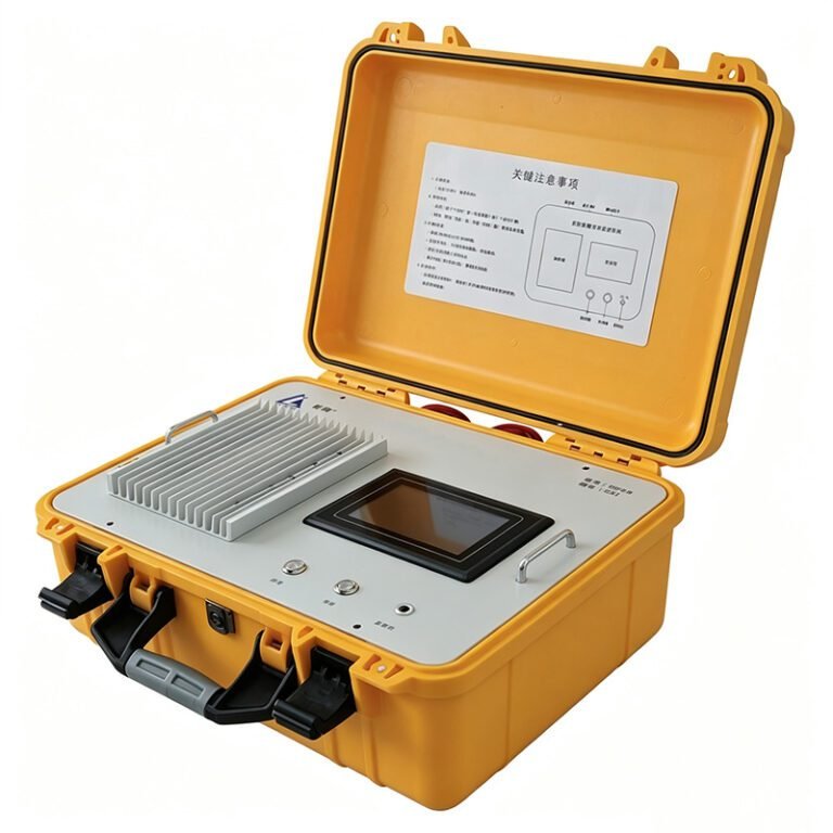
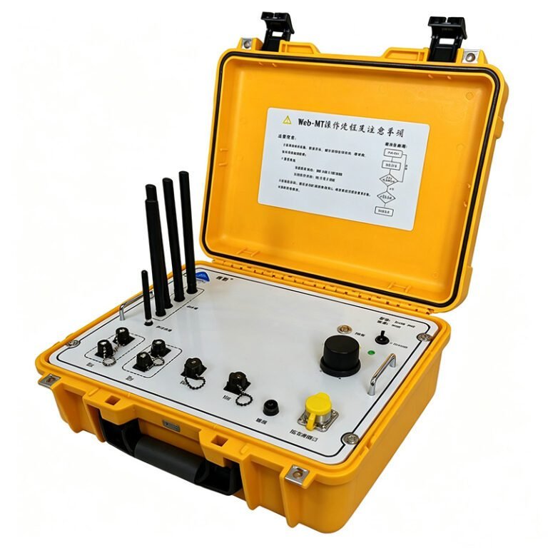
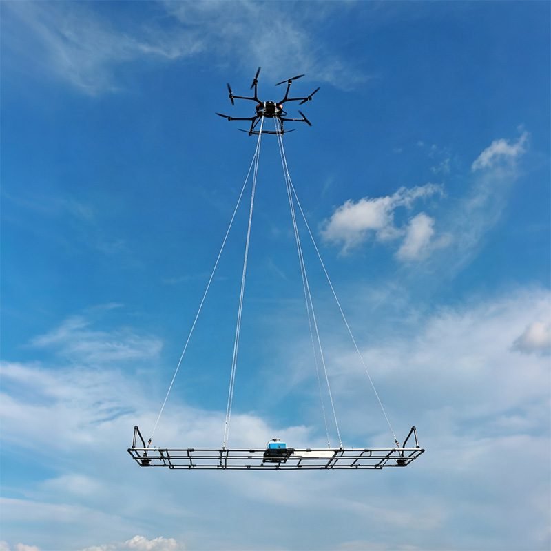
The near-surface frequency-domain electromagnetic system (NAFEM) including in a low-altitude frequency-domain electromagnetic detection mainframe, multi-frequency detection sensors, and an UAV.
The frequency-domain airborne electromagnetic method has significant advantages in terms of detection efficiency, handling complex terrains, and identifying shallow low-resistivity geological bodies. It is applicable to engineering surveys, environmental investigations, and hydrogeological exploration, among others. It is particularly suitable for scenarios such as locating faults, karst, underground water resources, archaeology, and void zone detection.
Features
1. Lightweight UAV-Mounted Design for Complex Terrain
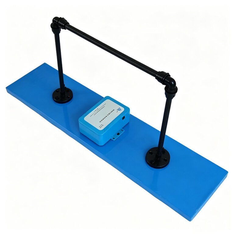
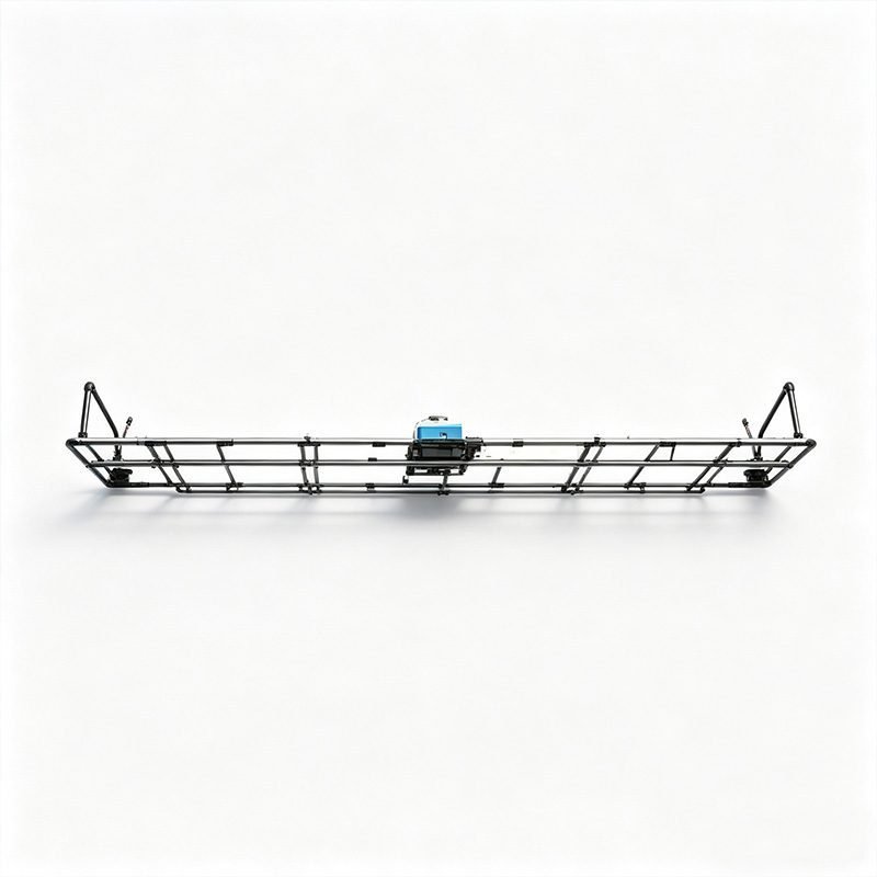
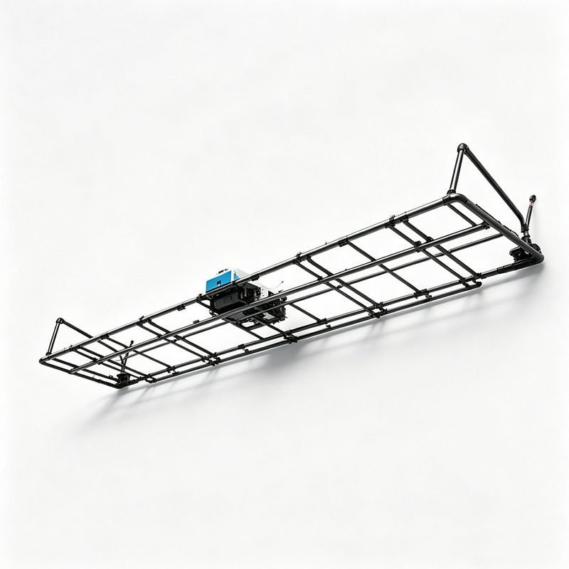
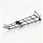
NAFEM adopts a lightweight design with dimensions of 500×65×10cm. The system is compact in size and lightweight in weight, making it easy to mount on multi-rotor UAVs. It is perfectly suitable for operations in complex terrains such as mountains, wetlands, and urban areas where ground access is difficult. Low-altitude flight enables high-resolution near-surface detection.
2. Wireless Control System for Intelligent Operation
The system is equipped with a wireless control system. It connects via WiFi to a mobile phone or tablet. Operators control the UAV and monitor data in real time. The convenient and efficient human-machine interaction experience makes operation and management more intelligent. No dedicated ground station or cables are required.
3. RTK Real-Time Positioning, Centimeter-Level Accuracy
NAFEM is equipped with RTK real-time positioning technology. Horizontal positioning accuracy reaches 0.5m. Fixed solution accuracy reaches 1cm. Height measurement covers 0-40m with ±1% accuracy. This ensures precise spatial coordinates for every measurement point. Data quality and interpretation reliability are significantly improved.
4. Multi-Frequency Synchronous Measurement with Excellent Vertical Resolution
The system integrates transmission and reception functions. It supports 7-frequency synchronous measurement at 128Hz, 256Hz, 512Hz, 1024Hz, 2048Hz, 4096Hz, and 8192Hz. Each frequency penetrates to a different depth. Multi-frequency data enables layered resistivity modeling. Excellent vertical resolution performance distinguishes thin layers and shallow anomalies.
5. One-Transmitter-Two-Receiver Signal Extraction
NAFEM uses one-transmitter-two-receiver signal extraction technology. This configuration achieves high-precision data collection. The dual-receiver design provides redundant measurements and improved signal-to-noise ratio. Data reliability is enhanced compared to single-receiver systems.
6. Edge Computing for Real-Time Processing
By adopting edge computing technology, real-time processing is completed simultaneously during data collection. Preliminary apparent resistivity sections are available in the field. Invalid data is identified immediately. Survey efficiency is significantly enhanced. Post-processing time is reduced.
Technical Principles
NAFEM operates on the frequency-domain electromagnetic (FEM) method. The transmitter coil generates a continuous-wave primary magnetic field at multiple discrete frequencies. This primary field induces eddy currents in conductive subsurface targets. The eddy currents generate secondary magnetic fields. Two receiver coils measure the in-phase and quadrature components of the secondary field.
Each operating frequency penetrates to a characteristic depth based on the skin effect. Lower frequencies (128Hz, 256Hz) probe deeper. Higher frequencies (4096Hz, 8192Hz) resolve shallow details. The 7-frequency spectrum provides a depth-resolved resistivity profile from surface to approximately 30-50m depth.
| Frequency (Hz) | Approximate Depth (m) | Primary Application |
|---|---|---|
| 128 | 30-50 | Deep groundwater, bedrock interface |
| 256 | 20-35 | Fault zones, deep karst |
| 512 | 15-25 | Aquifer boundaries, clay layers |
| 1024 | 10-18 | Shallow groundwater, voids |
| 2048 | 5-12 | Pipeline detection, archaeology |
| 4096 | 3-8 | Utility cables, shallow cavities |
| 8192 | 1-5 | Very shallow structures, soil layers |
The one-transmitter-two-receiver configuration measures the secondary field at two spatial positions. This provides additional constraints for inversion. Vertical resolution is improved. Lateral consistency is verified.
Specifications
The NAFEM system comprises three core components. Low-Altitude Frequency-Domain EM Mainframe. Multi-Frequency Detection Sensors. UAV Flight Platform.
1. Low-Altitude Frequency-Domain EM Mainframe
| Parameter | Specification |
|---|---|
| Frequency range | 128Hz, 256Hz, 512Hz, 1024Hz, 2048Hz, 4096Hz, 8192Hz |
| Sampling rate | 102.4kHz |
| Sampling bit depth | 24 bits |
| Output rate | 1Hz |
| Coil parameters | Separated coplanar coil |
| Magnetic moment | 174 A·m² |
| Connection method | WiFi to mobile phone or tablet |
| Power supply | 24V |
| Size | 500×65×10cm |
2. Multi-Frequency Detection Sensors
The sensor array includes one transmitter coil and two receiver coils in separated coplanar geometry. The transmitter operates at all seven frequencies sequentially or simultaneously depending on mode. Receiver coils detect the secondary field with high sensitivity. The 174 A·m² magnetic moment ensures adequate signal strength for near-surface targets.
3. UAV Flight Platform and Positioning System
| Parameter | Specification |
|---|---|
| Positioning accuracy | Single point 1.5m, Fixed 1cm |
| Horizontal accuracy | 0.5m |
| Height measurement | 0-40m, accuracy ±1% |
| Flight control | Wireless via mobile device |
The UAV platform is selected based on payload capacity and endurance. Multi-rotor drones with vertical take-off and landing are preferred. RTK base station provides centimeter-level differential corrections.
Applications
1. Fault Detection
Locate and map shallow fault zones. Faults often present resistivity contrasts due to fractured rock, clay gouge, or fluid alteration. NAFEM multi-frequency data resolves fault geometry and dip. Engineering hazard assessment and seismic microzonation are supported.
2. Karst Mapping
Detect karst cavities, sinkholes, and dissolution features. Air-filled cavities show high-resistivity anomalies. Water-filled cavities show low-resistivity responses. The 7-frequency spectrum discriminates cavity type and fill material. Construction safety and foundation design benefit.
3. Groundwater Exploration
Map shallow aquifers and water-bearing fracture zones. Freshwater-saline water interfaces are identified through resistivity contrast. Seasonal water table fluctuations are monitored. Well placement and water resource management are optimized.
4. Archaeological Survey
Detect buried walls, foundations, tombs, and ditches. Archaeological features often present resistivity or magnetic contrasts with natural soils. Non-invasive rapid coverage prioritizes excavation targets. Heritage site preservation is ensured.
5. Void Zone Detection
Identify underground voids, tunnels, and abandoned mine workings. Void geometry and depth are estimated from multi-frequency response. Urban infrastructure safety and land-use planning are supported.
6. Soft Clay Layer Detection
Measure soft clay thickness and calculate volume. Soft clay shows characteristic low-resistivity response. Layer boundaries are mapped at high resolution. Thickness contours guide engineering design and ground improvement.
Cases
Case 1: Urban Pipeline Detection
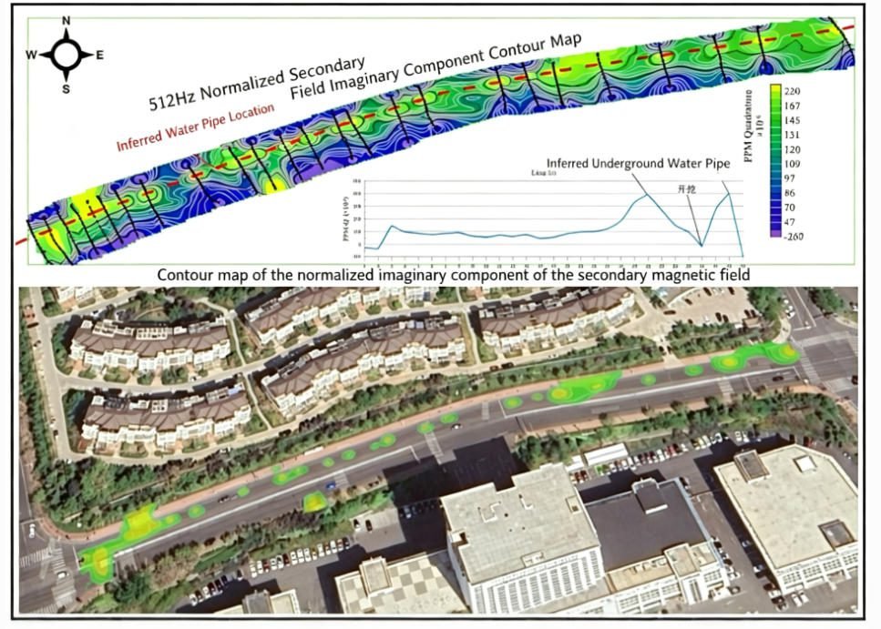
A municipal utility mapping project required locating buried water mains, gas pipes, and electrical cables in an urban area. NAFEM was mounted on a multi-rotor UAV. The 2048Hz and 4096Hz frequencies targeted shallow utilities. The UAV flew at 10m altitude along planned survey lines. Real-time resistivity sections identified multiple conductive anomalies. Anomalies were correlated with utility records. Pipeline depth and orientation were estimated. The survey was completed in one day with minimal traffic disruption.
Case 2: Soft Clay Layer Detection
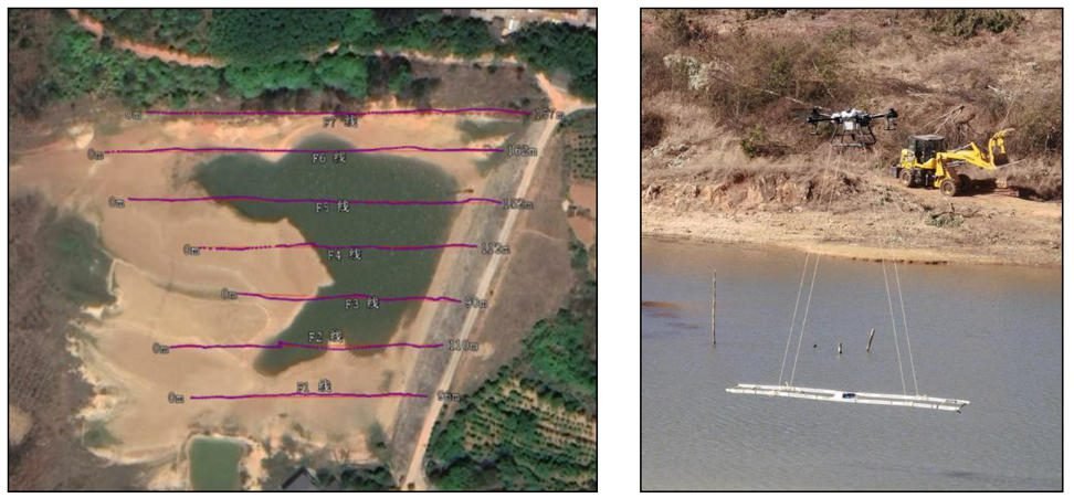
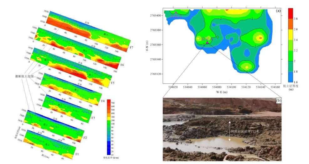
A construction project required mapping soft clay thickness for foundation design. NAFEM was deployed to measure the soft clay layer across a 2km² site. The 512Hz and 1024Hz frequencies optimally resolved the clay layer. Multi-frequency data was inverted to produce a 3D resistivity model. Soft clay thickness was extracted and contoured. Volume calculations supported earthwork planning. The results correlated with borehole data. Design parameters were optimized based on geophysical results.
FAQ
In gravity exploration (SI), what is the unit of gravity? How to convert gravity units between SI and CGS?
① In SI, it is m·s-2, and one percent of it is the international unit abbreviation g.u.;
② Conversion between SI and CGS: 1g.u.=10-1 mGal
What are gravitational field and gravitational potential?
Gravitational field: The space around the earth with gravity is called the gravitational field.
Gravitational potential: The gravitational potential W in the gravitational field is equal to the work done by a particle of unit mass moving from infinity to that point.
What is the normal gravity field of the earth? What are the rules for the change of the normal gravity field with latitude and altitude?
① The normal gravity field of the earth: Assuming that the earth is a rotating ellipsoid (reference plane), the surface is glossy, the internal density is uniform, or it is distributed in concentric layers, the density of each layer is uniform, and the deviation of the shape of the ellipsoid from the geoid is very small, then the gravity field generated by the earth is the normal gravity field.
② The normal gravity value is only related to the latitude, the smallest at the equator and the largest at the poles, with a difference of about 50,000 g.u.; the rate of change of the normal gravity value with latitude is the largest at 45° latitude, and zero at the equator and the poles; the normal gravity value decreases with increasing altitude, and its rate of change is -3.086 g.u.. The main feature of the long-term change is the "westward drift" of the geomagnetic elements, both the dipole field and the non-dipole field drift westward, and have a global nature.
What is the relationship between gravitational field strength and gravitational acceleration?
The gravitational field strength is equal to the gravitational acceleration in both numerical and dimensional terms, and the two are in the same direction. In gravity exploration, all references to gravity refer to gravitational acceleration. The gravitational field strength at a point in space is equal to the gravitational acceleration at that point.
What is gravity exploration?
Gravity exploration is an exploration method that is based on the density difference of rocks and ores. Since density difference will cause local changes in the normal gravity field of the earth (i.e. gravity anomaly), it is used to solve geological problems by observing and studying gravity anomalies.