Welcome to Geotech!

Spread Spectrum Induced Polarization System


PRODUCT PARAMETERS
Description
【SSIP】Full-wave Spread Spectrum Induced Polarization System
 Abstract
Full-wave Spread Spectrum Induced Polarization System was New generation IP survey system. It enables large detection depth (>1000 m), high precision 2D and 3D spectral IP measurements. On the instrument, with the M sequence pseudo-random spread spectrum signal, which greatly improves the frequency domain resolution and the anti-interference ability of the signal. With wireless distributed array receiving system,the spread spectrum IP signal detection achieve large depth, high efficiency and high accuracy. The relative phase spectrum method was used to correct the electromagnetic coupling induction, and the phase response and Cole-Cole model parameters were obtained.The signal to noise ratio (SNR) was enhanced by spreading spectrum signal emission, Robust and related techniques.Through the precise inversion of multi-frequency points and multiple devices with terrain, Got the precision imaging of the detection target and rich geoelectric information.Finally, through the analysis of multi-frequency points and multi-parameter inversion results, we can got the high confidence prediction of metallogenic favorable areas is realized.
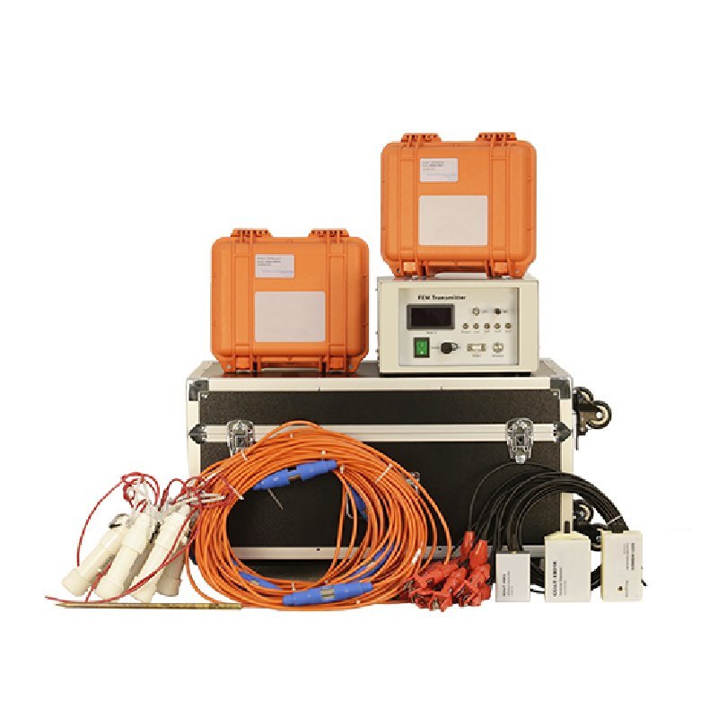
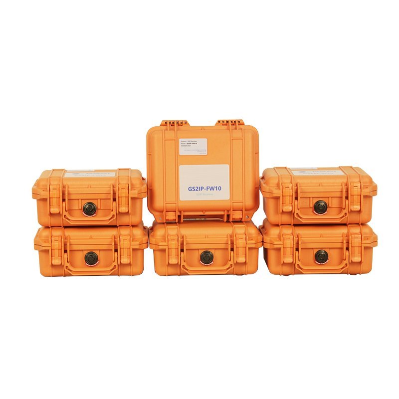
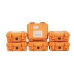
Full-wave Spread Spectrum Induced Polarization System mainly includes spread spectrum IP transmission system and spread spectrum IP receiving system. Specifically including acquisition station, 7 tapped channel cable, unpolarized electrode, relay station, ZigBee extension cable, tripod, current station, current sensor, transmitter, rectifier, generator, power supply cable, equipment and accessories.

Working principle
Spread spectrum IP is a method to improve the signal’s anti-interference ability and accuracy through spread spectrum technology, which is widely used in the field of geophysical exploration. Its basic principle is to improve the signal’s anti-interference performance and accuracy by expanding the low-frequency electrical signal to a high-frequency bandwidth.
Applications
● Mineral resource exploration: It can be used to measure the geology, rock and mineral content and ore body size of the mining area, and provide technical support for mineral resource exploration.
● Oil and gas detection: It can measure the distribution, scale and reserves of underground oil and gas reservoirs, and conduct analysis and evaluation to provide real-time feedback data for the exploration, development and utilization of oil and gas resources.
● Water resource development: The spread spectrum IP instrument can quickly measure the groundwater level, water quality and hydrogeological structure, providing a basis for water resource development and protection.
● Shallow geological survey
● Urban underground space exploration
Features
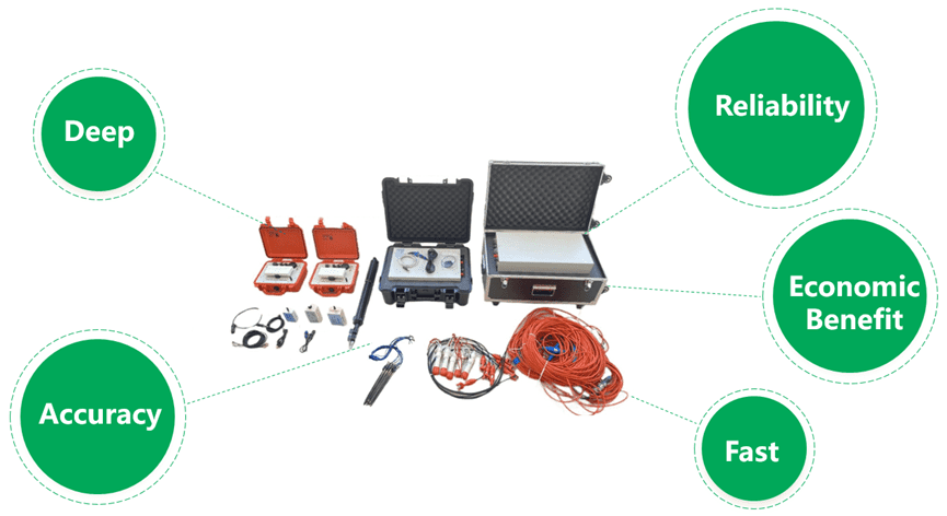
● Deep (great depth)
The exploration depth exceeds 1km, while the maximum exploration depth of IP instruments at home and abroad does not exceed
500m.
● Precise (high accuracy)
The instrument can measure uV-level voltage signals, and the measured resistivity value error is less than 1%, which is far higher than the mV-level signal requirements of conventional IP instruments.
● Accurate (accurate results)
Through spread spectrum IP signal detection, multi-frequency point observation, relative phase spectrum decoupling, AI denoising and other technologies, accurate measurement of resistance characteristics and excitation characteristics is achieved, improving the credibility of inversion results.
● Fast (fast speed)
The system adopts wireless distributed array observation, and a complete strip profile can be measured with a single power supply. Under Class II terrain conditions, IP sounding at a depth of 1km can complete at least 20 sounding points per day, while conventional IP sounding can complete at most 2 sounding points per day.
● High (high efficiency)
The high efficiency of array observation can greatly save exploration costs. Under Class II terrain conditions, the gross profit of sounding at a depth of 1km can reach more than 80% according to normal budget standards.
Functions
● Full waveform array collection of telluric electromagnetic signals
● Fast parallel computation of impedance estimation
● Time series analysis
● Spectrum and correlation analysis
● Instrument host and magnetic rod response analysis
● Checkpoints and consistency error calculations
● Data quality statistics
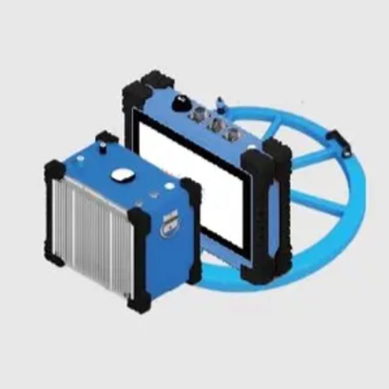
Product Composition
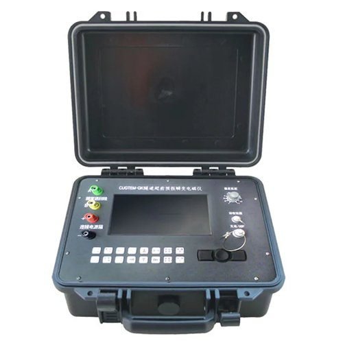
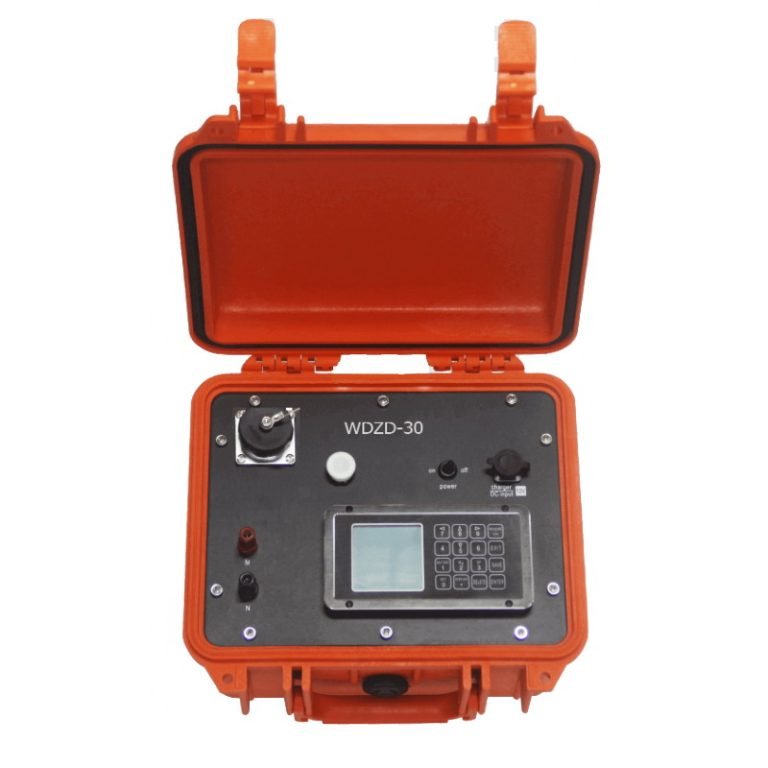
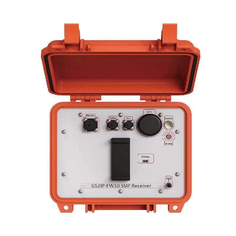
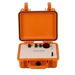
(一)Receiver Component
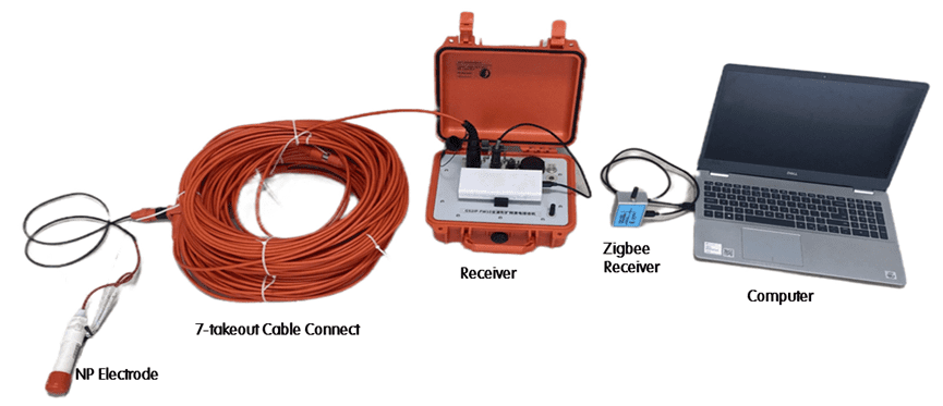
1. Computer with Zigbee Receiver to control and monitor whole system
2. Multiple Receiver with Cable and NP electrode to collect Full wave signal
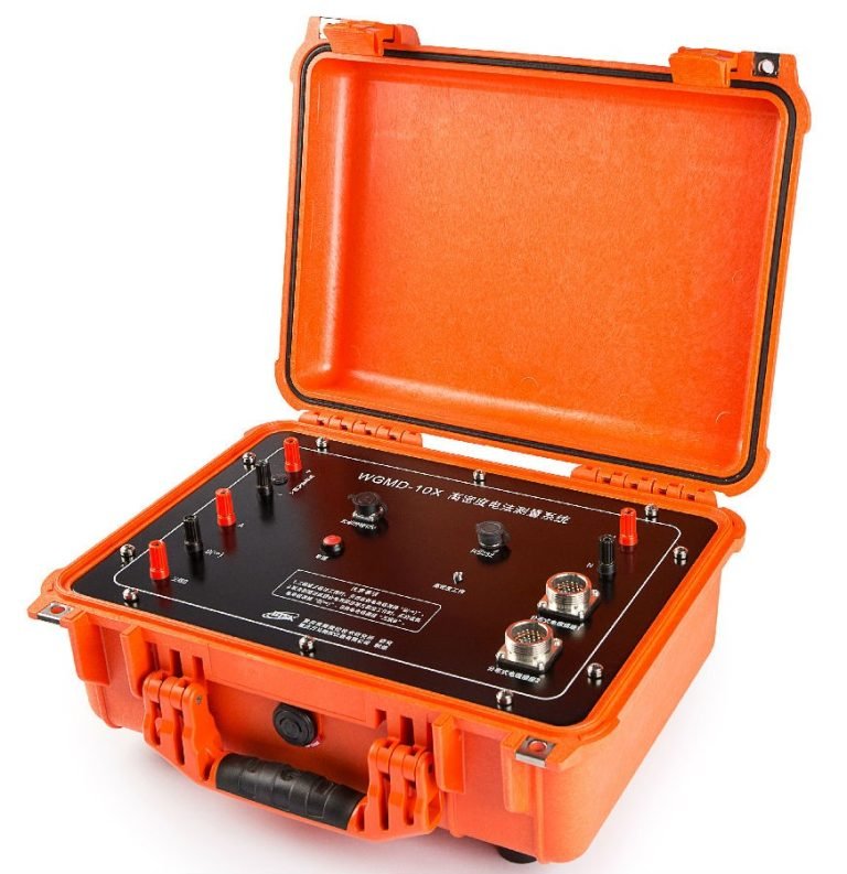
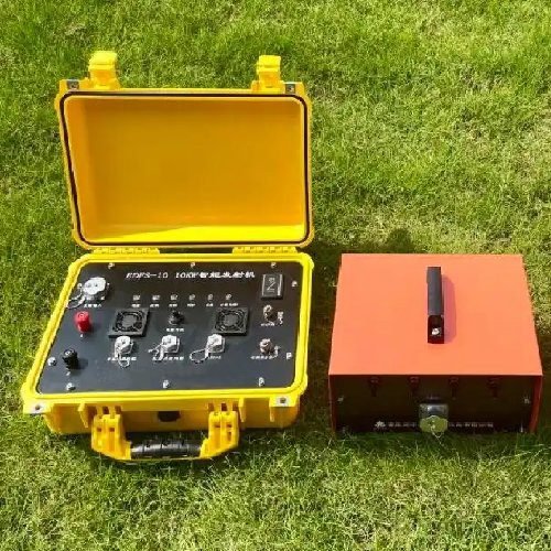
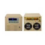
(二)Transmitter Component
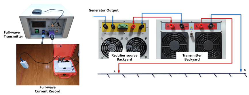
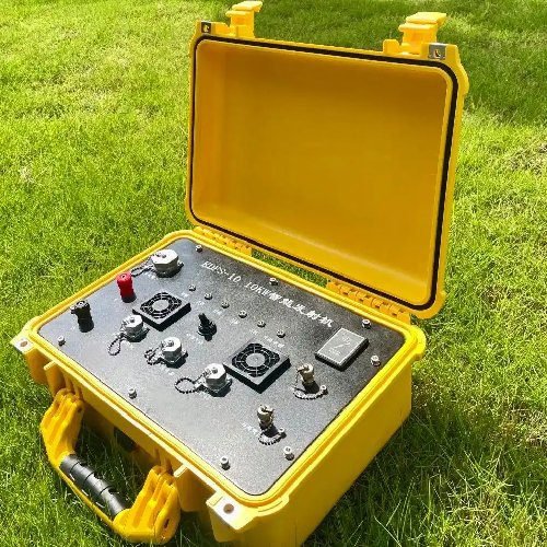
1. Transmitter(3kw(1000V/3A),10kw(1000V/10A),50kw(1000V/50A))
2. Full-wave Current Record
3. Parallelable Rectifier Source (10A,up to 200A)
Specifications
Receiver
| Item | Parameters |
| Channel | 6 |
| Sample rate | 15/150/2400Hz automatic control |
| ADC | 32 bit |
| Gain | 1~64 |
| GPS Accuracy | 30ns |
| Dynamic Range | 160dB |
| Weight | 2.8kg |
| Dimensions | 27cm × 24.6cm × 12.4cm |
| Power Supply | 5V Power Bank |
| Connect | Wi-Fi, ZigBee(max to 1.6km), Internet |
| TDP | 2.5W |
| Operating Temperature | -20℃~60℃ |
Transmitter
| Item | Parameters |
| Max Voltage | 1000V(2000V , Optional need serial connect) |
| Max Current | 5/10/15/20/30A(Optional need Parallel connect) |
| Composite | Support Serial and Parallel |
| Frequency | 1/8192-128Hz(Controllable) |
| Transmitter Wave | Programmable Support Time Domain and Frequency Domain |
| GPS Sync Accuracy | 30ns |
| Connect | Wi-Fi, ZigBee(max to 1.6km), Internet |
| Operating Temperature | -20℃~60℃ |
FAQ
In gravity exploration (SI), what is the unit of gravity? How to convert gravity units between SI and CGS?
What are gravitational field and gravitational potential?
What is the normal gravity field of the earth? What are the rules for the change of the normal gravity field with latitude and altitude?
What is the relationship between gravitational field strength and gravitational acceleration?
What is gravity exploration?