Welcome to Geotech!

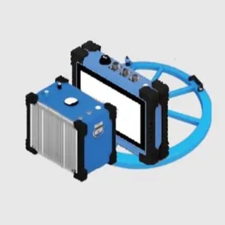
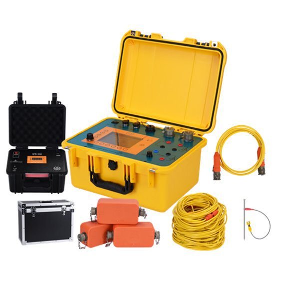
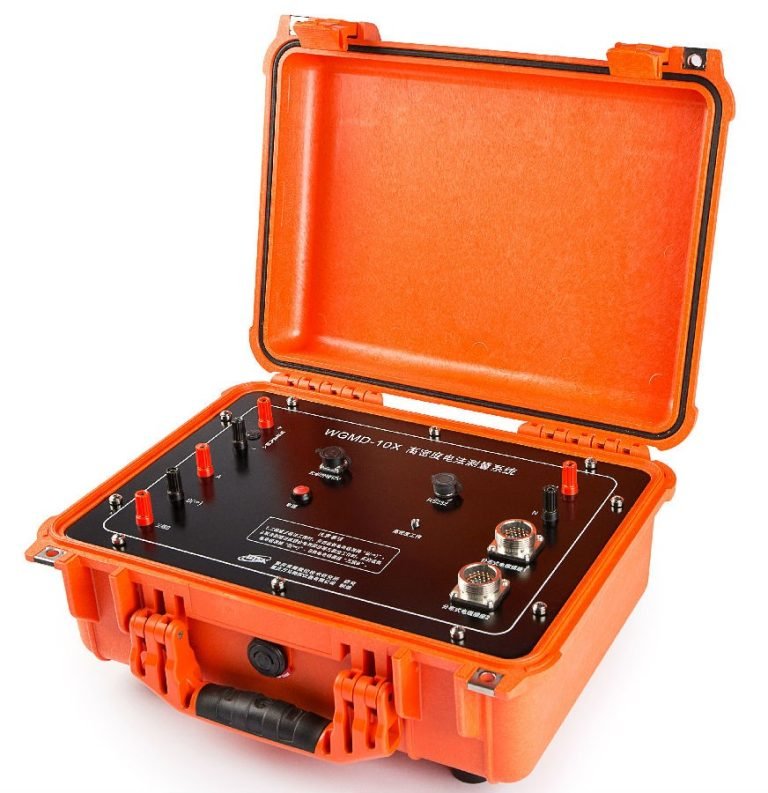
DJF Series 10kW High-Power Digital DC Induced Polarization Measurement System


PRODUCT PARAMETERS
Description
DJF Series 10kW High-Power Digital DC Induced Polarization Measurement System
 Article Title
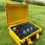
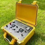
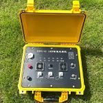
DJF Series 10kW High-Power DC Induced Polarization (IP) Measurement System: Professional Solution for Deep Mineral Exploration & Engineering Surveys
(Note: Related terms:High-power induced polarization (IP) technology, High-current IP methods, Digital DC IP measurement system, IP surveying instruments, Chargeability measurement, IP parameter acquisition)
Principles of High-Power Induced Polarization (IP) Technology
High-power induced polarization technology is a geophysical exploration method widely used in mineral resource surveys. It utilizes high-frequency electrical currents to generate an electromagnetic field underground. By analyzing variations in the electromagnetic field, mineral deposits can be detected. During exploration, parameters such as current frequency, amplitude, duration, and electrode configuration are controlled to capture distinct electromagnetic field characteristics, enabling the estimation of underground mineral reserves.
Technical Advantages
Compared to traditional geophysical exploration methods, high-power IP technology offers the following advantages:
- High Sensitivity: Detects subtle electromagnetic field variations in mineral deposits, enabling effective identification of weak metallic ores.
- Non-Invasive: Conducts surface surveys without excavation, overcoming challenges faced by conventional geological methods.
- High Efficiency: Delivers rapid, accurate, and large-scale exploration, particularly effective for extensive mineral deposit surveys.

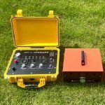
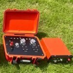
Product Overview
The DJF Series High-Power DC Induced Polarization Measurement System is a next-generation solution designed for deep multi-metal mineral exploration. Featuring stable performance and high precision, it leads the domestic market. Key attributes include:
- Lightweight design, high supply voltage, and large power output.
- Massive data storage capacity with real-time data acquisition and display of resistivity and polarizability.
- Applications span multi-metal mineral exploration, engineering geophysics, groundwater detection, geothermal reservoir identification, and hydrogeological surveys.
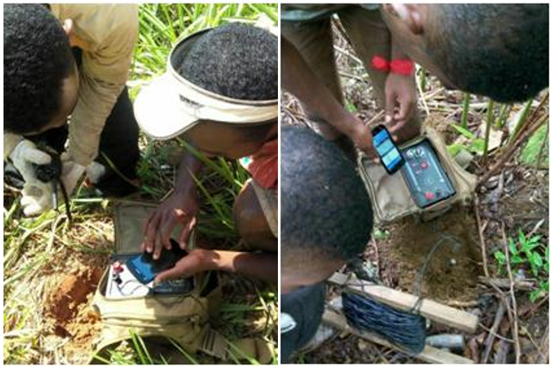
Applications
- Underground cavities, coal mine goafs, dam piping leak detection, engineering surveys.
- Metal/non-metal mineral exploration, geothermal resource identification.
- Groundwater resource mapping, geological stratification.
- Environmental surveys, landfill leak detection, geohazard assessments.
Key Features
- Multifunctional: Field measurements of apparent resistivity, polarizability, and half-life time; records full charge/discharge cycles and IP decay for multi-parameter analysis.
- Multi-Parameter Analysis: Computes polarizability across time intervals and decay indices to distinguish ore anomalies.
- Deep Exploration: Depth ranges from 500–800 m, adjustable via electrode spacing.
Core Advantages
Smart Synchronization Control
- Triple synchronization modes: Software/Quartz Clock/GPS (optional).
- Compatibility: Integrates with traditional IP receivers for versatile setups.
Precision Data Management
- Military-grade real-time clock: Millisecond timestamping.
- Industrial flash memory: Stores 100,000+ current-time datasets with power-loss protection.
Safety Protection
- Triple-circuit protection: Over/under-voltage, overcurrent, open-circuit.
- Dual-state monitoring: LED indicators for operational/fault status.
Accurate Measurement
- Ground impedance detection: Real-time AB electrode resistance monitoring.
- Quartz timebase: 0.1ppm precision clock for timing accuracy.
Full-Wave Sampling
- Full-waveform recording: Enables polarization rate recalculation and self-potential interference monitoring.
- System self-calibration: Step-response calibration ensures <0.5% IP measurement error.
Intelligent Noise Suppression
- Adaptive filtering: 50/60Hz industrial noise cancellation.
- Dynamic gain control: 128-level AGC for weak signal optimization.
System Compatibility
- Global synchronization: Supports mainstream time-domain IP transmitters.
- Signal enhancement: Quartz/GPS modes boost SNR by 40% vs. traditional methods.
Robust Engineering Design
- IP67 rating: Dust/waterproof, operable in -20℃ to 60℃ extremes.
- Expandable storage: Up to 64GB for permanent data retention.
Specifications
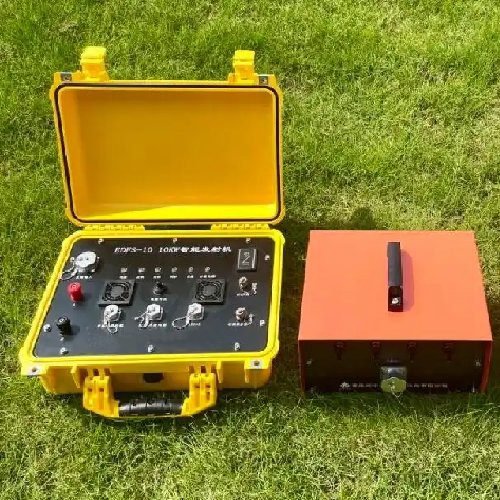
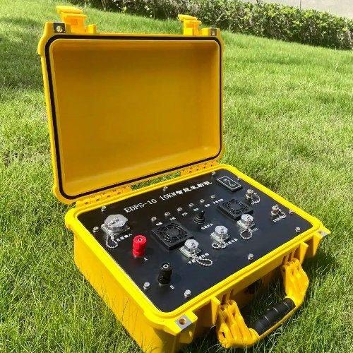
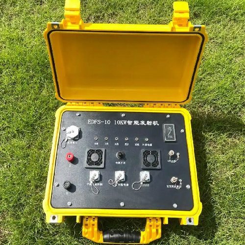
| Transmitter | Parameters |
|---|---|
| Max. Transmitting Power | 10kW |
| Max. Transmitting Current | 10A |
| Max. Transmitting Voltage | 1200VDC |
| Current Accuracy | ±1% |
| Duty Cycle Options | 4S, 8S, 16S, 32S, 64S, 128S, 256S |
| Output Waveform | Alternating-polarity waveform(1:1 ratio), 1–60s pulse width |
| Current Data Storage | ≥8000 datasets, programmable intervals (min. 1 minute) |
| Synchronization Modes | GPS, High-precision quartz clock, Software |
| Operating Temperature | -20℃ to +60℃, 95% Rh |
| Dimensions | 80×450×360mm |
| Weight | 22kg |
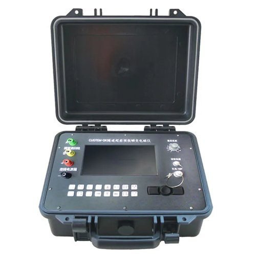
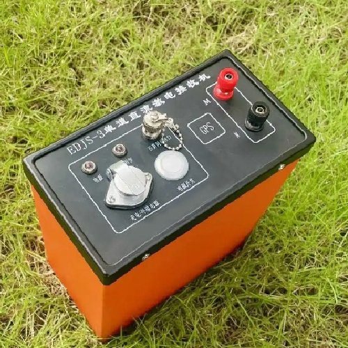
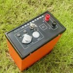
| Receiver | Parameters |
|---|---|
| Synchronization Modes | Software, GPS, Quartz clock |
| Voltage Range | ±40V (32-bit A/D) |
| Voltage Resolution | 5nV |
| Data Recording | Full-waveform current/potential recording |
| Voltage Accuracy | ≤0.1% (>1mV), ±1μV (≤1mV) |
| Polarization Rate Accuracy | ±0.2% relative error |
| Input Impedance | ≥50MΩ, >120dB 50Hz suppression |
| SP Compensation | ±40V auto-tracking digital compensation |
| Display | 5-inch 24-bit LCD (1000cd/m² sunlight-readable) |
| Storage | 16GB (expandable to 64GB), USB 2.0 |
| Battery | 16.8V, 23-hour runtime |
| Waterproof Rating | IP67 |
| Dimensions | 240×95×240mm |
| Weight | 1.5kg |
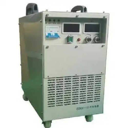
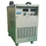
| Rectifier | Parameters |
|---|---|
| Max. Output Power | 10kW |
| Max. Output Voltage | 1200V |
| Max. Output Current | 10A |
| Voltage/Current Accuracy | ±1% |
| Input Power | 220V/50Hz (±10% fluctuation) |
| Operating Temperature | 10℃ to +50℃, 95% Rh |
| Dimensions | 600×370×340mm |
| Weight | 80kg |
Case Study

FAQ
In gravity exploration (SI), what is the unit of gravity? How to convert gravity units between SI and CGS?
What are gravitational field and gravitational potential?
What is the normal gravity field of the earth? What are the rules for the change of the normal gravity field with latitude and altitude?
What is the relationship between gravitational field strength and gravitational acceleration?
What is gravity exploration?