Welcome to Geotech!

What is Continuous Resistivity Profiling?
Continuous Resistivity Profiling (CRP) is an efficient geophysical method for obtaining subsurface resistivity distribution through continuous movement of electrode arrays. Compared to traditional static resistivity methods (e.g., ERT), its core innovations include:
- Dynamic Data Acquisition: Real-time measurements at speeds of 1-5 m/s (applicable on land or vessels), covering 20-50 km² per day
- Multi-Channel Synchronization: 128+ electrodes activated simultaneously, improving vertical resolution to 0.3-1 m (vs. 2-5 m for traditional methods)
- Expanded Applications: From land mineral exploration to marine pipeline inspection (e.g., subsea cables, oil/gas pipelines)
Scientific Principle: A towed electrode array (5-10 m spacing) injects low-frequency current (1-10 Hz) into the ground, measures potential gradients, and inverts the data to build 3D resistivity models.
Comparative Analysis: CRP vs. Other Geophysical Methods
1. CRP vs. High-Density Resistivity Method
| Metric | CRP | High-Density Resistivity Method |
|---|---|---|
| Efficiency | Dynamic continuous measurement, 5-10x faster | Static point measurement requiring repeated electrode setup |
| Resolution | Horizontal: 0.5-2 m | Vertical: 1-3 m |
| Cost | 100−220USD/km (land) | 280−800USD/km² |
| Applications | Linear projects (roads, pipelines), coastal zones | Detailed mineral/geothermal surveys |
2. Synergy Between CRP and Ground-Penetrating Radar (GPR)
- CRP Strength: Greater penetration depth (50-150 m in freshwater, 10-30 m in seawater)
- GPR Limitation: Signal attenuation in conductive seawater (limited to <30 m on land)
- Integrated Strategy: CRP locates deep anomalies; GPR maps shallow structures
Key Applications and Case Studies
Application 1: Marine Engineering Surveys
- Subsea Pipeline Inspection: In an East Asian port project, CRP located a damaged 0.5 m-diameter oil pipeline buried 8 m deep with <0.3 m positioning error
- Coral Reef Exploration: GeoTech’s system identified 5 freshwater lenses in the South China Sea, achieving 90% drilling validation
Application 2: Land Linear Projects
- Railway Subgrade Risk Detection: CRP identified 12 permafrost thaw zones on the Tibetan Plateau, reducing repair costs by 35%
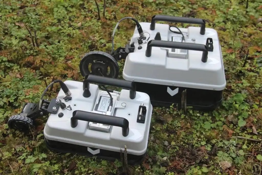
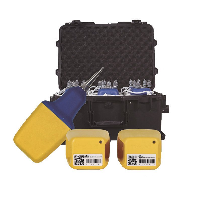
Equipment Recommendations and Specifications
- Electrode Array: 128 titanium electrodes (IP68 corrosion-resistant)
- Operating Depth: Up to 200 m water depth (shelf-ready)
- Real-Time Imaging: AI-powered inversion software generates resistivity pseudo-sections on-site
Land Rapid Survey Kit
- Mobility: All-terrain vehicle-mounted, covering 80-120 km/day
- Accuracy: Resistivity range 0.1-10,000 Ω·m, error <2%
Integrated Multi-Method Survey Strategies
- Phase 1 (CRP): Large-scale anomaly screening (200−500/km²)
- Phase 2 (GPR): 10m×10m grid survey on target zones
- Phase 3 (Seismic): Depth validation of targets (error <5%)
Case Result: A copper mine project reduced target identification time by 60% and increased drilling success rate to 78%
Further reading | Technical solutions related to this article
In the field of resource exploration and engineering testing, accurate data is the key to success. As an innovator of resource and environmental instruments, Geotech has always taken high-precision electrical exploration technology as its core to provide reliable solutions for global users.
If you want to learn more about how the [Electrical Exploration System (ERT)] can help mineral exploration and geological research, please click on the electrical instrument product page to explore details, or visit Geotech’s official website to view the full range of exploration equipment (covering more than ten categories of products such as magnetometers, seismic nodes, and geological radars). Our technical team is on call at any time to customize scientific solutions for your project – making unknown strata a controllable data map.
