Welcome to Geotech!
-1.png)


Magnetometry in Archaeology: Unveiling Ancient Site Mysteries
TIPS:Magnetometry in archaeology transforms how researchers discover buried heritage. This guide explains how archaeological geophysics teams use proton magnetometers for non-invasive site detection. You will learn how magnetometry in archaeology reveals hidden foundations and artifacts. We cover field techniques, data interpretation, and equipment selection for archaeological geophysics projects.
Ⅰ. Foundations of Archaeological Geophysics
Archaeological geophysics applies scientific instruments to buried heritage. These methods detect subsurface features without digging. Magnetometry leads this field with proven results.
1. What Is Magnetometry in Archaeology?
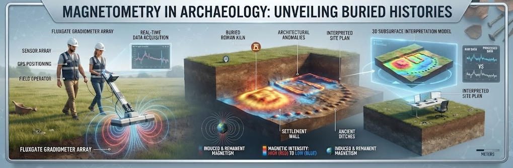
Magnetometry in archaeology measures local magnetic field variations. Buried features often change the magnetic properties of soil. Fired clay becomes more magnetic. Ditches fill with magnetic topsoil. Metal artifacts create strong anomalies.
Proton magnetometers detect these changes with high precision. They measure differences at the nanotesla level. This sensitivity reveals subtle features. Archaeologists can map entire sites before breaking ground.
2. How Proton Magnetometers Work
Proton magnetometers use quantum physics principles. Hydrogen atoms in a fluid precess in Earth’s magnetic field. The precession frequency relates directly to field strength. Instruments count this frequency precisely.
This method provides absolute field measurements. Results remain stable across temperatures. Modern units achieve 0.05 nT resolution. Such precision exceeds most archaeological requirements.
3. Types of Magnetic Survey Equipment
Several instruments serve archaeological geophysics. Fluxgate gradiometers offer rapid coverage. They measure field gradients between two sensors. Caesium vapor magnetometers provide higher sensitivity. They detect weaker anomalies at greater depths.
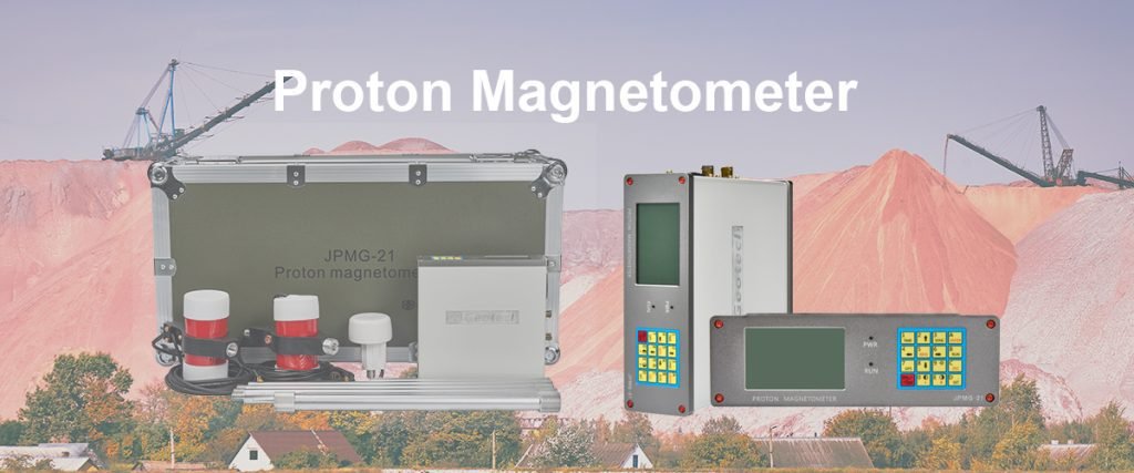
Proton magnetometers balance accuracy and cost. They suit most archaeological applications. Their reliability makes them popular worldwide. Geotech manufactures advanced proton magnetometers for this market.
Ⅱ. Detecting Archaeological Sites with Magnetic Surveys
Magnetic surveys identify sites faster than traditional methods. Large areas scan in days rather than weeks. This efficiency transforms project planning.
1. Rapid Site Reconnaissance
Archaeological teams first survey broad regions. Magnetometers identify anomaly clusters. These clusters suggest buried structures. Teams then focus detailed work on promising zones.
This approach saves time and resources. Excavation becomes targeted rather than speculative. Non-invasive archaeology preserves sites intact. Future researchers can revisit undisturbed contexts.
2. Mapping Buried Structures
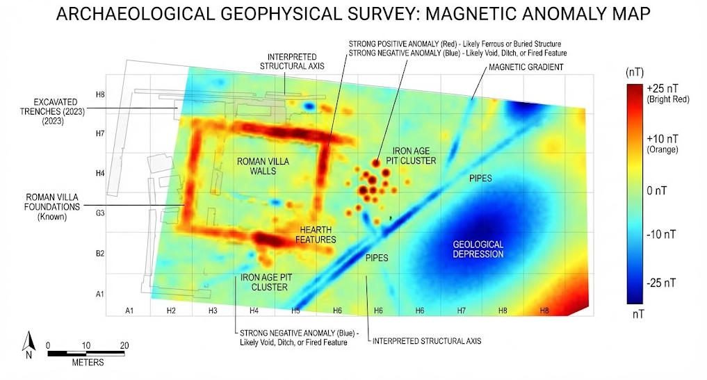
Buried structure mapping creates detailed anomaly plots. Software converts raw data into visual maps. Dark spots may indicate fired features. Light areas suggest stone foundations. Linear patterns reveal walls or roads.
Archaeologists interpret these patterns with geological knowledge. They distinguish cultural features from natural variations. Experience improves interpretation accuracy. Training programs develop these skills systematically.
3. Identifying Specific Feature Types
Different features produce distinct signatures. Kilns and hearths create strong positive anomalies. They heat iron minerals in clay. This process enhances magnetic susceptibility.
Ditches and pits often show negative anomalies. They fill with less magnetic subsoil. Foundations may appear as linear patterns. Metal objects produce sharp spikes. Understanding these signatures guides excavation strategy.
Ⅲ. Non-Invasive Archaeology: Protecting Heritage
Non-invasive archaeology represents modern ethical practice. It minimizes damage to fragile sites. Magnetometry supports this approach directly.
1. Preserving Site Integrity
Excavation destroys archaeological context permanently. Once removed, soil layers cannot be replaced. Non-invasive methods document sites without damage. Future techniques may extract more information.
Magnetometry provides complete site coverage. It records every magnetic anomaly. Digital archives preserve these data indefinitely. Researchers revisit datasets with new questions.
2. Meeting Regulatory Requirements
Many jurisdictions now require geophysical survey before excavation. Heritage managers demand minimal intervention. Magnetometry satisfies these requirements efficiently.
Commercial projects benefit particularly. Developers assess archaeological potential early. They avoid costly delays during construction. Proactive surveys reduce project risks significantly.
3. Supporting Long-Term Monitoring
Permanent magnetometer installations track site changes. They detect erosion or subsidence effects. Time-lapse surveys reveal seasonal variations. This monitoring informs conservation decisions.
Climate change increases monitoring importance. Rising water tables affect magnetic signatures. Soil chemistry shifts alter readings. Continuous data track these transformations.
Ⅳ. Field Techniques for Archaeological Magnetometry
Successful surveys require proper technique. This section covers essential practices.
1. Survey Design and Grid Layout
Teams establish regular grids across survey areas. Grid squares typically measure 20 by 20 meters. Lines run parallel at fixed intervals. Common spacings range from 0.25 to 1 meter.
Closer spacing improves resolution. It detects smaller features. However, acquisition time increases proportionally. Teams balance resolution against available time.
2. Data Collection Procedures
Operators walk systematic transects. They maintain consistent sensor height. Standard practice keeps sensors 30 centimeters above ground. This height minimizes near-surface noise.
Walking speed affects data quality. Faster speeds reduce spatial resolution. Slower speeds improve detail but extend survey time. Experienced operators find optimal pacing.
Base stations record diurnal variations. Earth’s field changes throughout the day. These changes affect all measurements. Base station data correct for this drift.
3. Processing and Visualization
Raw data require processing before interpretation. Software removes spikes and noise. Filters smooth random variations. Corrections apply for diurnal drift.
Visualization uses color scales or grayscale. Warm colors typically show positive anomalies. Cool colors indicate negative values. Contour lines highlight gradient changes.
Advanced processing creates 3D models. Multiple depth slices reveal feature geometry. These models guide excavation planning. They show feature relationships clearly.
Ⅴ. Case Studies: Magnetometry in Action
Real projects demonstrate magnetometry’s power. These examples illustrate typical applications.
1. Roman Settlement Discovery
A survey in England targeted a suspected Roman site. Magnetometers revealed a complex settlement pattern. Rectilinear enclosures appeared clearly. Central buildings showed as strong anomalies.
Excavation confirmed the magnetic interpretation. Stone foundations matched anomaly boundaries. A kiln produced the strongest signal. The survey guided excavation efficiently. It focused limited resources on productive areas.
2. Prehistoric Earthwork Mapping
A North American project examined a mound complex. Magnetometry distinguished natural and cultural features. Buried hearths appeared as discrete anomalies. Midden deposits created broader patterns.
The survey revealed previously unknown structures. Concentric rings suggested palisade locations. These findings revised settlement interpretations. Non-invasive archaeology produced new knowledge without excavation.
3. Industrial Heritage Documentation
A European project documented a former ironworks. Strong anomalies marked furnace locations. Slag deposits created distinctive patterns. Building foundations appeared as linear features.
The survey supported heritage management decisions. It identified areas requiring protection. Development plans avoided sensitive zones. Magnetometry balanced preservation with urban renewal.
Ⅵ. Selecting Magnetic Survey Equipment
Choosing appropriate instruments ensures project success. Consider these factors carefully.
1. Sensitivity Requirements
Site geology determines sensitivity needs. High-contrast sites suit basic instruments. Subtle features demand higher resolution. Proton magnetometers with 0.05 nT sensitivity handle most cases.
Soil type affects magnetic contrast. Volcanic soils produce strong background signals. Sedimentary soils show weaker variations. Instrument selection matches local conditions.
2. Coverage Area and Terrain
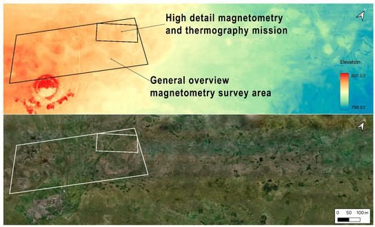
Large projects need rapid acquisition. Multi-sensor arrays cover ground faster. Vehicle-mounted systems suit open terrain. Pedestrian surveys work in rough or restricted areas.
Drone-mounted magnetometers access difficult sites. They fly over water or marshland. Aerial coverage complements ground surveys. Integrated approaches maximize information return.
3. Budget and Support Considerations
Instrument cost varies significantly. Entry-level proton magnetometers serve small projects. Advanced systems with GPS integration cost more. Software packages add additional expense.
Manufacturer support matters for long-term use. Training programs accelerate skill development. Repair services minimize downtime. Geotech offers comprehensive support worldwide.
Ⅶ. Future Trends in Archaeological Geophysics
Technology continues advancing rapidly. Several trends shape future practice.
1. Multi-Sensor Integration
Modern platforms carry multiple sensors. Magnetometers combine with ground-penetrating radar. Electrical resistivity adds complementary data. Joint interpretation improves feature identification.
Integrated systems reduce field time. Single traverses collect multiple datasets. Registration aligns different data types. Combined visualizations show comprehensive site pictures.
2. Real-Time Data Processing
Field computers now process data instantly. Operators view preliminary maps immediately. They adjust survey parameters on-site. Quality control improves dramatically.
Cloud connectivity enables remote collaboration. Specialists review data from distant offices. Decisions accelerate without travel delays. Projects become more responsive.
3. Artificial Intelligence Applications
Machine learning assists data interpretation. Algorithms recognize common feature types. They flag anomalies for human review. Processing speed increases significantly.
AI also optimizes survey design. Software predicts optimal line spacing. It estimates detection probabilities. These tools improve project planning efficiency.
Ⅷ. Conclusion
Magnetometry in archaeology provides essential capabilities. It detects buried structures without excavation. It maps sites with remarkable detail. It supports heritage preservation ethically.
Proton magnetometers remain central to this work. Their precision, reliability, and cost-effectiveness serve diverse projects. From Roman settlements to industrial heritage, applications continue expanding.
Geotech develops advanced magnetic survey equipment for archaeology. Our proton magnetometers deliver the sensitivity professionals demand. We support projects from initial survey design through final interpretation. Contact our team to discuss your archaeological geophysics requirements.
Non-invasive archaeology represents the future of heritage research. Magnetometry leads this transformation. Embrace these techniques for more effective, ethical archaeological practice.
Reference Sources
| Organization | URL |
|---|---|
| Archaeology Data Service (ADS) – Geophysical Guide | https://archaeologydataservice.ac.uk/help-guidance/guides-to-good-practice/ |
| Historic England – Geophysical Survey Techniques | https://historicengland.org.uk/research/methods/terrestrial-remote-sensing/geophysical-techniques/ |
| Society for American Archaeology (SAA) | https://www.saa.org/ |
| European Archaeological Council (EAC) | https://www.europeanarchaeologicalcouncil.org/ |
| National Park Service (NPS) – Archaeology Program | https://www.nps.gov/subjects/archaeology/index.htm |
FAQ
Q1: What is magnetometry in archaeology and how does it work?
A1: Magnetometry in archaeology measures local magnetic field variations caused by buried features. Proton magnetometers detect changes at the nanotesla level. Fired clay, metal artifacts, and filled ditches create distinct magnetic signatures. This non-invasive method maps subsurface structures without excavation.
Q2: What is a proton magnetometer used for in archaeological surveys?
A2: A proton magnetometer measures absolute magnetic field strength with high precision. Archaeologists use it to detect kilns, hearths, walls, and metal objects. It achieves 0.05 nT sensitivity. This instrument suits most archaeological geophysics applications.
Q3: How deep can magnetometry detect buried archaeological features?
A3: Detection depth depends on feature size and contrast. Typical surveys identify features within 2 meters depth. Larger features may extend deeper. Caesium magnetometers detect weaker anomalies at greater depths. Soil conditions significantly affect results.
Q4: What are the advantages of non-invasive archaeology with magnetometry?
A4: Non-invasive archaeology preserves sites intact. Magnetometry covers large areas rapidly. It creates permanent digital records. It satisfies regulatory requirements before excavation. This approach saves costs and protects heritage for future research.
Q5: Can magnetometry distinguish different types of archaeological features?
A5: Yes, different features produce characteristic signatures. Kilns create strong positive anomalies. Ditches often show negative anomalies. Walls appear as linear patterns. Metal objects produce sharp spikes. Experienced interpreters recognize these patterns reliably.