Welcome to Geotech!


Technological Innovations and Future Prospects in Magnetometry Archaeology
TIPS :Discover technological innovations in magnetometry archaeology—non – invasive detection, high – resolution mapping, and interdisciplinary research. Explore future prospects and how these advancements are shaping archaeological exploration.
Ⅰ. Introduction to Magnetometry in Archaeology
Magnetometry has become a cornerstone in archaeological investigations, enabling non – invasive detection of subsurface features. As technology progresses, innovations in magnetometry are revolutionizing how archaeologists explore and understand historical sites. This article delves into the technological advancements in archaeomagnetometry, its non – invasive detection capabilities, high – resolution mapping, future directions, and interdisciplinary research potential.
Ⅱ. Technological Innovation in Archaeomagnetometry
2.1 Tech Advancements in Archaeological Magnetometry
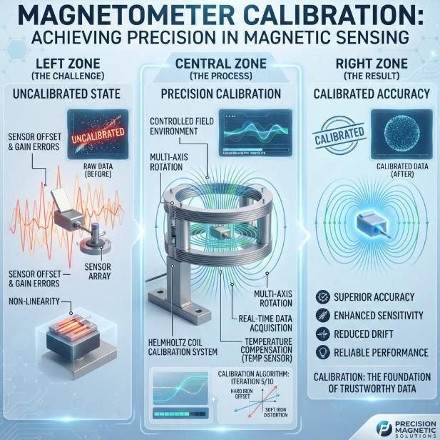
Technological innovation in magnetometry archaeology (tech advancements in archaeological magnetometry, new developments in archaeology) is driven by miniaturization, enhanced sensor sensitivity, and improved data processing. Modern magnetometers, such as fluxgate and gradiometer sensors, can detect extremely subtle magnetic anomalies associated with buried structures, artifacts, or geological features.
For example, in the excavation of an ancient Roman city, advanced magnetometers were able to map the layout of buildings, roads, and even sewage systems with unprecedented accuracy. These sensors can differentiate between natural magnetic variations in the soil and those caused by human activity, providing archaeologists with clear signals to follow.
2.2 New Developments Shaping Archaeological Exploration
New developments in archaeomagnetometry are expanding the boundaries of exploration. The integration of artificial intelligence (AI) and machine learning algorithms into data processing is a game – changer. These algorithms can sift through massive amounts of magnetic data, identifying patterns and anomalies that might be missed by human analysts.
In addition, the development of portable and drone – mounted magnetometers allows for rapid surveying of large areas. In remote or difficult – to – access regions, such as dense rainforests or mountainous terrain, drone – based magnetometry can cover vast expanses in a short time, opening up new archaeological frontiers.
Ⅲ. Non – Invasive Archaeological Detection Technology
3.1 Non – Destructive Dig – Site Sensing
Non – invasive archaeological detection technology (non – destructive dig – site sensing, non – invasive heritage discovery) is one of the most significant contributions of magnetometry to archaeology. Traditional archaeological methods often involve invasive excavation, which can damage or destroy sites. Magnetometry, on the other hand, allows archaeologists to “see” beneath the surface without disturbing the ground.
In the study of Native American burial mounds, non – invasive magnetometry surveys have been used to determine the location of graves and artifacts, ensuring their preservation while still gathering valuable information. This technology is also crucial for monitoring and protecting cultural heritage sites from looting and accidental damage.
3.2 Preserving Heritage Through Non – Invasive Methods
Non – invasive magnetometry not only aids in discovery but also in preservation. By providing detailed subsurface maps, it helps archaeologists plan excavations in a way that minimizes impact on the site. For example, in the restoration of historical cities, magnetometry data can guide the placement of new infrastructure to avoid damaging ancient ruins.
Furthermore, public engagement in archaeology is enhanced through non – invasive methods. Virtual reconstructions of archaeological sites based on magnetometry data can be shared with the public, raising awareness and appreciation for cultural heritage without the need for physical access to sensitive sites.
Ⅳ. High – Resolution Archaeological Mapping
4.1 Detailed Heritage Site Visualization
High – resolution archaeological mapping (detailed heritage site visualization, fine – scale archaeological imaging) using magnetometry provides archaeologists with a level of detail that was previously unattainable. High – resolution magnetometers can detect small – scale features such as individual post holes, hearths, and even the remains of organic materials that have left magnetic imprints in the soil.
In the study of medieval villages, high – resolution mapping has revealed the layout of houses, barns, and fields, giving insights into the daily lives of past inhabitants. This level of detail allows for a more nuanced understanding of archaeological sites, including their function, social structure, and evolution over time.
4.2 Fine – Scale Imaging for In – Depth Analysis
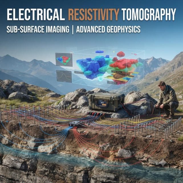
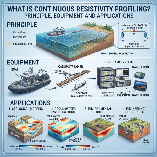
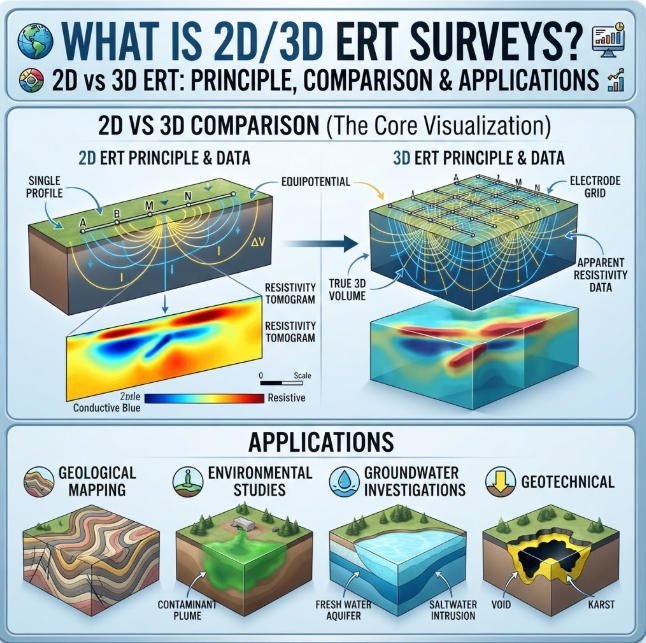
Fine – scale archaeological imaging through magnetometry enables in – depth analysis of archaeological sites. By combining magnetometry data with other geophysical techniques, such as ground – penetrating radar (GPR) and electrical resistivity tomography (ERT), archaeologists can create comprehensive 3D models of subsurface features.
These models can be used to study the relationship between different structures within a site, as well as their relationship to the surrounding landscape. In the case of ancient temples, for example, 3D models can reveal the alignment of structures with celestial events, providing insights into the religious and astronomical knowledge of past cultures.
Ⅴ. Future Development of Archaeological Magnetometry
5.1 Upcoming Progress in Archaeological Sensing
The future development of archaeological magnetometry (upcoming progress in archaeology, future of archaeological sensing) holds great promise. Continued advancements in sensor technology are expected to result in even more sensitive and accurate magnetometers. Quantum – based magnetometers, currently in the research phase, have the potential to detect magnetic fields with unprecedented precision, opening up new possibilities for detecting extremely faint or deep – seated archaeological features.
In addition, the integration of magnetometry with other emerging technologies, such as augmented reality (AR) and virtual reality (VR), will transform how archaeologists interact with and interpret data. AR – based visualizations of magnetometry results on – site will allow archaeologists to instantly see subsurface features in the context of the landscape, enhancing real – time decision – making during surveys.
5.2 Anticipating the Future of Archaeological Magnetometry
The future of archaeological magnetometry also lies in its increasing accessibility. As technology becomes more affordable and user – friendly, smaller archaeological teams and even citizen scientists will be able to utilize magnetometry in their research. This democratization of archaeomagnetometry has the potential to lead to numerous new discoveries, especially in regions that have been previously under – explored due to limited resources.
Moreover, the application of magnetometry in underwater archaeology is expected to grow. Submarine magnetometers can detect shipwrecks, sunken cities, and other underwater archaeological sites, providing insights into maritime history and trade routes.
Ⅵ. Interdisciplinary Archaeological Research
6.1 Cross – Field Dig – Site Investigations
Interdisciplinary archaeological research (cross – field dig – site investigations, multi – disciplinary heritage study) is being advanced by magnetometry. Archaeologists are increasingly collaborating with experts in other fields, such as geophysics, computer science, and anthropology, to gain a more comprehensive understanding of archaeological sites.
For example, by combining magnetometry data with isotopic analysis of soil samples, archaeologists can study the diet and movement of past populations. In the study of ancient trade networks, interdisciplinary research using magnetometry to map production sites and isotopic analysis to trace the origin of artifacts can reveal the extent and complexity of trade routes.
6.2 Multi – Disciplinary Approaches to Heritage Study
Multi – disciplinary approaches to heritage study are enriching our understanding of the past. Magnetometry provides a common data set that can be analyzed from different disciplinary perspectives. Geophysicists can study the geological context of archaeological sites, while anthropologists can use the same data to explore past human behavior and social structures.
In the case of ancient ceremonial sites, magnetometry – based interdisciplinary research can reveal the astronomical alignments of structures (geophysics), the religious significance of these alignments (anthropology), and the technological capabilities of the people who built them (engineering). This holistic approach to archaeological research is leading to more comprehensive and insightful interpretations of the past.
Ⅶ. Case Studies: Innovation in Action
7.1 High – Resolution Mapping of an Ancient City
In the excavation of an ancient Greek city, high – resolution magnetometry was used to create a detailed map of the entire site. The map revealed the layout of the city, including temples, marketplaces, and residential areas. This data allowed archaeologists to study the urban planning and social structure of the city, leading to new insights into ancient Greek civilization.
7.2 Non – Invasive Detection of a Medieval Village
In a rural area of England, non – invasive magnetometry surveys detected the remains of a medieval village. The surveys revealed the location of houses, barns, and a church, as well as fields and roads. This discovery provided valuable information about the daily lives of medieval peasants, including their agricultural practices and community organization.
Reference
- WIKI:https://en.wikipedia.org/wiki/Electrical_resistivity_tomography
- Society of Exploration Geophysicists (SEG) https://seg.org/
- Society of Environmental and Engineering Geophysicists (EEGS) https://www.eegs.org/
- Geology and Equipment Branch of China Mining Association http://www.chinamining.org.cn/
- International Union of Geological Sciences (IUGS) http://www.iugs.org/
- European Geological Survey Union (Eurogeosurveys) https://www.eurogeosurveys.org/