Welcome to Geotech!

ERT vs TEM: Which Geophysical Method Fits Your Project?
TIPS:Cross-hole Electrical Resistivity Tomography (ERT) and Transient Electromagnetic Method (TEM) are two complementary geophysical techniques for hydrogeological surveys. This technical guide compares how ERT System delivers high-resolution near-surface imaging while TEM achieves deep penetration for groundwater detection. Learn which method fits your project depth, budget, and geological conditions.

Ⅰ. ERT vs TEM: Choosing the Right Geophysical Method
Selecting the optimal geophysical method often confuses project managers and field engineers. Electrical Resistivity Tomography (ERT) and Transient Electromagnetic Method (TEM) both map subsurface resistivity. Yet their physical principles, operational workflows, and application strengths differ significantly. This guide provides a data-driven comparison to help you choose the right ERT System or TEM configuration for your hydrogeological or geotechnical project.
Ⅱ. How ERT and TEM Work: Fundamental Differences
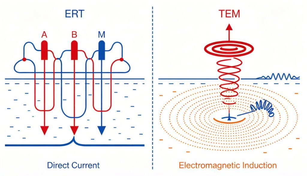
1. ERT: Direct Current Injection Method
Electrical Resistivity Tomography injects direct current into the ground through electrode arrays. The system measures voltage differences between potential electrodes. Apparent resistivity is calculated using the geometric factor and Ohm’s Law. Modern ERT System configurations use multi-electrode cables with automated switching units. A standard 48-channel survey collects thousands of data points along a 2D profile.
ERT requires galvanic contact with the ground. Electrode spacing determines both resolution and depth. Typical investigation depths range from 10 to 200 meters. The method excels at resolving lateral variations and near-surface structures.
2. TEM: Electromagnetic Induction Method
Transient Electromagnetic Method operates through electromagnetic induction. A transmitter loop on the surface emits a pulsed primary magnetic field. When the current shuts off, eddy currents form in conductive subsurface materials. The receiver coil measures the decaying secondary magnetic field over time.
TEM does not require physical contact with the ground. This non-invasive approach allows rapid deployment on asphalt, frozen ground, or rocky terrain. Depth penetration extends from 50 meters to over 800 meters depending on loop size and transmitter power.
Ⅲ. Depth Penetration and Resolution Comparison
1. ERT Depth Range and Resolution
Electrical Resistivity Tomography provides exceptional near-surface resolution. With 1-meter electrode spacing, features as small as 0.5 meters can be resolved. However, depth penetration is limited by array length. Investigation depth typically equals one-third to one-fifth of the total electrode spread.
For a 120-electrode system with 5-meter spacing, maximum reliable depth reaches approximately 120 meters. Beyond this, signal-to-noise ratio degrades significantly. ERT is ideal for shallow aquifer mapping, foundation investigations, and landfill monitoring.
2. TEM Depth Range and Resolution
Transient Electromagnetic Method achieves superior depth penetration. A 40×40 meter transmitter loop can reach 200-250 meters depth. With larger loops and higher power, depths exceeding 800 meters are achievable. However, TEM has a shallow “blind zone” typically 10-20 meters deep where early-time data is contaminated by transmitter turn-off effects.
TEM resolves vertical layering well but offers poorer lateral resolution compared to ERT. The method is optimal for deep aquifer exploration, geothermal reservoir mapping, and regional groundwater studies.
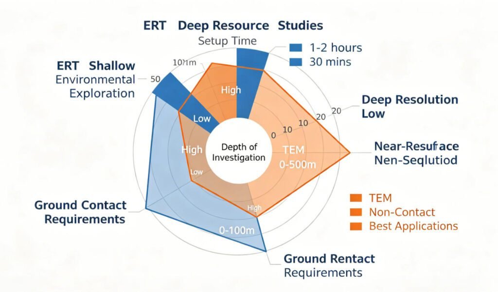
| Parameter | ERT System | TEM Method |
|---|---|---|
| Principle | DC resistivity array | Electromagnetic induction |
| Depth Range | 10–200 m | 50–800+ m |
| Near-Surface Resolution | Excellent (0.5–2 m) | Poor (blind zone 10–20 m) |
| Deep Resolution | Moderate | Good for conductors |
| Ground Contact | Required (electrodes) | Not required (loops) |
| Setup Time | 2–4 hours | 30–60 minutes |
| Best For | Shallow 2D/3D imaging | Deep vertical sounding |
Ⅳ. Field Deployment and Operational Efficiency
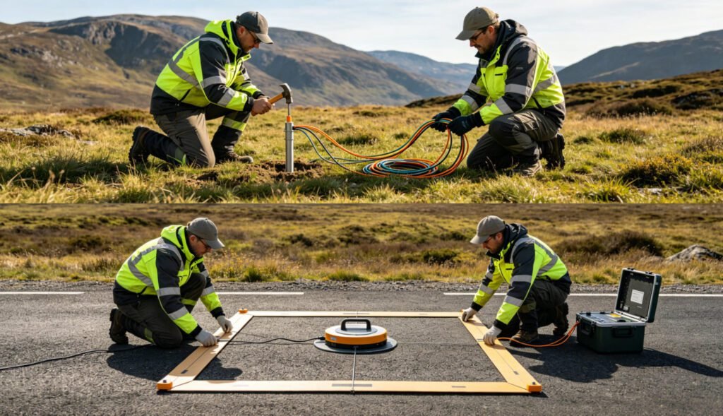
1. ERT Field Workflow
Deploying an ERT System requires careful site preparation. Field crews hammer stainless steel electrodes into the ground at regular intervals. Cable connections must be checked for contact resistance. A 48-channel survey with 2-meter spacing takes 2–4 hours including setup.
Terrain challenges affect ERT significantly. Rocky surfaces, asphalt, or frozen ground prevent electrode insertion. In such conditions, alternative arrays or preprocessing adjustments become necessary. The Geotechcn WGMD system includes automatic contact resistance checking and Bluetooth-enabled wireless data transmission to streamline operations.
2. TEM Field Workflow
Transient Electromagnetic Method deployment is faster and more flexible. Crews lay out a wire loop on the ground surface. No digging or hammering is required. A single sounding takes minutes. Moving the loop to the next station is quick, enabling rapid coverage of large areas.
TEM works effectively on any surface including pavement, ice, or bare rock. This versatility reduces project delays in challenging environments. The Geotechcn TEM system features a portable transmitter with 30A maximum current and microsecond-range shutdown times for clean early-time data.
Ⅴ. Application-Specific Method Selection
1. Groundwater Exploration
For shallow aquifer delineation (0–50 m), Electrical Resistivity Tomography provides detailed 2D cross-sections. The method clearly distinguishes clay layers, sand aquifers, and bedrock interfaces. Time-lapse ERT monitoring tracks seasonal water table fluctuations.
For deep aquifer exploration (>100 m), Transient Electromagnetic Method is preferred. TEM identifies conductive water-bearing zones at depths unreachable by standard ERT arrays. In Indonesia, TEM surveys have successfully mapped aquifers beyond 200 meters depth in volcanic terrains.
2. Mineral Exploration
ERT with Induced Polarization (IP) capability detects disseminated sulfide mineralization. The chargeability parameter distinguishes ore bodies from barren conductive zones. Geotechcn ERT systems support simultaneous resistivity and IP data acquisition.
TEM excels at detecting massive conductive ore bodies at depth. The method has been used for decades in base metal exploration. Modern systems can identify targets beneath conductive overburden that would mask ERT signals.
3. Environmental and Engineering Surveys
ERT dominates near-surface environmental applications. Contaminant plume mapping, landfill leak detection, and foundation void identification all benefit from ERT’s high spatial resolution. Cross-hole ERT configurations between boreholes provide detailed 3D imaging for geotechnical site investigation.
TEM is superior for regional-scale environmental assessments. Rapid coverage of large areas makes it cost-effective for initial site screening. The method also works well in urban settings where surface infrastructure prevents electrode deployment.
Ⅵ. Integrated ERT-TEM Workflows
1. Complementary Data Acquisition
Modern hydrogeological projects increasingly combine both methods. ERT provides high-resolution shallow imaging. TEM extends the depth range beyond ERT limitations. The overlapping zone (typically 50–150 m) allows cross-validation and reduces interpretation uncertainty.
A typical integrated workflow begins with TEM reconnaissance. Rapid broad-area coverage identifies anomalous zones. Follow-up ERT surveys target these areas with detailed 2D or 3D imaging. This two-stage approach optimizes both efficiency and resolution.
2. Case Study: Cross-Hole ERT + TEM Validation
A geotechnical investigation used dual-borehole Electrical Resistivity Tomography with 30 electrodes per hole at 1-meter spacing. The cross-hole configuration detected a water-bearing zone between boreholes 18 meters apart. Transient Electromagnetic Method validation with a central-loop configuration confirmed the anomaly at 16 meters depth. TEM also identified a deeper conductive layer at 35 meters not resolved by the ERT array.
This integrated approach demonstrates how ERT and TEM compensate for each other’s limitations. ERT provided precise lateral positioning. TEM added depth penetration and confirmed deep targets.
Ⅶ. Equipment Selection and Budget Considerations
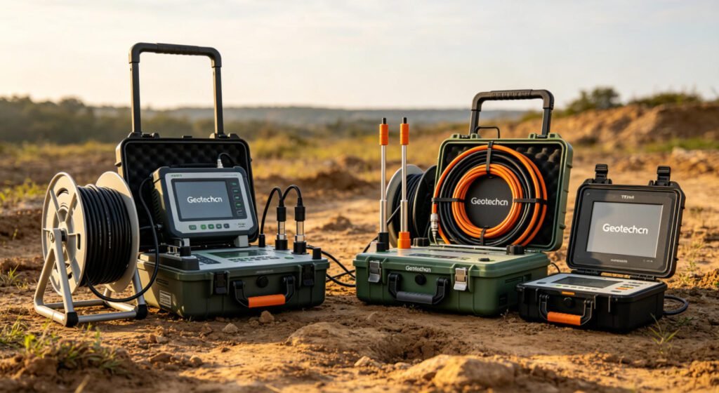
1. ERT System Investment
Entry-level ERT System configurations with 48 channels range from $15,000 to $30,000. High-end 120-channel systems with IP capability and 3D inversion software reach $50,000–$80,000. Electrode cables, switches, and software licenses add to initial costs.
Operational costs include field crew time (2–3 persons) and electrode replacement. Data processing requires trained personnel. Geotechcn offers scalable systems allowing channel expansion as project demands grow.
2. TEM System Investment
Transient Electromagnetic Method systems vary widely based on power and loop configuration. Portable shallow-depth units start around $20,000. Deep-penetration systems with high-power transmitters and multi-turn loops exceed $100,000.
TEM operational advantages include faster field surveys and smaller crew requirements. Single-operator systems are available for routine groundwater exploration. The Geotechcn TEM platform offers modular transmitter options to match budget and depth requirements.
Ⅷ. Conclusion
Electrical Resistivity Tomography and Transient Electromagnetic Method serve distinct but complementary roles in geophysical exploration. ERT delivers high-resolution near-surface imaging ideal for engineering and shallow environmental projects. TEM achieves superior depth penetration for regional groundwater and deep mineral exploration.
Method selection depends on target depth, required resolution, surface conditions, and budget constraints. For comprehensive site characterization, integrated ERT-TEM workflows provide the most robust subsurface models. Geotechcn offers both technologies with expert technical support to optimize your geophysical investigation.
Learn more professional geophysical solutions at www.geotechcn.net.
Reference
【TEM Method Principles and Deep Penetration】: https://guidelinegeo.com/methods/transient-electromagnetics-tem/
【Comparative Study ERT vs. TEM】: https://www.temcompany.com/research/research-papers/towed-and-airborne-electromagnetic-methods/
【Applications of TEM in Groundwater Exploration】: https://www.exactglobal.co.id/optimizing-deep-aquifer-exploration-in-indonesia-accuracy-analysis-of-transient-electromagnetic-method-tem-vs-resistivity/
【Comparison of ERT and TEM for Saltwater Intrusion Detection】: https://www.akademisains.gov.my/asmsj/article/geophysical-mapping-of-saltwater-intrusion-using-ert-and-tem-methods-at-pantai-umt-terengganu-malaysia/
【Overview of the TEM Method】: https://www.sciencedirect.com/topics/earth-and-planetary-sciences/electromagnetic-method
【Geotechcn TEM Technology Page】: https://geotechcn.net/service/what-is-transient-electromagnetic/
【Geotechcn ERT vs. TEM Comparison Page】: https://geotechcn.net/service/ert-vs-tem/
【Applications of ERT in Groundwater Recharge Zone Assessment】: https://www.frontiersin.org/journals/water/articles/10.3389/frwa.2025.1636613/full
【Advantages of TEM in Permafrost Exploration】: https://pureportal.spbu.ru/files/101068442/activelayerandpermafrostinvestigation11.2022.pdf
FAQ
What is the main difference between ERT and TEM?
Electrical Resistivity Tomography injects direct current through ground electrodes to measure resistivity. Transient Electromagnetic Method uses induction loops to generate and detect electromagnetic fields. ERT requires ground contact; TEM does not. ERT excels at shallow high-resolution imaging; TEM penetrates deeper.
Which method is better for deep groundwater exploration?
Transient Electromagnetic Method is generally better for deep groundwater exploration beyond 100 meters. TEM can reach 500+ meters depth with appropriate loop configurations. Electrical Resistivity Tomography is limited to approximately 200 meters maximum in standard configurations.
Can ERT and TEM be used together?
Yes. Integrated workflows combine ERT’s high-resolution shallow imaging with TEM’s deep penetration. TEM reconnaissance identifies target zones. Follow-up ERT surveys provide detailed characterization. This approach reduces overall project cost and interpretation uncertainty.
What surface conditions prevent ERT deployment?
ERT requires electrode insertion into the ground. Rocky terrain, asphalt, concrete, and frozen surfaces prevent deployment. Transient Electromagnetic Method works on any surface including pavement and ice, making it more versatile in challenging environments.
How do I choose between ERT and TEM for my budget?
For shallow projects (<50 m) requiring detailed imaging, ERT System offers lower entry cost. For deep targets or large-area coverage, Transient Electromagnetic Method reduces field time and crew costs. Geotechcn provides both technologies with scalable configurations to match project budgets.

