Welcome to Geotech!

Seismic Solutions:Airport Site survey solutions
Description
Ⅰ. Overview
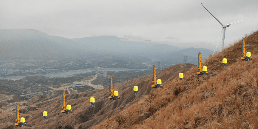
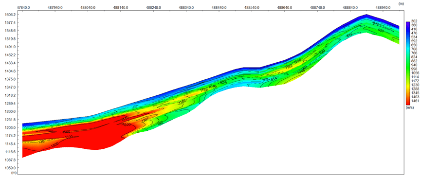
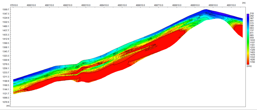
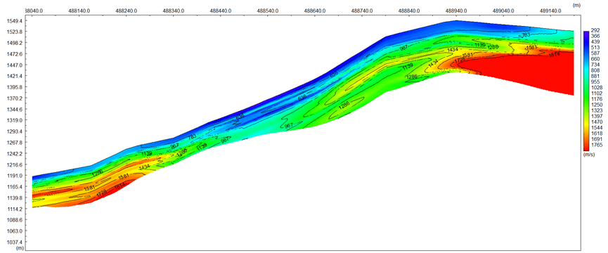
The owner needs to select a location to build an airport and needs to survey the underground soil layers at the planned location. Airport Site on the top of mountain, North of site was klint. South of site was deep valley.
Ⅱ. Project objectives
Detect the depth of landslide surface at south and thickness of weak/intense weathering layer at north
Ⅲ. Survey methods
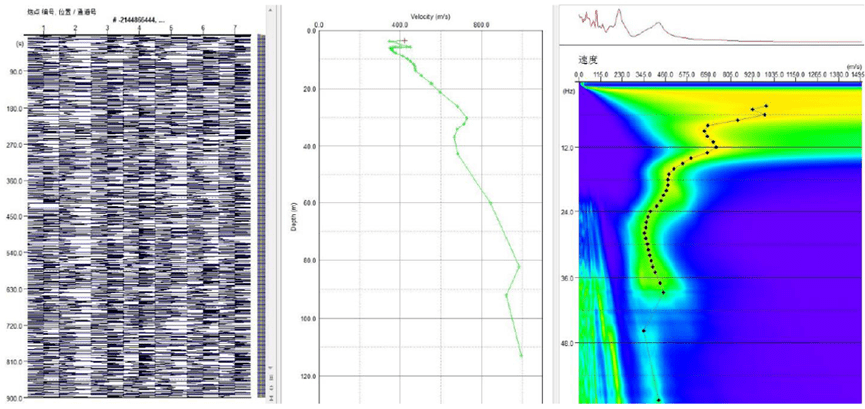
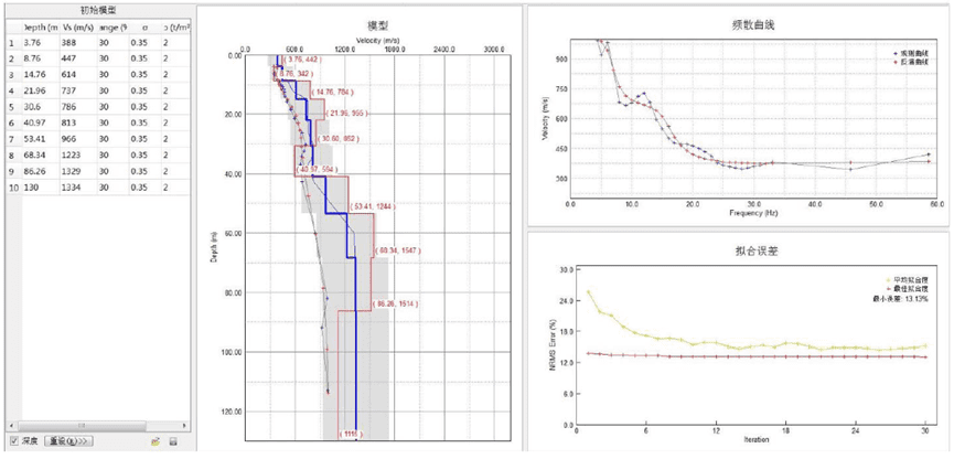
The industry name is Passive Surface Wave(PSW).It is a method of seismic exploration that does not need source excitation, by laying a geophone on the surface in a certain way, receiving natural seismic waves and background noise continuously for a period of time, using the surface wave dispersion characteristic to invert the depth-velocity curve and shear wave velocity profile.
Advantage:
- High precision
- Low cost
- Wide detection depth
Ⅳ.Survey design
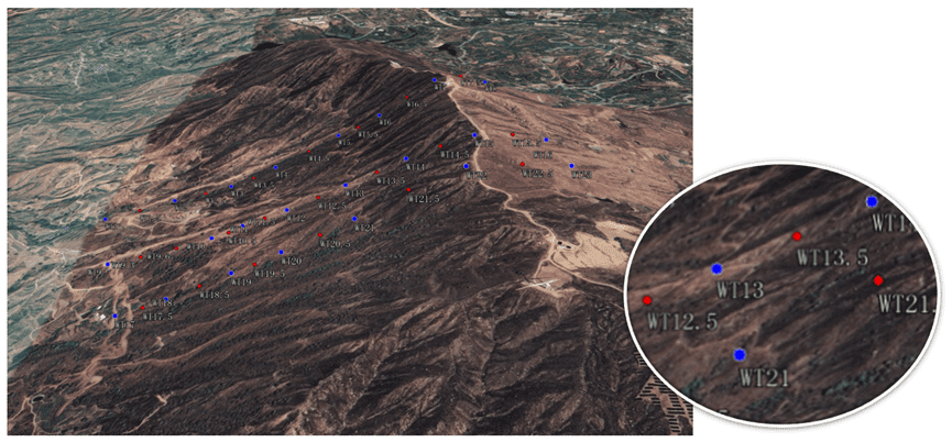
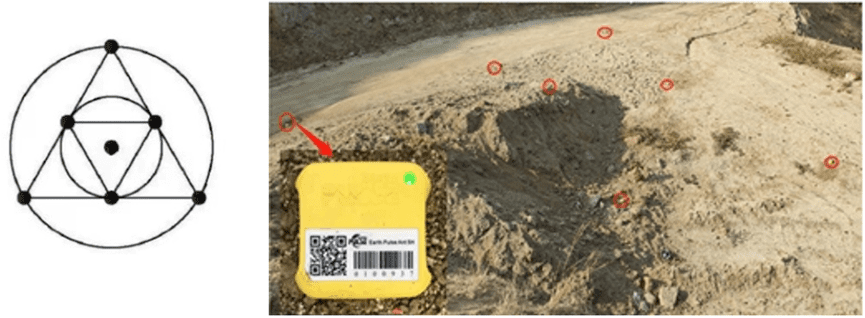
This survey used Geotech’s GE-ANT-1C Seismic nodal instrument[Survey method:Passive Surface Wave(PSW)]. 3 PSW Line, each Point use 7 Node seismic as triangular array observation system,Maximum radius 9m.
Ⅳ. Survey process
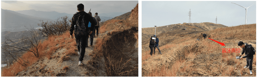
1. Survey Time: 48 hours ( 24 hour for layout and recycle; 24 hours for measurement )
2. Staff: 3~4 people ( Topo staff:1; Tech staff: 1; Labor:1~2 )
Ⅴ. Data analysis
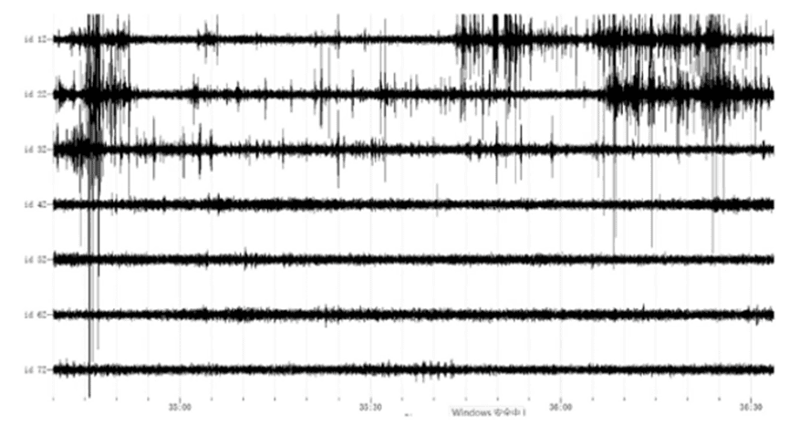
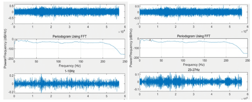
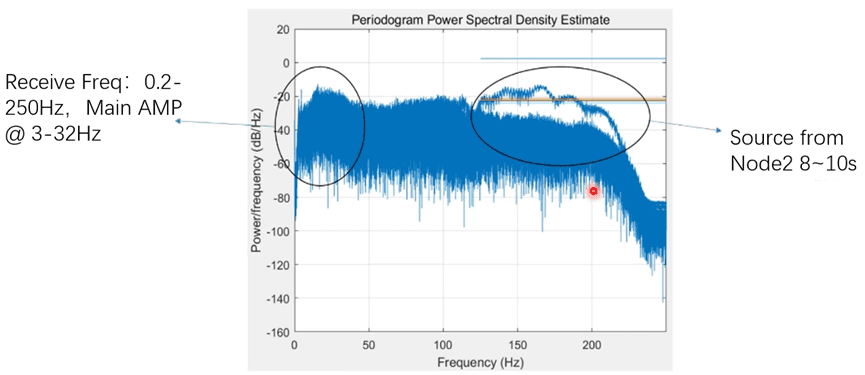
Analysis of micro-motion acquisition data:
- The seismometer at each node is in good condition.
- The whole data has broadband characteristics, ranging from 0.2-250 Hz;
- The noise source is mainly high frequency anthropogenic noise, with a frequency of 120-220 Hz.
FAQ
What is the main difference between a single tap and a double tap?
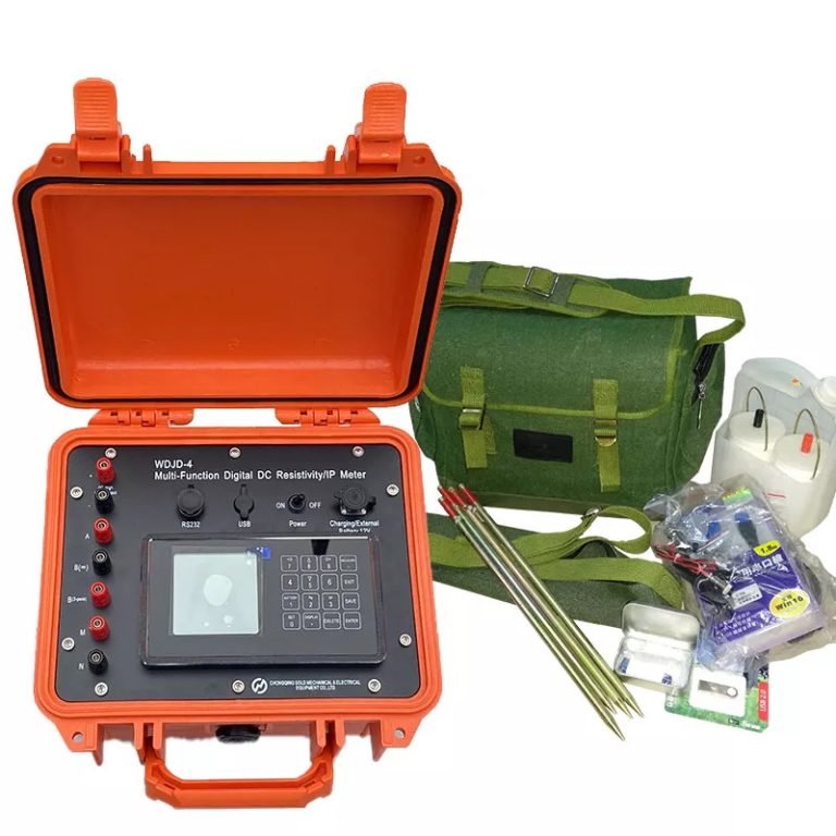
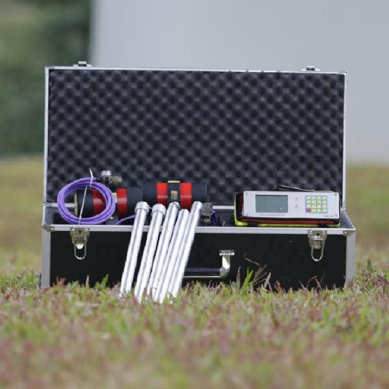
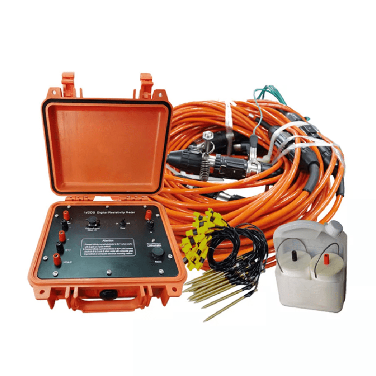
What is the principle of high-density electrical prospecting?
What are the advantages of high-density electrical method?
In what fields is the high-density electrical method generally used?
What are the application characteristics of high-density electrical method?