Welcome to Geotech!
-1.png)

Proton Magnetometer Applications: Geological, Mineral, Archaeological and Engineering Surveys
Description
Overview:This case study documents the application of a proton magnetometer in high-precision iron ore exploration in Xichang, China. The project used ground magnetic surveying to delineate magnetic anomaly bodies and evaluate their relationship with potential magnetite mineralization. A 1:5,000 survey network, 100 m line spacing, 20 m station spacing, repeated observations, and 20-second diurnal monitoring were applied to improve data reliability. The results identified six magnetic anomalies, with M1–M4 considered favorable for further investigation and M1 preliminarily interpreted as likely related to magnetite.
Ⅰ. Case Overview
1. Project Background
In mineral resource exploration, high-quality magnetic data can provide important information for identifying magnetic geological bodies, geological structures, and potential iron ore targets.
This case documents the application of the JPMG proton magnetometer in an iron ore prospecting project in Xichang, China.
The project was designed to use a high-precision ground magnetic survey to delineate magnetic anomaly bodies and provide a technical basis for subsequent iron ore exploration.
The Xichang area has complex geological conditions and abundant mineral resources. The primary ore-bearing layer is associated with volcaniclastic rock lenses. The ore bodies occur in several forms, including stratiform, sub-stratiform, and lenticular bodies.
These ore bodies gradually transition into the surrounding rocks. This geological setting places high requirements on the resolution and reliability of magnetic survey data.
2. Project Objective
The main objective of the Xichang iron ore prospecting project was to:
- Define the boundaries of magnetic anomaly bodies.
- Analyze the spatial distribution of magnetic anomalies.
- Identify areas favorable for magnetite mineralization.
- Provide a scientific basis for follow-up exploration.
- Improve the geological interpretation of the survey area.
The project therefore focused on high-precision ground magnetic surveying, rather than relying only on conventional medium- or low-precision magnetic observations.
Ⅱ. Geological Conditions and Exploration Challenges
1. Geological Setting
The work area is located in the northwest part of the Yunnan–Guizhou Plateau.
The terrain includes middle- and low-mountain areas, intermountain basins, and streams. The geological setting is relatively complex.
The primary ore-bearing layer consists mainly of volcaniclastic rock lenses.
The ore bodies are generally:
- Stratiform
- Sub-stratiform
- Lenticular
- Imbricate or layered
The ore bodies are broadly parallel to each other and have an occurrence consistent with the surrounding rocks.
The ore bodies show a gradual transition with the surrounding rocks, which makes accurate delineation of magnetic responses particularly important.
2. Why High-Precision Magnetic Surveying Was Required
Conventional medium- or low-precision magnetic surveys may not provide sufficient detail when magnetic anomalies are relatively complex or when geological targets are closely distributed.
A high-density ground magnetic survey can provide more detailed spatial information.
In this project, the survey was therefore designed with relatively close station spacing.
The purpose was not simply to obtain a large number of measurements. The objective was to obtain a sufficiently detailed magnetic-field dataset for anomaly delineation and geological interpretation.

Ⅲ. JPMG Proton Magnetometer Used in the Project
1. Instrument Overview
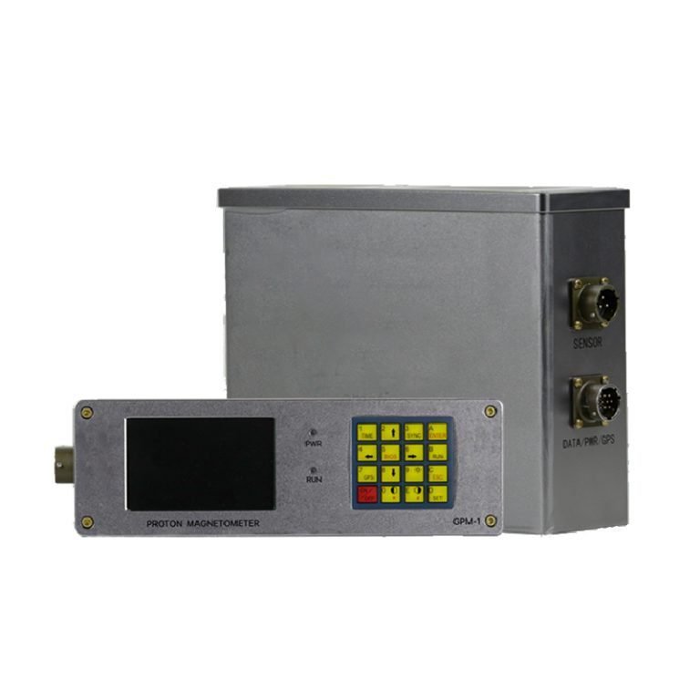
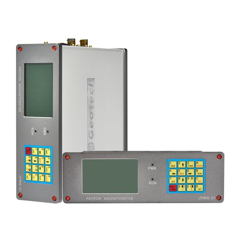
The project used the JPMG proton magnetometer for ground total-field magnetic measurements.
A proton magnetometer measures total magnetic-field intensity through proton precession.
The fundamental relationship can be expressed as:
f = γB / 2π
where:
- f is the proton precession frequency.
- γ is the proton gyromagnetic ratio.
- B is the magnetic-field magnitude.
The advantage of this measurement principle is that magnetic-field intensity can be determined from a physical frequency measurement.
2. High-Precision Measurement
The original case describes the JPMG system as using a high-precision OCXO, or oven-controlled crystal oscillator.
The original product description specifies:
- Measurement accuracy: ±0.1 nT
- Resolution: 0.01 nT
- High-stability OCXO frequency reference
These are product-specific specifications and should be understood as specifications of the JPMG instrument used in the case, rather than universal characteristics of proton magnetometers.
3. Stability in Field Acquisition
The built-in OCXO is intended to improve frequency stability.
This is important because proton magnetometer measurements depend on accurately determining the proton precession frequency.
In practical field surveys, however, instrument stability is only one part of total data quality.
Survey design, magnetic interference, positioning, temporal variation, measurement procedure, and data processing must also be controlled.
Ⅳ. Survey Network Layout and Field Data Acquisition
1. Survey Scale
The geophysical survey was conducted at a scale of:
1:5,000
A total of:
25 high-precision magnetic survey lines
were designed.
The survey parameters were:
| Survey Parameter | Project Value |
|---|---|
| Survey scale | 1:5,000 |
| Number of survey lines | 25 |
| Line spacing | 100 m |
| Point spacing | 20 m |
| Survey-line length | 1.6 km |
| Controlled survey area | Approximately 4 km² |
| Measurement parameter | Total magnetic-field intensity T |
| Diurnal sampling interval | 20 s |
These values are the actual survey parameters reported in the project case. They should not be generalized as universal magnetic-survey design parameters.
2. Measurement-Point Positioning
Baseline measurements used a lightweight GPS system.
The reported positioning accuracy was:
4 m
According to the original case, GPS was used to locate measurement points according to the designed survey network.
Before field measurements, GPS calibration was conducted using a known reference point.
This procedure helped maintain the spatial relationship between magnetic observations and the designed survey grid.
3. Total-Field Magnetic Measurement
The observation parameter was the total magnetic-field intensity T.
Measurements were conducted according to the planned survey network.
During acquisition, abnormal and distorted points were repeatedly observed.
This repeat-observation procedure was important because isolated magnetic readings can be affected by temporary interference, positioning problems, operator conditions, or other field effects.
4. Diurnal Variation Observation
Diurnal magnetic variation was monitored using an instrument of the same type at a fixed base point.
The observation started before the morning calibration measurements and continued until after the evening calibration measurements.
The reported sampling interval was:
20 seconds
This provided a temporal reference for correcting magnetic-field variation during mobile acquisition.
Ⅴ. Results and Engineering Value of the Proton Magnetometer
1. Improved Prospecting Efficiency
The original project describes the JPMG proton magnetometer as portable and easy to operate.
This allowed ground magnetic measurements to be conducted efficiently across the survey area.
High-density field observations provided more detailed magnetic information without requiring a fundamentally different exploration method.
The main value was the ability to obtain sufficiently dense magnetic data for anomaly delineation.
2. Improved Anomaly Delineation
High-precision magnetic measurements helped define the spatial distribution and boundaries of magnetic anomalies.
This supported the identification of M1–M6 and subsequent classification of their relative exploration significance.
For iron ore exploration, this information can be used to identify areas requiring follow-up investigation.
3. Performance Under Complex Geological Conditions
The Xichang project involved mountainous and relatively complex geological conditions.
The original case emphasizes the instrument’s stability and anti-interference performance during field acquisition.
However, these advantages should be understood in the context of the complete survey workflow.
Good magnetic data require both a suitable instrument and disciplined field procedures.
4. Data Reliability
The project used:
- Repeated observations at abnormal points.
- Repeated observations at distorted points.
- A fixed magnetic base point.
- Same-type instrumentation for diurnal monitoring.
- 20-second diurnal sampling.
- Subsequent magnetic-data correction.
This combination improved the reliability of the final dataset.
The case therefore demonstrates an important engineering principle:
Reliable magnetic interpretation depends on acquisition control as well as instrument performance.
Ⅵ. Why This Xichang Case Matters for Iron Ore Exploration
1. The Case Demonstrates a Complete Workflow
The value of this project is not simply that a proton magnetometer was used.
The case demonstrates a complete field-to-interpretation workflow:
Survey design → GPS positioning → total-field acquisition → repeat observation → diurnal monitoring → correction → filtering → upward continuation → contour mapping → anomaly interpretation
This is much more valuable for professional readers than a simple product introduction.
2. High-Density Magnetic Data Improve Interpretation
The original project concludes that high-precision continuous ground magnetic surveying can obtain more detailed magnetic anomaly information.
With relatively small station spacing, the magnetic-field curve can be represented more continuously.
This can improve the ability to identify and interpret magnetic anomalies.
3. Anomaly Persistence Provides an Additional Interpretation Constraint
The M1–M6 analysis demonstrates another important point.
The original magnetic map alone identified six anomalies.
Upward-continuation processing then provided additional information about their relative shallow or deeper character.
This helped distinguish the anomalies considered more important for mineral exploration from those associated with shallow materials or rock masses.
Ⅶ. Practical Lessons for Proton Magnetometer-Based Iron Ore Surveys
1. Design the Survey Around the Geological Target
There is no universal line spacing or station spacing for every magnetic survey.
The appropriate survey density depends on:
- Target size.
- Expected magnetic contrast.
- Geological complexity.
- Terrain.
- Existing geological information.
- Required interpretation resolution.
The 100 m line spacing and 20 m point spacing used in this Xichang project are therefore case-specific project parameters.
2. Use Repeat Measurements
Abnormal and distorted points should be checked in the field whenever practical.
This reduces the risk of carrying acquisition artifacts into the interpretation stage.
3. Monitor Diurnal Variation
For surveys affected by temporal magnetic-field variation, a fixed base station provides an important reference.
The Xichang case used the same type of instrument at a fixed point and recorded observations every 20 seconds.
4. Combine Original Data with Processed Products
The original magnetic dataset should remain available.
Processed products such as:
- Filtered maps.
- Upward-continuation maps.
- Derivative maps.
- Contour maps.
should be interpreted alongside the original measurements.
5. Do Not Treat Magnetic Anomalies as Confirmed Ore
This is perhaps the most important interpretation principle.
A magnetic anomaly may indicate:
- Magnetite.
- Magnetic host rock.
- Geological structure.
- Shallow magnetic material.
- Cultural interference.
Additional geological or exploration evidence is required to confirm the economic significance of a target.
Ⅷ. Conclusion
The successful application of the JPMG proton magnetometer in the Xichang iron ore prospecting project demonstrates the practical value of high-precision ground magnetic surveying in complex geological environments.
The project used a 1:5,000 survey network with 25 magnetic survey lines, 100 m line spacing, 20 m station spacing, and approximately 4 km² of controlled area.
Total magnetic-field intensity was measured using the JPMG proton magnetometer.
Abnormal and distorted points were repeatedly observed, while a fixed base point was used for diurnal variation monitoring with a 20-second sampling interval.
he case demonstrates that the value of a proton magnetometer is not limited to its measurement sensitivity.
The complete survey workflow — including survey design, positioning, repeat observation, diurnal monitoring, data processing, upward continuation, and geological interpretation — determines whether magnetic-field measurements can be transformed into useful exploration information.
For iron ore exploration, the Xichang case provides a practical example of how high-precision magnetic surveying can support anomaly delineation and mineral-target evaluation.
Related Articles
| Title | Core Content | URL |
|---|---|---|
| Application of High-Precision Magnetic Method in Iron Mine Exploration | Closely related Xichang high-precision magnetic survey case with detailed geological background, survey design, M1–M6 interpretation, and upward-continuation analysis. | https://geotechcn.net/application/application-of-high-precision-magnetic-method-geo-mg-proton-magnetometer/ |
| Proton Magnetometer Single Sensor Version | JPMG single-sensor product information, specifications, applications, and field configuration. | https://geotechcn.net/products/magnetic-instrument/proton-magnetometer-single/ |
| Proton Magnetometer Dual-Sensor Version | Dual-sensor JPMG configuration for magnetic and gradient measurements. | https://geotechcn.net/products/magnetic-instrument/dual-sensor-proton-magnetometer/ |
| How Does a Proton Magnetometer Work? | Explains proton polarization, precession, Larmor relationship, measurement cycle, and technical specifications. | https://geotechcn.net/service/proton-magnetometer-magnetic-measurement/ |
| Magnetometer Basics: Proton Magnetometer Insights | Covers proton magnetometer fundamentals, total-field measurement, applications, and technology comparison. | https://geotechcn.net/service/proton-magnetometer-insights/ |
| High-Precision Magnetic Survey in Mineral Exploration | Related mineral exploration case combining magnetic surveying and electromagnetic sounding. | https://geotechcn.net/application/application-of-high-precision-magnetic-survey-in-mineral-exploration/ |
| Iron Ore and Magnetic Mineral Exploration Solution | Application-oriented solution covering JPMG magnetic surveying, anomaly analysis, gradients, and mineral exploration. | https://geotechcn.net/application/proton-magnetometer-solution/ |
| Comprehensive Urban Underground Space Detection Using JPMG Proton Magnetometer | Extends the magnetic application cluster into underground infrastructure and urban geophysical investigation. | https://geotechcn.net/application/comprehensive-urban-underground-space-detection-solution-using-jpmg-proton-magnetometer/ |
Reference Sources
| Title | Core Content | URL |
|---|---|---|
| USGS — Instrumentation | Technical background on geomagnetic instrumentation, including proton magnetometers for total-field measurements. | http://www.usgs.gov/programs/geomagnetism/science/instrumentation |
| USGS — Gravity and Magnetic Surveys of the Skaergaard Intrusion, East Greenland | Documents the application of proton-precession magnetometry in geological and mineral-resource investigation. | http://pubs.usgs.gov/publication/ofr20251030 |
| USGS — Regional Airborne Electromagnetic and Magnetic Surveys | Demonstrates the application of magnetic data to geological mapping and mineral-resource investigation. | http://www.usgs.gov/data/regional-airborne-electromagnetic-and-magnetic-surveys-basin-and-range-province-nevada-oregon |
| National Park Service — Archaeology and Magnetometry | Provides authoritative background on magnetometry as a non-invasive geophysical method. | http://www.nps.gov/teachers/classrooms/archeology-and-magnetometry.htm |
| American Institute of Physics — Physics and Archaeology | Provides historical and technical context for magnetic prospecting and proton-precession magnetometers. | http://physicstoday.aip.org/features/physics-and-archaeology |
FAQ
Q1. What was the purpose of the proton magnetometer survey in the Xichang iron ore project?
The survey aimed to delineate magnetic anomaly bodies and identify areas potentially associated with magnetite mineralization. The project used a 1:5,000 ground magnetic survey with 25 lines, 100 m line spacing, and 20 m point spacing. The resulting magnetic data were processed and interpreted to identify six anomalies for further geological evaluation.
Q2. What survey parameters were used in the Xichang magnetic survey?
The project used a 1:5,000 survey scale, 25 high-precision magnetic lines, 100 m line spacing, 20 m point spacing, and 1.6 km line length. The controlled area was approximately 4 km². Portable GPS was used for positioning, while total magnetic-field intensity T was measured with the JPMG proton magnetometer.
Q3. How were diurnal magnetic variations controlled in the project?
Diurnal variation was monitored using the same type of high-performance instrument at a fixed benchmark. Observations started before morning field calibration and continued after evening calibration. The reported sampling interval was 20 seconds. These observations provided a temporal reference for correcting changes in the magnetic field during mobile survey acquisition.
Q4. What did the six magnetic anomalies M1–M6 indicate?
The project identified six magnetic anomalies with different distributions, intensities, and morphological characteristics. M1–M4 were considered relatively large and strong anomalies located in favorable mineralization areas. M1 was considered the strongest exploration target and was preliminarily interpreted as likely related to magnetite, while M5 and M6 were associated with shallow materials or rock masses.
Q5. Why was upward continuation used in the Xichang magnetic survey?
Upward continuation was used to analyze the spatial behavior of magnetic anomalies at different continuation heights. According to the project interpretation, M5 disappeared and M6 almost disappeared when continuation increased from 20 m to 500 m, while M1–M4 remained visible. This supported the interpretation that M5–M6 were shallower responses and M1–M4 were associated with deeper magnetic sources.
FAQ
What is the main difference between a single tap and a double tap?
The double tap has a large current and can be used for IP testing to get more accurate data.
What is the principle of high-density electrical prospecting?
High-density apparent resistivity method is an array prospecting method, also known as automatic apparent resistivity system, which is developed from direct current method. Its function is equivalent to the combination of quadrupole sounding and electrical profiling method. The artificial electric field is formed by supplying electricity to the underground through electrodes. The distribution of the electric field is closely related to the distribution of the resistivity of the underground rock and soil medium. By measuring the artificial electric field at different parts of the surface, the distribution of the apparent resistivity of the underground medium is understood, and the underground geological structure is inferred and interpreted based on the distribution of the apparent resistivity of the rock and soil medium.
What are the advantages of high-density electrical method?
The principle of high-density electrical method is the same as that of traditional resistivity method. It is a combination method of multiple devices and multiple pole distances that integrates electrical depth sounding and electrical profiling method, which can obtain the conductivity characteristics of two-dimensional underground media. It has the characteristics of multi-device data acquisition in one pole arrangement, and highlighting abnormal information by obtaining ratio parameters, which greatly increases the amount of collected data, improves work efficiency, and ensures the accuracy and reliability of the pole running process.
This method is particularly sensitive to the water content of the surrounding rock. If the surrounding rock is broken and contains water, its apparent resistivity is significantly reduced. The apparent resistivity of intact and hard rock and soil is significantly higher than that of the surrounding rock in the fault zone or broken zone and water-rich zone. This method has a clear principle and intuitive images. It is a geophysical method with high resolution. In recent years, with the improvement of computer data acquisition technology, the exploration efficiency has been greatly improved, the coverage area and detection depth of the profile have been increased, reliable data can be obtained in a strong interference environment, the signal-to-noise ratio has been greatly improved, and the geological body can be accurately detected. This method has been widely and successfully applied in engineering and hydrogeological exploration and exploration of mineral and water resources.
In what fields is the high-density electrical method generally used?
(1) Application in coalfield and mine goaf detection
(2) Non-destructive detection of termite nests in dam foundations
(3) Karst and foundation surveys of railways, roads and tunnels
(4) Delineation of stratum lithology boundaries
(5) Survey of the leakage range of landfills
(6) Ancient tomb surveys
(7) Detection of sewage pipes
(8) Non-destructive testing of leakage in reservoirs and river dams
(9) Detection of bedrock fracture zones
(10) Soil salinity and water quality surveys
(11) Detection of ancient tunnels, air-raid shelters, metal burial sites, etc.
What are the application characteristics of high-density electrical method?
(1)The high-density resistivity method is based on the resistivity method, so it is suitable for all underground explorations with obvious conductivity differences;
(2)Any medium underground will have a weak polarization potential at the moment of power on and off, which will affect our measurement of the true potential difference. When the electrode distance is small, the loop current is large, which has little effect on the measurement results; when the electrode distance is too large, the interference potential is close to the effective potential, which has a greater impact on the measurement results. Therefore, due to the influence of the power supply electrode distance, the exploration depth cannot be too large, generally within 100m. When the conductivity of the soil medium is good, it can be appropriately increased, and the exploration depth in the soil medium with poor conductivity is appropriately smaller;
(3)It is generally less used in cities, near large transmission lines, etc. due to site restrictions and industrial stray current interference; 4. In areas such as concrete pavements and exposed bedrock surfaces, it is also less used due to the difficulty of electrode layout.