Welcome to Geotech!

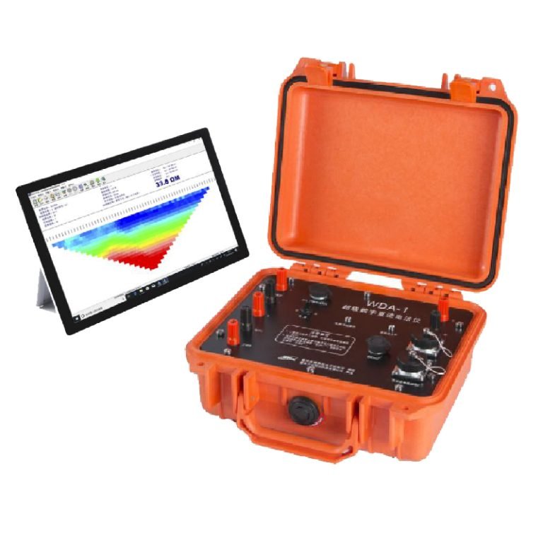
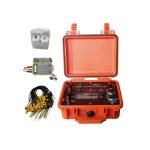
WDA-1 IP Sounding Meter


PRODUCT PARAMETERS
Description
WDA-1 DC Electrical Resistivity IP Sounding Meter
 Abstract
WDA-1 super digital DC resistivity/IP meter, is a newly developed electricalmethod instrument, adopting many advanced technologies such as tablet PC, Bluetooth,24bit A/D, and high power control. WDA-1 is specific instrument for the variousgeophysical explorations, with the most parameters, various funcitons, and the mostadvanced performance at present.
Working principle
Electrical prospecting is a group of geophysical prospecting methods that use the electrical properties of rocks and ores (such as conductivity, electrochemical activity, magnetic conductivity and dielectric properties, the so-called “electrical differences”) to find minerals and study geological structures. It uses instruments to observe artificial and natural electric fields or alternating electromagnetic fields, analyze and interpret the characteristics and laws of these fields to achieve the purpose of prospecting.
Vertical electrical sounding (VES) is a geophysical method for investigation of a geological medium. The method is based on the estimation of the electrical conductivity or resistivity of the medium. The estimation is performed based on the measurement of voltage of electrical field induced by the distant grounded electrodes (current electrodes).
Applications
●Energy resource exploration
●City geophysical exploration
●Railway and bridge prospecting
●Metal and non-metal mineral resources prospecting
●City geophysical exploration
●Hydrology and engineering geology to inspect base of dam
●Flood protection levee for incipient faults
Features
●Unique and open measuring process control
●Measuring various parameters, wide application
●High power supply, wide current range, high accuracy
●Bluetooth technology facilitating wireless remote control
●extending data storage capacity and collection software functions
Detailed description
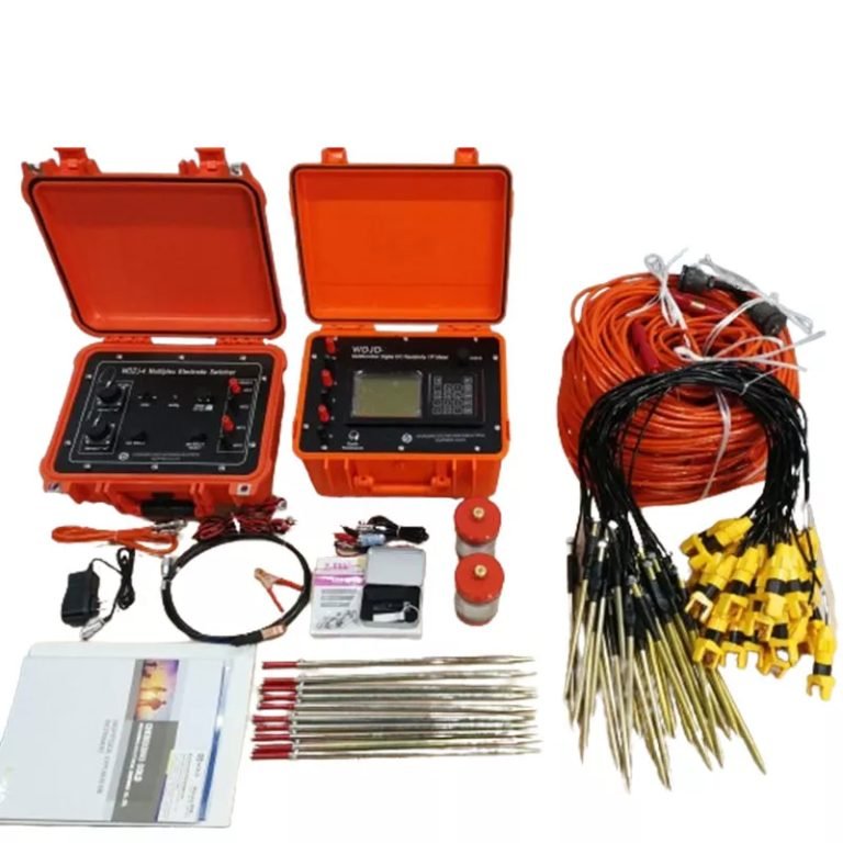
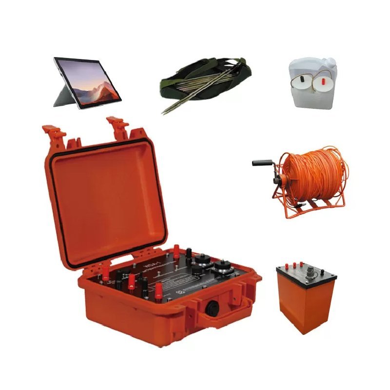
WDA-1 can works with intelligent cable system for multi-electrode 2D/3D Resistivity/IP imaging survey.
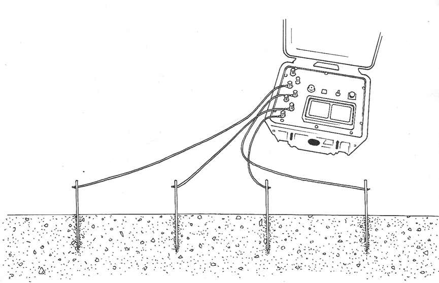
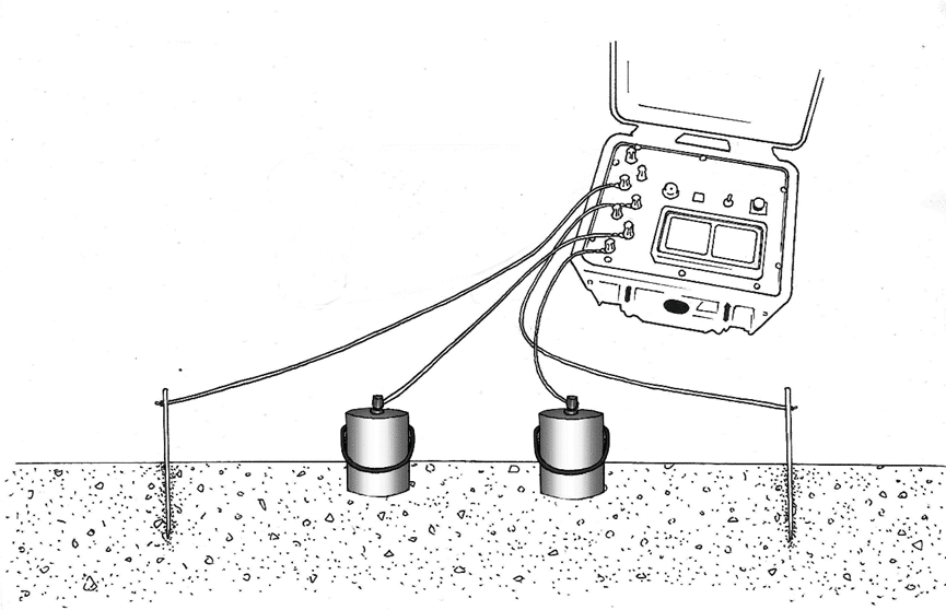
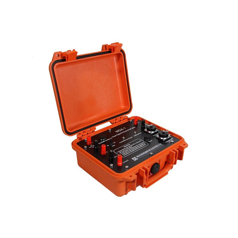
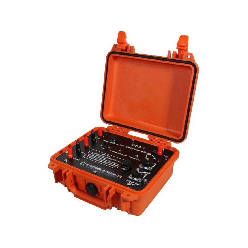
● The transmitter and the receiver are designed in one unit, portable and light. The 200V internal transmitting power of WDA-1 can conduct Res survey in wide variety of explorations.
● It is available to measure data of voltage (VP), current (IP), apparent resistivity (ρS), Self-Potential (SP), apparent polarizability (M~M7), metal factor (G1~G7), half decay time (TH), deviation (r), induce polarization ratio (J) and voltage decay curve, etc.
● Max power up to 9000W (1500V*6A), voltage input range is 160Vp-p, high measuring precision of small signal.
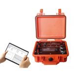
● Bluetooth technology enables the tablet PC to control the WDA-1 mainframe in 10 meters.
● Data collecting and data storage are controlled by tablet PC. Software is flexible to be upgraded and extended.
● Integrated with multistage filtration and signal enhancement technologies and suppression against common mode interference and differential mode interference. Measurement precision is high.
● Transmitting unit supports over-voltage protection, over-current protection and AB open-circuit protection as well as DC high voltage reverse connection protection.
Specifications
Receiving section
| Item | Parameters |
| Voltage | ±32V (24 bit A/D). If Vp≥5mV, accuracy is ±0.2% ±1LSB If 0.1mV≤Vp<5mV, accuracy is ±1% ±1LSB |
| Apparent polarizability measurement accuracy | ±0.2%±1LSB |
| Input impedance | >50MΩ |
| SP compensation range | ±10V |
| Maximum supply current | 6A (24bit A/D with WDZJ-3, no more than 2.5A) If Ip≥5mA, accuracy is ±0.2% ±1LSB If 0.1mA≤Ip<5mA, accuracy is ±1% ±1LSB |
| Suppression | For 50Hz industrial frequency interference (common mode and differential mode interference), suppression is more than 80dB. |
Transmitter
| Item | Parameters |
| Maximum transmitting power | 9000W |
| Maximum supply voltage | 1500V (with WDZJ-3, no more than 450V) |
| Supply current | 6A |
| Transmitting power pulse width | 1~60s, duty cycle is 1:1 |
Other parameters
| Item | Parameters |
| Power supply | Internal 7.4V 4Ah rechargeable battery continuously lasts for 20 hours (or 12V external power supply). |
| Ports support (transmitting unit) | A, B, M and N connecting ports, DC high voltage input ports and external battery terminals, 2 cable ports, RS-232, Bluetooth. |
| Working temperature | -10℃~+50℃, 95%RH |
| Storage temperature | -20℃~+60℃ |
| Weight | ≤4kg |
| Dimension | 270mmx246mmx123mm |
| Internal power source | Mximum voltage 96V (two notches, 48V and 96V); Maximum current is 0.7A |
FAQ
In gravity exploration (SI), what is the unit of gravity? How to convert gravity units between SI and CGS?
What are gravitational field and gravitational potential?
What is the normal gravity field of the earth? What are the rules for the change of the normal gravity field with latitude and altitude?
What is the relationship between gravitational field strength and gravitational acceleration?
What is gravity exploration?