Welcome to Geotech!

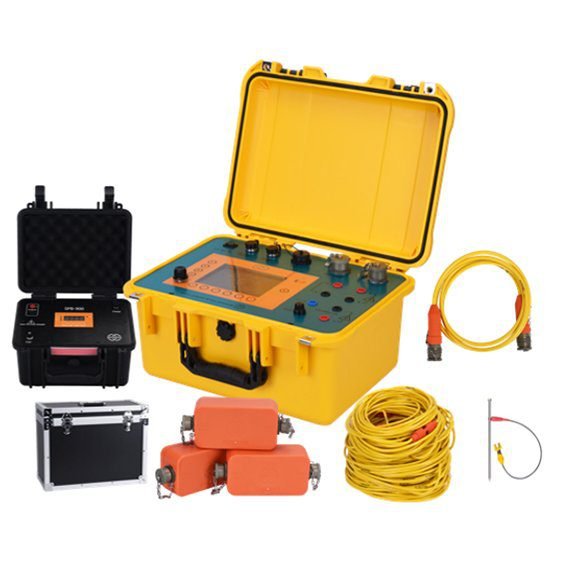
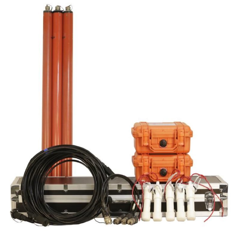
WGMD-4 Distributed High-density Electrical Method System


PRODUCT PARAMETERS
Description
 Abstract
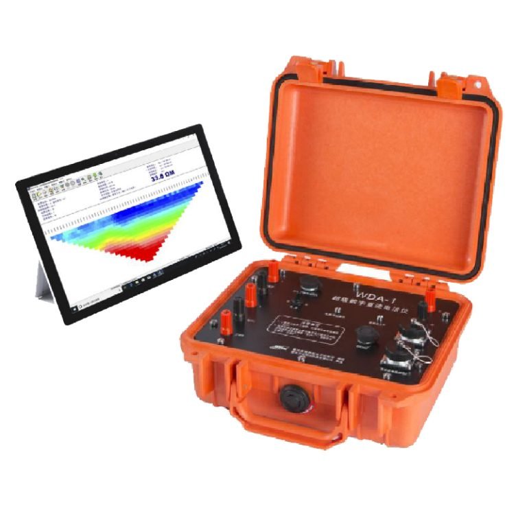
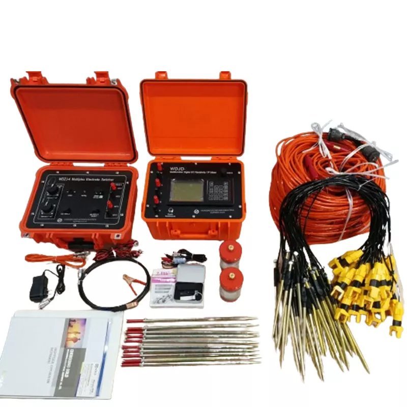
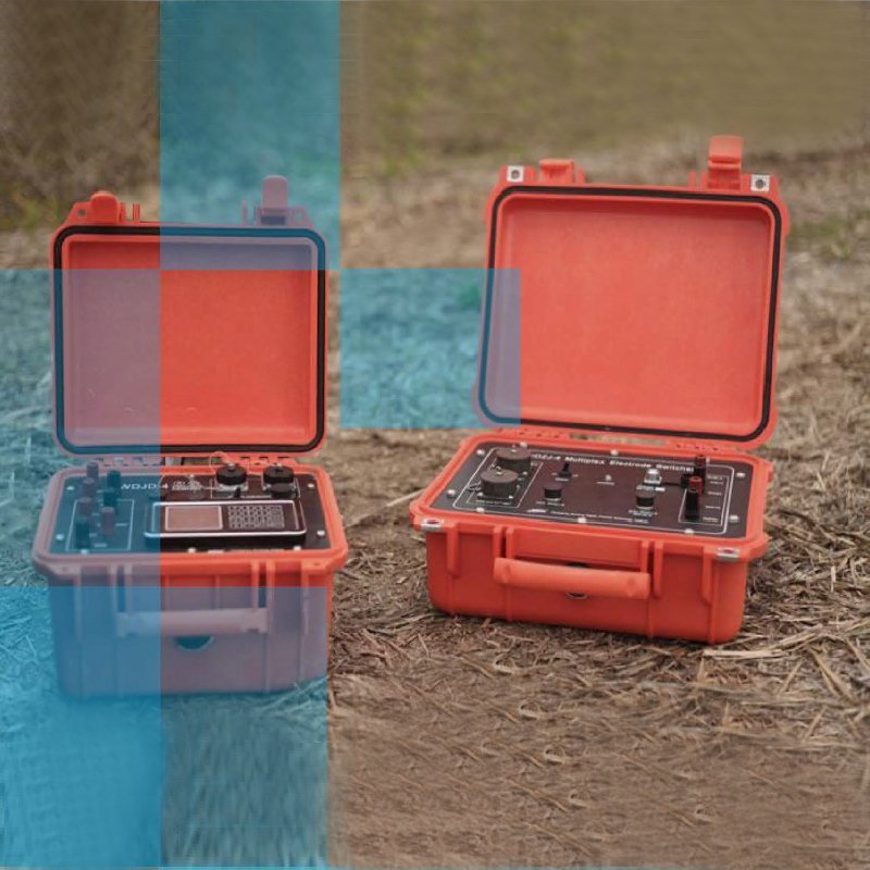
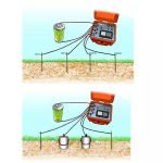
GMD-4 centralized high-density electrical method system is a high-density electrical method system composed of a set of combined equipment. The system uses WDZJ-60/WDZJ-120 multi-function digital DC induced polarization instrument as the measurement and control host, and is equipped with multi-channel electrode converters, centralized high-density cables, and electrodes to form a high-density electrical method system. The system has the characteristics of large storage capacity, accurate and fast measurement, and easy operation. It can be easily used with commonly used high-density electrical method processing software, making the analysis work more convenient and intuitive.
| System components and functions | WGMD-4 Distributed High-density Electrical Method System |
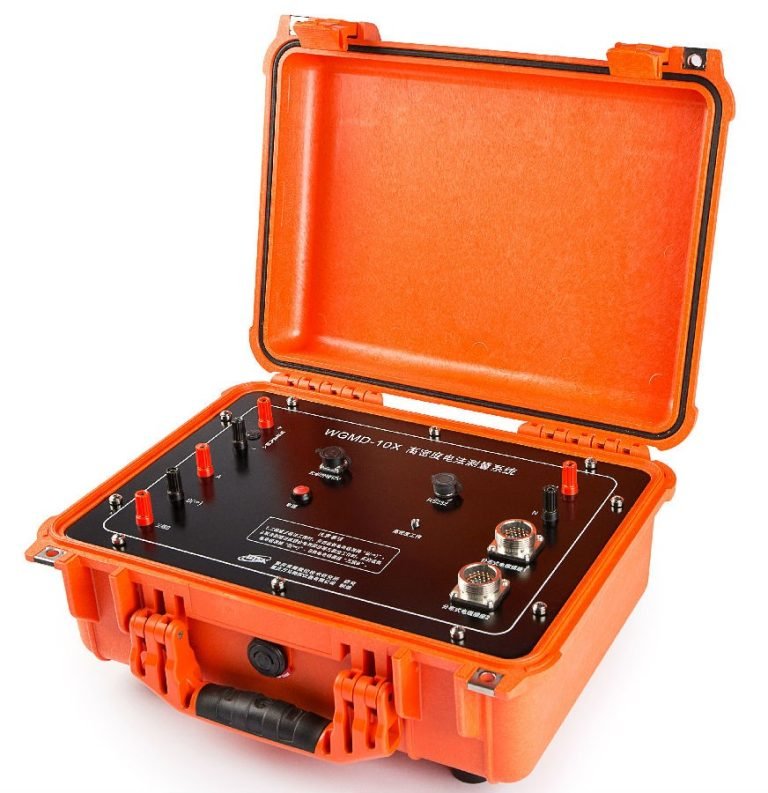
| Host | WDZJ-60/WDZJ-120 multi-function digital DC induced polarization instrument |
| Converter or adapter | None |
| DC high voltage power supply | External |
| Cable, electrode | Distributed high-density resistivity, IP switch cables, electrodes |
Working principle
Resistivity sounding method does not take in to account horizontal changes in thesubsurface resistivity. While 2d electrical imaging method with the resistivity changes in vertical as well as horizontal directions along the survey line.
Typical 1D resistivity sounding surveys usually involve about 10 to 20 readings, which 2-D imaging survey can finish thousand of points with different configuration. So the working efficiency improved greatly.
Applications
● Metal and nonmetal mineral resources detection
● City geophysical exploration, railway and bridge inspection
● Hydrology and engineering geology as seeking for ground water, inspecting dam base and flood protection levee for incipient faults
● Geothermal prospecting
● Landslides and other geological disaster exploration
Arrays
● Wenner Alpha
● Wenner Beta
● Wenner Gamma
● Dipole-dipole
● Schlumberger
● 3P-direct
● 3P-reverse
● 2P AM
● 3P A-MN
● 3P AB-M
● MN-B
● SP-M
● SP-MN
● Combined profiling
Features
● Transmitting unit and receiving unit are of all-in-one design, portable and lightweight.
● Super high-power, high anti-interference performance and precision: up to 6600w (1100v×6A) power, 48Vp-p voltage range ensures to get a good result in a area with high resistance.
● Automatically achieving compensation of self-potential, drift and electrode polarization, up to ±10V.
● Receiving unit support transient over-voltage protection, transmitting unit supports over-voltage protection, over-current protection and AB open-circuit protection.
● For general resistivity and IP survey function, 9 types of electrode arrays are available. Electrode distance (namely “Program”) can be inputted or called. Geometric factor can also be generated automatically or calculated manually.
● For multi-electrode 2D resistivity imaging, up to 18 electrode arrays are available. It could scanning measure according to fixed section (including AMNB, ABMN, AMBN,AMN, MNB, A-MN-B, Sp M, Sp MN, charge M, charge MN) or continuous rolling scanning measure according to variable section (including A-M, A-MN, AB-M, AB-MN, MN-B, A-MN rectangle).
● Program: the program can memorize 100 groups of electrode distances, avoiding repetitive input. Or you just input a program Id and step to call the corresponding electrode distances.
● Earth resistance inspection: ground condition can be inspected at any time.
● Mass data storage: Up to 1GB capacity (extended) enable store 5,000,000 groups measuring data (including current, voltage, SP, Ro, Ms, metal factor, TH, R, J).
● All parameter and data are under power-failure protection; and thus data will not be lost even thought the system shuts down accidentally.
● USB port enables it to transfer data to computer.
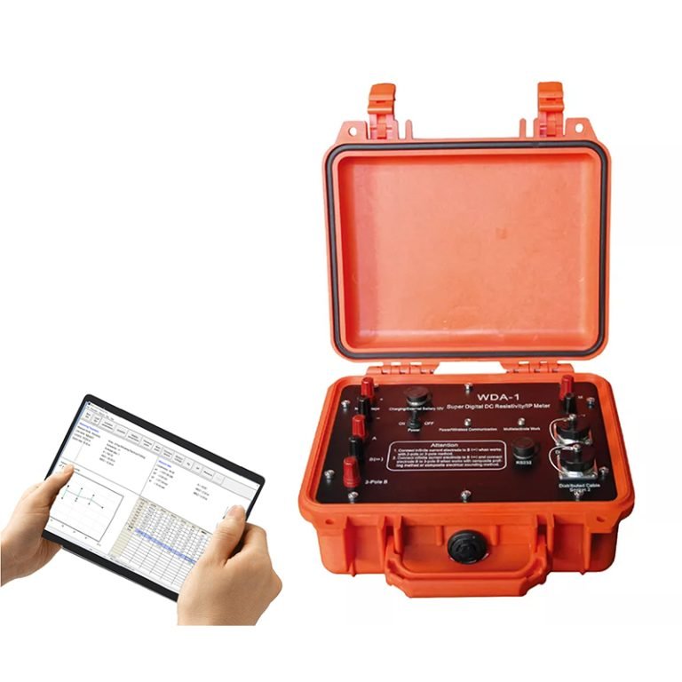
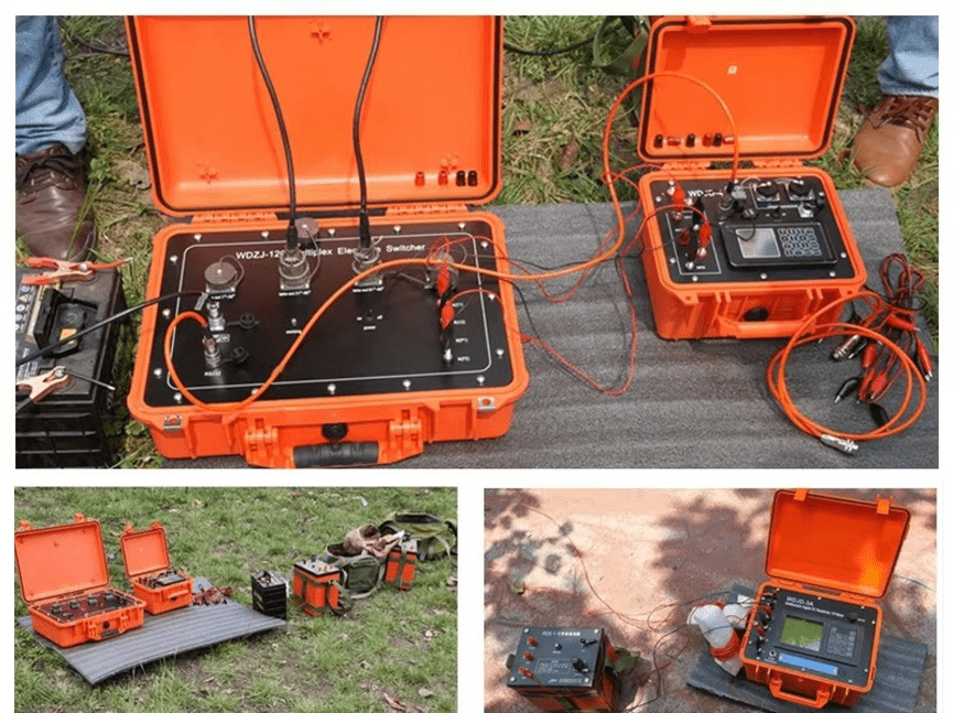
Detailed description
Support flexible configuration combination
WERT-4B: mainframe +intelligent cable (no limit on electrode qty)
| Mainframe | Earth resistivity/IP meter | Quantity: 1 set |
| Cable | Resistivity cable(10 take-outs) | Unlimited usage (depending on demand) |

Specifications
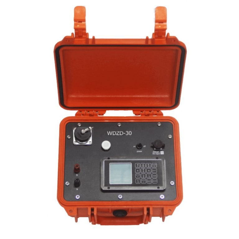
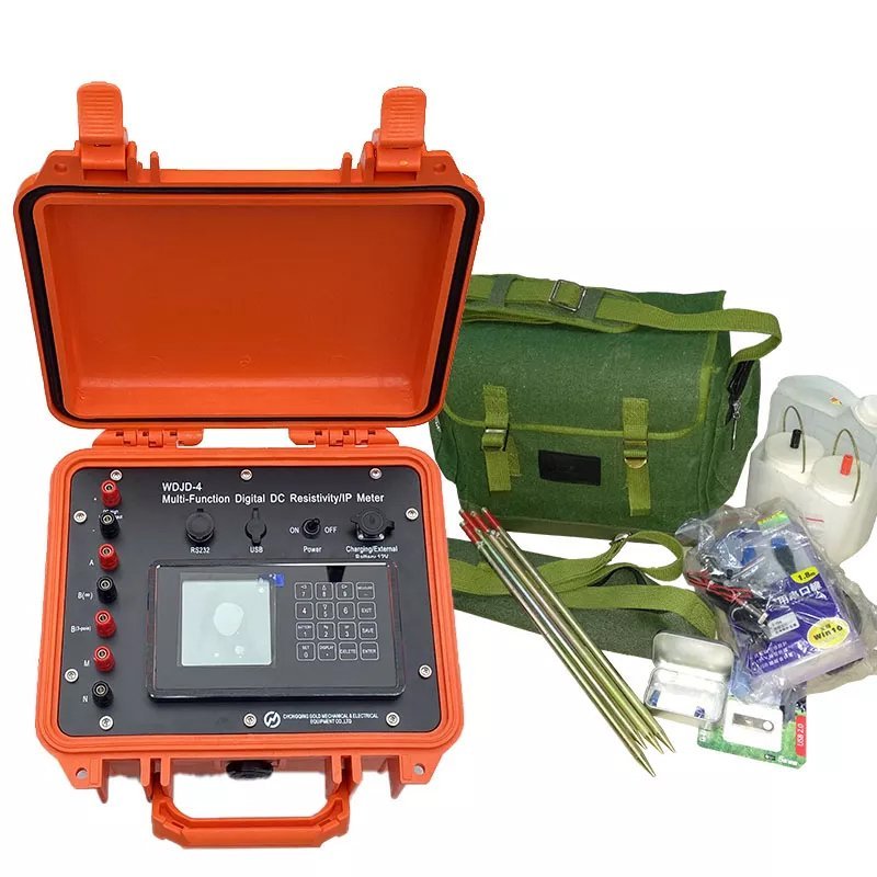
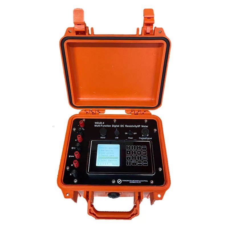
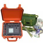
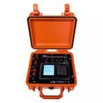
(一)WDZJ-60/WDZJ-120 Multi-function Digital DC IP Instrument (Test and Control Host)
Receiving section
| Item | Parameters |
| Voltage channel | ±24V, ±0.4% ±1 word, 24-bit A/D |
| Input impedance | ≥50MΩ |
| Apparent polarizability precision | ±1% ± 1LSB |
| SP compensation range | ±10V |
| Current channel | 6A, ±0.4% ±1 LSB , 24-bit A/D |
| Current precision | If Ip≥ 10mA, ± 5‰ ± 1 LSB; If Ip< 10 mA, ±1% ± 1 LSB. |
| Suppression | ≥80dB for 50Hz industrial frequency (common mode interference or differential mode interference) |
Transmitter
| Item | Parameters |
| Max transmitting power | 4500W (for general Res/IP sounding); 2400W (for WERT-4B, limited by intelligent Res cable). |
| Max voltage | ±900V(for general Res/IP sounding); ±800V(for WERT-4B, limited by intelligent Res cable). |
| Max current | ±5A(for general Res/IP sounding); ±3A(for WERT-4B, limited by intelligent Res cable). |
| Pulse width | 4500W (for general Res/IP sounding); 2400W (for WERT-4B, limited by intelligent Res cable). |
Other parameters
| Item | Parameters |
| Storage capacity | ≥1GB |
| Instrument power supply | Built-in lithium battery, can work continuously for more than 30 hours |
| Host interface | A, B, M, N, DC high voltage, external battery and charging, 2 interfaces with distributed high-density cables, RS-232 and USB, etc. |
| Working temperature | -10℃~+50℃, 95%RH |
| Storage temperature | -20℃~+60℃ |
| Dimension (L×W×H) | 270mm×246mm×175mm |
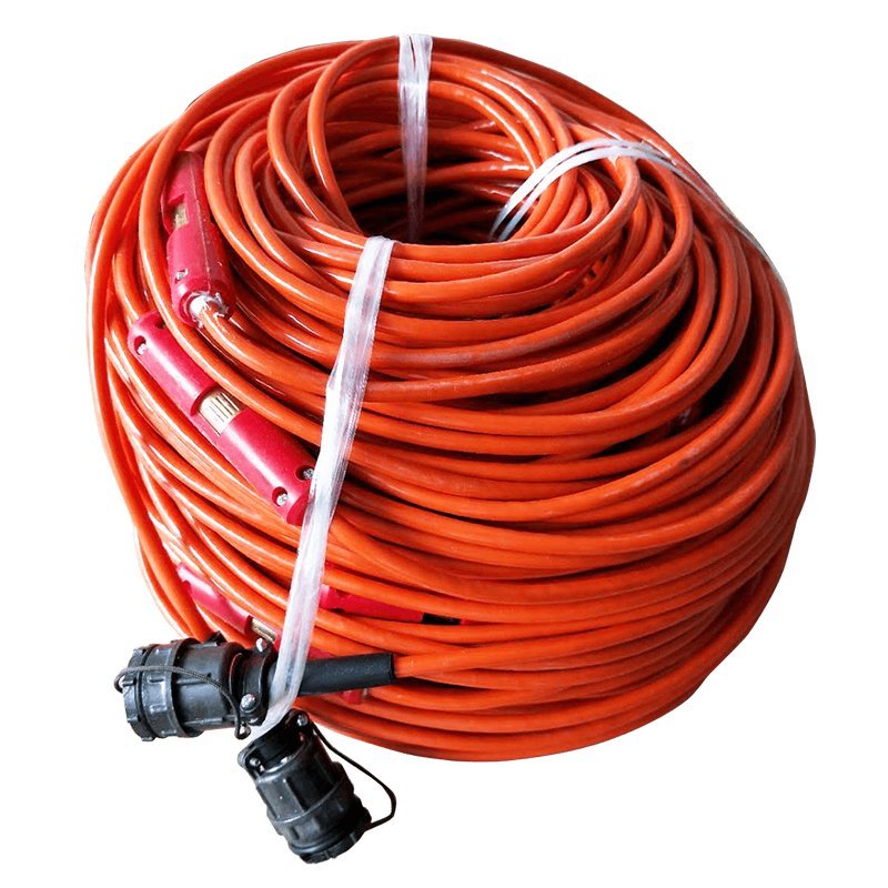
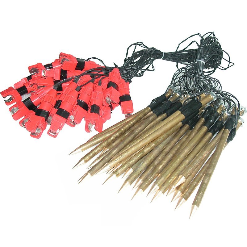
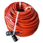
(二)Distributed 2D high-density resistivity, 2D high-density IP switch cable (optional)
| Item | Parameters |
| Cable | The sheath is made of wide temperature polyurethane material, with an outer diameter of Φ8mm |
| Quantity | Purchase according to the required quantity |
| Operating temperature | -20℃~+70℃ |
(三)Distributed 2D, 3D high-density resistivity, 2D high-density IP switch electrode (optional)
| Item | Parameters |
| Stainless steel electrode | Φ10mm×280mm, with stainless steel spring |
| Quantity | Purchase according to the required quantity |
Case Study

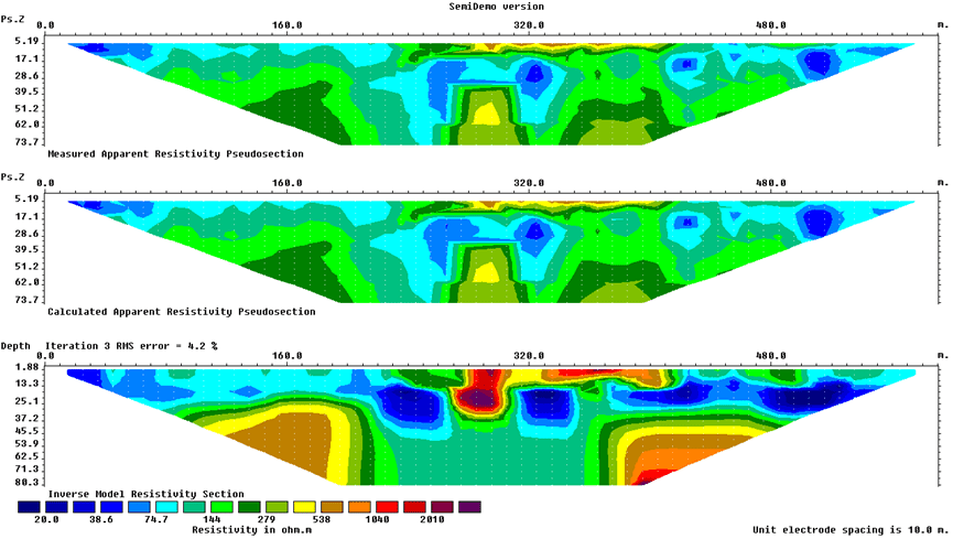
2D data inversion

Application with wenner array from Albania
Gold exploration from Madagascar
FAQ
In gravity exploration (SI), what is the unit of gravity? How to convert gravity units between SI and CGS?
What are gravitational field and gravitational potential?
What is the normal gravity field of the earth? What are the rules for the change of the normal gravity field with latitude and altitude?
What is the relationship between gravitational field strength and gravitational acceleration?
What is gravity exploration?