Welcome to Geotech!

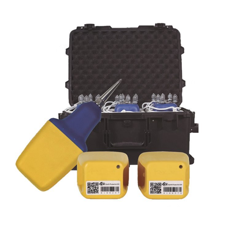
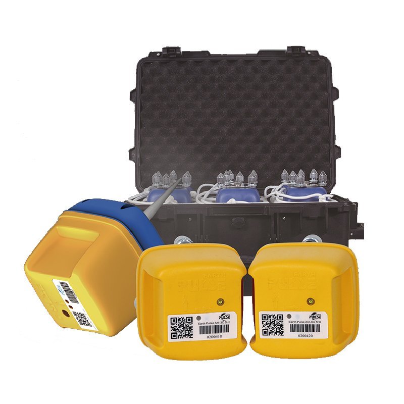
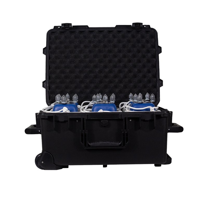
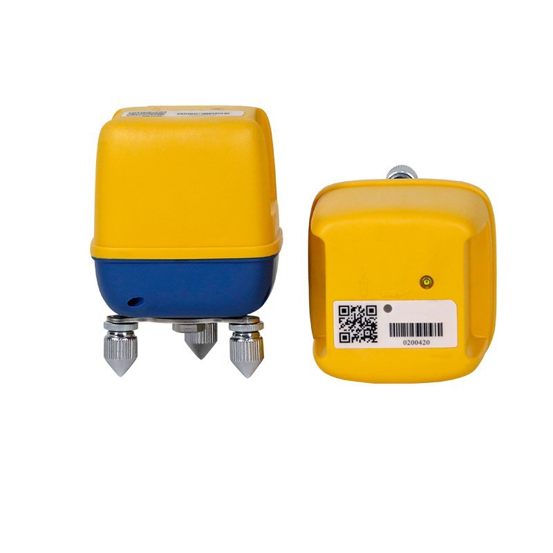
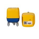
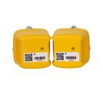
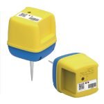
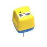
GE-ANT-3C Seismic nodal instrument


PRODUCT PARAMETERS
Description
 Abstract
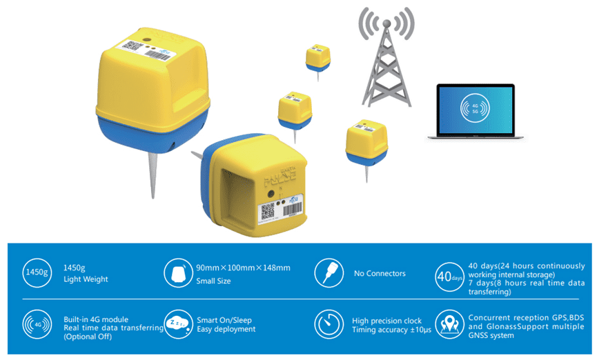
GE-ANT-3C is a new generation of high-precision three-component seismograph, which adopts advanced GPS/Beidou synchronization algorithm, ultra-low power circuit design and real-time data communication technology. The product has high integration, long continuous working time, no contact points, and can adapt to various complex surfaces and harsh environments. In addition, GE-ANT-3C uses the most advanced analog-to-digital conversion design, and the dynamic range of the product far exceeds similar products, which can monitor smaller vibration signals.
Applications
● Seismic regional safety evaluation
● Shallow geological survey
● Urban underground space exploration
● Geothermal exploration
● Coal goaf exploration
● Mineral/ natural gas exploration
Features
Specifications
(一)Physical Parameter
| Item | Parameters |
| Weight | 1450g |
| Size | 90mm×100mm×128mm(Without Spike) |
| Working Temperature | -40℃ to +70℃ |
| Waterproof | IP68 |
| Working Time @ 25 ℃ | 40 days(24 hours continuously working internal storage) 7 days(8 hours real time data transferring) |
| Charging Time | 9 hours |
(二)Instrument Parameter
| Item | Parameters |
| Number of Channels | 3 |
| ADC | 32 bit |
| Sampling Rate | 0.25ms,0.5ms,1ms,2ms,4ms,8ms,10ms,20ms |
| Preamplififier Gain | 0-36dB(6dB steps) |
| Low Cut Filter | 1Hz,DC removed or turn off |
| Anti Aliasing Filter | 206.5Hz@2ms(82.6% Nyquist frequency) optional maximum phase or minimum phase |
| 0dB @ Max Input | 2.5VpeaK |
| Equivalent Input Noise @ 12dB | 0.5uV@0.25ms / 0.2uV@2ms / 0.14uV@4ms |
| Instantaneous Dynamic Range @ 12dB | 118.9dB@0.25ms / 126.8dB@2ms / 130dB @4ms |
| Total Dynamic Range | 150dB |
| Timing Standard | <1ppm |
| Time Accuracy | ±10μs |
| Internal Storage | Extended from 32GB to 128GB |
| Built in GPS | GPS, BDS, GLONASS,GNSS(Concurrent reception) are used for timing and positioning |
(三)Geophone Parameter
| Item | Parameters-1 | Parameters-2 |
| Optional Geophone | 5Hz | 2Hz |
| Natural Frequency(Hz) | 5±7.5% | 2±15% |
| DC Resistance(Ω) | 1850±5% | 6400±10% |
| Sensitivity(V/m/s) | 80±5% | 260±15% |
| Damping | 0.7±7.5% | 0.7±15% |
| Distortion | ≦0.2% | ≦3% |
| Aliasing(Hz) | ≧120 | ≧90 |
Software System
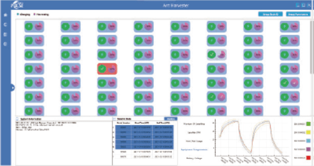
(一)Data-Harvest & Charging Center
(二)Ant-Data Manager

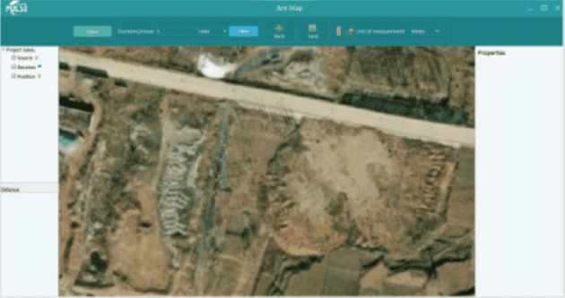
(三)Ant Map
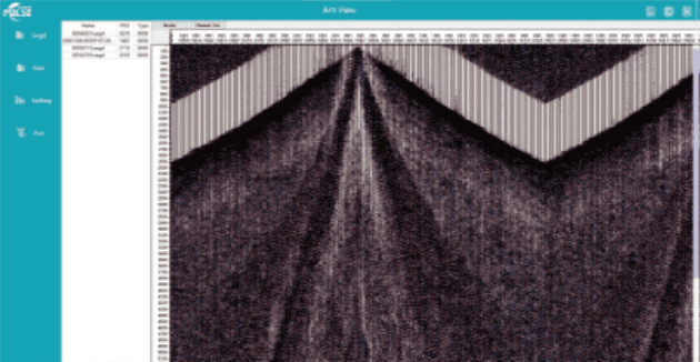
(四)Ant View
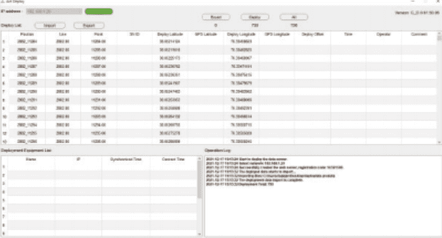
(五)Ant Deploy
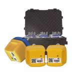
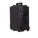
Auxiliary Equipment

FAQ
In gravity exploration (SI), what is the unit of gravity? How to convert gravity units between SI and CGS?
① In SI, it is m·s-2, and one percent of it is the international unit abbreviation g.u.;
② Conversion between SI and CGS: 1g.u.=10-1 mGal
What are gravitational field and gravitational potential?
Gravitational field: The space around the earth with gravity is called the gravitational field.
Gravitational potential: The gravitational potential W in the gravitational field is equal to the work done by a particle of unit mass moving from infinity to that point.
What is the normal gravity field of the earth? What are the rules for the change of the normal gravity field with latitude and altitude?
① The normal gravity field of the earth: Assuming that the earth is a rotating ellipsoid (reference plane), the surface is glossy, the internal density is uniform, or it is distributed in concentric layers, the density of each layer is uniform, and the deviation of the shape of the ellipsoid from the geoid is very small, then the gravity field generated by the earth is the normal gravity field.
② The normal gravity value is only related to the latitude, the smallest at the equator and the largest at the poles, with a difference of about 50,000 g.u.; the rate of change of the normal gravity value with latitude is the largest at 45° latitude, and zero at the equator and the poles; the normal gravity value decreases with increasing altitude, and its rate of change is -3.086 g.u.. The main feature of the long-term change is the "westward drift" of the geomagnetic elements, both the dipole field and the non-dipole field drift westward, and have a global nature.
What is the relationship between gravitational field strength and gravitational acceleration?
The gravitational field strength is equal to the gravitational acceleration in both numerical and dimensional terms, and the two are in the same direction. In gravity exploration, all references to gravity refer to gravitational acceleration. The gravitational field strength at a point in space is equal to the gravitational acceleration at that point.
What is gravity exploration?
Gravity exploration is an exploration method that is based on the density difference of rocks and ores. Since density difference will cause local changes in the normal gravity field of the earth (i.e. gravity anomaly), it is used to solve geological problems by observing and studying gravity anomalies.