Welcome to Geotech!

Comprehensive Urban Underground Space Detection Solution Using JPMG Proton Magnetometer
Description
1. Introduction
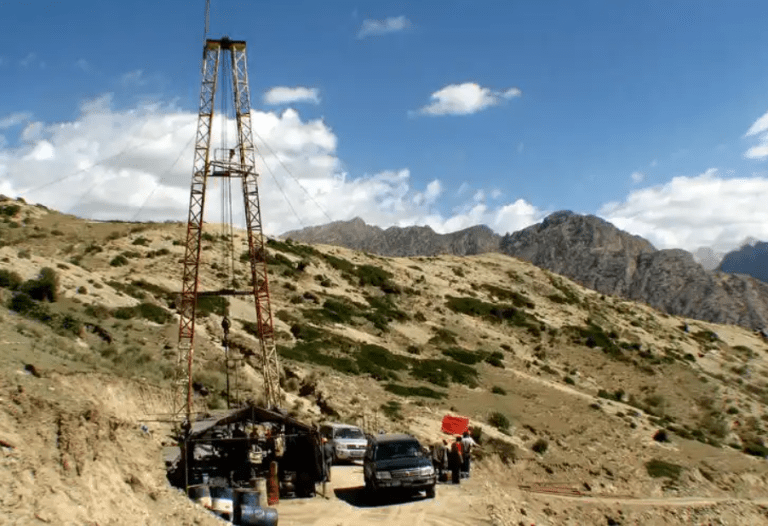
In urban environments, the complexity and diversity of underground spaces present significant challenges for infrastructure development and maintenance. As urbanization accelerates, the development and utilization of underground spaces have become an essential part of urban growth. Understanding the distribution of underground structures, buried objects, and cavities is crucial for municipal construction, infrastructure maintenance, and environmental protection. Traditional underground detection methods often involve invasiveness, high costs, and low efficiency. Therefore, utilizing efficient, non-invasive geophysical exploration techniques becomes an effective solution to these problems.
The proton magnetometer, as a high-precision geophysical exploration tool, provides accurate underground magnetic field data, helping to quickly identify underground structures and anomalies. The urban underground space detection solution based on the JPMG proton magnetometer presented in this paper can effectively address a series of challenges in urban underground space exploration, offering a high-efficiency, safe, and precise detection method.
2. Solution Overview
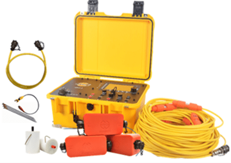
The JPMG proton magnetometer is a tool used for detecting underground spaces by measuring the magnetic field in high precision. It detects underground objects or structures by measuring the intensity, variation, and gradient of the magnetic field. The instrument offers exceptionally high sensitivity and accuracy, making it ideal for urban environments where underground spaces are complex.
Why Choose Proton Magnetometry?
- High Sensitivity: The JPMG proton magnetometer has a magnetic field measurement accuracy of ±0.1nT and a resolution as high as 0.01nT, enabling the detection of minute magnetic anomalies.
- Versatility: It works effectively in complex urban environments, adapting to various natural or man-made magnetic field interferences in underground spaces.
- Real-Time Data Collection and Analysis: The instrument allows for real-time data collection and direct transmission to computers or other storage devices, making it easy to analyze data on-site.
3. Key Features of the JPMG Proton Magnetometer
The JPMG proton magnetometer offers various measurement modes and incorporates several advanced technologies that provide strong support for urban underground space exploration.
3.1 High Precision and Sensitivity
The JPMG proton magnetometer can measure magnetic fields with extreme precision, with a sensitivity of up to 0.05nT. It is capable of detecting subtle magnetic anomalies, enabling the identification of buried objects or structures.
3.2 Multiple Measurement Modes
- Mobile Mode: Suitable for large-scale geophysical surveys where operators can walk along measurement lines, simultaneously collecting magnetic field data and generating continuous magnetic profiles.
- Base Station Mode: Ideal for long-term, stable magnetic field observation. This mode allows for continuous measurement in fixed locations, offering valuable data for diurnal corrections and long-term monitoring.
- Gradient Mode: This mode measures the difference between two magnetic field readings, providing high precision for detecting underground structures. It is especially useful for identifying tunnels, pipelines, and other underground anomalies.
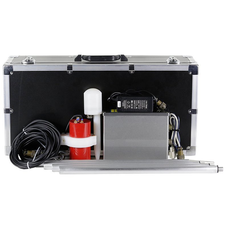
3.3 High-Precision GPS Integration
The JPMG proton magnetometer is equipped with high-precision GPS, allowing accurate positioning for each measurement point. This feature is crucial for data accuracy and traceability, particularly in urban environments.
3.4 Real-Time Data Transmission and Processing
The instrument supports data transmission via USB or RS-232 interfaces, enabling fast analysis and decision-making. This ensures timely access to the collected data for processing and interpretation.
4. Methodology
4.1 Survey Planning
Urban underground space exploration begins with selecting the measurement areas, focusing on known underground structures or unexplored zones. Preliminary planning can utilize existing building plans, utility maps, and other relevant documents to help identify areas of interest.
After selecting the survey areas, deploy several base stations to conduct long-term magnetic field observations, providing real-time correction values for data accuracy. Then, use the mobile measurement mode to cover the target areas and ensure comprehensive data coverage.
4.2 Data Collection
In Walking Mag (mobile) mode, operators can collect magnetic field data while walking, enabling large-scale continuous measurements. Each measurement point records the time, geographic location, magnetic field value, and signal quality, ensuring data accuracy and validity.
In specific areas, gradient mode can be used for higher precision, measuring the magnetic field variations between two distinct points, which helps identify the precise shape and distribution of underground structures.
4.3 Data Processing and Analysis
The collected data undergoes preliminary processing on-site to remove interference signals and perform diurnal corrections. Magnetic anomalies are analyzed to identify potential underground features, such as tunnels, pipelines, or voids.
Data can be further analyzed on computers, integrated with GIS (Geographic Information Systems) for spatial data visualization. This results in magnetic anomaly maps of the underground space, assisting decision-makers in understanding the distribution and structure of the underground environment.
5. Applications
5.1 Underground Utility Detection
The proton magnetometer helps identify underground infrastructure such as water pipes, gas lines, and electrical cables. It is crucial for ensuring the safety of urban construction and operation, as it allows municipal authorities to monitor and maintain utilities more effectively.
5.2 Tunnel and Void Detection
The proton magnetometer is effective in detecting underground voids, tunnels, or mine shafts. This is essential for urban underground space development, especially when constructing new buildings and infrastructure.
5.3 Archaeological Exploration
During urban construction, the proton magnetometer can be used for archaeological excavations, helping to locate buried historical structures or artifacts and prevent accidental damage to important cultural heritage sites.
5.4 Environmental Monitoring
The proton magnetometer is also valuable for monitoring changes in the urban underground environment, such as shifts in magnetic fields caused by groundwater flow or geological activity.
6. Solution Advantages
6.1 Non-Invasive and Safe
The proton magnetometer operates without disrupting the underground environment. Its non-invasive measurement method allows for precise exploration without the need for excavation or other forms of disturbance. This is especially important in urban environments where underground infrastructure is dense.
6.2 Efficiency and Large-Scale Coverage
The JPMG proton magnetometer can cover large areas rapidly, making it ideal for urban environments with complex underground structures. Its real-time data transmission and analysis allow for quick decision-making, reducing exploration time and costs.
6.3 Accurate and Reliable Data
The combination of high-precision magnetic field measurements and GPS positioning ensures reliable and accurate data. This makes the JPMG proton magnetometer an ideal tool for urban underground space exploration, capable of accurately mapping the location and distribution of underground structures.
7. Conclusion
As urbanization continues to accelerate, the development and management of underground spaces face increasing challenges. The JPMG proton magnetometer-based urban underground space detection solution offers an effective response to these challenges with its high precision, efficiency, and non-invasive capabilities. Through real-time monitoring, precise detection, and comprehensive data analysis, the proton magnetometer provides strong technical support for urban underground space exploration. With the advancement of technology, proton magnetometry will play an even more critical role in urban underground space detection in the future.
FAQ
What is the main difference between a single tap and a double tap?
What is the principle of high-density electrical prospecting?
What are the advantages of high-density electrical method?
In what fields is the high-density electrical method generally used?
What are the application characteristics of high-density electrical method?