Welcome to Geotech!

What is electrical resistance tomography?
Electrical Resistivity Tomography (ERT) is a geophysical exploration technique that involves placing electrodes on the ground surface or in boreholes to inject electrical current into the subsurface and measuring the resulting voltage differences. This method allows for the imaging of subsurface resistivity distributions and is widely used in environmental surveys, engineering investigations, hydrogeology, and archaeology.
Working Principle of ERT
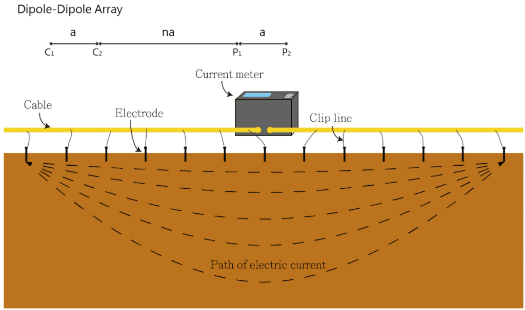
ERT is based on the principle that different geological materials have varying electrical resistivities. By injecting current into the ground and measuring potential differences, the resistivity distribution of subsurface materials can be inferred. Common electrode array configurations include Wenner, Schlumberger, and dipole-dipole, each suitable for different exploration depths and resolution requirements.
Main Applications of ERT
- Environmental Surveys: Identifying groundwater contamination, detecting landfill leaks, and monitoring groundwater flow.
- Engineering Investigations: Assessing the electrical resistivity characteristics of foundation soils and evaluating the stability of subsurface structures.
- Hydrogeology: Mapping the distribution of aquifers and monitoring changes in groundwater levels.
- Archaeology: Non-destructive detection of buried archaeological features, such as tombs and building foundations.
Comparison of ERT with Other Geophysical Methods
Compared to Ground Penetrating Radar (GPR), seismic methods, and magnetic methods, ERT offers unique advantages:
- Resolution: Provides high-resolution 2D and 3D images of subsurface resistivity, aiding in the identification of complex geological structures.
- Depth: The depth of investigation can be adjusted by varying electrode spacing, allowing for both shallow and deep subsurface exploration.
- Versatility: Applicable in various geological settings, especially in areas with conductive materials like water.
However, ERT also has limitations, such as sensitivity to groundwater chemistry and potential interference in high-noise environments. Therefore, it is often used in conjunction with other geophysical methods to obtain comprehensive subsurface information.
Advantages of ERT
- Non-Invasive: ERT is a non-destructive testing method that does not harm the environment or subsurface structures.
- Repeatability: Measurements can be repeated multiple times, making ERT suitable for long-term monitoring applications.
- Efficiency: Modern ERT systems utilize multi-electrode arrays and automated data collection, enabling rapid acquisition of extensive subsurface data.
- Cost-Effectiveness: Compared to direct exploration methods like drilling, ERT is relatively low-cost and suitable for large-scale preliminary surveys.
Data Processing and Interpretation in ERT
ERT data processing involves forward modeling and inversion analysis. Forward modeling simulates subsurface current distribution to understand resistivity responses under different geological conditions. Inversion analysis reconstructs subsurface resistivity structures from measured data, employing algorithms such as least squares and global optimization methods.
Interpreting ERT data requires integrating geological context and other exploration information to identify subsurface features like geological units, faults, and aquifers. For instance, high resistivity areas may correspond to dry sand and gravel layers, while low resistivity areas might indicate saturated clay layers

