Welcome to Geotech!

2025 Geophysical Application Academic Conferences: The New Journey of the Industry Driven by Innovation and the Outstanding Contributions of Geotech Instrument
In the surging development of the geophysical application industry in 2025, academic conferences are like bright stars, illuminating the path of technological innovation and industry communication. These grand events have gathered the top wisdom from around the world, showcased cutting – edge technologies and innovative concepts, and injected continuous vitality and opportunities into the field of geophysical applications. Geotech Instrument Co., Ltd., as a mainstay in the industry, plays an irreplaceable leading role in this innovation trend with its excellent products and advanced technologies.

The 2025 Annual Meeting of the Beijing Geophysical Society: Pioneering New Frontiers in Geophysical Technologies
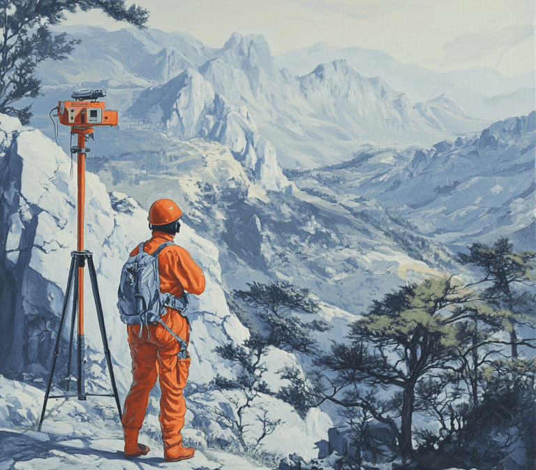
The 2025 Annual Meeting of the Beijing Geophysical Society, with the theme of “New Theories, New Methods, and New Technologies in Geophysics and Their Applications in Earth Sciences and Engineering”, has attracted the active participation of numerous authoritative scholars globally. The official website of the conference is [the official website of the Beijing Geophysical Society] (the specific URL needs to be supplemented, and you can improve it according to the actual situation). During the conference, in – depth discussions around multiple cutting – edge themes have clearly pointed out the direction for the future development of geophysical technologies. In the discussion of “Research Progress on Active Faults in China”, accurately detecting the location and activity patterns of faults is of great significance for earthquake disaster prevention. Geotech Instrument’s Electrical Resistivity Tomography (ERT) technology plays a crucial role here. The ERT system, with its ability to accurately measure the changes in underground resistivity, can clearly outline the outline of faults, providing researchers with detailed geological structure information. For example, in a fault detection project in an earthquake – prone area, with the help of Geotech Instrument’s ERT equipment, a previously undiscovered buried fault was successfully detected, providing key data for earthquake disaster assessment and prevention in this area, greatly enhancing the scientificity and accuracy of earthquake prevention work. In the research of “Satellite Geodesy and Glacier Mass Balance”, accurate monitoring of glacier mass changes is inseparable from high – precision measurement equipment. The company’s high – precision measurement instruments can not only stably obtain satellite geodesy data but also, combined with advanced data processing algorithms, provide reliable data support for glacier mass balance research, contributing to new progress in global climate change research.
The 2024 Annual Meeting of the Guangdong Geophysical Society and the 4th Guangdong – Hong Kong – Macao Geophysical Academic Forum: A Successful Model of Industry – University – Research Integration
The 2024 Annual Meeting of the Guangdong Geophysical Society and the 4th Guangdong – Hong Kong – Macao Geophysical Academic Forum, focusing on “Guangdong – Hong Kong – Macao Geophysics and Big Data”, has successfully brought together the wisdom of industry, academia, and research. Its official website is the official website of the Guangdong Geophysical Society. In the exploration of the earth’s internal structure, Geotech Instrument’s High – Density Electrical Method equipment achieves a fine – scale detection of the underground target area through high – density electrode arrangement. In the pre – project survey of subway construction in a large city, the use of this equipment accurately detected the complex underground geological structure, including the distribution of different strata and potential geological hazards such as karst caves, providing detailed and reliable geological data for subway line planning, effectively ensuring the smooth progress of the subway construction project. In the field of oil and gas resource exploration technology development, the company’s DC Resistivity Sounding and Vertical electrical sounding (VES) technology products can accurately measure the resistivity changes at different underground depths, thereby effectively determining the location and thickness of oil and gas reservoirs. In an offshore oil and gas field exploration project, relying on these technologies, potential oil and gas reservoirs were accurately located, laying a solid foundation for subsequent mining work, significantly improving the efficiency and success rate of oil and gas resource exploration.
The First Global “International Conference on Earth – layer Coupling (ICES)”: International Cooperation Promotes the Upgrading of Disaster Prevention and Control Technologies
The first global “International Conference on Earth – layer Coupling (ICES)”, jointly organized by Chengdu University of Technology and several other units, has attracted 120 top scientists in the field of earth sciences from 14 countries and regions. The official website of the conference is the special page of the conference on the website of Chengdu University of Technology. The conference has conducted in – depth discussions on earth – layer coupling and natural disaster prevention and control. In the research of geological disasters such as earthquakes, volcanoes, and landslides, Geotech Instrument’s Induced Polarization (IP) technology can effectively distinguish different types of minerals and rocks underground, helping researchers more accurately judge the stability of the geological structure. In a landslide disaster hidden danger investigation project in a mountainous area, the use of IP technology products quickly identified the boundaries of potential landslides and unstable strata, providing an important basis for formulating scientific and reasonable prevention and control measures, effectively safeguarding the lives and property of mountainous area residents. At the same time, the company’s earthquake monitoring equipment has the characteristics of high sensitivity and high precision, capable of real – time monitoring of earthquake activities and providing timely and accurate data for earthquake early warning systems, playing a vital role in earthquake disaster prevention.
The 243rd “Mengxi” Geoscience Expert Forum: Technological Innovation and Application Breakthroughs in the Energy Field
At the 243rd “Mengxi” Geoscience Expert Forum, John Eastwood’s shared seismic attribute discrimination analysis technology and micro – seismic monitoring methods have provided brand – new ideas for the development and utilization of energy and mineral resources. Although the official website of this forum has not been retrieved for the time being, it has a profound impact in the industry. Geotech Instrument also has rich product application experience in the energy field. Its Resistivity Imaging and Electrical Imaging technologies perform outstandingly in reservoir monitoring, being able to real – time monitor the resistivity changes inside the reservoir, helping oil companies better understand reservoir dynamics and then optimize extraction plans. For example, during the extraction process of an oilfield, using this technology, the changes in the oil – water interface inside the reservoir were detected in a timely manner, providing a scientific basis for adjusting the extraction strategy, effectively improving oil extraction efficiency and reducing extraction costs.
Geotech Instrument Co., Ltd. has always been firmly committed to providing advanced technologies and high – quality products for the global geophysical application industry. By continuously increasing research and development investment and constantly promoting innovation, the company has always maintained a leading position in multiple key technical fields such as Electrical Resistivity Tomography (ERT) and High – Density Electrical Method, providing powerful support for the development of many fields such as geological exploration, mineral prospecting, environmental monitoring, and engineering surveys. With the continuous in – depth development of the geophysical application industry, Geotech Instrument will continue to closely follow the academic forefront, deeply integrate the latest research results into product research and development and practical applications, and contribute more wisdom and strength to the prosperity and development of the industry.