Welcome to Geotech!

Electrical & Magnetic instrument Solution :The landfill leakage detection solution
Description
Ⅰ.Project introduction
Purpose of the survey: Under non-excavation conditions: assessment of landfill boundary, burial depth, buried volume, landfill leachate seepage and surrounding cultivated land conditions provide reliable information for later construction.
Ⅱ.Investigation method
Detection is performed by inductive electromagnetic (EM) and electrical resistivity (Tomography) using geophysical detection.(The packing density of landfills and the enrichment of leachate in the survey area will cause the difference between the conductivity of the detector and the original rock and soil, which is suitable for the intervention of physical exploration methods).
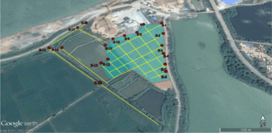
Ⅲ.On-site program
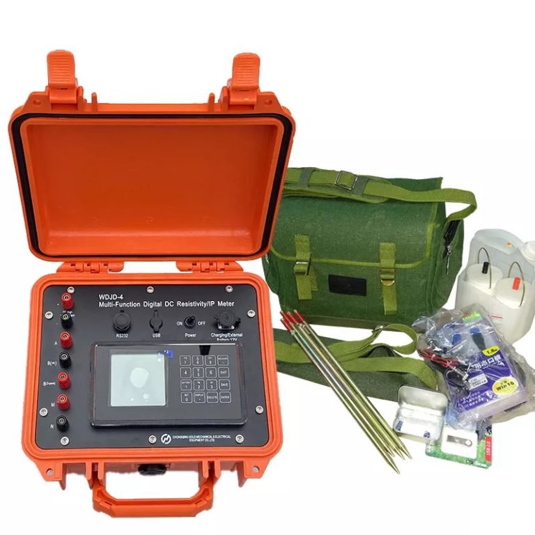
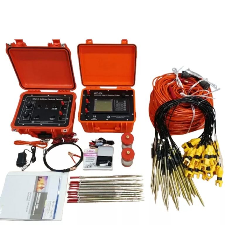
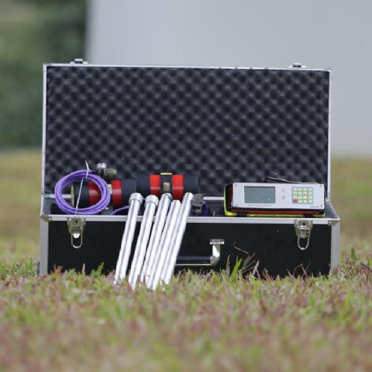
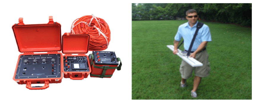
Equipment
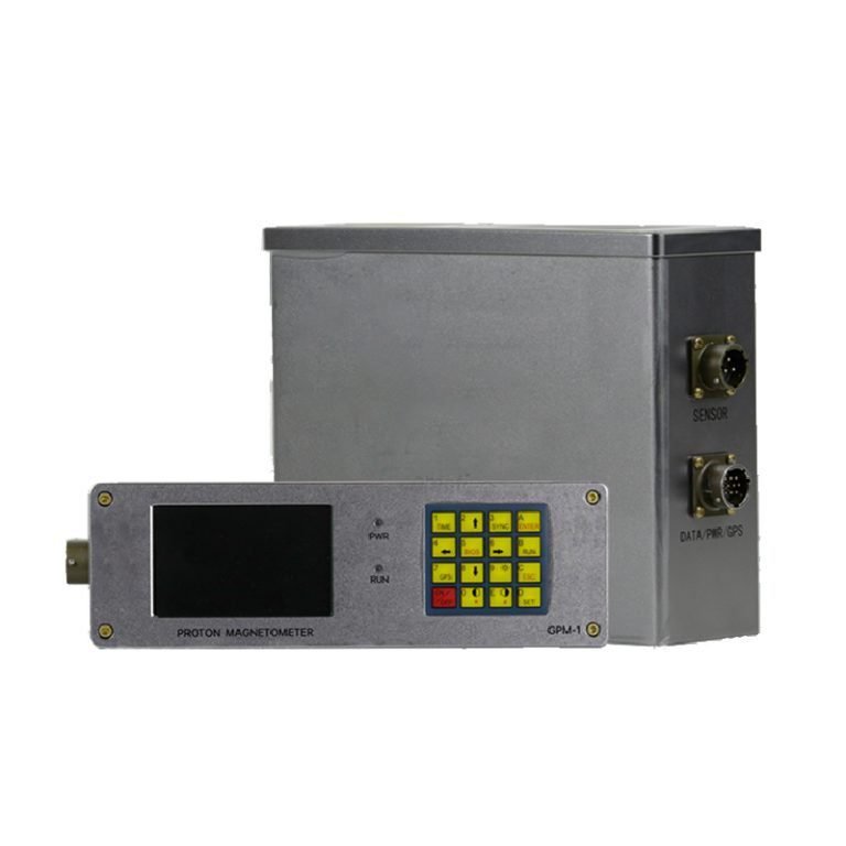
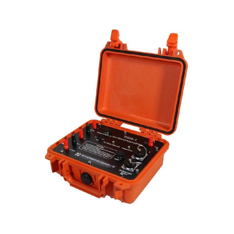
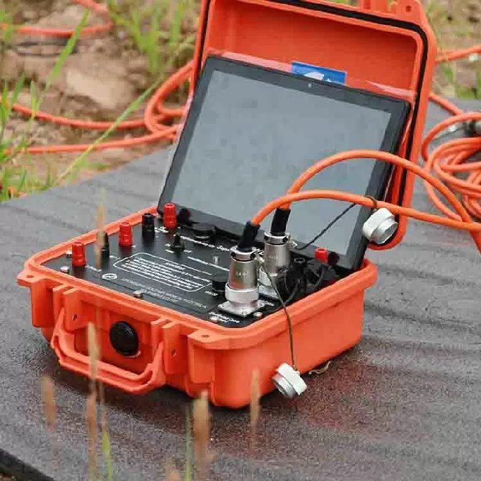
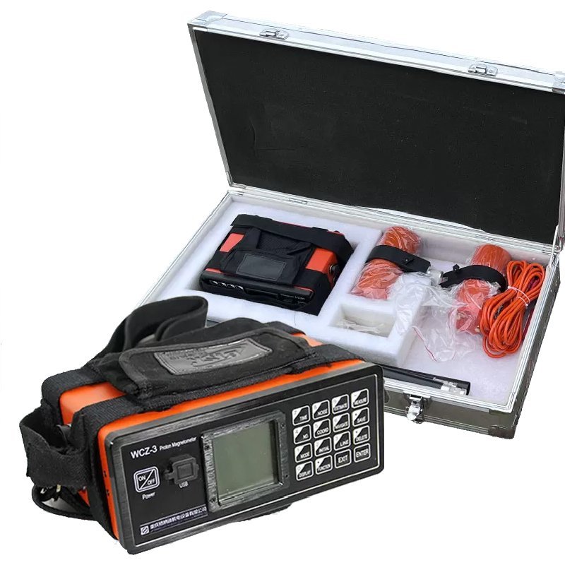
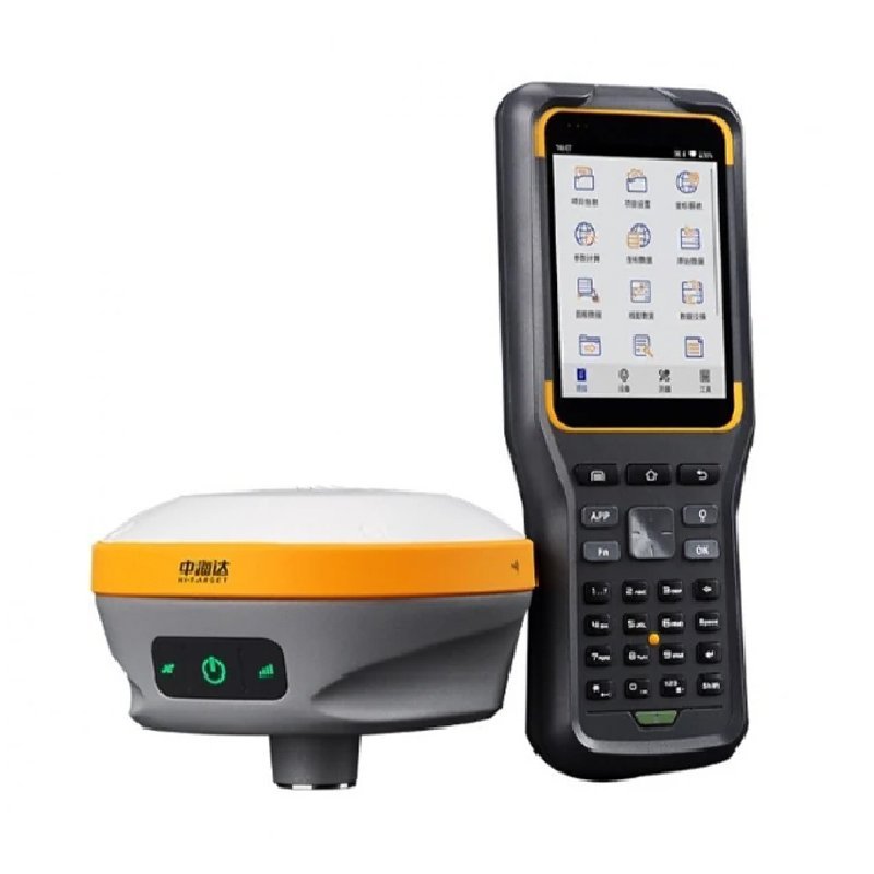
The survey selected Geotech’s WGMD-10V 5-channel distributed high-density electrical measurement system and WCZ-3 GPS Proton Precession Magnetometer. The position information of the measurement points was collected by RTK.
Test program
Reasonable layout of survey lines can ensure the acquisition of high-quality data. The total area of the survey area is 26000m², and a regional grid layout is carried out with a grid spacing of 20-30 meters. A total of 18 ERT survey lines are laid.
Ⅳ.Electric method working principle
Induction electromagnetic works
The main method of induction electromagnetic method (EM) is frequency domain electromagnetic method (FDEM), which generates an induced magnetic field in the formation through the instantaneous current of the coil, and calculates the apparent conductivity of the material by recording the phase difference of the secondary magnetic field. In a fixed case, the two-dimensional tangent plane distribution of the conductivity of the material at a specific depth can be delineated.

It is often presented in the form of a cut plane equivalent image or a single point measurement, depicting the difference in surface electrical distribution, and the conductivity of the physical unit (mS/m), representing different heights and values in different shades.
Electrical resistivity tomography works
The resistivity method is a geophysical method based on the difference in dielectric resistivity. The detection principle of the DC resistance method is to establish an artificial electric field by using a direct current to pass a pair of current poles A and B into the ground. By the difference in conductivity between the interlayer media, another potential pair M, N can be used to measure the potential difference between the electric field between M and N, thereby obtaining the apparent resistivity of the formation and estimating the underground formation. Conductivity distribution.

Ⅴ.Results show
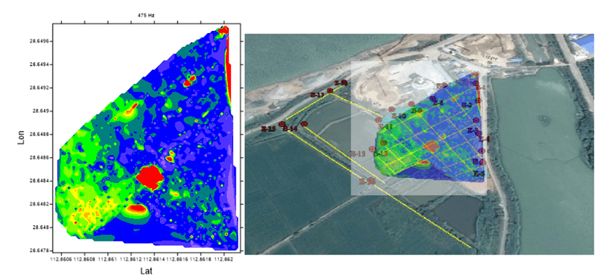
EM Result
The figure shows that the overall conductivity of the survey area is high, and the detection value is about 100-300 ms/m. It is speculated that the landfill leachate in this field has spread to the whole area, and the high conductivity in the area (>500ms/ m) is distributed in the southwest corner. It is speculated that this area is the collection area of landfill leachate. There is no obvious anti-seepage work in this area, and there is a hidden danger of further spread of pollution.
ERT Result
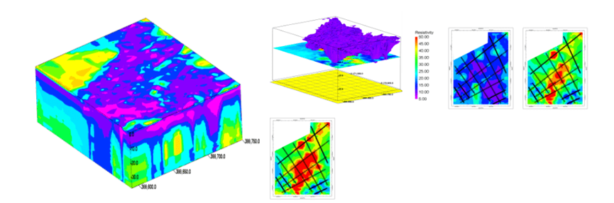
The high-density resistivity method results of the survey area are used to establish a three-dimensional model, and the results of 3D and other deep-section results show that most of the depths of 0 to 15 meters are low-resistivity formations, and the resistivity values are lower than 20 Ohm-m; >15 meters. The formation resistivity has begun to rise; the depth of 18-20 meters is the original formation, and there is no landfill resistivity characteristic. The volume of waste is estimated to be 300,000 to 350,000 cubic meters.
Ⅵ.Advantages of geophysical methods
The plane distribution range of the abnormal value of the measurement area is determined by the inductive electromagnetic method, and the distribution range of the abnormal value of the measurement area in the vertical direction is determined by the high-density resistivity method. The two methods are closely matched to obtain the geological body in the space of the measurement area. Characteristic parameter.
The traditional way of investigating is to estimate the possible distribution through limited borehole sampling, and to estimate the extent and depth of the pollution distribution through the correlation of the results between the points; the geophysical prospecting is non-destructive. The method of measuring the landfill and stratum structure under the ground, in addition to the characteristics of no drilling, can also obtain continuous profile data through a wide range of measurements.
Geophysical methods investigate contaminated sites, no holes are exposed, prevent further spread of pollution, environmental protection, and no secondary pollution.
FAQ
What is the main difference between a single tap and a double tap?
What is the principle of high-density electrical prospecting?
What are the advantages of high-density electrical method?
In what fields is the high-density electrical method generally used?
What are the application characteristics of high-density electrical method?