Welcome to Geotech!
-1.png)


How to select Geophysical Instruments 2026 丨Geophysical Instruments Selection Guide
TIPS:Geophysical instruments are essential tools for modern subsurface exploration. This geophysical instruments guide helps B2B buyers select the right devices for mining, groundwater, and engineering projects. You will learn how to match geophysical instruments to site conditions. You will also discover how to verify calibration standards and control data quality in the field.
Ⅰ. Introduction
Geophysical instruments have transformed how industries explore the subsurface. Mining teams use these tools to locate ore bodies. Engineering firms rely on them to assess ground stability. Environmental consultants deploy them to track contamination plumes. The global geophysical services market now exceeds USD 15 billion annually. This growth reflects rising demand for precise, non-destructive subsurface data.
Yet selecting the right geophysical instruments remains challenging. Buyers face dozens of device types. Each method offers distinct advantages. Each carries specific limitations. A proton magnetometer excels at magnetic mapping. It cannot detect electrical conductivity. An ERT system maps resistivity variations. It struggles in highly resistive terrains. Understanding these trade-offs saves capital. It also prevents costly survey failures.
This guide approaches geophysical instruments from a B2B procurement perspective. We examine five core device categories. We present a technical validation framework. We also explore calibration standards and data quality control. These insights help exploration managers, chief geophysicists, and procurement officers make informed decisions.
Ⅱ. What Are Geophysical Instruments
Geophysical instruments are devices that measure physical properties of the Earth. These properties include electrical conductivity, magnetic susceptibility, seismic wave velocity, density, and electromagnetic response. Geophysicists interpret these measurements to model subsurface structures without drilling.
Modern geophysical instruments combine hardware and software. Field sensors collect raw data. Data loggers store measurements. Inversion software converts signals into visual models. This integration allows real-time quality control. It also accelerates decision-making in the field.
The applications span multiple sectors. Mineral explorers use magnetic and electromagnetic systems. Civil engineers prefer seismic and GPR tools. Hydrogeologists favor resistivity and EM methods. Archaeologists deploy magnetometers and ground-penetrating radar. Each sector demands specific instrument configurations.
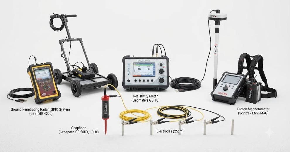
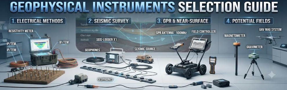
Ⅲ. Core Categories of Geophysical Instruments
1.Electrical & Electromagnetic Instruments
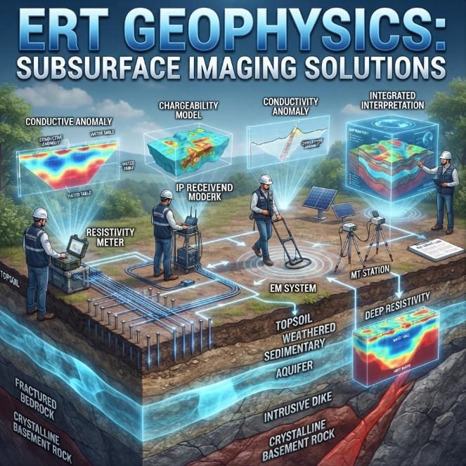
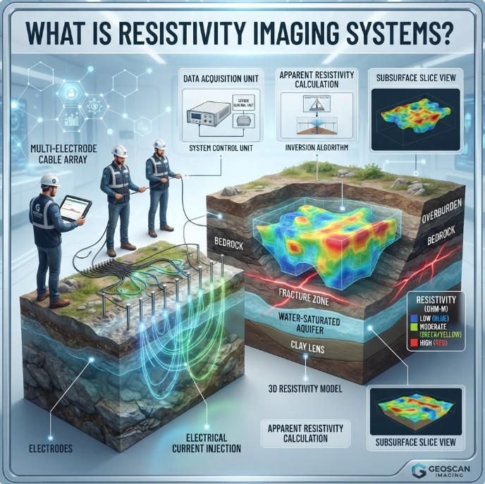
Electrical methods inject current into the ground. They measure resulting voltage differences. These measurements reveal subsurface resistivity distributions.
Electrical Resistivity Tomography (ERT) instruments use multi-electrode arrays. Modern systems support 2D and 3D imaging. Channel counts range from 24 to 256 electrodes. Exploration depths extend from 5 meters to over 1,500 meters. ERT excels at groundwater mapping. It also identifies clay layers and fracture zones.
Induced Polarization (IP) instruments add chargeability measurements. These detect disseminated sulfides. IP surveys support mineral exploration. They also track environmental contamination.
Electromagnetic (EM) instruments operate without ground contact. Frequency-domain systems (FDEM) measure terrain conductivity. Time-domain systems (TDEM) probe deeper structures. EM methods suit large-area reconnaissance. They also work well in areas with difficult terrain.
2.Seismic Instruments
Seismic instruments generate acoustic waves. They record how these waves reflect and refract through subsurface layers. This reveals geological structures at depth.
Refraction seismographs map bedrock topography. They determine overburden thickness. Reflection systems image deeper stratigraphy. They identify fault zones and hydrocarbon traps.
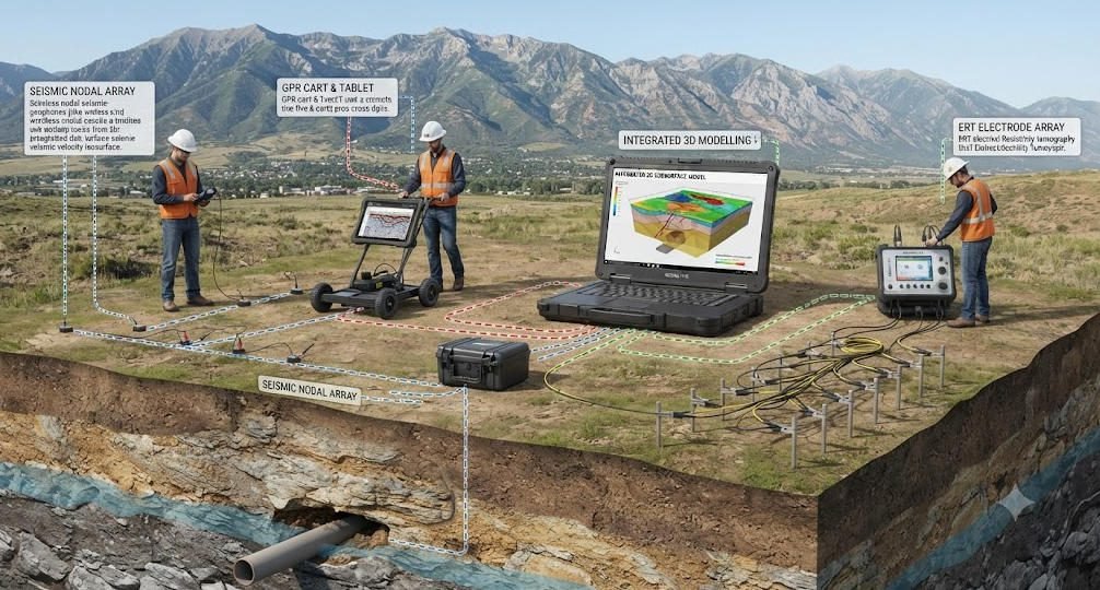
Modern seismic instruments use wireless nodal technology. Cable-free geophones reduce deployment time. Each node weighs under 500 grams. Batteries last 10+ days. This innovation cuts labor costs. It also improves safety on complex sites.
Multi-channel analysis of surface waves (MASW) has gained popularity. It provides shear-wave velocity profiles. Engineers use these profiles for site classification. They also assess liquefaction risk.
3.Magnetic & Gravity Instruments
Magnetometers measure variations in Earth’s magnetic field. These variations indicate buried ferrous objects. They also reveal magnetic mineral deposits.
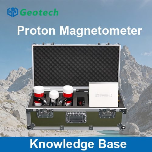
Proton precession magnetometers offer absolute field measurements. They achieve ±0.5 nT accuracy. Optical pump magnetometers provide higher sensitivity. They suit fine-scale archaeological surveys. Fluxgate magnetometers measure field gradients. They detect UXO and buried pipelines.
Gravimeters measure gravitational acceleration. They identify density contrasts. These instruments support oil and gas exploration. They also detect voids and sinkholes.
4.Ground Penetrating Radar (GPR)
GPR transmits high-frequency electromagnetic pulses. It records reflections from subsurface interfaces. This creates cross-sectional images of shallow structures.
Antenna frequencies range from 12.5 MHz to 3.0 GHz. Lower frequencies penetrate deeper. Higher frequencies resolve finer details. A 100 MHz antenna reaches 30+ meters. A 1.5 GHz antenna resolves rebar in concrete.
GPR works best in resistive soils. Sandy and rocky terrains yield excellent results. Clay-rich or saline soils absorb radar energy. This limits penetration depth. Modern GPR instruments include GPS integration. They also offer real-time data visualization.
5.Borehole Logging Systems
Borehole geophysical instruments characterize formations at depth. These tools operate within drilled holes. They provide continuous property profiles.
Common logging tools include natural gamma, resistivity, and caliper probes. Full-waveform sonic tools measure seismic velocities. Optical televiewers image borehole walls. EM induction logs detect conductive zones outside the casing.
Borehole methods complement surface surveys. They ground-truth geophysical interpretations. They also reveal features that surface methods miss.
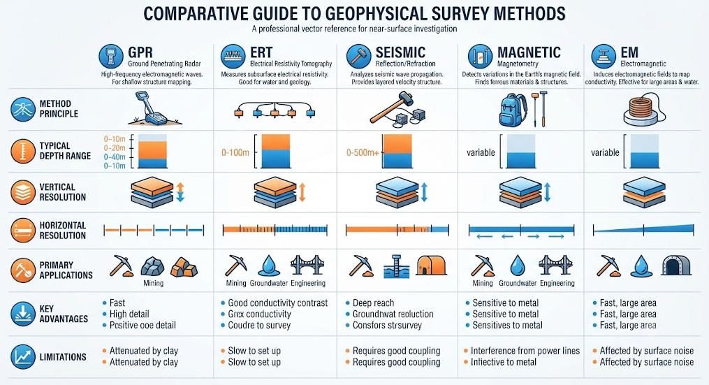
Ⅳ. B2B Procurement: Technical Validation Framework
1.Define Survey Objectives
Start with clear project goals. Identify your target physical property. Metallic ore bodies respond to magnetic and EM methods. Groundwater aquifers appear in resistivity data. Void spaces show in GPR profiles.
Determine required depth of investigation. Shallow utility mapping needs GPR. Deep crustal studies require seismic reflection. Specify resolution requirements. High-resolution work demands dense sensor spacing. It also needs high-frequency instruments.
2.Match Method to Site Conditions
Terrain affects instrument selection. Rugged mountains favor portable magnetometers. Urban environments require compact GPR carts. Wetlands need waterproof electrode systems.
Cultural noise limits some methods. Power lines interfere with EM surveys. Metal fences distort magnetic data. Paved surfaces prevent electrode insertion. Understanding these constraints prevents data corruption.
3.Verify Calibration Standards
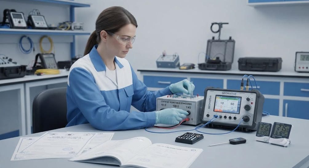
Calibration ensures measurement accuracy. Send instruments to certified labs annually. Verify sensor responses against known standards. Document all calibration certificates. Many clients now require traceable calibration records.
ISO/IEC 17025 accreditation marks reliable calibration labs. These labs follow international measurement standards. They provide formal certificates with traceability references. They also document measurement uncertainty.
Field crews should perform daily checks. Verify instrument voltages at the start of each day. Check cable insulation for damage. Test GPS accuracy before surveys begin. Record quality factors for each reading.
4.Assess Total Cost of Ownership
Initial purchase price represents only part of the investment. Consider calibration costs. Factor in software licenses. Account for training expenses. Include maintenance budgets.
Rental programs offer flexibility. They allow access to latest technology. They also eliminate long-term storage needs. For short projects, renting geophysical instruments often proves more economical than purchasing.
Ⅴ. Technology Trends in Geophysical Instruments
The exploration industry continues to evolve. Wireless nodal systems replace cabled arrays. AI accelerates data interpretation. Multi-physics instruments combine multiple sensors. These trends improve efficiency. They also reduce exploration costs.
Wireless technology has transformed seismic surveys. Nodal instruments eliminate cable weight. They also reduce setup time by 60% or more. Each node operates as an independent data collector. This allows flexible array designs.
AI-powered inversion software now processes data in real time. Machine learning algorithms identify anomalies faster than human interpreters. They also reduce subjective bias in data analysis. Cloud platforms enable remote collaboration. Teams can review survey results from anywhere.
Multi-physics instruments represent the next frontier. These devices collect magnetic, electrical, and seismic data simultaneously. They reduce equipment redundancy. They also simplify field logistics. Geotech Instrument Co., Ltd. designs modular systems for such workflows. Our GIM Series integrates ERT, IP, and magnetic modules. This compatibility supports seamless multi-method surveys.
Ⅵ. Field Best Practices & Data Quality Control
Geophysical instruments require regular care. Clean electrodes after each ERT survey. Check cable insulation for damage. Store magnetometers away from magnetic sources. Keep GPR antennas free of dirt and moisture.
Field crews should follow standardized procedures. Deploy electrodes in straight lines. Maintain consistent spacing. Record GPS coordinates for all stations. Monitor battery levels throughout the day. Back up data after each survey line.
Data quality control involves multiple checks. Cross-correlate data between adjacent survey lines. Verify depth calibration with drill hole information. Check for anthropogenic noise during acquisition. Avoid using radio transmitters near sensitive instruments.
Quality interpretation depends on quality data. Each link in the chain must maintain high standards. This includes quality instruments, experienced operators, good procedures, and thorough verification.
Ⅶ. Conclusion
Geophysical instruments selection demands technical knowledge and strategic thinking. Buyers must understand method capabilities. They must match instruments to site conditions. They must also verify calibration standards and plan for maintenance.
The exploration industry continues to advance. Wireless systems replace cables. AI accelerates interpretation. Multi-physics devices combine sensors. These innovations improve survey efficiency. They also reduce operational costs.
At Geotech Instrument Co., Ltd., we support B2B clients worldwide. Our product portfolio covers electrical, magnetic, seismic, and radar instruments. We provide technical consultation. We also offer training and after-sales support. Visit https://geotechcn.net to explore our solutions.
Reference Sources
| Organization | URL |
|---|---|
| U.S. Geological Survey (USGS) – Geophysical Methods | https://water.usgs.gov/ogw/bgas/methods.html |
| American Geophysical Union (AGU) | https://www.agu.org/ |
| Society of Exploration Geophysicists (SEG) | https://seg.org/ |
| Society of Environmental and Engineering Geophysicists (EEGS) | https://www.eegs.org/ |
| International Union of Geological Sciences (IUGS) | http://www.iugs.org/ |
FAQ
Q1.What are geophysical instruments used for?
Geophysical instruments measure physical properties of the subsurface. These properties include electrical conductivity, magnetic susceptibility, seismic velocity, and density. Industries use these measurements for mineral exploration, groundwater detection, engineering site assessment, environmental monitoring, and archaeological surveys. The data helps teams map structures without excavation or drilling.
Q2.How do I choose the right geophysical instruments?
Start by defining your target and required depth. Then evaluate site conditions including terrain, soil type, and cultural noise. Next, compare method capabilities against your budget and timeline. Finally, verify that instruments carry current calibration certificates. Consulting with experienced manufacturers like Geotech Instrument Co., Ltd. can streamline this decision.
Q3.What is the difference between GPR and ERT instruments?
GPR uses high-frequency radar pulses to image shallow subsurface structures. It excels at locating utilities, voids, and rebar. ERT injects electrical current into the ground to map resistivity distributions. It works better for groundwater, clay layers, and deep geological structures. GPR prefers resistive soils. ERT functions in most soil types but requires ground contact.
Q4.How deep can geophysical instruments detect?
Detection depth varies by method and configuration. GPR reaches 0.5 to 30 meters depending on antenna frequency and soil conditions. ERT systems probe 5 to 1,500 meters based on electrode spacing and array geometry. Seismic reflection surveys image structures thousands of meters deep. Magnetometers detect anomalies at depths from surface to several hundred meters depending on target size.
Q5.What calibration standards apply to geophysical instruments?
ISO/IEC 17025 accreditation marks reliable calibration laboratories. Annual calibration against known standards ensures measurement accuracy. Field crews should perform daily voltage checks and GPS verification. Many clients now require traceable calibration certificates for audit compliance. Proper calibration directly impacts data quality and project success.