Welcome to Geotech!
-1.png)


Magnetometer in Military Applications: Uses and Technological Advancements
TIPS:Discover how magnetometers support military operations—from detecting underwater mines to aerial surveillance. Explore their applications, defense – grade requirements, and technological advancements for modern warfare.
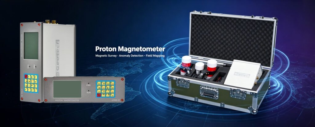
Ⅰ. Introduction to Magnetometer’s Role in Military Domains
Magnetometers, as precision magnetic sensors, have become integral to modern military operations. From detecting underwater mines to mapping terrain for strategic planning, their ability to sense magnetic field variations provides critical intelligence. This guide explores how magnetometers are applied in military contexts—like underwater mine detection and aircraft magnetic surveys—and traces their technological evolution to meet defense – level demands.
Ⅱ. Magnetometer in Military Applications: Defense – Oriented Use Cases
2.1 Magnetic Sensor in Defense and Military Use of Magnetometers
Magnetometers in military applications (magnetic sensor in defense, military use of magnetometers) span diverse operations. In naval missions, they detect submerged mines by identifying the magnetic signatures of metal ordnance. A mine’s ferrous components disrupt the Earth’s magnetic field, and magnetometers pinpoint these anomalies, enabling safe navigation in contested waters.
On land, military geophysical exploration uses magnetometers to map terrain for infrastructure assessment or to locate unexploded ordnance (UXO). In post – conflict zones, magnetometers scan for UXO, reducing risks to civilians and troops. These applications demonstrate the versatility of magnetometers in safeguarding personnel and enabling mission success.
2.2 Adapting Magnetometers to Harsh Military Environments
Military operations often occur in extreme environments—subzero arctic seas, scorching deserts, or high – altitude mountain ranges. Magnetometers must withstand these conditions while delivering accurate data. Ruggedized designs, with reinforced casings and temperature – resistant components, ensure reliability.
For example, a submarine – deployed magnetometer must function at extreme depths, resisting pressure and saltwater corrosion. Advanced calibration techniques also account for environmental magnetic interference, such as variations in the Earth’s magnetic field across different latitudes, ensuring consistent performance worldwide.
Ⅲ. Military – Grade Magnetometer Requirements: Meeting Defense Standards
3.1 Defense – Level Sensor Standards and Military – Spec Magnetometer Needs
Military – grade magnetometers (defense – level sensor standards, military – spec magnetometer needs) adhere to strict performance criteria. Sensitivity is paramount—detecting faint magnetic signatures of deeply buried ordnance or stealthy submarines. High – resolution sensors can distinguish between natural magnetic anomalies (e.g., mineral deposits) and man – made threats (e.g., mines).
Reliability is another key standard. Military operations depend on real – time data, so magnetometers must operate without failure. Redundant systems and self – diagnostic features ensure continuous functionality, even in the event of component malfunctions.
3.2 Balancing Performance and Security in Military Systems
Security is critical in military applications. Magnetometer data—especially in sensitive operations like submarine detection—must be encrypted to prevent interception. Secure communication protocols and tamper – proof hardware protect intelligence, ensuring adversaries cannot exploit magnetic survey data.
Additionally, military magnetometers often integrate with broader defense systems (e.g., GPS, sonar). Interoperability standards ensure seamless data sharing across platforms, enabling comprehensive situational awareness for commanders.
Ⅳ. Underwater Mine Detection: Submarine Explosive Discovery
4.1 Submarine Explosive Discovery and Underwater Ordnance Identification
Underwater mine detection (submarine explosive discovery, underwater ordnance identification) is a life – saving application of magnetometers. Naval vessels deploy towed magnetometer arrays or autonomous underwater vehicles (AUVs) equipped with magnetometers to sweep coastal waters and shipping lanes.
These systems detect the magnetic field distortions caused by metallic mines, even in murky or deep waters. By mapping these anomalies, mine – countermeasure teams can neutralize threats, ensuring safe passage for friendly ships. In modern conflicts, this capability is vital for maintaining maritime dominance and protecting civilian trade routes.
4.2 Technological Advances in Underwater Mine Detection
Advances in magnetometer technology have enhanced mine detection. Multi – sensor fusion—combining magnetic data with sonar, lidar, or optical sensors—improves target identification, reducing false positives. Machine learning algorithms analyze magnetic signatures in real – time, distinguishing between mines and harmless debris like shipwrecks or natural formations.
In the Strait of Hormuz, these advanced systems provide rapid, accurate mine detection, safeguarding one of the world’s most critical oil – transport routes.
Ⅴ. Aircraft Magnetic Detection: Aerial Magnetic Sensing
5.1 Aerial Magnetic Sensing and Plane – Based Magnetic Survey
Aircraft magnetic detection (aerial magnetic sensing, plane – based magnetic survey) supports various military missions. Surveillance aircraft use magnetometers to map large areas for geological intelligence, identifying mineral – rich regions or potential enemy infrastructure.
In search – and – rescue operations, magnetometers detect the magnetic signatures of downed aircraft or submarines, even in remote or oceanic environments. The wide coverage and speed of aerial surveys make magnetometers invaluable for rapid threat assessment and resource mapping.
5.2 Enhancing Aircraft – Mounted Magnetometer Capabilities
Aircraft – mounted magnetometers face unique challenges, such as vibration from flight and interference from the aircraft’s own metal structure. Active cancellation systems counteract these effects, using coils to generate opposing magnetic fields and neutralize interference.
High – altitude drones equipped with miniaturized magnetometers extend surveillance capabilities, reaching areas too dangerous for manned flights. These drones provide persistent monitoring of contested zones, delivering real – time magnetic data to command centers.
Ⅵ. Military Geophysical Exploration: Defense – Related Earth Study
6.1 Defense – Related Earth Study and Military – Oriented Geology Survey
Military geophysical exploration (defense – related earth study, military – oriented geology survey) uses magnetometers to analyze terrain for strategic advantage. By mapping subsurface magnetic structures, planners identify stable areas for base construction or vulnerable zones prone to landslides or avalanches.
In mountainous regions, magnetometer data helps design secure supply routes, avoiding geologically unstable areas. This intelligence reduces the risk of infrastructure damage and ensures logistical resilience during operations.
6.2 Supporting Military Operations with Geophysical Intelligence
Geophysical intelligence (GEOINT) derived from magnetometer surveys informs a range of military decisions—from targeting enemy fortifications to assessing the environmental impact of operations. For example, detecting the magnetic signature of an underground bunker reveals its location and construction materials, guiding strike strategies.
By integrating GEOINT with other intelligence sources (e.g., signals intelligence, human intelligence), commanders gain a comprehensive understanding of the battlefield, enabling more effective and ethical decision – making.
Ⅶ. Case Studies: Magnetometer Success in Military Missions
7.1 Naval Mine Clearance in the Persian Gulf
During a mine – clearance operation in the Persian Gulf, a naval task force used magnetometer – equipped AUVs to detect and neutralize hidden mines. The high – sensitivity magnetometers identified 20+ mines in shallow waters, ensuring safe passage for coalition ships and preventing potential casualties.
7.2 Aerial Surveillance for UXO Detection in Post – Conflict Zones
In a post – conflict region, military aircraft equipped with magnetometers surveyed a former battle zone. The magnetic data revealed the location of buried UXO, allowing explosive ordnance disposal teams to safely remove threats, restoring safety to local communities.
Reference
- WIKI:https://en.wikipedia.org/wiki/Electrical_resistivity_tomography
- Society of Exploration Geophysicists (SEG) https://seg.org/
- Society of Environmental and Engineering Geophysicists (EEGS) https://www.eegs.org/
- Geology and Equipment Branch of China Mining Association http://www.chinamining.org.cn/
- International Union of Geological Sciences (IUGS) http://www.iugs.org/
- European Geological Survey Union (Eurogeosurveys) https://www.eurogeosurveys.org/

