Welcome to Geotech!


Portable Magnetic Gradiometer Field Operation Guidelines
TIPS:Learn field operation guidelines for portable magnetic gradiometers—pre – operation checks, procedures, data handling, and emergency protocols—to ensure accurate, safe, and efficient fieldwork in archaeology, geophysics, and monitoring.
Ⅰ. Introduction to Portable Magnetic Gradiometer Field Operations
Portable magnetic gradiometers are vital for precise magnetic field measurements in archaeology, geophysics, and environmental monitoring. Adhering to field operation specifications ensures accurate data, equipment safety, and efficient workflows. This guide covers pre – operation setup, procedures, data handling, and emergency protocols for reliable fieldwork.
Ⅱ. Field Operation Specifications of Portable Magnetic Gradiometers
2.1 Outdoor Use Rules for Handheld Sensors and On – Site Operation Guidelines
Field operation specifications (outdoor use rules for handheld sensors, on – site operation guidelines) start with understanding your gradiometer’s capabilities. Familiarize yourself with sensor sensitivity, battery life, and environmental limits (e.g., temperature, moisture).
For example, in archaeological surveys, ensure the gradiometer is calibrated to detect subtle magnetic anomalies without interference. Follow manufacturer guidelines for sensor orientation and survey patterns (e.g., grid – based scanning) to ensure consistent data collection.
2.2 Aligning Operations with Equipment Capabilities
Match field procedures to your gradiometer’s strengths. High – sensitivity models require strict noise control (e.g., avoiding metal objects, power lines), while ruggedized models can handle harsh terrain. In geophysical exploration, use systematic survey paths to cover large areas efficiently, leveraging the gradiometer’s ability to detect deep – seated magnetic sources.
Ⅲ. Pre – Operation Preparation
3.1 Before – Use Setup and Preliminary Work Before Operation
Pre – operation preparation (before – use setup, preliminary work before operation) ensures readiness. Start with equipment checks: verify battery levels, sensor calibration, and data logging functionality. In remote fieldwork, carry spare batteries and calibration tools.
For environmental monitoring projects, scout the survey area to identify interference sources (e.g., pipelines, vehicles) and plan paths to avoid them. This reduces data noise and ensures accurate measurements.
3.2 Minimizing Risks Through Thorough Preparation
Thorough preparation minimizes risks. In cold climates, use thermal insulation to protect the gradiometer’s electronics. For marine surveys, ensure waterproofing and buoyancy. By addressing environmental challenges in advance, you avoid equipment failure and data loss during critical operations.
Ⅳ. Operation Process and Precautions
4.1 Working Procedures and Warnings, Steps and Safety Tips
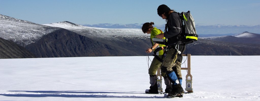
Operation process and precautions (working procedures and warnings, steps and safety tips) guide fieldwork. Follow a clear workflow: power on, calibrate, collect data, and power off. In archaeology, use slow, steady movements to capture subtle magnetic anomalies, avoiding sudden jerks that disrupt measurements.
Safety tips include wearing appropriate gear (e.g., sturdy boots for rough terrain) and staying aware of hazards (e.g., wildlife, unstable ground). In urban surveys, coordinate with local authorities to ensure public safety and access.
4.2 Maximizing Accuracy and Safety in the Field
Maximize accuracy by maintaining consistent survey parameters (e.g., speed, altitude). In drone – mounted gradiometer surveys, program stable flight paths to avoid turbulence – induced errors. Prioritize safety by marking survey areas and using communication devices in remote locations, ensuring quick response to emergencies.
Ⅴ. Data Collection and Recording
5.1 Info Gathering and Note – Taking, Data Acquisition and Logging
Data collection and recording (info gathering and note – taking, data acquisition and logging) ensure traceability. Record metadata: time, location, weather, and any anomalies (e.g., equipment glitches, unexpected magnetic signals). In geophysical surveys, use GPS – integrated gradiometers to log coordinates automatically.
For complex projects, maintain a field notebook to document observations (e.g., “Strong anomaly at grid 3, likely metal artifact”). This contextual data is critical for post – processing and interpreting results accurately.
5.2 Ensuring Data Integrity for Post – Processing
Ensure data integrity by validating recordings in the field. Periodically check data logs for gaps or errors, re – measuring suspect areas immediately. In environmental monitoring, use redundant data logging (e.g., internal memory + external drive) to prevent loss, ensuring comprehensive post – processing analysis.
Ⅵ. Emergency Handling Measures
6.1 Crisis Response and Contingency Plans for Fieldwork
Emergency handling measures (crisis response, contingency plans for fieldwork) prepare for unexpected events. Develop protocols for equipment failure (e.g., backup sensors, repair kits) and environmental hazards (e.g., sudden weather changes, wildlife encounters).
In remote archaeology, carry first – aid kits and satellite communication devices. For equipment – related emergencies (e.g., sensor malfunction), have a clear process to switch to manual data collection or abort safely, preserving partial datasets.
6.2 Minimizing Disruption to Fieldwork Operations
Minimize disruption by rehearsing emergency protocols. Train team members to respond to crises (e.g., equipment loss, injury) efficiently. In time – sensitive projects, have backup plans (e.g., alternative survey routes, spare equipment) to maintain progress while addressing emergencies.
Ⅶ. Case Studies: Safe and Effective Field Operations
7.1 Archaeological Survey Success
A team used a portable gradiometer to survey a suspected Roman villa site. By following pre – operation checks, systematic grid surveys, and thorough data logging, they identified buried structures with minimal interference. Emergency protocols (e.g., rain shelters) ensured uninterrupted work during unexpected showers.
7.2 Geophysical Exploration Efficiency
In a mineral exploration project, strict pre – operation calibration and noise avoidance led to the discovery of a deep – seated ore deposit. Emergency plans (e.g., evacuation routes for harsh weather) kept the team safe, demonstrating how preparation ensures success.
Reference
- WIKI:https://en.wikipedia.org/wiki/Electrical_resistivity_tomography
- Society of Exploration Geophysicists (SEG) https://seg.org/
- Society of Environmental and Engineering Geophysicists (EEGS) https://www.eegs.org/
- Geology and Equipment Branch of China Mining Association http://www.chinamining.org.cn/
- International Union of Geological Sciences (IUGS) http://www.iugs.org/
- European Geological Survey Union (Eurogeosurveys) https://www.eurogeosurveys.org/