Welcome to Geotech!
-1.png)


Geological Radar in Science and Technology: Applications and Future Prospects
Overview:Geological radar delivers non-invasive near-surface imaging for geophysical exploration. This article reviews geological radar detection applications and analyzes geological radar development prospects across mineral exploration and geological hazard geological radar monitoring scenarios.
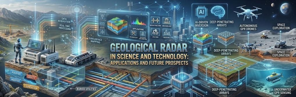
Geological radar, commonly associated with Ground Penetrating Radar (GPR) technology, is an important geophysical tool for investigating shallow subsurface structures. By transmitting electromagnetic pulses into the ground and analyzing the reflected signals, geological radar helps engineers and geologists identify underground interfaces, buried objects, and geological anomalies without extensive excavation.
As geological exploration continues to evolve, geological radar technology is finding applications in mineral exploration, engineering investigation, underground infrastructure detection, and geological hazard assessment. Advances in data acquisition, signal processing, and intelligent interpretation are also creating new opportunities for more efficient subsurface investigations.
1. Applications of Geological Radar in Geological Exploration
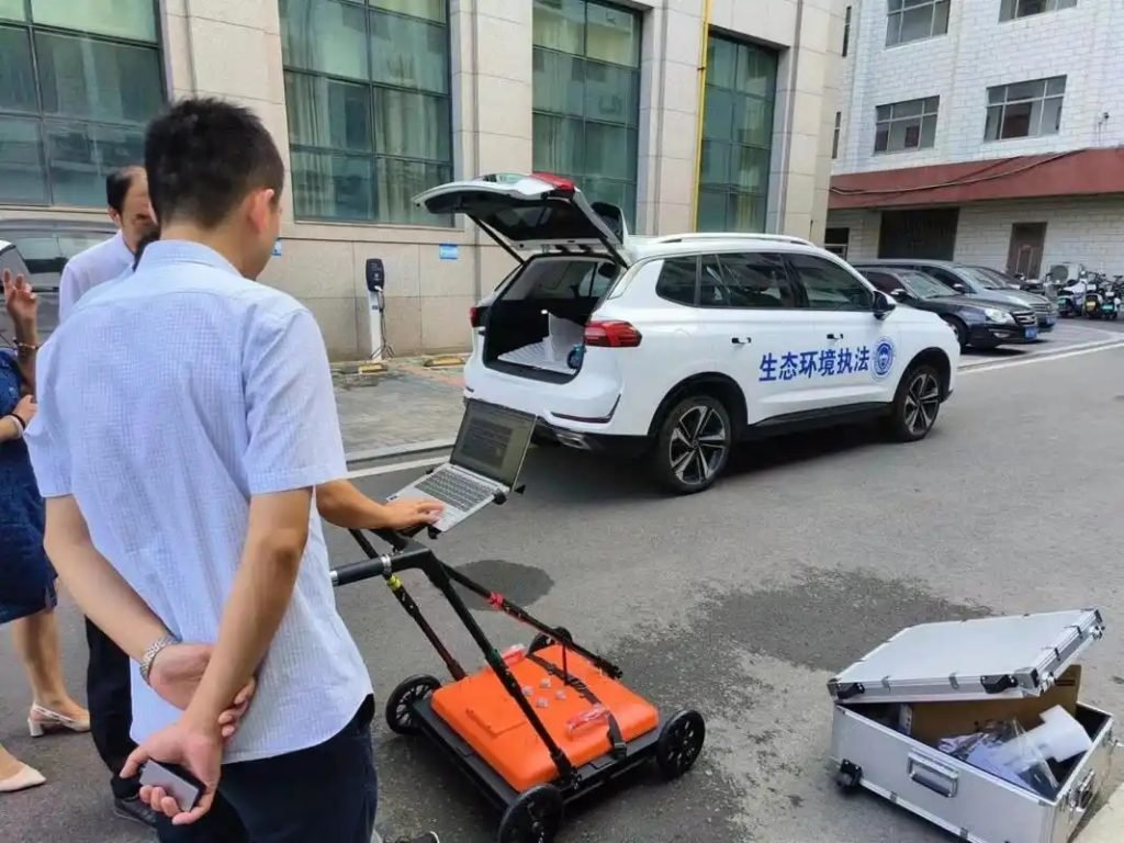
In today’s technological era, geological radar has become one of the useful tools available for subsurface investigation. Its ability to collect continuous profiles and provide high-resolution images of suitable near-surface targets makes it valuable for geological surveys and engineering projects.
Geological radar detection can provide supplementary information about underground geological structures and material boundaries. When interpreted alongside geological mapping, borehole information, and other geophysical survey results, GPR data can help specialists develop a more comprehensive understanding of subsurface conditions.
Typical applications include identifying shallow geological interfaces, locating buried structures, investigating potential cavities, and supporting engineering site assessments. The effectiveness of a survey depends on the ground conditions, target characteristics, antenna frequency, and survey design.
2. Geological Radar in Mineral Exploration
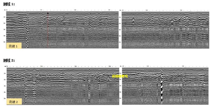
Geological radar technology can support mineral exploration by identifying radar-reflective structures and discontinuities in suitable near-surface geological environments. Changes in the electromagnetic properties of subsurface materials may produce reflections that help geologists investigate fractures, rock boundaries, cavities, and other structural features.
[Retain the original “Geological disaster warning” image here, in its current position. Keep the existing image file and visual unchanged.]
The information obtained from geological radar can contribute to geological interpretation and help guide follow-up investigations. However, GPR does not directly identify every mineral deposit or determine its grade. Its effectiveness depends on whether the target creates a detectable electromagnetic contrast and whether the surrounding ground allows radar signals to penetrate.
For mineral exploration projects, geological radar is therefore best considered a complementary method. Depending on the geological setting and exploration objectives, it may be combined with electrical resistivity, induced polarization (IP), electromagnetic surveys, magnetic surveys, or drilling data to improve the overall interpretation.
3. Geological Radar for Geological Hazard Detection
Geological radar detection also has important applications in engineering investigation and geological hazard assessment. It can help identify subsurface anomalies associated with potential cavities, fractures, changes in material properties, and other features relevant to ground stability.
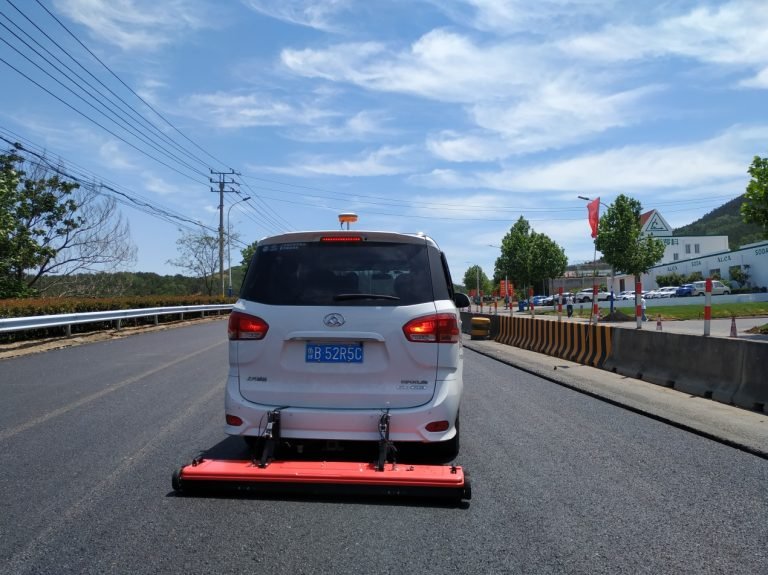
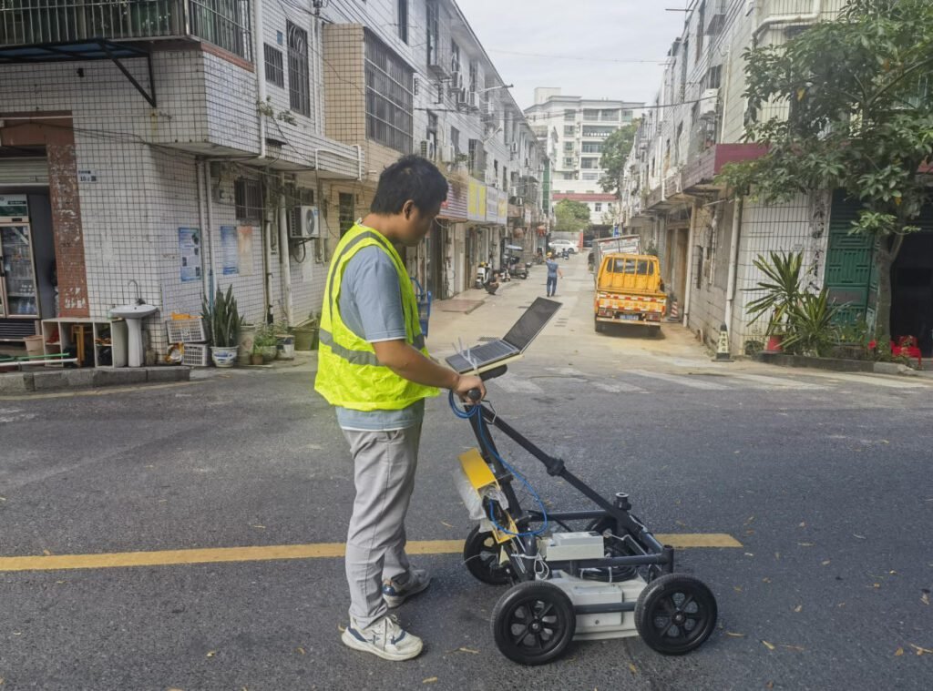
In road construction, tunnel investigation, urban development, and infrastructure maintenance, GPR surveys can support the detection of shallow voids, buried utilities, and structural irregularities. The resulting profiles help engineers identify areas that may require additional investigation.
Geological radar can also contribute to monitoring projects when repeated surveys are designed to detect changes in subsurface conditions. However, GPR should not be regarded as a universal real-time warning system. Detecting groundwater-level changes, evaluating soil stability, or forecasting geological disasters generally requires appropriate monitoring methods, repeated measurements, site-specific interpretation, and independent verification.
By providing detailed subsurface information under suitable conditions, geological radar can support risk assessment and help project teams make more informed decisions about further investigation and mitigation.
4. Future Prospects of Geological Radar Technology
With continuing advances in geophysical instrumentation and computing, geological radar technology has considerable potential for further development. Improvements in antenna design, data acquisition, positioning, signal processing, and visualization can help make subsurface surveys more efficient and their results easier to interpret.
Future developments are likely to focus on several areas:
4.1 Improved Data Acquisition and Signal Processing
Advances in hardware and processing algorithms can improve the consistency of data collection and help specialists distinguish meaningful reflections from noise. Better positioning and survey-line control can also support more reliable mapping of underground features.
4.2 Integration with Artificial Intelligence and Big Data
Artificial intelligence and data analytics may help automate selected tasks, including radar-pattern recognition, anomaly screening, and the classification of potential subsurface targets. These tools can assist specialists in handling large datasets and prioritizing areas for further investigation.
Nevertheless, automated interpretation still requires suitable training data, quality control, and expert review. AI-generated classifications should be validated against site conditions and independent information before they are used for engineering decisions.
4.3 Integration with Other Geophysical Methods
Combining geological radar with complementary geophysical techniques can provide a more complete understanding of the subsurface. For example, GPR may offer detailed information about shallow structures, while electrical resistivity tomography (ERT) can help characterize resistivity variations over a different depth range, depending on survey design and ground conditions.
Integrated interpretation can reduce reliance on a single dataset and help distinguish between alternative geological explanations. The most suitable combination of methods depends on the target, site conditions, required resolution, and investigation depth.
5. Conclusion: The Growing Role of Geological Radar
Geological radar detection provides an effective approach to investigating shallow subsurface structures in suitable geological and engineering environments. Its applications include mineral exploration support, underground structure detection, infrastructure investigation, and geological hazard assessment.
As data acquisition, signal processing, and intelligent interpretation continue to develop, geological radar technology is expected to become increasingly integrated with other geophysical methods and digital workflows. Its greatest value lies in providing useful subsurface evidence that can be combined with geological knowledge and complementary measurements to support more reliable decisions.
For project teams evaluating geological radar solutions, selecting appropriate equipment and survey parameters should begin with the investigation objective, expected target characteristics, site conditions, and required depth and resolution.
To learn more about geological radar equipment and related geophysical exploration solutions, explore Geotech Instrument Co., Ltd.’s radar instruments and application resources.
Related Articles
| Title | URL |
|---|---|
| geological exploration | https://geotechcn.net/service/geophysical-surveying-explained/ |
| geological radar detection technology | https://geotechcn.net/company-news/core-technology-of-radar/ |
| underground pipeline and cavity detection | https://geotechcn.net/application/comprehensive-solution-case/ |
| integrated geophysical exploration methods | https://geotechcn.net/application/comprehensive-solution-case/ |
| radar instruments | https://geotechcn.net/ |
Reference Sources
| Title | Core Content | URL |
|---|---|---|
| Ground Penetrating Radar | SEG Wiki authoritative reference on GPR principles and applications | https://wiki.seg.org/wiki/Ground_penetrating_radar |
| U.S. Environmental Protection Agency (EPA) | USGS guide to ground penetrating radar geological applications | https://www.epa.gov/environmental-geophysics/ground-penetrating-radar-gpr |
| Standard Guide for GPR Surveys | ASTM D6432 standard for GPR geophysical survey practice | https://www.astm.org/d6432-19.html |
| Geophysical Radar Technology | IEEE Geoscience standard for GPR instrumentation and methods | https://standards.ieee.org/standard/1876 |
| Federal Highway Administration (FHWA) | Geological Society of London guide to GPR mineral applications | https://infotechnology.fhwa.dot.gov/gpr-ground-penetrating-radar-utility-general/ |
FAQ
Q1: What is geological radar used for in geophysics?
Geological radar, or ground penetrating radar, is used for non-invasive near-surface subsurface imaging in geophysics. It maps geological structure, mineral deposits and stratigraphic layers by transmitting high-frequency EM pulses and recording reflections. Common applications include mineral exploration, geohazard assessment and engineering site investigation.
Q2: How does geological radar support mineral exploration?
Geological radar detects and maps near-surface mineral deposits by imaging dielectric contrasts between ore minerals and host rock. It delineates ore body shape, size and depth, and resolves internal structural features. The method supports both regional reconnaissance and detailed deposit characterization for mineral development decisions.
Q3: Can geological radar be used for geological hazard warning?
Yes, geological radar is used for geological hazard early warning and monitoring. It images subsurface structure and detects hazard features such as unstable slopes, sinkhole development and groundwater changes. Time-lapse radar monitoring can identify developing conditions before they become catastrophic, supporting risk mitigation and early warning.
Q4: What is the future of geological radar technology?
Geological radar technology continues to advance with improved antenna design, signal processing and interpretation software. Future development will focus on integration with AI and big data for automated interpretation, deeper penetration, higher resolution and improved real-time monitoring for hazard applications.
Q5: How deep can geological radar detect?
Geological radar depth depends on ground conductivity and antenna frequency. Higher frequencies give higher resolution but shallower depth; lower frequencies penetrate deeper with lower resolution. Typical depths range from less than a meter to tens of meters depending on ground conditions. Conductive clay or wet soils reduce depth; resistive dry rocks allow deeper penetration.