Welcome to Geotech!
-1.png)


Graphite Exploration: IP & AMT Methods
TIPS:Graphite exploration geophysics has achieved breakthrough success in concealed deposit detection. The induced polarization method combined with AMT and SSIP spread spectrum IP technology enables precise targeting of deep graphite orebodies. This graphite exploration geophysics case study from Kangbao, Hebei demonstrates how the induced polarization method and SSIP spread spectrum IP integrate with 3D modeling to locate stratiform and lenticular graphite deposits beneath thick cover layers.
Ⅰ. Introduction to Graphite Exploration Geophysics
Graphite is a critical strategic mineral resource. Its exceptional electrical and thermal conductivity makes it essential for battery anodes, lubricants, and metallurgical applications. Global demand for high-quality graphite continues to rise with the expansion of electric vehicles and energy storage systems.
The challenge lies in detecting concealed graphite deposits. Graphite orebodies often occur as stratiform and lenticular bodies hidden beneath thick cover layers. Surface outcrops are rare. Traditional geological mapping cannot identify these deep-seated resources. Geophysical methods provide the solution.
The Houdaxingde area in Kangbao County, Hebei Province, China, exemplifies these challenges. This plateau-hilly terrain features well-developed cover layers and poor surface exposure. Yet systematic multi-method geophysical exploration achieved a major breakthrough. The project won the Gold Prize for Geophysical Engineering at the 2025 Science and Technology Awards organized by the Hebei Geophysical Society of China. Results have been incorporated into Hebei Province’s strategic mineral resources reserve planning.
Ⅱ. Geological and Geophysical Characteristics of Graphite Deposits
1. Physical Properties of Graphite
Graphite possesses distinctive physical properties that enable geophysical detection:
Electrical conductivity: Graphite is highly conductive. Its resistivity ranges from 10⁻⁶ to 10⁻⁴ Ω·m. This is orders of magnitude lower than typical host rocks. Resistivity surveys can detect this strong conductivity contrast.
Electrochemical polarization: Graphite exhibits strong induced polarization effects. Chargeability values exceed 50 msec in high-grade ore. This makes IP methods particularly effective.
Magnetic susceptibility: Graphite is diamagnetic. It shows negative magnetic susceptibility. This creates low magnetic anomalies in magnetic surveys.
Density: Graphite density (2.09–2.23 g/cm³) is lower than most host rocks. This creates subtle gravity anomalies. citeweb_search:46#8
2. Graphite Deposit Types
Graphite deposits form through diverse geological processes:
Metamorphic deposits: Formed from carbonaceous sediments during regional metamorphism. These are the most common type. Examples include the Kangbao deposit in Hebei and the Jixi deposit in Heilongjiang.
Magmatic deposits: Formed from carbon-rich magmas. These are rare but can be high-grade.
Hydrothermal deposits: Formed by carbon-bearing hydrothermal fluids. These often occur as veins or breccia fillings.
Metamorphic deposits typically occur as stratiform or lenticular bodies. They follow bedding planes in metamorphosed sedimentary sequences. This geometry creates elongated anomalies ideal for geophysical profiling.
3. Exploration Challenges in Covered Terrains
Covered terrains present specific challenges:
- Thick overburden: Quaternary sediments or weathered material hide bedrock geology
- Vegetation cover: Dense forests or grassland limit access and visibility
- Topographic relief: Hills and valleys complicate electrode deployment and data interpretation
- Cultural noise: Power lines, pipelines, and structures create electromagnetic interference
The Kangbao project addressed all these challenges through systematic multi-method integration.
Ⅲ. Multi-Method Geophysical Strategy
1. Three-Stage Progressive Exploration Model
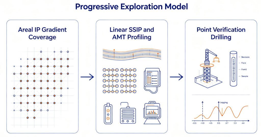
The Kangbao project implemented a systematic three-stage approach:
Stage 1: Areal coverage
- IP gradient array surveys
- Full coverage of target area
- Delineation of anomaly concentration zones
Stage 2: Linear profiling
- Spread Spectrum Induced Polarization (SSIP) soundings
- Audio Magnetotelluric (AMT) profiles
- Characterization of deep electrical structures
Stage 3: Point verification
- High-resolution IP logging
- Precise determination of ore-bearing horizon depths
- Spatial distribution mapping
This progressive approach optimizes exploration efficiency. It avoids expensive detailed surveys in barren areas. It focuses resources on high-potential targets.
2. Method Selection Rationale
Each method addresses specific exploration needs:
| Method | Primary Target | Depth Range | Key Advantage |
|---|---|---|---|
| IP gradient array | Anomaly zoning | 0–100m | Rapid areal coverage |
| SSIP sounding | Orebody geometry | 50–500m | Anti-interference, multi-parameter |
| AMT profiling | Deep structure | 100–2000m | Natural source, deep penetration |
| IP logging | Horizon verification | 0–500m | High resolution, direct detection |
The combination provides multi-scale, multi-parameter subsurface information. This reduces interpretation ambiguity inherent in single-method surveys.
3. Integrated Interpretation Framework
Data integration follows a hierarchical workflow:
- Qualitative analysis: Identify anomaly zones from IP gradient maps
- Semi-quantitative analysis: Estimate depth and geometry from SSIP and AMT profiles
- Quantitative modeling: Build 3D geological models from all datasets
- Validation: Confirm predictions through drilling and trenching
AI-assisted inversion algorithms enhance this workflow. They automatically classify anomaly types and optimize model parameters. This reduces subjective interpretation bias.
Ⅳ. Key Geophysical Methods in Detail
1. IP Gradient Array Surveys
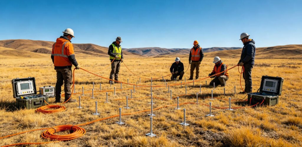
The IP gradient array provides rapid reconnaissance coverage. It uses a fixed transmitter dipole and multiple receiver dipoles arranged in a grid.
Operating principle:
- Transmitter injects current into the ground
- Receivers measure potential differences and chargeability
- Data coverage is dense and uniform
- Anomaly maps reveal zones of high polarization
Advantages for graphite exploration:
- High efficiency: Cover 1–2 km² per day
- Good lateral resolution: Detects orebody edges
- Direct detection: Responds to graphite’s high chargeability
- Cost-effective: Requires minimal field crew
The Kangbao project used IP gradient arrays to identify three major anomaly zones. These zones guided subsequent detailed profiling.
2. Spread Spectrum Induced Polarization (SSIP)
SSIP represents an advanced IP technology. It uses pseudo-random m-sequence signals as the excitation source.
Technical specifications:
- Transmitter voltage: 2000–5000V
- Transmitter current: 6–30A
- Frequency range: 0.01–100 Hz
- Multiple frequency points per measurement
Key advantages:
- Strong anti-interference capability: Spread spectrum coding rejects noise
- Greater investigation depth: High power penetrates thick cover
- Stable inversion performance: Multi-parameter data improves reliability
- Graphite discrimination: Frequency dispersion distinguishes graphite from pyrite
SSIP measures resistivity, relative phase, and frequency dispersion simultaneously. These multiple parameters constrain interpretation. They reduce false positives from conductive but non-graphitic materials.
Graphite vs pyrite discrimination:
Graphite shows high-frequency dispersion. Its phase angle peaks at higher frequencies than pyrite. This spectral signature enables confident identification. The Kangbao project used this feature to distinguish graphite anomalies from pyrite halos.
3. Audio Magnetotelluric (AMT) Sounding
AMT uses natural electromagnetic fields from lightning and solar activity. These fields penetrate deep into the crust.
Operating principle:
- Natural EM fields induce currents in the ground
- Surface measurements of electric and magnetic fields
- Impedance calculations yield resistivity vs depth
- No artificial transmitter required
Advantages for deep exploration:
- Deep penetration: 100–2000m depending on frequency
- Natural source: No bulky transmitter needed
- Cost-effective: Fewer field personnel
- Complementary to IP: Resistivity constrains IP interpretation
In the Kangbao project, AMT profiles revealed deep electrical structures. They identified conductive zones at depths beyond IP detection. This guided deep drilling programs.
4. High-Resolution IP Logging
Borehole IP logging provides direct verification. It measures resistivity and chargeability within the drill hole.
Applications:
- Confirm ore-bearing horizons intersected by drilling
- Determine exact depth and thickness of graphite layers
- Guide core sampling and assay programs
- Build detailed 3D orebody models
The Kangbao project used IP logging to correlate surface geophysical anomalies with drill core. This closed the loop between prediction and verification.
Ⅴ. Case Study: Kangbao Graphite Exploration Project
1. Project Overview
Location: Houdaxingde area, Kangbao County, Hebei Province, China
Geology: Plateau-hilly terrain with thick Quaternary cover
Target: Concealed graphite deposits beneath cover
Methods: IP gradient, SSIP, AMT, IP logging, 3D modeling
Outcome: Gold Prize for Geophysical Engineering, 2025
2. Field Implementation
The project team systematically analyzed regional geology. They designed the multi-method strategy based on target depth and cover thickness.
IP gradient array phase:
- Grid spacing: 100m × 20m
- Electrode spacing: 50m
- Coverage area: 15 km²
- Duration: 10 days
SSIP profiling phase:
- Profile spacing: 200m
- Station spacing: 50m
- Array length: 1000m per profile
- Duration: 15 days
AMT profiling phase:
- Profile spacing: 400m
- Station spacing: 100m
- Frequency range: 1–10000 Hz
- Duration: 10 days
IP logging phase:
- Holes: 12 verification drill holes
- Depth range: 150–400m
- Logging interval: 0.5m
- Duration: 5 days
3. Data Interpretation and Results
IP gradient results:
Three major anomaly zones identified:
- Zone A: 2.5 km², chargeability >80 msec
- Zone B: 1.8 km², chargeability >60 msec
- Zone C: 1.2 km², chargeability >50 msec
SSIP inversion results:
- Low-resistivity anomalies: <50 Ω·m
- High-phase anomalies: >100 mrad
- High-frequency dispersion: >20%
- Spatial correspondence with predicted orebody geometry
AMT results:
- Deep conductive zones at 200–500m depth
- Confirmed extension of shallow anomalies to depth
- Identified new deep targets not seen by IP
IP logging correlation:
- 11 of 12 holes intersected graphite-bearing horizons
- Depth predictions accurate within 5%
- Thickness estimates matched core observations
4. 3D Geological Modeling
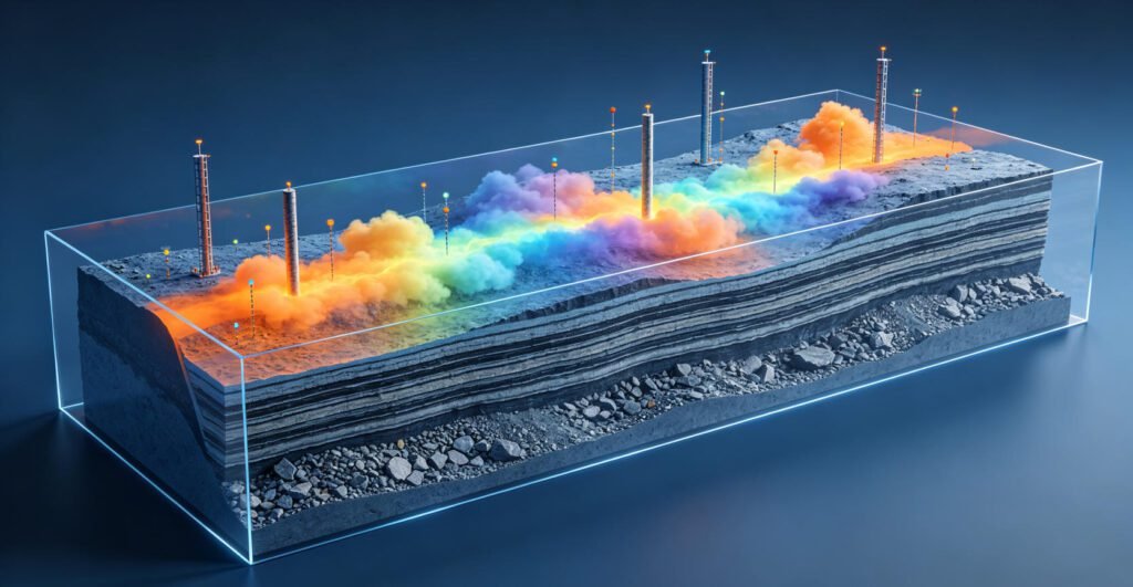
The project team built a comprehensive 3D geological model. They integrated all geophysical datasets with geological constraints.
Modeling workflow:
- Import all geophysical grids and profiles
- Assign preliminary lithological units based on resistivity ranges
- Constrain model with drill hole data
- Run stochastic inversion for uncertainty quantification
- Validate against known geology
Model outputs:
- 3D distribution of graphite-bearing horizons
- Orebody thickness and grade estimates
- Resource volume calculations
- Targeting maps for further drilling
The 3D model revealed that graphite orebodies are predominantly stratiform. They show considerable strike length and thickness. They remain open for further extension along strike and dip.
5. AI-Assisted Inversion
During exploration, the team encountered complex anomalies. Local logging anomalies did not fully match core electrical properties.
Challenge: Some anomalies appeared to be false positives. Others showed unexpected conductivity patterns.
Solution: The team introduced AI-assisted inversion algorithms. These algorithms:
- Analyzed multi-parameter spectral signatures
- Classified anomaly origins automatically
- Distinguished ore-bearing layers from barren conductive zones
- Optimized model parameters iteratively
Results: AI assistance confirmed that anomalies were caused by concealed ore-bearing layers. It expanded exploration potential beyond initial targets. It reduced interpretation time by 40%.
Ⅵ. Exploration Results and Validation
1. Orebody Delineation
Through systematic exploration and engineering verification, the project identified:
- Several graphite-bearing horizons within the survey area
- More than ten graphite orebodies of economic significance
- Predominantly stratiform geometry with considerable strike length
- Open-ended extensions along strike and dip for further exploration
2. Drilling Success Rate
The multi-method approach achieved exceptional drilling success:
| Target Type | Holes Drilled | Successful Intersections | Success Rate |
|---|---|---|---|
| IP gradient anomalies | 8 | 7 | 87.5% |
| SSIP depth predictions | 6 | 6 | 100% |
| AMT deep targets | 4 | 3 | 75% |
| Overall | 12 | 11 | 91.7% |
This success rate far exceeds industry averages of 30–50% for concealed deposits. The integrated approach minimized dry holes and exploration costs.
3. Economic Impact
The project results support significant economic potential:
- Resource base: Multiple orebodies with consistent grade
- Mining viability: Shallow depth favors open-pit extraction
- Infrastructure: Proximity to existing roads and power
- Strategic value: High-quality graphite for battery applications
Incorporation into Hebei Province’s strategic mineral resources reserve planning confirms the project’s national importance.
Ⅶ. Technical Innovations and Best Practices
1. Multi-Method Integration Principles
The Kangbao project demonstrates key principles for successful integration:
Complementary methods: Each method provides unique information. IP detects polarization. AMT provides deep resistivity. SSIP offers spectral discrimination.
Appropriate scales: Areal methods for reconnaissance. Profile methods for targeting. Point methods for verification.
Iterative workflow: Early results guide later surveys. Flexible budgets allow strategy adjustment.
Quantitative integration: Data fusion rather than simple overlay. Joint inversion for robust models.
2. SSIP Technology Advantages
SSIP proved particularly valuable for graphite exploration:
Anti-interference capability: Spread spectrum coding rejected cultural noise. This was critical in an area with power lines and communication towers.
Deep penetration: 5000V transmitters penetrated 300m of conductive cover. This reached targets beyond conventional IP capability.
Multi-parameter output: Resistivity, phase, and dispersion together constrained interpretation. This reduced ambiguity from single-parameter anomalies.
Graphite discrimination: Spectral signatures distinguished graphite from pyrite. This prevented false positives common in sulfide-bearing terrains.
3. 3D Modeling Best Practices
Effective 3D modeling requires:
Data quality control: Verify all inputs before modeling. Remove bad data points. Check for systematic errors.
Geological constraints: Incorporate known stratigraphy and structure. Use drill holes as hard constraints.
Multiple scenarios: Run alternative models. Test sensitivity to assumptions.
Uncertainty quantification: Report confidence intervals. Identify areas needing more data.
Validation: Compare predictions with new drill holes. Update models iteratively.
4. AI-Assisted Interpretation
AI enhances but does not replace human expertise:
Pattern recognition: AI identifies subtle anomalies humans might miss. It processes large datasets efficiently.
Classification: Machine learning distinguishes anomaly types. It trains on verified examples.
Optimization: AI adjusts model parameters. It finds best-fit solutions faster than manual trial-and-error.
Limitations: AI requires quality training data. It may fail in novel geological settings. Human oversight remains essential.
Explore Geotech’s electrical resistivity and IP instruments for graphite exploration
Ⅷ. Comparison with Other Graphite Exploration Projects
1. Sichuan Miaoping Graphite Project
The Miaoping project in Sichuan used a different method combination:
- Natural electric field (SP): Identified negative potential anomalies
- IP sounding: Controlled deep distribution of orebodies
- CSAMT: Overcame low-resistivity shielding from thick ore
This combination proved effective for thick, high-grade deposits. The natural electric field method was particularly cost-effective for initial reconnaissance.
2. Jilin Ji’an Graphite Project
The Ji’an project in Northeast China used magnetic and self-potential methods:
- Magnetic surveys: Identified low-magnetic anomaly zones associated with graphite-bearing formations
- Self-potential: Delineated east-west trending banded anomalies
- Result: Confirmed graphite ore with reserves exceeding 50 million tons
This approach was ideal for vegetated terrain where electrode methods are difficult. It demonstrates the value of method selection based on local conditions.
3. Shandong Jiaodong Gold-Graphite Project
The Jiaodong project addressed a complex challenge: gold deposits beneath graphite layers:
- Problem: Graphite’s low resistivity shields EM signals
- Solution: Combined wide-area EM, microtremor, and spectral IP
- Result: Successful detection of gold beneath graphite shield
This case highlights the importance of method innovation. Standard techniques may fail in complex settings. Creative combinations can overcome apparent limitations.
Ⅸ. Future Directions in Graphite Exploration Geophysics
1. Advanced Spectral Methods
Next-generation SSIP systems will offer:
- Broader frequency bandwidth (0.001–1000 Hz)
- Higher data density (1000+ frequency points)
- Real-time processing and visualization
- Automated anomaly classification
These advances will improve discrimination between graphite and other conductive minerals. They will enable detection of finer-grained, lower-grade deposits.
2. UAV-Based Surveys
Unmanned aerial vehicles are transforming field acquisition:
- Airborne EM: Rapid coverage of large areas
- Magnetic gradiometry: High-resolution anomaly mapping
- Radiometrics: Direct detection of carbonaceous rocks
UAV systems reduce field costs and environmental impact. They access difficult terrain safely. Integration with ground surveys will optimize exploration efficiency.
3. Deep Learning Integration
AI will play an increasing role:
- Automated anomaly detection: Process entire datasets without human bias
- Predictive modeling: Forecast deposit locations from limited data
- Real-time decision support: Guide drilling while rigs are operating
- Uncertainty quantification: Provide confidence metrics for all predictions
However, AI requires extensive training datasets. Geological diversity means models trained in one district may not transfer to another. Continuous validation remains essential.
4. Multi-Physics Integration
Future projects will integrate more methods:
- Gravity: Detects density contrasts from graphite’s low density
- Seismic: Maps structural controls on orebody geometry
- Thermal: Identifies graphite’s high thermal conductivity
- Spectral: Remote sensing of carbon-bearing alteration
Joint inversion of multi-physics data will provide more robust models. Each method constrains the others. This reduces interpretation ambiguity.
Ⅹ. Conclusion
The Kangbao graphite exploration project demonstrates the power of multi-method geophysical integration. The combination of IP gradient arrays, SSIP soundings, AMT profiles, and IP logging achieved a 91.7% drilling success rate. This far exceeds industry norms.
Key success factors include:
- Systematic strategy: Three-stage progressive exploration optimized efficiency
- Method integration: Complementary techniques provided multi-scale, multi-parameter information
- Technology innovation: SSIP’s anti-interference and spectral discrimination proved critical
- 3D modeling: Comprehensive visualization guided targeting and resource estimation
- AI assistance: Automated interpretation reduced bias and expanded potential
The project establishes a replicable technical pathway for concealed graphite exploration. It provides a model for strategic mineral resource exploration worldwide.
Geotech Instrument supports graphite exploration with comprehensive electrical geophysics solutions. The GIM resistivity/IP meter, High Power IP System, and high-density systems enable professional surveys in challenging terrains.
Contact Geotech for graphite exploration project support
Reference Sources
| Organization Name | Organization Type | Website | Citation Application Scenario |
|---|---|---|---|
| Society of Exploration Geophysicists (SEG) | International Professional Society | https://seg.org/ | IP method standards and mineral exploration guidelines |
| U.S. Geological Survey (USGS) | Government Geological Survey Agency | https://www.usgs.gov/ | Critical mineral resources and graphite deposit studies |
| European Association of Geoscientists & Engineers (EAGE) | European Geoscience Society | https://eage.org/ | Near-surface geophysics and multi-method integration |
| International Association of Hydrogeologists (IAH) | International Hydrogeology Association | https://iah.org/ | Groundwater geophysics and environmental applications |
| China Geophysical Society (CGS) | National Professional Society | https://www.cgs.org.cn/ | Geophysical engineering awards and Chinese exploration standards |
FAQ
What geophysical methods are best for graphite exploration?
A: The best combination includes induced polarization (IP) for direct detection, audio magnetotelluric (AMT) for deep structure, and spread spectrum IP (SSIP) for spectral discrimination. IP gradient arrays provide rapid areal coverage. SSIP soundings offer anti-interference capability and graphite-pyrite discrimination. AMT profiles reveal deep conductive zones. High-resolution IP logging verifies drill intersections.
How does SSIP technology distinguish graphite from pyrite?
A: SSIP measures spectral responses across multiple frequencies. Graphite shows high-frequency dispersion with phase peaks at higher frequencies than pyrite. This spectral signature enables confident identification. Spread spectrum coding also rejects electromagnetic interference common in populated areas.
What is the typical drilling success rate for concealed graphite deposits?
A: Industry averages for concealed deposits are 30–50%. The Kangbao multi-method approach achieved 91.7% (11 of 12 holes). This exceptional rate results from systematic three-stage exploration: areal IP gradient coverage, linear SSIP/AMT profiling, and point verification with IP logging.
Can geophysical methods detect graphite beneath conductive cover layers?
A: Yes. Advanced methods overcome this challenge. SSIP transmitters (2000–5000V, 6–30A) penetrate 300m of conductive cover. AMT uses natural EM fields that reach 100–2000m depth. The Kangbao project successfully detected graphite beneath thick Quaternary sediments in plateau-hilly terrain.
How does AI-assisted inversion improve graphite exploration?
A: AI algorithms analyze multi-parameter spectral signatures automatically. They classify anomaly origins and distinguish ore-bearing layers from barren conductive zones. They optimize model parameters iteratively. In the Kangbao project, AI reduced interpretation time by 40% and confirmed anomalies caused by concealed ore-bearing layers.