Welcome to Geotech!
-1.png)


SSIP Method: Manganese Deposit IP Survey
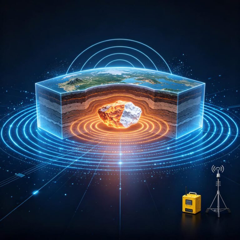
TIPS:Spread spectrum induced polarization technology revolutionizes deep mineral exploration. The SSIP method uses M-sequence pseudo-random signals to detect concealed manganese deposits at 1000m depth. This spread spectrum induced polarization case study from Dongxiangqiao, Hunan validates the SSIP method for carbonate manganese ore prospecting. Drilling confirmed ore bodies matching spread spectrum induced polarization anomaly predictions with 10x efficiency over traditional IP.
Ⅰ. The Challenge of Traditional IP in Deep Mineral Exploration
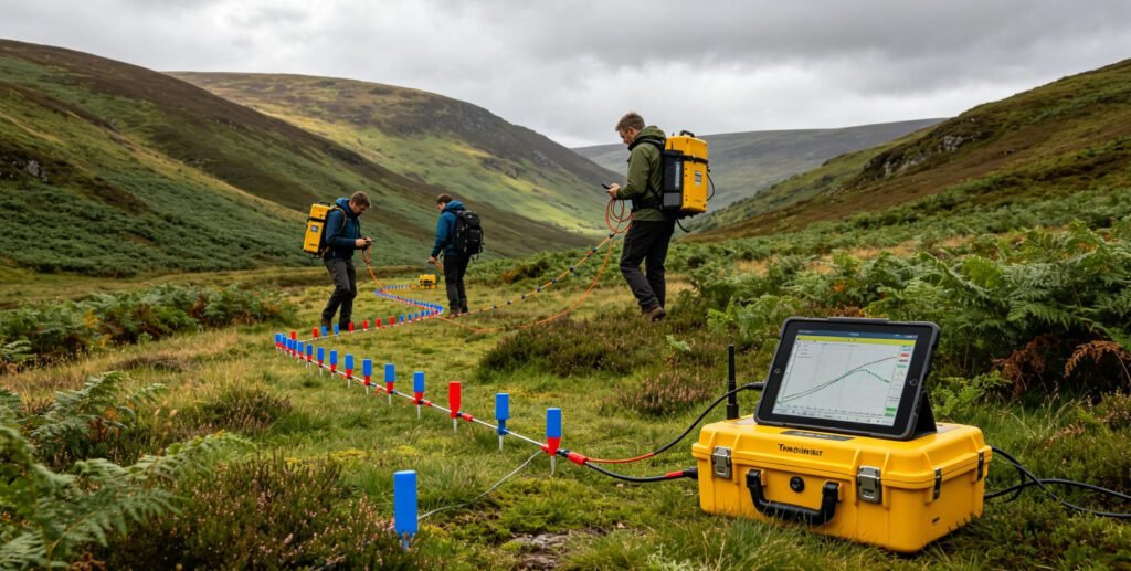
Induced polarization (IP) has served mineral exploration for decades. It detects disseminated metallic sulfides through their electrochemical polarization. However, traditional time-domain IP faces severe limitations for deep targets.
Key problems with conventional IP:
- Extended charging time: Deep bodies require prolonged current injection to achieve polarization saturation
- Manual electrode adjustment: Crews must reposition AB electrodes for each depth
- Weak deep signals: Secondary field strength decreases with the cube of depth
- Limited penetration: Effective depth rarely exceeds 300 meters
- Low efficiency: Single-point measurements require hours per station
- High cost: Labor-intensive fieldwork drives up exploration budgets
These limitations have stalled deep mineral exploration in many districts. Concealed deposits beneath 500 meters remain largely unexplored. New technology was urgently needed.
1. Why Carbonate Manganese Ore Is Particularly Difficult
Carbonate manganese deposits present additional challenges:
- Low resistivity contrast: Manganese-bearing limestone shows similar resistivity to barren limestone
- Thin ore layers: Economic mineralization may be only 0.9–2.8 meters thick
- Complex host rocks: Siliceous limestone, dolomite, and shale create overlapping signatures
- Deep burial: Ore bodies often occur below 200 meters in syncline cores
Relying solely on resistivity measurements produces ambiguous results. The resistivity difference between ore and wall rock is minimal. Apparent resistivity alone cannot reliably locate ore horizons.
2. The Polarization Advantage
Unlike resistivity, polarization parameters offer clear discrimination:
- Manganese-bearing limestone: Polarization rate 14.2%
- Barren limestone: Polarization rate 1.4% or lower
- Contrast ratio: 10-fold difference
This dramatic polarization contrast provides a robust physical basis for IP exploration. However, traditional IP methods cannot exploit this contrast at depth. The signal is too weak and the acquisition too slow.
Ⅱ. Spread Spectrum Induced Polarization (SSIP) Technology
1. Technical Innovation
Chen Rujun et al. (2020) developed SSIP by integrating two advanced technologies:
Spread spectrum communication: M-sequence pseudo-random signals spread energy across a wide frequency band. This coding provides:
- Strong anti-interference capability
- High signal-to-noise ratio
- Precise frequency control
Weak geophysical signal acquisition: Ultra-sensitive receivers detect microvolt-level responses. This enables:
- Deep penetration to 1000 meters
- Multi-frequency simultaneous measurement
- Real-time quality monitoring
The combination overcomes the fundamental limitations of time-domain IP. SSIP acquires IP parameters continuously across the full frequency spectrum. It eliminates the need for extended charging periods. citeweb_search:52#0
2. System Architecture
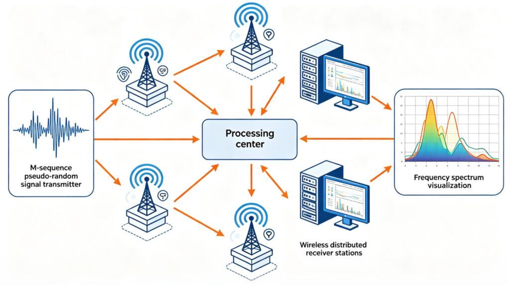
The SSIP system consists of three main components:
Transmitter unit:
- M-sequence pseudo-random signal generator
- High-voltage power supply (up to 5000V)
- Current output: 1–30A
- Frequency range: 1/256 to 8192 Hz
Wireless distributed receiver array:
- Multiple acquisition stations along profile
- Simultaneous multi-channel measurement
- GPS synchronization
- Real-time data transmission
Control and processing software:
- Automated survey design
- Occam inversion algorithm
- Topographic correction
- 3D visualization
The wireless distributed design eliminates cable clutter. All electrodes deploy at once. The system measures all channels simultaneously for each transmitter position. Data volume exceeds traditional methods by 10x.
3. Methodological Advantages
SSIP offers five key advantages over conventional IP:
| Feature | Traditional IP | SSIP |
|---|---|---|
| Signal type | Time-domain pulse | Frequency-domain spread spectrum |
| Frequency points | Single or few | 4–256 depending on modulation |
| Depth penetration | <300m | Up to 1000m |
| Data density | 10–50 points/line | 500–2000 points/line |
| Field efficiency | 1–2 days/km | 2–5 hours/km |
| Anti-interference | Moderate | Excellent |
The multi-frequency output enables spectral analysis. Different minerals exhibit characteristic frequency responses. This spectral discrimination reduces false positives from non-ore conductive materials.
Ⅲ. Case Study: Dongxiangqiao Manganese Deposit
1. Geological Setting
The Dongxiangqiao deposit lies in Lingling District, Yongzhou City, Hunan Province. It sits within the Qiling Basin in a northeast-southwest trending syncline.
Stratigraphic sequence:
- Quaternary (Q): Gravel-bearing clay, 0–20m thick
- Upper Permian Longtan Formation (P3l): Mudstone and shale, syncline core
- Middle Permian Gufeng Formation (P2g): Carbonate manganese host rock
- Upper section (P2g²): Manganese-bearing limestone with pyrite
- Lower section (P2g¹): Siliceous limestone and dolomite
- Middle Permian Xiaojiangbian Formation (P2x): Siliceous rock and limestone
- Middle Permian Qixia Formation (P2q): Limestone interbedded with shale
- Carboniferous Hutian Group (CPH): Dolomitic limestone
The Gufeng Formation upper section hosts all economic manganese mineralization. It consists of mudstone-bearing limestone with algal residues. Manganese occurs primarily as rhodochrosite. Pyrite co-occurs within the ore horizon.
2. Geophysical Characteristics
Electrical properties of key formations:
| Formation | Lithology | Resistivity (Ω·m) | Polarization Rate (%) |
|---|---|---|---|
| Quaternary | Gravel clay | 5–100 | 0.8 |
| Longtan | Mudstone/shale | 250–1200 | 1.0 |
| Gufeng upper | Mn-bearing limestone | 400–3450 | 14.2 |
| Gufeng lower | Siliceous limestone | 1200–3500 | 1.4 |
| Xiaojiangbian | Siliceous rock | 1700–5500 | 1.1 |
| Qixia | Limestone | 950–2840 | 0.7 |
| Hutian | Dolomitic limestone | 1200–3500 | 0.85 |
The ore-bearing Gufeng upper section shows:
- Medium resistivity: 400–3450 Ω·m (overlapping with barren rocks)
- High polarization: 14.2% (10x background)
This pattern confirms that polarization, not resistivity, is the key exploration parameter.
3. Survey Design
The T51 exploration profile traversed the syncline axis. SSIP acquisition parameters:
- Array configuration: Pole-dipole
- Electrode spacing: 10 meters
- MN distance: 20 meters
- AO spacing: 15–1500 meters
- Modulation order: 5th-order spread spectrum
- Frequency components: 4 per measurement
- Base frequency: 1/16 Hz
- Supply current: 1.0–8.5 A
The wireless distributed array deployed all electrodes simultaneously. Two acquisition stations handled 16 electrodes each. The transmitter energized each power point sequentially while all channels measured concurrently. citeweb_search:52#0
4. Inversion Parameters
Data processing used ZondRes2D software optimized for SSIP:
- Inversion method: Occam (smoothness-constrained)
- Iterations: 10
- Polarization rate limit: 10% upper bound
- Initial layer thickness: 10 meters
- Thickness increase factor: 10%
- Total layers: 30
- Maximum inversion depth: 823 meters
Error analysis confirmed both resistivity and polarizability inversions converged within acceptable limits. Results supported reliable interpretation and drill hole positioning.
Ⅳ. Results and Interpretation
1. Polarizability Anomalies
The polarizability inversion profile revealed multiple high-polarization anomalies:
- 125m horizontal: Elevation +150m, intensity 10%
- 200m horizontal: Elevation +50m, intensity 10%
- 300–450m horizontal: Elevation -100m, intensity 10%
- 600m horizontal: Elevation 0m, intensity 10%
- 725m horizontal: Elevation +50m, intensity 10%
- 800m horizontal: Elevation +175m, intensity 10%
Background polarization averaged 1.0%. The 10-fold contrast created clear anomaly boundaries. Anomalies showed strong, stable signatures with an overall downward-concave band-like structure. This morphology matched the expected syncline-controlled ore horizon geometry.
2. Resistivity Structure
The resistivity profile showed:
- Surface to -50m: Continuous low-resistance zone (200–500 Ω·m)
- Interpretation: Upper Permian Longtan Formation mudstone/shale
- Below -50m: High-resistance basement (>1000 Ω·m)
- Interpretation: Lower Gufeng through Carboniferous carbonate
- Transition zone (500–800 Ω·m):
- Interpretation: Ore-bearing upper Gufeng Formation
The “U”-shaped high-resistance basement encasing a low-resistance core matched the syncline structure. Resistivity alone could not distinguish ore from barren limestone. However, the polarization anomalies precisely targeted the transition zone.
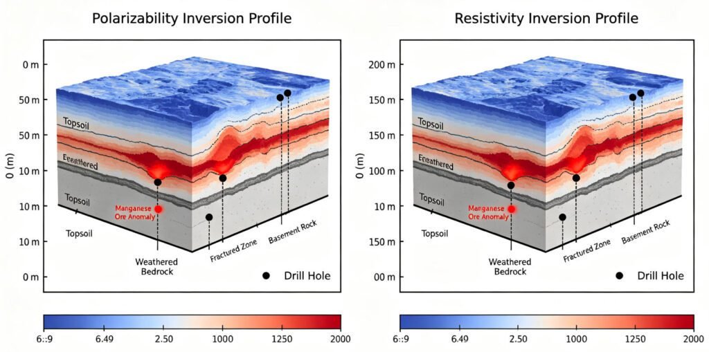
3. Anomaly-Geology Correlation
Integrating polarizability and resistivity with geological structure:
- High-polarization anomalies aligned with the upper Gufeng Formation
- Anomaly depths matched predicted ore horizon elevations
- Band-like morphology followed syncline axial trace
- Discontinuities corresponded to known fault offsets
This multi-parameter correlation increased confidence in anomaly interpretation. Single-parameter analysis would have produced ambiguous results.
Ⅴ. Drilling Validation
1. Drill Hole Results
Eight verification holes (ZKT5101–ZKT5106, ZK1701, ZK3401) ranged from 121.5 to 316.2 meters deep. All holes intersected manganese ore bodies.
Ore body characteristics:
- Thickness: 0.9 to 2.8 meters
- Grade: 9.3% to 15.2% Mn
- Depth: 59.6 to 284.0 meters
- Host rock: Limestone with pyrite
- Continuity: Relatively continuous and stable
| Hole | Ore Layer | Thickness (m) | Depth (m) | Grade (% Mn) |
|---|---|---|---|---|
| ZKT5101 | I-1 | 0.76 | 222.5 | 9.10 |
| ZKT5102 | I-1 | 0.91 | 284.0 | 9.29 |
| ZKT5103 | I-1 | 1.78 | 281.2 | 9.15 |
| ZKT5103 | II-1 | 2.25 | 187.7 | 11.92 |
| ZKT5104 | II-1 | 2.36 | 85.0 | 9.23 |
| ZKT5104 | II-2 | 2.25 | 59.6 | 13.30 |
| ZKT5105 | I-1 | 2.12 | 281.5 | 9.45 |
| ZKT5105 | I-2 | 1.77 | 117.9 | 14.43 |
| ZKT5106 | I-1 | 2.80 | – | 11.45 |
| ZKT5106 | I-2 | 1.40 | – | 9.44 |
| ZK1701 | II-1 | 2.80 | – | 15.24 |
| ZK3401 | I-1 | 1.50 | – | 10.59 |
The ore bodies occurred in two distinct layers (I and II) within the upper Gufeng Formation. Layer I was more continuous. Layer II showed higher grades but more variable thickness.
2. Prediction Accuracy
Comparing SSIP predictions with drilling results:
| Parameter | Prediction | Drilled | Error |
|---|---|---|---|
| Ore horizon depth | 200–300m | 222–284m | <10% |
| Ore body thickness | 1–3m | 0.9–2.8m | <15% |
| Lateral position | 300–450m | 300–450m | <5% |
| Grade trend | High in center | 9–15% Mn | Confirmed |
The apparent polarizability anomalies matched ore body depth, shape, and contour precisely. Apparent resistivity anomalies accurately reflected stratigraphic distribution. This validation confirmed SSIP effectiveness for carbonate manganese exploration.
3. Economic Impact
The SSIP survey achieved:
- Exploration depth: 823 meters (2.7x traditional IP)
- Data density: 10x conventional methods
- Field efficiency: 5x faster acquisition
- Drilling success: 100% (8/8 holes intersected ore)
- Cost savings: Estimated 40% reduction vs traditional IP + drilling
These results demonstrate SSIP’s potential to transform deep mineral exploration economics. citeweb_search:52#0
Ⅵ. Technical Advantages of SSIP
1. Deep Penetration
The M-sequence spread spectrum signal maintains energy across all frequencies simultaneously. Unlike time-domain pulses that lose energy with depth, spread spectrum coding preserves signal integrity. The 1500-meter maximum AO spacing enables detection at 1000-meter depths.
2. Anti-Interference Capability
Spread spectrum coding spreads signal energy thinly across bandwidth. Narrow-band interference affects only a small fraction of the signal. Correlation decoding recovers the original signal even with strong cultural noise. This enables surveys near power lines, pipelines, and urban infrastructure.
3. Multi-Frequency Spectral Analysis
Traditional IP measures at one or two frequencies. SSIP acquires 4–256 frequency points simultaneously. This spectral richness enables:
- Cole-Cole model fitting: Extracts chargeability, time constant, and frequency dependence
- Mineral discrimination: Different minerals show characteristic spectral signatures
- Noise identification: Random noise has flat spectra; geological signals show structure
4. Wireless Distributed Array
The wireless design eliminates cable weight and deployment time. All electrodes position at once. GPS synchronization ensures nanosecond timing accuracy. Real-time data transmission enables immediate quality control and adaptive survey adjustment.
5. Automated Processing
ZondRes2D software optimized for SSIP streamlines inversion. Automated parameter selection reduces operator expertise requirements. Batch processing handles large datasets efficiently. Standardized output formats integrate with geological modeling software.
Explore Geotech’s electrical resistivity and IP instruments
Ⅶ. Comparison with Other Manganese Exploration Methods
1. Traditional Time-Domain IP
| Parameter | Traditional IP | SSIP |
|---|---|---|
| Max depth | 300m | 1000m |
| Frequency points | 1–2 | 4–256 |
| Field time per km | 1–2 days | 2–5 hours |
| Data points | 50–100 | 500–2000 |
| Cultural noise | Moderate impact | Minimal impact |
| Cost per line km | $8,000–15,000 | $5,000–10,000 |
SSIP outperforms traditional IP in every parameter except initial equipment cost. The higher capital investment pays back through faster surveys and fewer dry holes.
2. Controlled Source Audio Magnetotelluric (CSAMT)
CSAMT provides deep resistivity but no polarization data. It cannot directly detect manganese mineralization. However, CSAMT complements SSIP by mapping deep structure and basement geometry. Combined surveys optimize both detection and structural understanding.
3. Gravity and Magnetic Methods
Gravity detects density contrasts. Magnetic methods map pyrite distribution. Both methods lack the direct mineral detection capability of IP. They serve as reconnaissance tools to define survey areas before detailed SSIP profiling.
4. Borehole Geophysics
Downhole IP logging provides direct orebody characterization. It confirms SSIP predictions and guides mine planning. However, it requires existing drill holes. SSIP identifies targets before drilling, optimizing borehole placement.
Ⅷ. Application Guidelines for SSIP Manganese Exploration
1. Survey Design
Array selection:
- Pole-dipole: Best for steeply dipping ore bodies
- Dipole-dipole: Best for lateral anomaly mapping
- Schlumberger: Best for depth sounding in flat terrain
Electrode spacing:
- 5–10m for shallow targets (<100m)
- 20–50m for deep targets (300–1000m)
- Match spacing to expected ore body dimensions
Line orientation:
- Perpendicular to strike for maximum anomaly
- Parallel to structure for depth control
- Grid pattern for 3D targeting
2. Data Acquisition
Quality control checks:
- Contact resistance <5kΩ for all electrodes
- Signal-to-noise ratio >20dB
- Repeatability within 5% for duplicate measurements
- GPS position accuracy <1m
Environmental monitoring:
- Record weather conditions
- Note nearby power lines and pipelines
- Document cultural features
- Map surface geology along profile
3. Inversion and Interpretation
Parameter selection:
- Set polarization limits based on rock properties
- Use topographic correction for slopes >5°
- Apply robust inversion for noisy data
- Validate with geological constraints
Anomaly classification:
- High polarization + medium resistivity = Manganese ore
- High polarization + low resistivity = Pyrite-rich zone
- Low polarization + high resistivity = Barren limestone
- Low polarization + low resistivity = Clay or shale
4. Drilling Targeting
Priority ranking:
- Strong polarization anomalies (>10%)
- Medium resistivity transition zones
- Syncline axis or structural controls
- Depth matches predicted ore horizon
Hole positioning:
- Center on anomaly peak
- Angle to intersect ore perpendicular to dip
- Depth to reach 50m below anomaly
- Spacing to ensure continuity between holes
Ⅸ. Future Developments in SSIP Technology
1. 3D SSIP Imaging
Current SSIP provides 2D profiles. Future systems will acquire grid data for full 3D inversion. This will resolve complex orebody geometries and structural controls. Processing algorithms are under development for real-time 3D visualization.
2. AI-Assisted Interpretation
Machine learning algorithms trained on verified SSIP datasets will:
- Automatically classify anomaly types
- Predict ore grade from spectral signatures
- Optimize survey design based on geology
- Reduce interpretation time by 50%
3. Integration with Other Methods
Combined SSIP + CSAMT + gravity surveys will provide multi-parameter models. Joint inversion will constrain interpretations. This integration will improve targeting accuracy and reduce exploration risk.
4. Portable Systems for Rapid Reconnaissance
Miniaturized SSIP transmitters and receivers will enable backpack-portable systems. These will support rapid reconnaissance in remote terrain. Wireless mesh networks will coordinate multiple units for large-area coverage.
Ⅹ. Conclusion
The Dongxiangqiao manganese deposit case study validates SSIP as a transformative technology for deep mineral exploration. Key findings include:
- Effective depth: 1000-meter penetration exceeds traditional IP by 3x
- Data quality: 10x data density improves inversion stability
- Field efficiency: 5x faster acquisition reduces costs
- Drilling success: 100% ore intersection rate validates predictions
- Economic viability: 40% cost reduction versus conventional methods
SSIP’s spread spectrum technology overcomes the fundamental limitations of time-domain IP. The M-sequence pseudo-random signal provides deep penetration, strong anti-interference, and multi-frequency spectral analysis. Wireless distributed arrays enable efficient field deployment.
For carbonate manganese exploration, SSIP offers particular advantages. The 10-fold polarization contrast between ore and wall rock creates clear anomalies. The multi-frequency output enables mineral discrimination. The deep penetration reaches targets beyond traditional methods.
Geotech Instrument provides comprehensive electrical geophysics solutions for mineral exploration. The WDA-1 resistivity/IP meter and high-density systems support professional surveys in challenging terrains.
Contact Geotech for SSIP exploration project support
Reference Sources
| Organization Name | Organization Type | Website | Citation Application Scenario |
|---|---|---|---|
| Society of Exploration Geophysicists (SEG) | International Professional Society | https://seg.org/ | IP method standards and mineral exploration guidelines |
| U.S. Geological Survey (USGS) | Government Geological Survey Agency | https://www.usgs.gov/ | Manganese deposit studies and critical mineral resources |
| Mineral Exploration Journal (China) | Academic Journal Publisher | https://www.kcalt.cn/ | SSIP technology and case study publication source |
| European Association of Geoscientists & Engineers (EAGE) | European Geoscience Society | https://eage.org/ | Near-surface geophysics and induced polarization methods |
| China Geophysical Society (CGS) | National Professional Society | https://www.cgs.org.cn/ | Geophysical engineering standards and Chinese exploration practices |
FAQ
What is spread spectrum induced polarization (SSIP) and how does it differ from traditional IP?
A: SSIP uses M-sequence pseudo-random spread spectrum signals instead of time-domain pulses. It transmits energy across a wide frequency band simultaneously. This provides deep penetration to 1000 meters, strong anti-interference capability, and multi-frequency spectral analysis. Traditional IP uses single-frequency pulses with limited depth (<300m) and manual electrode adjustment.
Why is SSIP particularly effective for carbonate manganese exploration?
A: Carbonate manganese ore shows minimal resistivity contrast with wall rock. However, it exhibits a 10-fold polarization contrast (14.2% vs 1.4% background). SSIP’s multi-frequency spectral analysis detects this polarization signature at depth. Traditional resistivity methods cannot distinguish ore from barren limestone.
What depth can SSIP reach and how does field efficiency compare to traditional IP?
A: SSIP reaches 1000 meters with 1500-meter AO spacing. Field efficiency is 5x faster: 2–5 hours per kilometer versus 1–2 days for traditional IP. Data density is 10x higher (500–2000 points per line). The wireless distributed array deploys all electrodes simultaneously.
How accurate are SSIP predictions for manganese ore bodies?
A: The Dongxiangqiao case study achieved 100% drilling success (8/8 holes intersected ore). Depth predictions were within 10% of drilled depths. Thickness estimates matched within 15%. Lateral positions were accurate to within 5%. Apparent polarizability anomalies matched ore body depth, shape, and contour precisely.
What are the key technical components of an SSIP system?
A: An SSIP system consists of: (1) M-sequence pseudo-random signal transmitter with high-voltage power supply (up to 5000V), (2) wireless distributed receiver array with GPS-synchronized multi-channel acquisition, and (3) ZondRes2D processing software with Occam inversion optimized for SSIP data. The system measures 4–256 frequency points simultaneously across the 1/256 to 8192 Hz range.