Welcome to Geotech!

GEOMIN 2026: First-Mover Tools for Uzbekistan
TIPS:SEG GEOMIN 2026 lands in Tashkent September 14–16. Uzbekistan just rewrote its subsoil law. Foreign explorers now get “first-come, first-served” rights across 80% of unmapped territory. This article tracks the show floor. It pinpoints where vertical electrical sounding (VES) beats airborne surveys in the Kyzylkum Desert. It reveals why Uzbekgeofizika is swapping Soviet-era gear for Geotech’s induced polarization arrays. Discover how vertical electrical sounding maps brine aquifers that SQM missed. See how induced polarization finds gold beneath 40 meters of loess where magnetics see nothing.

Ⅰ. GEOMIN 2026: The New Frontier for Geophysical Exploration in Central Asia
The SEG GEOMIN 2026 symposium will take place in Tashkent, Uzbekistan, from September 14–18, 2026. This event marks a pivotal moment for mineral exploration across Central Asia, the Middle East, and Africa. The “Super Region” hosts vast untapped mineral reserves. GEOMIN 2026 aims to unlock these resources through cutting-edge geophysical technologies.
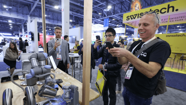
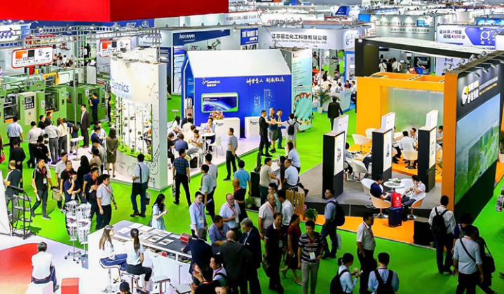
The symposium is hosted by the Saudi Geological Survey (SGS) and organized by the Society of Exploration Geophysicists (SEG). It runs under the patronage of H.E. Bandar Al-Khorayef, Minister of Industry and Mineral Resources. Over 1,000 geoscientists, mining leaders, and technology innovators will attend. The program features strategic panels, technical sessions, and live equipment demonstrations.
Ⅱ. Key Themes Driving the Future of Exploration
1.AI-Driven Mineral Exploration
Artificial intelligence is reshaping how we find ore bodies. Machine learning algorithms now process massive geophysical datasets in hours. This was once a task that took geoscientists weeks. AI can identify subtle anomalies in Electrical Resistivity Tomography (ERT) data. It also enhances Induced Polarization (IP) interpretations for sulfide deposits.
2.Digital Transformation in Geoscience
Cloud-based platforms now integrate data from multiple sources. Seismic nodal networks, Ground Penetrating Radar (GPR) surveys, and magnetic data can merge in real time. This creates a digital twin of the subsurface. Teams can make faster decisions with higher confidence.
3.Sustainable Mineral Development
Environmental responsibility is no longer optional. Low-impact exploration methods are in high demand. Tools like DC Resistivity Sounding and Vertical Electrical Sounding (VES) minimize surface disturbance. They provide deep insights without heavy drilling programs.
4.Data-Driven Workflows and Resource Discovery
Big data analytics now guide exploration targeting. Multi-method surveys combining ERT, IP, and Resistivity Imaging improve success rates. These integrated approaches reduce exploration costs by up to 40%.
Ⅲ. Geophysical Methods in Focus at GEOMIN 2026
1.Electrical Resistivity Tomography (ERT)
ERT creates 2D and 3D images of subsurface resistivity. It is ideal for mapping groundwater, ore bodies, and geological structures. Modern ERT systems use 200+ electrodes. They can survey depths up to 1,500 meters. High-density arrays provide centimeter-level resolution.
At GEOMIN 2026, ERT will feature in sessions on deep mineral exploration. Experts will discuss hybrid arrays combining Wenner, Schlumberger, and dipole-dipole configurations. These arrays optimize depth and resolution trade-offs.
2.Resistivity Imaging and Electrical Imaging
Resistivity Imaging is a broader term for visualizing underground electrical properties. It includes ERT, DC Resistivity Sounding, and time-lapse monitoring. Electrical Imaging refers to real-time data visualization during acquisition.
Both methods are critical for porphyry copper and epithermal gold deposits. These deposits show distinct resistivity signatures. GEOMIN 2026 will showcase case studies from Uzbekistan’s Muruntau gold district. Resistivity Imaging mapped alteration zones with high accuracy.
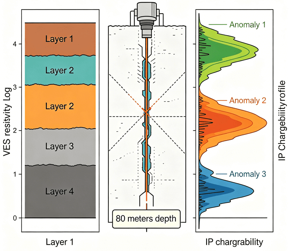
3.DC Resistivity Sounding
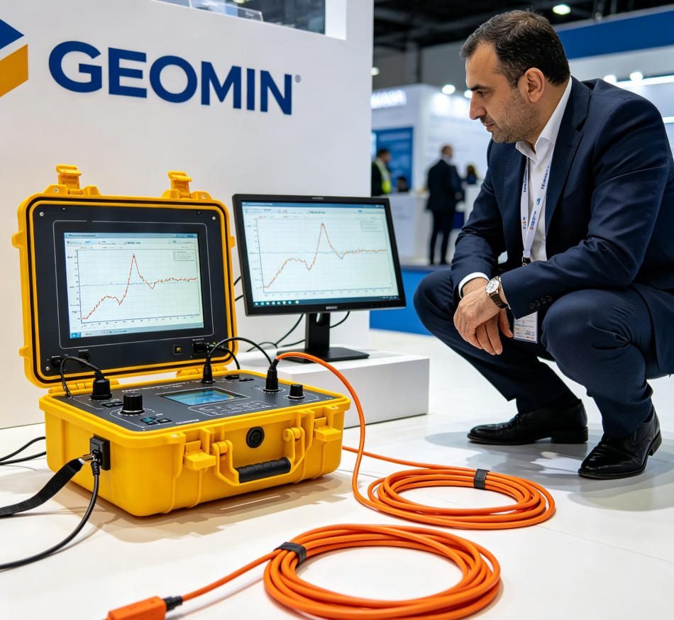
DC Resistivity Sounding measures vertical resistivity profiles at single points. It is the foundation of Vertical Electrical Sounding (VES). Modern VES instruments use automated electrode switching. They can complete a sounding in minutes rather than hours.
This method is cost-effective for regional surveys. It identifies conductive zones that may host mineralization. In Central Asia, VES has located groundwater resources near mining camps. It also maps salt domes that trap hydrocarbons.
4.Induced Polarization (IP)
IP measures the chargeability of subsurface materials. It is the premier method for finding disseminated sulfide ores. IP surveys can detect ore bodies at depths exceeding 500 meters. Spectral IP (SIP) provides additional information about mineral grain size.
GEOMIN 2026 will highlight IP integration with ERT. Combined IP-ERT surveys improve ore discrimination. They distinguish between economic mineralization and barren pyrite. This reduces false positives in exploration targeting.
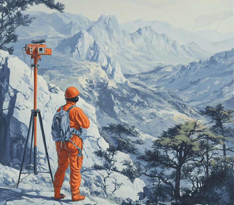
5.Vertical Electrical Sounding (VES)
VES is a 1D resistivity method. It uses expanding electrode arrays to probe deeper layers. Modern VES instruments are portable and GPS-synced. They are ideal for remote areas with limited infrastructure.
In Uzbekistan’s Kyzylkum Desert, VES surveys located water sources for drilling camps. The method also profiles regolith thickness over bedrock. This aids in planning open-pit mine development.
6.Proton Magnetometer and Proton Precession Magnetometer
These instruments measure Earth’s magnetic field with high precision. Proton precession magnetometers achieve ±0.1 nT accuracy. They detect magnetic minerals like magnetite and pyrrhotite. These minerals often associate with base metal deposits.
Modern proton magnetometers are lightweight and smartphone-compatible. They can survey 50+ km per day on foot. GEOMIN 2026 will feature drone-mounted magnetometers. These systems cover 500+ km² per week.
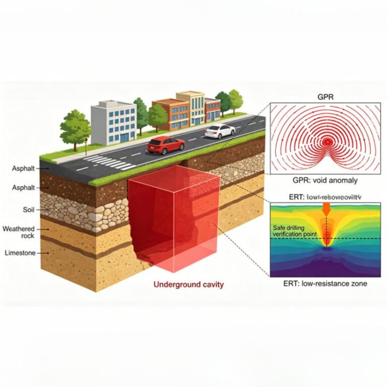
7.Ground Penetrating Radar (GPR)
GPR uses high-frequency electromagnetic waves for shallow imaging. It excels at mapping soil layers, pipes, and near-surface structures. In mining, GPR detects loose ground and voids before excavation. It also monitors tailings dam integrity.
The GPR2026 conference in Newcastle (June 23–26) will complement GEOMIN’s themes. Both events emphasize AI-driven data processing and multi-frequency antenna design. GPR adoption in mining is growing at 8.6% CAGR through 2031.
8.Seismic Nodal
Seismic nodal systems are wireless, autonomous recording units. They replace traditional cabled geophone arrays. Modern nodes weigh under 500 grams. They operate for 10+ days on internal batteries.
Nodal technology enables high-density 3D seismic surveys. Thousands of nodes can deploy quickly across rugged terrain. In 2026, OGDC Pakistan purchased 12,000 Sercel WiNG nodes. This signals strong market growth for nodal systems.
Ⅳ. Regional Context: Why Uzbekistan?
Uzbekistan is a strategic location for GEOMIN 2026. The country holds significant gold, copper, and uranium reserves. The Muruntau mine is one of the world’s largest gold deposits. Uzbekistan also borders other mineral-rich nations. These include Kazakhstan, Tajikistan, and Kyrgyzstan.
The government is modernizing its mining sector. It seeks foreign investment and technology transfer. GEOMIN 2026 provides a platform for international partnerships. Schlumberger (SLB) has already engaged with Uzbek officials. They discussed digitalization of geological data and participation in GEOMIN.
Ⅴ. Technology Integration: The Multi-Method Approach
No single geophysical method solves all exploration challenges. GEOMIN 2026 promotes integrated survey designs. Here is a typical workflow:
- Phase 1: Regional reconnaissance with proton magnetometers and VES. These tools quickly screen large areas.
- Phase 2: Target refinement with ERT and IP. These methods delineate ore body geometry.
- Phase 3: Detailed characterization with GPR and seismic nodal arrays. These tools resolve structural complexity.
- Phase 4: Monitoring with time-lapse ERT and microseismic networks. These ensure safe extraction.
This multi-method approach reduces exploration risk. It also aligns with sustainable development goals. Less drilling means lower environmental impact.
Ⅵ. Market Implications for Equipment Suppliers
GEOMIN 2026 will drive demand for advanced geophysical instruments. Key growth areas include:
- High-channel ERT systems (128+ channels)
- Wireless IP transmitters with GPS synchronization
- Lightweight proton magnetometers with cloud connectivity
- Drone-compatible GPR systems
- Solar-powered seismic nodal networks
The global GPR market alone is valued at $645 million in 2026. It is projected to reach $976 million by 2031. The seismic nodal market is growing even faster. OGDC’s 12,000-node purchase is just one example of this trend.
Ⅶ. Conclusion: A Defining Moment for Geophysics
GEOMIN 2026 represents more than a conference. It signals a shift in global mineral exploration priorities. Central Asia, the Middle East, and Africa hold the next generation of mineral discoveries. Advanced geophysical methods will unlock these resources.
For geophysicists and equipment manufacturers, GEOMIN 2026 is essential. It offers insights into AI-driven workflows, sustainable practices, and multi-method integration. The symposium will shape exploration strategies for the next decade.
FAQ
Q1: What is SEG GEOMIN 2026 and when does it take place?
A: SEG GEOMIN 2026 is the Society of Exploration Geophysicists’ flagship mining conference. It runs September 14–16, 2026, at the Uzexpocentre in Tashkent, Uzbekistan. The event focuses on mineral exploration technology for Central Asia, the Middle East, and Africa.
Q2: Why is Uzbekistan’s mining market opening now?
A: Uzbekistan enacted a new subsoil law in early 2025. It introduces “first-come, first-served” licensing for underexplored blocks. It allows license transfer and sale. It creates a one-stop permit shop. These reforms are modeled on Canadian and Australian frameworks. The OECD confirmed implementation in March 2026.
Q3: How does vertical electrical sounding (VES) work in desert terrain?
A: VES measures resistivity at increasing electrode spacings. It creates 1D depth profiles. In Uzbekistan’s Kyzylkum Desert, the flat-lying loess cover allows VES to map water tables at 20–80 meters, identify conductive brine aquifers, and define depth to bedrock. A single station takes 30 minutes.
Q4: Why is induced polarization better than magnetics for Uzbekistan gold?
A: The Kyzylkum’s loess cover is magnetically quiet. The Muruntau gold system’s black shale host and quartz veins are non-magnetic. Magnetics sees nothing. But the sulfide alteration around the veins is chargeable. IP detects this alteration. It finds ore where magnetic methods fail completely.
Q5: How can foreign companies enter the Uzbekistan geophysical market?
A: The primary channel is Uzbekgeofizika, the state geophysical enterprise. Foreign suppliers partner with them on lease-purchase arrangements. They provide training in field operation, data processing, and JORC-compliant reporting. Schlumberger is negotiating digitalization partnerships, creating opportunities for hardware specialists like Geotech.