Welcome to Geotech!

Geophysical Equipment Market Outlook 2026
Ⅰ. Executive Summary
The global geophysical exploration industry enters a transformative phase in 2026. Electrical Resistivity Tomography (ERT) and seismic nodal technologies now lead market growth. IMARC Group and allied research bodies project robust expansion across electrical, magnetic, seismic, and radar segments. Electrical Resistivity Tomography (ERT) systems dominate hydrogeology and mineral surveys. Seismic nodal devices reshape land acquisition economics. This report distills key market drivers, technology shifts, and regional opportunities for exploration professionals and equipment buyers.
Ⅱ. IMARC 2026 Market Overview: A New Growth Cycle
1.Market Size and Growth Drivers
The global geophysical services market will reach approximately USD 10.31 billion in 2026. North America holds 63.24% of this share, valued at USD 10.49 billion. Asia-Pacific follows with USD 2.83 billion, while Europe reaches USD 2.02 billion. The overall sector grows at a 3.38% CAGR through 2034. Energy security needs, mineral demand for EV batteries, and infrastructure modernization fuel this expansion. Governments in Saudi Arabia, Canada, and Australia increase exploration budgets. Private operators seek deeper, more complex targets. Both trends demand advanced instrumentation.
2.Technology Segment Breakdown
The market splits into seismic, magnetic, electromagnetic, gravity, and borehole logging technologies. Seismic methods retain the largest revenue share. Electrical methods grow fastest. Magnetic surveys stabilize with steady demand. Ground Penetrating Radar (GPR) expands in urban utility mapping. Each segment shows distinct innovation patterns. Equipment manufacturers now prioritize portability, wireless connectivity, and AI-driven data processing.
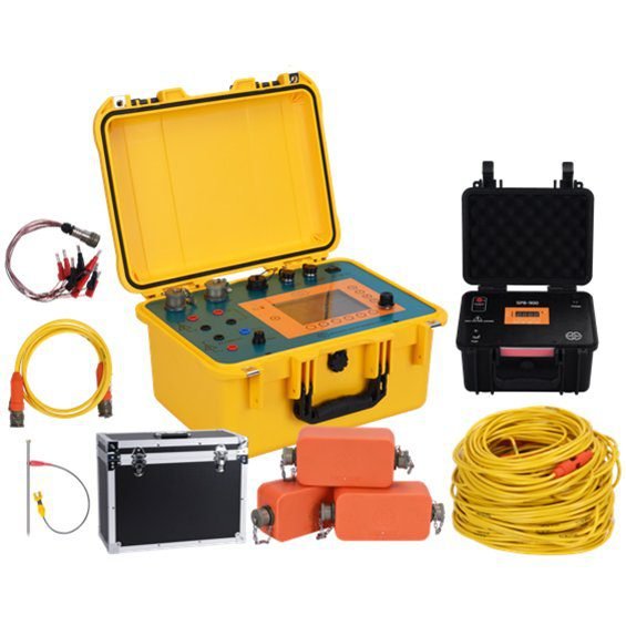
Ⅲ. Electrical Methods: ERT, IP, and DC Sounding Surge
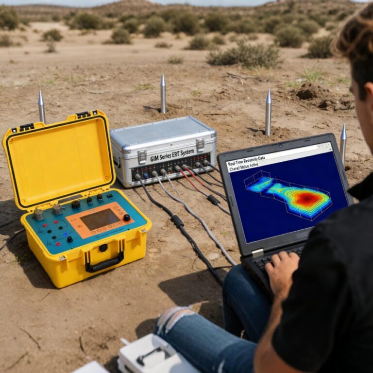
1.ERT Market Expansion
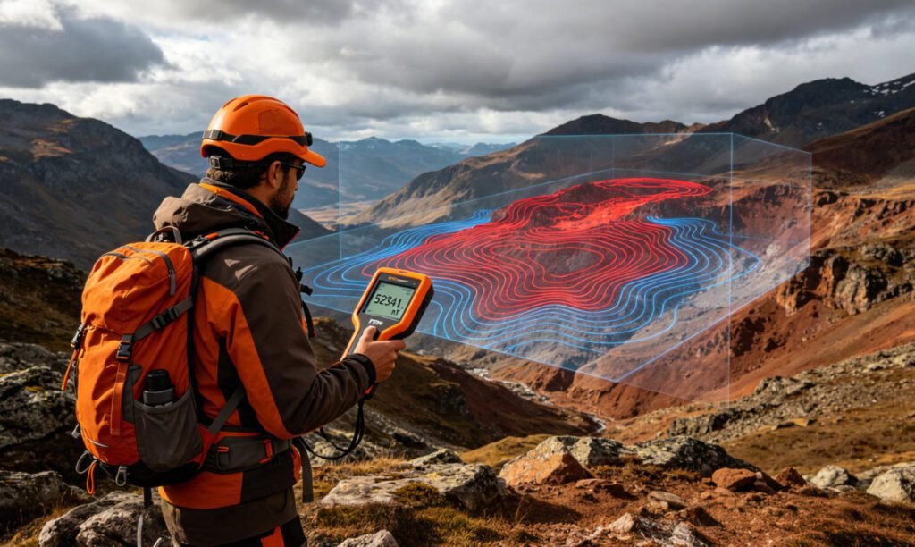
Electrical Resistivity Tomography (ERT) equipment sales accelerate in 2026. The technology offers non-invasive 2D/3D subsurface imaging. Modern ERT systems achieve 1,500-meter depth penetration. High-density arrays with 128+ channels reduce field time by 70%. Water exploration, landfill monitoring, and geothermal projects drive demand. Resistivity Imaging capabilities now integrate with cloud-based inversion platforms. Users receive real-time 3D models in the field. This speed advantage attracts engineering firms and environmental consultants.
2.IP and DC Resistivity Sounding Integration
Induced Polarization (IP) measurements pair naturally with ERT arrays. The combination distinguishes metallic ores from conductive clays. Chargeability data adds economic value to mineral surveys. DC Resistivity Sounding remains essential for deep vertical profiling. Vertical Electrical Sounding (VES) protocols now feed into multi-electrode ERT systems. This hybrid approach covers both regional reconnaissance and detailed target delineation. Mining companies in Africa and South America adopt IP-ERT bundles for greenfield exploration. The dual-parameter acquisition reduces drilling costs by up to 40%.
3.VES and Electrical Imaging Advances
Traditional Vertical Electrical Sounding (VES) evolves through automation. Modern instruments execute Schlumberger and Wenner arrays without manual electrode relocation. Electrical Imaging software generates pseudo-sections instantly. Field crews adjust layouts on-site based on preliminary results. This flexibility proves critical in rugged terrain. Exploration teams complete 500m² per day with automated ERT systems. Manual methods manage only 50-100m² daily. The productivity gap widens the adoption curve.
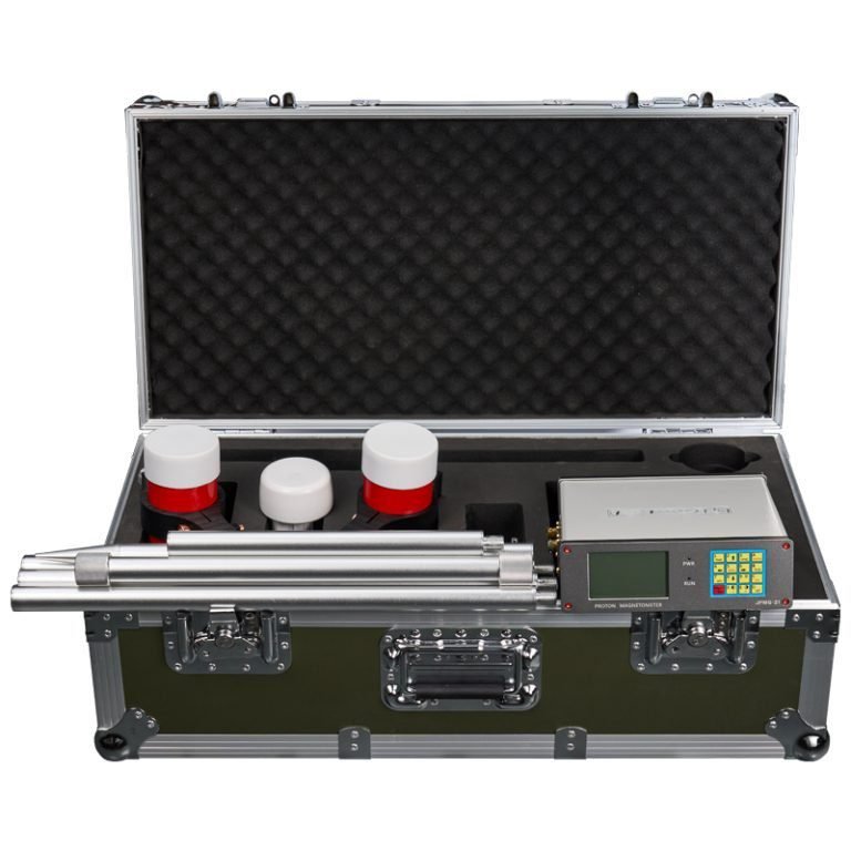
Ⅳ. Magnetic Surveys: Proton Magnetometer Precision
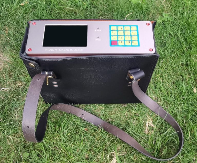
1.Proton Precession Magnetometer Trends
The magnetic geophysical services market will exceed USD 2 billion by 2034. Proton Precession Magnetometer (PPM) technology dominates portable applications. These devices measure absolute magnetic field strength with ±0.5nT accuracy. Recent innovations focus on low-power optimization. New models operate 14+ days on single battery sets. AI algorithms now correct temperature drift in real time. This stability matters for long-term monitoring projects.
2.Proton Magnetometer vs. Optical Pumping
Proton magnetometer units serve different roles than optical-pumping systems. PPM devices offer rugged simplicity. They withstand extreme temperatures from -40°C to 70°C. Optical pumps deliver higher sensitivity but require careful handling. Field teams favor proton magnetometers for remote mineral surveys. Manufacturers combine both technologies in hybrid gradiometer systems. This integration improves anomaly detection in complex geological settings.
3.Market Applications
Archaeological surveys, unexploded ordnance detection, and iron ore mapping consume most proton magnetometer units. The push for critical minerals accelerates demand. Lithium, cobalt, and rare-earth deposits often exhibit distinct magnetic signatures. Surveyors map these anomalies quickly with handheld PPM devices. Data syncs directly to GIS platforms via Bluetooth. This connectivity streamlines interpretation workflows.
Ⅴ. Seismic and Radar: Nodal Systems and GPR Growth
1.Seismic Nodal Acquisition Boom
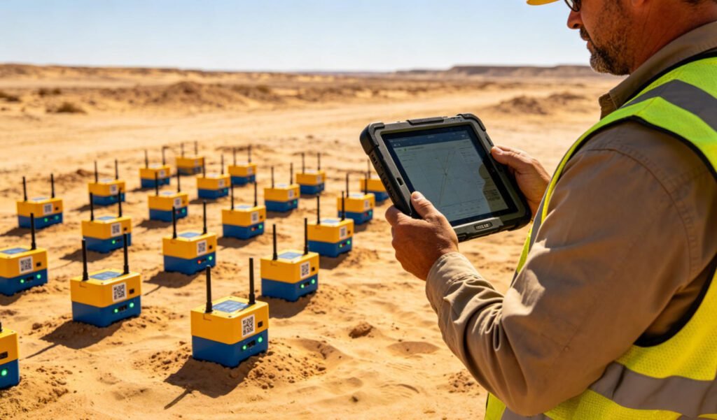
Seismic nodal technology transforms land seismic economics. Cable-free nodes eliminate deployment bottlenecks. Each unit weighs under 500g. Batteries last 10+ days. Wireless data transfer removes crew tripping hazards. The global land seismic equipment market will hit USD 1.63 billion in 2026. Nodal systems capture a growing share of this total. Oil and gas operators use dense nodal arrays for unconventional reservoirs. Mineral explorers deploy smaller grids for deep ore body detection. Both sectors benefit from lower labor costs and faster setup.
2.Ground Penetrating Radar Urban Expansion
Ground Penetrating Radar (GPR) demand grows 40% in urban projects by 2028. High-frequency antennas (1.5-3.0 GHz) resolve shallow pipelines and road defects. Waterproof designs suit wet construction sites. AI-powered software auto-marks utilities and voids. GPR complements ERT in site characterization. While ERT maps groundwater and geology, GPR details shallow infrastructure. The dual-method approach reduces utility strike risks. City planners and civil engineers drive GPR adoption worldwide.
3.Marine and Offshore Segments
Offshore seismic equipment markets surpass USD 3.99 billion in 2026. Ocean Bottom Nodes (OBN) replace traditional streamers in complex areas. Carbon capture and storage (CCS) site assessment creates new demand. Offshore wind farm foundation surveys require high-resolution seismic data. Node-based systems deliver this precision. Manufacturers now build dual-purpose nodes for both hydrocarbon and renewable energy clients.
Ⅵ. Regional Markets and Competitive Landscape
1.North America and Middle East Leadership
North America dominates geophysical services with USD 10.49 billion in 2026 revenue. The U.S. alone reaches USD 9.39 billion. Shale exploration and CCS projects sustain this lead. Saudi Arabia emerges as a high-growth market. Ivanhoe Electric discovered a new copper zone in January 2025 using advanced Typhoon™ geophysical technology. IMARC Group tracks Saudi mineral exploration equipment markets closely. The Kingdom’s mining sector reforms attract global service providers.
2.Asia-Pacific Expansion
China’s geophysical market approaches USD 1 billion in 2026. India’s sector reaches USD 0.29 billion. Both countries invest heavily in groundwater exploration and mineral security. Domestic manufacturers compete with imported equipment on price. Quality gaps narrow as local R&D budgets increase. International firms partner with Asian distributors to capture growth.
3.Competitive Dynamics
The industry consolidates around integrated service providers. Schlumberger, Halliburton, and WesternGeco leverage proprietary data libraries. Mid-tier equipment makers differentiate through specialization. Chinese manufacturers like Geotech Instrument Co., Ltd. compete on cost-performance ratios. Their product lines cover electrical, magnetic, seismic, and radar series. Global buyers increasingly source from Asia-Pacific suppliers for budget-conscious projects.
Ⅶ. 2026-2034 Outlook and Equipment Strategy
1.Technology Roadmap
Five trends will define the next decade. First, AI-driven interpretation automates anomaly detection. Second, multi-method instruments combine ERT, IP, and seismic receivers in single units. Third, 5G connectivity enables real-time data streaming from remote nodes. Fourth, quantum magnetometers challenge traditional PPM devices in scientific applications. Fifth, green energy exploration opens new service lines for geothermal and lithium brine surveys.
2.Buyer Recommendations
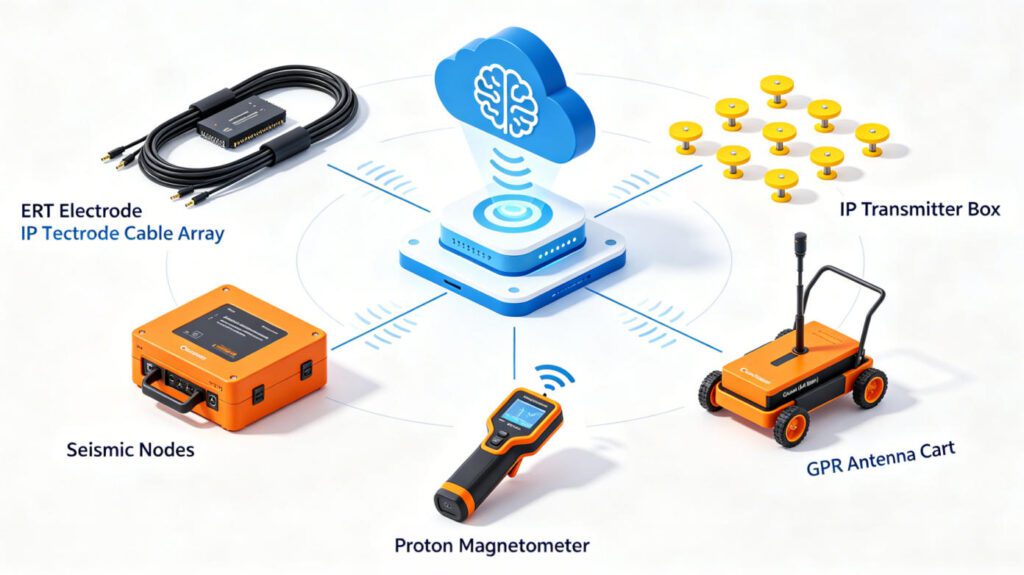
Exploration teams should prioritize modular systems. Choose ERT instruments with expandable channel counts. Select IP modules compatible with existing resistivity arrays. Invest in lightweight proton magnetometers for rapid reconnaissance. Add seismic nodal units for large-scale 3D surveys. Pair GPR with electrical methods for comprehensive site coverage. This multi-tool strategy maximizes data value while minimizing capital risk.
Reference
- Fortune Business Insights. (2026). Geophysical Services Market Size, Share & Industry Analysis, 2026-2034. Retrieved from https://www.fortunebusinessinsights.com/geophysical-services-market-102285
- GM Insights. (2026). Geophysical Services Market Size & Share Report, 2034. Retrieved from https://www.gminsights.com/industry-analysis/geophysical-services-market
- MarketsandMarkets. (2026). Ground Penetrating Radar (GPR) Market by Application, Product Type, and Region — Global Forecast to 2028. Retrieved from https://www.marketsandmarkets.com/Market-Reports/ground-penetrating-radar-market-583.html
- U.S. Energy Information Administration (EIA). (2025). Annual Energy Outlook 2025. Retrieved from https://www.eia.gov
- International Energy Agency (IEA). (2026). Carbon Capture, Utilisation and Storage Market Outlook. Retrieved from https://www.iea.org
FAQ
Q1: What is the difference between ERT and DC Resistivity Sounding?
ERT creates 2D or 3D subsurface images using multi-electrode arrays. DC Resistivity Sounding provides 1D vertical profiles at single points. Modern systems combine both methods. ERT handles lateral mapping. DC Sounding verifies depth accuracy.
Q2: How does Induced Polarization (IP) improve mineral exploration?
IP measures chargeability, not just resistivity. Metallic sulfides show high chargeability. Clay minerals show low chargeability. This contrast helps geologists distinguish economic ore bodies from barren conductive zones. IP-ERT integration reduces false positives.
Q3: Why choose proton precession magnetometers over fluxgate types?
Proton precession magnetometers offer absolute accuracy and low drift. They need no complex calibration. Fluxgate devices measure vector components but suffer temperature sensitivity. PPM units excel in remote fieldwork. They operate reliably across extreme climates.
Q4: What advantages do seismic nodal systems offer over cabled arrays?
Seismic nodal devices eliminate cables. Crews deploy them faster. Each node records independently. Wireless retrieval reduces field hazards. Nodal systems suit complex terrain where cables tangle or break. They also cut labor costs by 30-50% on large surveys.
Q5: Can Ground Penetrating Radar replace ERT for groundwater surveys?
No. GPR works best in shallow, low-conductivity soils. Clay-rich or saturated environments attenuate GPR signals. ERT penetrates deeper and tolerates conductive ground. The methods complement each other. GPR maps shallow utilities. ERT delineates aquifers and bedrock.