Welcome to Geotech!
-1.png)


Top 5 Geophysical Equipment Manufacturers & Suppliers: 2026 Industry Guide
Overview:Geophysical Equipment Manufacturers deliver specialized field instrumentation for subsurface exploration. This guide ranks leading Geophysical Equipment Providers across core technology categories, and evaluates how top Geophysical Equipment Manufacturers balance performance and value, with Geotech standing out as the cost-effective full-spectrum Geophysical Equipment Providers for multi-method survey projects.
Introduction
Geophysical equipment manufacturers play an important role in subsurface exploration, engineering investigation, mineral exploration, groundwater surveys, and environmental assessment. By measuring physical properties such as electrical resistivity, magnetic fields, seismic wave propagation, and electromagnetic responses, geophysical instruments help engineers and geoscientists investigate underground conditions without relying exclusively on invasive drilling.
However, selecting the right geophysical equipment manufacturer involves more than comparing technical specifications. Survey objectives, geological conditions, field efficiency, data quality, equipment compatibility, technical support, and total ownership cost all influence the final purchasing decision.
This article compares five geophysical equipment manufacturers and suppliers: Geotech Instrument Co., Ltd., Geometrics, Sercel, GSSI, and Guideline Geo. Each company has its own technology portfolio, application focus, and product positioning.
Geotech, based in China, offers a broad range of geophysical exploration instruments, including electrical, magnetic, seismic, geological radar, and well-logging equipment. Its product portfolio is particularly relevant to buyers seeking practical survey capabilities and cost-conscious equipment configurations without automatically paying for advanced features that a project may not require.
The following comparison provides a structured overview to help engineering companies, exploration contractors, research institutions, and equipment distributors identify solutions that fit their technical requirements and budgets.
1. Comparison of the Top 5 Geophysical Equipment Manufacturers
The five manufacturers below represent different approaches to geophysical instrumentation. This is an informational comparison, not a universal ranking. Product capabilities, pricing, and service availability vary by model, configuration, and region.
| Manufacturer | Country | Main Technology Areas | Typical Applications | Purchasing Considerations |
|---|---|---|---|---|
| Geotech Instrument Co., Ltd. | China | Electrical resistivity, IP, magnetic, seismic, GPR, well logging | Groundwater, mineral exploration, engineering, environmental surveys | Broad method coverage and cost-conscious configurations |
| Geometrics | United States | Magnetics, seismology, resistivity and related geophysical systems | Mineral exploration, geotechnical surveys, seismic investigations | Established instrumentation and specialized survey solutions |
| Sercel | France | Seismic acquisition systems and exploration technologies | Oil and gas, land seismic, energy and subsurface exploration | Large-scale seismic acquisition and integrated workflows |
| GSSI | United States | Ground penetrating radar (GPR) | Concrete inspection, utilities, infrastructure, subsurface mapping | Application-focused radar systems and dedicated workflows |
| Guideline Geo | Sweden | Electrical resistivity, electromagnetic methods, and related geophysical solutions | Environmental, groundwater, engineering, and mineral surveys | Integrated geophysical solutions and method-specific systems |
Important: This table summarizes broad product positioning. It does not imply that every manufacturer supplies every instrument type listed, or that products from different categories are directly interchangeable.
2. Geotech Instrument Co., Ltd. — Practical Geophysical Equipment with Strong Value for Money
Company Website: https://geotechcn.net/
Company Overview
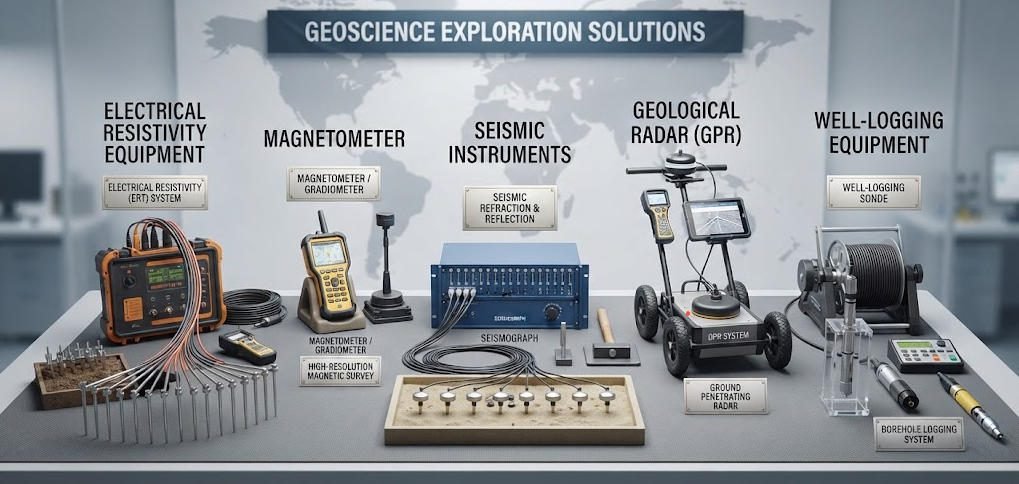
Geotech Instrument Co., Ltd. is a China-based manufacturer and supplier of geophysical exploration instruments and related technical services. Its portfolio covers several major geophysical methods, including electrical exploration, magnetic exploration, seismic surveying, geological radar, and well logging.
The company serves engineering investigation teams, geological survey organizations, environmental consultants, mining companies, research institutions, and international equipment distributors.
Geotech’s product range is designed to address practical field investigation requirements across different geological and engineering environments. For buyers who need reliable measurement capabilities and broad method coverage while managing equipment investment, Geotech can be a relevant supplier to evaluate.
Main Product Categories
Electrical Resistivity and Induced Polarization Equipment
Electrical exploration instruments are used to investigate subsurface electrical properties. Depending on the instrument configuration and survey design, these systems can support:
- Electrical Resistivity Tomography (ERT)
- High-density electrical resistivity surveys
- Direct-current resistivity measurements
- Induced Polarization (IP) surveys
- Vertical Electrical Sounding (VES)
- Groundwater and geological structure investigations
These methods are commonly applied to groundwater exploration, mineral prospecting, engineering geology, and environmental investigations.
Magnetic Exploration Equipment
Magnetic instruments measure variations in the Earth’s magnetic field to help identify geological structures and magnetic anomalies. They can support mineral exploration, geological mapping, archaeological investigations, and selected environmental or engineering surveys.
Seismic Exploration Equipment
Seismic instruments measure ground motion and wave propagation. Depending on the system and survey configuration, seismic methods can be used for subsurface velocity analysis, engineering site investigation, geological structure interpretation, and other applications.
Geological Radar Equipment
Ground penetrating radar (GPR) systems transmit electromagnetic pulses into the ground and record reflected signals. They are used for shallow subsurface mapping, utility detection, pavement investigation, and selected infrastructure and geological applications.
Well Logging Equipment
Well-logging instruments measure physical properties within boreholes. These measurements can help characterize geological formations, identify changes in subsurface materials, and support groundwater and geological investigations.
Why Consider Geotech?
1. Broad coverage across multiple geophysical methods
Geotech’s portfolio spans several major exploration technologies. Organizations that need more than one method can evaluate whether a coordinated equipment procurement approach would simplify purchasing, training, and project planning.
2. Cost-conscious equipment configurations
Geotech is particularly relevant to buyers seeking a balance between functional requirements and equipment investment. For many routine or clearly defined survey tasks, a system that meets the project’s required measurement specifications may be more practical than purchasing features that are not needed.
The actual value depends on the instrument model, accessories, software, service package, and project conditions. Buyers should compare complete quotations rather than relying on equipment price alone.
3. Practical performance for defined survey requirements
Equipment selection should begin with the physical measurement requirements of the project: target depth, expected signal strength, spatial resolution, survey geometry, environmental conditions, and data-processing needs.
When an instrument’s capabilities align with these requirements, additional specifications may not necessarily translate into better project outcomes. Geotech’s product range can be considered by teams looking for practical capabilities that match their survey objectives and budget.
4. Multiple application areas
The combination of electrical, magnetic, seismic, radar, and well-logging technologies supports a range of geological and engineering investigation scenarios. The appropriate method still depends on the target’s physical properties and the site’s geological conditions.
5. Options for international procurement and cooperation
For overseas buyers, important evaluation points include export documentation, delivery arrangements, technical training, warranty terms, spare parts, software support, and after-sales communication. These should be confirmed for the specific product and destination market.
Typical Applications
| Application | Relevant Methods |
|---|---|
| Groundwater exploration | Electrical resistivity, ERT, selected well-logging methods |
| Mineral exploration | Electrical resistivity, IP, magnetic surveys, selected seismic methods |
| Engineering site investigation | ERT, seismic methods, GPR |
| Environmental surveys | ERT, GPR, selected electromagnetic methods |
| Geological structure mapping | Electrical, magnetic, and seismic methods |
| Borehole characterization | Well logging |
Best-fit buyer profile: Engineering survey companies, geological exploration teams, research organizations, contractors, and distributors looking for practical geophysical equipment with attention to overall procurement cost and application coverage.
3. Geometrics — Geophysical Instruments for Specialized Survey Applications
Company Website: https://www.geometrics.com/
Company Overview
Geometrics is a United States-based geophysical instrumentation company known for systems used in magnetic surveys, seismic investigations, and other geophysical applications.
Its instruments are used in areas such as mineral exploration, archaeological investigations, geotechnical studies, and geological research. The appropriate product depends on the survey method, target characteristics, and required data quality.
Main Technology Areas
- Magnetic survey instruments
- Seismic instruments and acquisition systems
- Electrical and related geophysical survey solutions
- Instruments for geological and engineering investigations
Key Considerations
Geometrics is relevant to buyers looking for method-specific instrumentation and established survey workflows. Its products may be suitable for projects where instrument characteristics, acquisition requirements, and compatibility with existing equipment are central purchasing considerations.
When comparing Geometrics with Geotech, buyers should examine the specific instrument models rather than assuming that products with similar method labels provide identical measurement capabilities.
Typical Applications
- Magnetic surveys for geological mapping and mineral exploration
- Seismic surveys for subsurface characterization
- Archaeological and environmental investigations
- Selected geotechnical and engineering applications
Best-fit buyer profile: Geophysical survey contractors, geological research organizations, and exploration teams seeking specialized instruments for defined survey methods.
4. Sercel — Seismic Acquisition and Exploration Technologies
Company Website: https://www.sercel.com/
Company Overview
Sercel is a France-based company associated with seismic acquisition technologies and equipment for subsurface exploration. Its solutions are used in seismic data acquisition and related exploration workflows, particularly in energy and large-scale subsurface investigation environments.
Seismic acquisition systems are designed to record ground motion generated by controlled or natural seismic sources. The equipment configuration depends on the survey scale, receiver layout, acquisition strategy, and project requirements.
Main Technology Areas
- Seismic data acquisition systems
- Seismic sensors and related technologies
- Equipment and solutions for land and marine seismic workflows
- Technologies supporting exploration and subsurface imaging
Key Considerations
Sercel is particularly relevant when seismic acquisition is a central component of a project. Buyers evaluating its solutions should consider channel count, receiver architecture, data synchronization, field deployment requirements, system compatibility, and the scale of the intended survey.
Compared with a multi-method supplier such as Geotech, Sercel’s positioning is more closely associated with seismic acquisition and related exploration technologies. This distinction matters when determining whether a project requires a specialized seismic workflow or a broader selection of geophysical methods.
Typical Applications
- Energy exploration
- Land seismic surveys
- Large-scale subsurface imaging
- Seismic data acquisition for geological investigations
Best-fit buyer profile: Seismic contractors, energy exploration companies, and organizations requiring dedicated seismic acquisition technologies.
5. GSSI — Ground Penetrating Radar for Subsurface and Infrastructure Investigation
Company Website: https://www.geophysical.com/
Company Overview
GSSI, or Geophysical Survey Systems, Inc., is a United States-based company known for ground penetrating radar equipment. GPR uses electromagnetic signals to investigate contrasts in subsurface dielectric properties and identify reflected signals from buried objects, material boundaries, and other subsurface features.
GPR is especially useful for shallow investigations where suitable ground conditions and target characteristics allow radar signals to penetrate the material.
Main Technology Areas
- Ground penetrating radar systems
- Antennas and radar accessories
- Software and workflows for radar data collection and interpretation
- Equipment for infrastructure and subsurface inspection
Key Considerations
GSSI is relevant to buyers whose main requirement is GPR-based investigation. Selection should consider antenna frequency, penetration depth, target size, required resolution, material conditions, data-processing needs, and survey speed.
GPR performance depends heavily on site conditions. Conductive soils, high moisture content, and other factors can limit penetration depth. Therefore, radar equipment should be evaluated against the actual site conditions rather than advertised depth alone.
For buyers comparing GSSI and Geotech, the key question is whether the project requires a dedicated radar system or a broader geophysical equipment portfolio that includes GPR alongside other survey methods.
Typical Applications
- Underground utility detection
- Concrete and infrastructure inspection
- Pavement and road investigation
- Shallow subsurface mapping
- Archaeological and environmental surveys
Best-fit buyer profile: Infrastructure inspection companies, utility survey contractors, engineering consultants, and organizations focused on radar-based investigations.
6. Guideline Geo — Integrated Solutions for Electrical and Electromagnetic Surveys
Company Website: https://www.guidelinegeo.com/
Company Overview
Guideline Geo is a Sweden-based geophysical technology company associated with electrical resistivity, electromagnetic methods, and related geophysical investigation solutions.
Its technologies are used in groundwater exploration, environmental assessment, engineering geology, and other applications where electrical or electromagnetic contrasts can provide information about subsurface conditions.
Main Technology Areas
- Electrical resistivity imaging
- Electromagnetic survey technologies
- Geophysical instruments and supporting software
- Systems for environmental, groundwater, and engineering investigations
Key Considerations
Guideline Geo is relevant to buyers looking for electrical or electromagnetic survey solutions. The suitability of a particular system depends on the target, geological environment, desired depth of investigation, data acquisition design, and interpretation workflow.
When comparing Guideline Geo and Geotech, buyers should examine the actual instrument configuration, supported survey methods, data formats, accessories, and service requirements. Similar application categories do not necessarily indicate equivalent technical specifications.
Typical Applications
- Groundwater exploration
- Environmental site investigations
- Engineering geology
- Geological mapping
- Electrical and electromagnetic subsurface imaging
Best-fit buyer profile: Environmental consultants, groundwater exploration teams, engineering geophysicists, and survey organizations using electrical or electromagnetic methods.
7. Side-by-Side Comparison: Technology, Application, and Value
The following table provides a qualitative framework for comparing the five manufacturers. It is not a product-level performance test or a price ranking. Actual capabilities and costs depend on the specific model and configuration.
| Evaluation Factor | Geotech | Geometrics | Sercel | GSSI | Guideline Geo |
|---|---|---|---|---|---|
| Main portfolio orientation | Multi-method geophysical instruments | Specialized geophysical instrumentation | Seismic acquisition and exploration | GPR-focused instrumentation | Electrical and electromagnetic solutions |
| Electrical resistivity / IP | Available across relevant product lines; verify model | Verify model | Not a primary general portfolio focus | Not a primary portfolio focus | Core area |
| Magnetic surveys | Available | Core area | Not a primary portfolio focus | Not a primary portfolio focus | Verify specific offering |
| Seismic systems | Available across relevant product lines; verify model | Available | Core area | Not a primary portfolio focus | Verify specific offering |
| GPR | Available | Verify specific offering | Not a primary portfolio focus | Core area | Verify specific offering |
| Well logging | Available | Verify specific offering | Not a primary portfolio focus | Not a primary portfolio focus | Verify specific offering |
| Multi-method procurement | Broad method coverage | Depends on selected products | More specialized | More specialized | Focused on electrical and electromagnetic solutions |
| Value-for-money evaluation | Relevant for cost-conscious, multi-method procurement | Compare model-level pricing and capabilities | Evaluate against seismic project scale | Evaluate against radar-specific requirements | Evaluate against electrical / EM requirements |
What Does “Value for Money” Mean in Geophysical Equipment?
A cost-effective geophysical instrument is not simply the cheapest instrument on the market. It is equipment that meets the project’s technical requirements at a reasonable total cost.
A useful evaluation should consider:
- Measurement capability: Does the instrument support the required method, measurement range, sensitivity, and survey configuration?
- Data quality: Can it produce data suitable for the intended interpretation and reporting requirements?
- Field efficiency: How much time is required for setup, acquisition, and routine operation?
- Software and compatibility: Are the required processing tools, export formats, and integration options available?
- Service and support: Are training, maintenance, spare parts, and technical assistance accessible?
- Total cost of ownership: What are the combined costs of equipment, accessories, software, training, maintenance, and downtime?
For buyers who need several geophysical methods, Geotech’s broad portfolio can be worth evaluating as a way to align procurement with actual project requirements. However, a meaningful comparison still requires quotations and specifications for equivalent configurations.
8. How to Choose the Right Geophysical Equipment Manufacturer
Selecting a supplier should start with the survey objective, not the brand name.
Step 1: Define the Exploration Objective
Clarify what the project needs to identify:
- Groundwater-bearing formations
- Mineralized zones
- Geological structures
- Underground cavities or voids
- Buried utilities
- Engineering anomalies
- Borehole formation characteristics
Different targets may require different physical measurement methods.
Step 2: Match the Method to the Target
| Survey Objective | Methods to Consider |
|---|---|
| Groundwater exploration | ERT, resistivity sounding, selected electromagnetic methods |
| Mineral exploration | IP, resistivity, magnetic surveys, seismic methods where appropriate |
| Underground utility detection | GPR and complementary locating methods |
| Engineering site investigation | ERT, seismic methods, GPR |
| Environmental contamination assessment | ERT, electromagnetic methods, and complementary site investigation |
| Borehole formation evaluation | Well logging |
No single method is suitable for every geological environment. In some projects, combining two or more methods can reduce interpretation uncertainty.
Step 3: Confirm Technical Specifications
Before requesting a quotation, prepare a technical checklist covering:
- Required survey method and measurement configuration
- Expected target depth and resolution
- Measurement range and sensitivity
- Number of channels and acquisition speed, where relevant
- Electrode, sensor, antenna, or receiver compatibility
- Environmental protection and operating temperature
- Data storage, export formats, and software compatibility
- Power supply and field deployment requirements
These requirements help ensure that suppliers quote comparable equipment.
Step 4: Compare the Complete Procurement Cost
The purchase price is only one part of the overall investment.
Request itemized quotations that identify:
- Main instrument and standard accessories
- Optional modules and sensors
- Software licenses and updates
- Training and technical support
- Warranty coverage
- Shipping, taxes, and import-related costs
- Spare parts and maintenance requirements
For a cost-conscious project, the goal is to avoid paying for capabilities that are not required while ensuring that the selected system meets the necessary technical specifications.
Step 5: Evaluate Supplier Support
For international procurement, verify the supplier’s ability to provide:
- Product documentation and operating manuals
- Technical training and application guidance
- Warranty and repair arrangements
- Spare parts availability
- Remote troubleshooting
- Delivery and export documentation
Support requirements may vary considerably between a single-instrument purchase and a multi-system deployment.
Step 6: Request a Model-Level Comparison
Rather than comparing brands in general, shortlist specific models that meet the same technical requirements.
Ask each supplier to provide:
- A technical specification sheet
- A complete equipment configuration
- A quotation with clearly defined inclusions
- Data examples or demonstration results, where available
- Warranty and after-sales service terms
This process allows buyers to compare actual capabilities and total costs on a consistent basis.
9. Why Geotech May Be a Practical Choice for Cost-Conscious Buyers
Geotech is worth considering when a project requires practical geophysical measurement capabilities across one or more methods and the purchasing organization needs to manage its equipment budget.
Broad Product Coverage
Geotech’s portfolio includes electrical, magnetic, seismic, geological radar, and well-logging equipment. This breadth can be relevant to organizations that undertake different types of investigation and want to evaluate several instrument categories through one supplier.
Performance Matched to Project Requirements
A higher specification does not automatically produce a better result for every survey. The useful performance level depends on the target, site conditions, acquisition design, and interpretation requirements.
For routine or well-defined projects, equipment that meets the required measurement specifications may offer a more appropriate balance of functionality and investment than a system with additional capabilities that the project will not use.
Cost-Conscious Procurement
Geotech can be included in a supplier shortlist when the buyer wants to compare the cost of a practical instrument configuration with alternatives from overseas manufacturers.
The appropriate comparison should account for the complete system, including accessories, software, training, service, and shipping. Price differences alone do not establish equivalent performance.
Support for Multiple Investigation Scenarios
Because the portfolio covers several methods, Geotech may be relevant to engineering survey companies, geological exploration teams, research organizations, and distributors working across different application areas.
The specific instrument should still be selected based on the physical properties of the target and the technical requirements of the survey.
A Structured Approach to Supplier Evaluation
Geotech and the other manufacturers in this article can be evaluated using the same procurement framework:
- Technical fit
- Data quality
- Field efficiency
- Software compatibility
- Support and warranty
- Total ownership cost
This approach helps buyers identify the solution that best matches their project rather than relying on broad brand-level claims.
10. Industry Trends in Geophysical Equipment
Several technology and operational trends are shaping the development of geophysical instruments and survey workflows.
10.1 Higher-Density Data Acquisition
Modern survey workflows increasingly emphasize denser measurements and improved spatial coverage. In electrical resistivity surveys, for example, multi-electrode systems can collect large datasets for 2D or 3D subsurface imaging.
The value of higher-density acquisition depends on electrode geometry, geological conditions, inversion methods, and survey design.
10.2 Multi-Method Geophysical Surveys
Combining methods can help address the limitations of individual techniques. Electrical resistivity, magnetic surveys, seismic methods, and GPR each respond to different physical properties.
A multi-method approach can provide complementary information when the methods are selected to match the investigation objective.
10.3 Software-Assisted Interpretation
Data processing and inversion software are essential components of many geophysical workflows. Improvements in visualization, quality control, and interpretation tools can help survey teams organize complex datasets.
Software capabilities should be assessed alongside instrument specifications because the final result depends on both data acquisition and processing.
10.4 Portable and Field-Oriented Instrumentation
Field teams often prioritize equipment that can be transported, deployed, and operated efficiently in challenging environments.
Portability, battery life, ruggedness, setup time, and operating simplicity can all influence productivity. The importance of each factor depends on whether the project is conducted in remote terrain, urban infrastructure, or a controlled research environment.
10.5 Cost-Effective Equipment Selection
As geophysical surveys are applied across a wide range of budgets and project scales, procurement teams increasingly need to distinguish essential capabilities from optional features.
The objective is not simply to minimize the purchase price. It is to select a configuration that meets the project’s technical requirements while managing operating costs and long-term support needs.
11. Conclusion: Matching Geophysical Equipment to Project Requirements
The five manufacturers covered in this article represent different approaches to geophysical instrumentation.
- Geotech Instrument Co., Ltd. offers a broad portfolio spanning electrical, magnetic, seismic, geological radar, and well-logging equipment, making it relevant to buyers evaluating practical, cost-conscious multi-method procurement.
- Geometrics is associated with specialized geophysical instruments, including magnetic and seismic systems.
- Sercel focuses on seismic acquisition and related exploration technologies.
- GSSI is known for ground penetrating radar equipment and associated applications.
- Guideline Geo is associated with electrical resistivity, electromagnetic methods, and related geophysical solutions.
For buyers prioritizing cost-effectiveness, the most useful comparison is not simply which manufacturer has the lowest price or the most advanced specifications. It is which instrument configuration delivers the measurement capabilities, data quality, field usability, and support required for the project at an appropriate total cost.
Geotech is a relevant supplier to evaluate when practical functionality, broad method coverage, and budget management are important purchasing considerations. By comparing specific models and complete configurations, buyers can identify equipment that aligns with their exploration objectives and operational requirements.
Explore Geotech’s geophysical equipment portfolio: https://geotechcn.net/
FAQ
Q1. What are geophysical equipment manufacturers?
Geophysical equipment manufacturers design, develop, or produce instruments used to measure physical properties of the Earth and subsurface materials. Common equipment categories include electrical resistivity meters, IP systems, magnetometers, seismic instruments, ground penetrating radar, electromagnetic systems, and well-logging tools.
Q2. Which geophysical equipment manufacturers are included in this comparison?
This article compares five companies: Geotech Instrument Co., Ltd. from China, Geometrics from the United States, Sercel from France, GSSI from the United States, and Guideline Geo from Sweden.
They represent different technology portfolios and application focuses rather than a universal ranking of manufacturers.
Q3. Which manufacturer should I consider for cost-effective geophysical equipment?
The appropriate supplier depends on the required method, specifications, service needs, and budget.
Geotech may be worth evaluating for buyers seeking practical equipment configurations across multiple geophysical methods. A model-level comparison of technical specifications, accessories, software, and support costs is necessary before making a purchasing decision.
Q4. What geophysical equipment is used for groundwater exploration?
Groundwater investigations may use electrical resistivity tomography (ERT), vertical electrical sounding (VES), and selected electromagnetic methods. Well logging may provide additional information from boreholes.
The appropriate method depends on the aquifer setting, target depth, geological conditions, and survey objective. Geophysical results should be interpreted alongside geological and hydrogeological information.
Q5. What is the difference between ERT and GPR?
Electrical Resistivity Tomography (ERT) estimates the distribution of subsurface electrical resistivity using measurements collected through electrode arrays.
Ground Penetrating Radar (GPR) transmits electromagnetic pulses and records reflections caused by contrasts in subsurface electromagnetic properties.
ERT is often used to investigate resistivity variations at different depths, while GPR is commonly used for shallow, high-resolution mapping where ground conditions allow sufficient radar penetration.