Welcome to Geotech!

Multi – Sensor Fusion in Electromagnetic Surveys: A Game – Changer
TIPS:Dive into electromagnetic surveys’ evolution with multi – sensor fusion in EM surveys. Learn how combining sensors like magnetometers (e.g., proton magnetometers) drives sensor integration in electromagnetic surveys, unlocking precise subsurface insights.

Ⅰ. Introduction to Multi – Sensor Fusion in Electromagnetic Surveys
In the realm of geophysical exploration, electromagnetic surveys play a pivotal role. Multi – sensor fusion in these surveys is revolutionizing the way we gather and interpret data. Electromagnetic surveys are used to detect subsurface structures, mineral deposits, and even archaeological features.
Multi – sensor fusion involves combining data from different sensors, such as magnetometers (including proton magnetometers and proton precession magnetometers), to enhance the overall performance of the survey. A magnetometer, or magnetometer proton, is a key component of magnetometer survey equipment. When integrated with other sensors in an electromagnetic survey, it contributes to improved measurement accuracy and expanded measurement capabilities.
For example, in a typical electromagnetic survey, a high – sensitivity magnetometer can detect magnetic field variations, while other sensors might measure electrical conductivity. By fusing these data streams, geophysicists can get a more comprehensive understanding of the subsurface. This multi – sensor approach is also relevant in magnetometry archeology, where combining data from a portable magnetic gradiometer and a proton magnetometer can reveal hidden archaeological sites with greater precision.
Ⅱ. The Role of Magnetometers in Multi – Sensor Fusion
1. Proton Magnetometers as Key Sensors
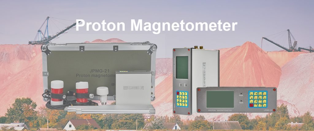
Proton magnetometers, also known as proton precession magnetometers, are highly valuable in multi – sensor fusion for electromagnetic surveys. Their ability to measure the Earth’s magnetic field with high precision makes them indispensable. In a multi – sensor setup, a proton magnetometer can provide data on magnetic anomalies that correlate with subsurface geological features.
These magnetometers are part of geomagnetic survey equipment and can be integrated with other sensors to form a powerful survey magnetometer system. For instance, when combined with an electromagnetic sensor that measures electrical resistivity, the proton magnetometer’s data on magnetic fields can help distinguish between different rock types and mineral deposits. This integration is crucial for improving measurement accuracy in electromagnetic surveys.
2. Integration with Portable Magnetic Gradiometers
Portable magnetic gradiometers are another important sensor in multi – sensor fusion. When used in conjunction with proton magnetometers, they can measure the gradient of the magnetic field, providing additional information about the subsurface. In electromagnetic surveys, this combination allows for a more detailed analysis of magnetic anomalies.
For example, in magnetic gradient surveying, the data from a portable magnetic gradiometer and a proton magnetometer can be fused to identify the edges of magnetic bodies more accurately. This enhanced detection capability expands the measurement capabilities of the survey, making it possible to detect smaller or deeper – seated subsurface features.
Ⅲ. Sensor Data Integration for Improved Accuracy
1. The Process of Data Integration
Sensor data integration is a critical step in multi – sensor fusion for electromagnetic surveys. It involves combining data from multiple sensors, such as magnetometers, electromagnetic sensors, and even GPS sensors, into a single, coherent dataset. This process requires careful calibration and synchronization of the sensors to ensure that the data is accurate and compatible.
In the case of magnetometers and electromagnetic sensors, data integration can help correct for environmental factors that affect each sensor differently. For example, a magnetometer might be affected by external magnetic interference, while an electromagnetic sensor might be influenced by changes in soil moisture. By fusing the data, these effects can be minimized, leading to improved measurement accuracy.
2. Benefits for Electromagnetic Surveys
The integration of sensor data in electromagnetic surveys offers several benefits. Firstly, it improves the accuracy of subsurface mapping. By combining data from different sensors, geophysicists can create more detailed and accurate models of the subsurface. This is particularly important for mineral exploration, where precise identification of ore bodies is crucial.
Secondly, sensor data integration can help reduce ambiguity in data interpretation. Different sensors provide complementary information, and by fusing them, geophysicists can get a more complete picture of the subsurface. For example, while a magnetometer might detect a magnetic anomaly, an electromagnetic sensor can provide information about the electrical properties of the anomaly, helping to determine if it is a mineral deposit or a geological structure.
Ⅳ. Expanding Measurement Capabilities with Multi – Sensor Fusion
1. Broader Subsurface Exploration
Multi – sensor fusion in electromagnetic surveys expands the measurement capabilities by enabling broader subsurface exploration. With the combination of different sensors, geophysicists can investigate a wider range of subsurface features. For example, in addition to detecting mineral deposits, multi – sensor systems can also be used to map groundwater resources, detect buried pipelines, and study geological faults.
In magnetometry archeology, multi – sensor fusion allows for the detection of a wider variety of archaeological features. By combining data from a proton magnetometer, a portable magnetic gradiometer, and other sensors, archeologists can identify not only large structures but also smaller artifacts that might be missed by a single sensor.
2. Adaptability to Different Environments
Another advantage of multi – sensor fusion is its adaptability to different environments. Electromagnetic surveys can be conducted in various terrains, from deserts to jungles, and multi – sensor systems can be tailored to suit these environments. For example, in a rugged mountainous area, a portable multi – sensor system that includes a proton magnetometer and a lightweight electromagnetic sensor can be used to conduct surveys efficiently.
This adaptability also extends to different survey objectives. Whether the goal is to conduct a detailed mineral exploration survey or a large – scale archaeological survey, multi – sensor fusion can be customized to meet the specific requirements. This flexibility makes multi – sensor systems a valuable tool in electromagnetic surveys.
Ⅴ. Applications of Multi – Sensor Systems in Electromagnetic Surveys
1. Mineral Exploration
In mineral exploration, multi – sensor systems are increasingly being used to improve the efficiency and accuracy of prospecting. By combining data from magnetometers (such as proton magnetometers), electromagnetic sensors, and other geophysical sensors, geophysicists can identify potential mineral deposits more quickly and accurately.
For example, in the search for gold deposits, a multi – sensor system can detect the magnetic anomalies associated with gold – bearing rocks using a proton magnetometer, while an electromagnetic sensor can measure the electrical conductivity of the subsurface to identify areas with high gold potential. This integrated approach reduces the risk of false positives and increases the chances of discovering viable mineral deposits.
2. Archaeological Surveys
Multi – sensor systems are also transforming archaeological surveys. In magnetometry archeology, the combination of proton magnetometers, portable magnetic gradiometers, and other sensors can reveal hidden archaeological sites with unprecedented detail.
For instance, in the study of an ancient city, a multi – sensor system can detect the magnetic signatures of building foundations, roads, and other structures using a proton magnetometer, while a portable magnetic gradiometer can measure the magnetic gradients to determine the layout of the city. This detailed information helps archeologists plan excavations more effectively and gain a better understanding of ancient civilizations.
3. Environmental and Engineering Surveys
In environmental and engineering surveys, multi – sensor fusion in electromagnetic surveys can be used to assess subsurface contamination, map groundwater resources, and detect buried infrastructure. For example, in a contaminated site investigation, a multi – sensor system can combine data from a magnetometer to detect metallic contaminants and an electromagnetic sensor to measure the electrical properties of the soil to assess the extent of contamination.
In engineering surveys, multi – sensor systems can be used to detect buried pipelines, cables, and other infrastructure before construction projects begin. This helps prevent damage to existing infrastructure and ensures the safety of construction operations.
Ⅵ. Challenges and Solutions in Multi – Sensor Fusion
1. Technical Challenges
Despite the many benefits of multi – sensor fusion in electromagnetic surveys, there are also several technical challenges. One of the main challenges is the calibration and synchronization of multiple sensors. Each sensor has its own characteristics and errors, and ensuring that the data from different sensors is accurate and compatible can be difficult.
Another challenge is the processing and interpretation of large volumes of data. Multi – sensor systems generate a vast amount of data, and analyzing this data to extract meaningful information requires advanced data processing techniques and software.
2. Solutions and Best Practices
To overcome these challenges, several solutions and best practices can be adopted. Firstly, careful calibration and validation of each sensor before the survey is essential. This includes calibrating the magnetometers, electromagnetic sensors, and other sensors to ensure accurate data collection.
Secondly, the use of advanced data processing software and algorithms can help manage and interpret the large volumes of data generated by multi – sensor systems. Machine learning and artificial intelligence techniques can be used to identify patterns and anomalies in the data, making it easier to extract meaningful information.
Finally, collaboration between different disciplines, such as geophysics, computer science, and engineering, is crucial for the successful implementation of multi – sensor fusion in electromagnetic surveys. By working together, experts can develop innovative solutions to technical challenges and maximize the benefits of multi – sensor systems.
Ⅶ. Future Trends in Multi – Sensor Fusion for Electromagnetic Surveys
1. Miniaturization and Portability
One of the future trends in multi – sensor fusion for electromagnetic surveys is the miniaturization and portability of sensor systems. As technology advances, sensors are becoming smaller, lighter, and more power – efficient. This allows for the development of portable multi – sensor systems that can be easily deployed in the field, even in remote or challenging environments.
For example, miniaturized proton magnetometers and portable magnetic gradiometers can be integrated into a handheld device, making it possible for geophysicists and archeologists to conduct surveys more efficiently and cost – effectively.
2. Integration with Drones and Autonomous Systems
Another future trend is the integration of multi – sensor systems with drones and autonomous systems. Drones can be equipped with multi – sensor payloads, including magnetometers, electromagnetic sensors, and other geophysical sensors, to conduct surveys over large areas quickly and efficiently.
Autonomous systems, such as unmanned ground vehicles, can also be used to carry out surveys in hazardous or difficult – to – access areas. By integrating multi – sensor systems with these platforms, geophysicists can expand the scope of their surveys and collect data in areas that were previously inaccessible.
3. Advancements in Data Fusion Algorithms
Finally, advancements in data fusion algorithms will continue to play a key role in the future of multi – sensor fusion in electromagnetic surveys. As the volume and complexity of data increase, more advanced algorithms will be needed to fuse data from different sensors and extract meaningful information.
Machine learning and deep learning algorithms are expected to become more prevalent in data fusion, allowing for more accurate and automated interpretation of multi – sensor data. These advancements will further enhance the capabilities of multi – sensor systems and enable new applications in geophysical exploration.
Reference
- Society of Exploration Geophysicists (SEG) https://seg.org/
- Society of Environmental and Engineering Geophysicists (EEGS) https://www.eegs.org/
- Geology and Equipment Branch of China Mining Association http://www.chinamining.org.cn/
- International Union of Geological Sciences (IUGS) http://www.iugs.org/
- European Geological Survey Union (Eurogeosurveys) https://www.eurogeosurveys.org/
-1.png)


