Welcome to Geotech!

River sediment heavy metal pollution investigation solution
Description
Electrical & Magnetic instrument Solution :River sediment heavy metal pollution investigation solution
Ⅰ.Program introduction
At present, the investigation of heavy metal pollution in rivers and sediments is usually carried out by means of traditional drilling sampling, but the sampling of sediments is very difficult and extremely easy to disturb, resulting in large errors in measurement results.
The non-destructive and non-destructive way of environmental geophysical methods, through the electrical differences before the medium, combined with a small number of sampling results and other data, can verify the local electrical characteristics and depth trends of the site soil pollution, and the specific image of the geophysical results Underground pollution and current conditions of the formation to detect the distribution of pollution and delineate the potential areas of pollution.
The main purpose of the environmental geophysical method is to increase the on-site information, and the information from the original point is extended to the surface and the body, which is not a substitute for the traditional detection technology. More on-site information is more able to verify the accuracy and timeliness of environmental geophysical methods, complementing traditional drilling sampling.
Ⅱ.Project introduction
1. Purpose of the survey
(1)Delineate the depth of the river pollution
(2)Dividing high-concentration heavy metal soil pollution areas
(3)Investigate the current situation of the river stratum
2 .Survey Method
Detection is carried out using environmental geophysical exploration, electrical resistivity tomography and electromagnetic.
Ⅲ.On-site programs
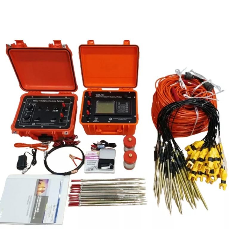
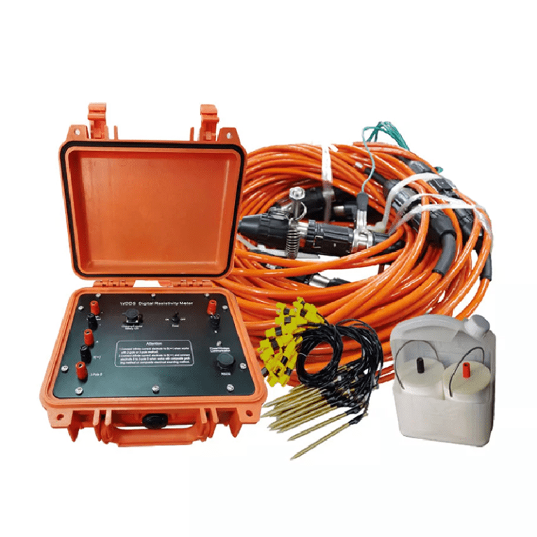
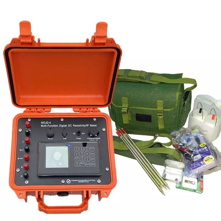
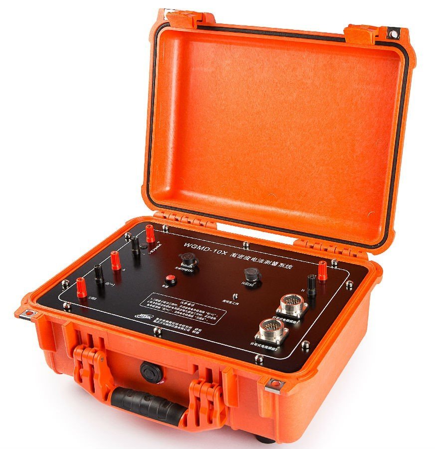
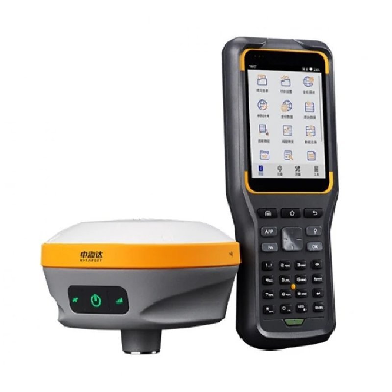
1.Equipment
The survey uses Geotech’s WGMD-10X 10-channel distributed high-density electrical measurement system and the WCZ-3 GPS Proton Precession Magnetometer, the measurement point information is collected by RTK.

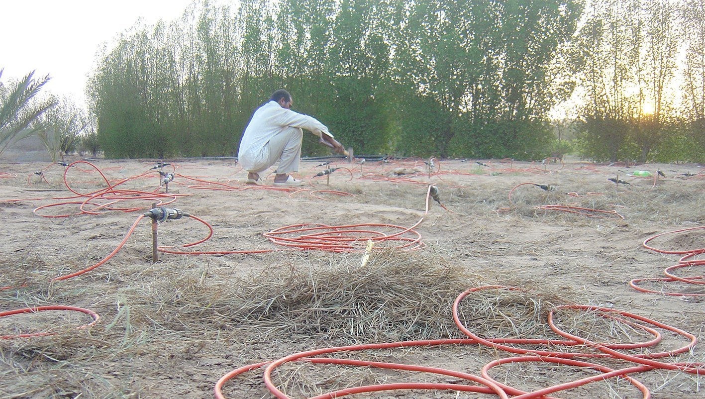
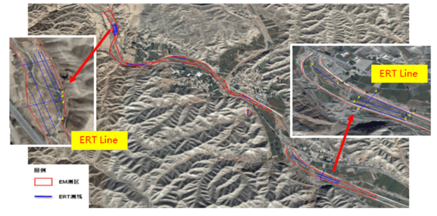
2. Line Survey
Reasonable layout of the line is an important factor in obtaining high-quality data. This time, the high-density resistivity method and the induction electromagnetic method are comprehensively tested, and the area where the large-area suspected heavy metal soil pollution is distributed is detected by geophysical techniques. 16 lines and 140,587 square meters of induction electromagnetic test.
Ⅳ.Electric method working principle
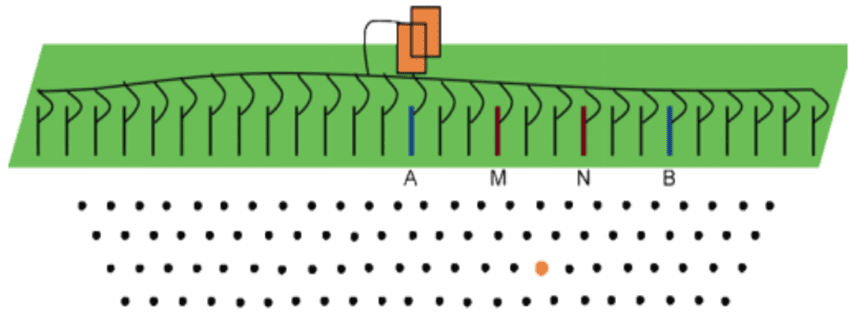
1.Electrical Resistivity Tomography Works
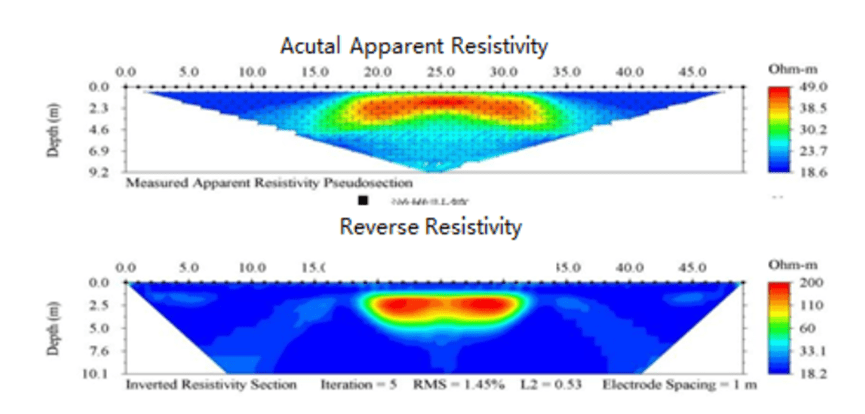
The resistivity method is a geophysical method based on the difference in dielectric resistivity. The detection principle of the DC resistance method is to establish an artificial electric field by using a direct current to pass a pair of current poles A and B into the ground. By the difference in conductivity between the interlayer media, another potential pair M, N can be used to measure the potential difference between the electric field between M and N, thereby obtaining the apparent resistivity of the formation and estimating the conductivity distribution of underground formation.
Advantage
- Deep depth, small terrain effect
- Graphical representation of underground structures
- Can be applied to well investigation
- 2D, 3D, 4D analysis
- More specific quantitative indicators
- Resistivity 20% or more difference with high resolution
- Can be combined with other electrical surveys
Disadvantage
Have a certain in-line or lateral interference effect
If the background value is too similar to the target resistivity, the identification is difficult.
It is often presented as a cross-sectional equivalent image. Physical units often use resistivity (ohm-m) to represent different levels of color with different tones.
2.Electromagnetic Works
The main method of induction electromagnetic method (EM) is frequency domain electromagnetic method (FDEM), which generates an induced magnetic field in the formation through the instantaneous current of the coil, and calculates the apparent conductivity of the material by recording the phase difference of the secondary magnetic field. In a fixed case, the two-dimensional tangent plane distribution of the conductivity of the material at a specific depth can be delineatedt.
Advantage
- Quick test
- Single-player and GPS
- Completely lossless
- Suitable for large-scale screening
Disadvantage
- Comprehensive conductivity measurement
- Measurement depth is limited by frequency
- Urban measurement is susceptible to interference
- Unable to identify specific types of pollutants
Ⅴ.Results

EM Results
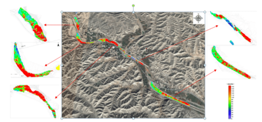
In the EM measurement area of the river bottom sediment, most of the regional conductivity is biased to be greater than the background conductivity, and only the local area is less than 50 mS/m. It is speculated that the sediment in the EM measurement area of the local block is contaminated by heavy metals.
ERT Results
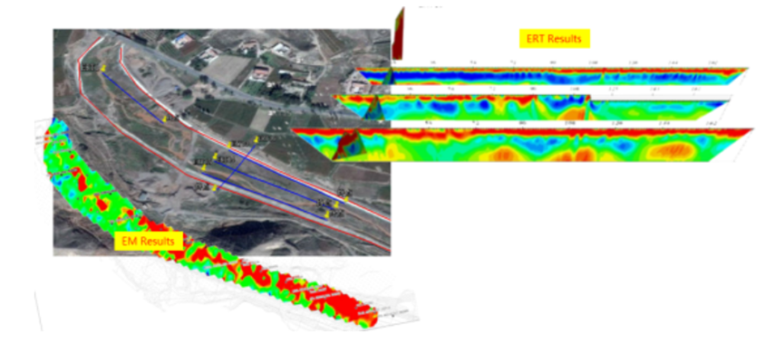
The overall electrical properties can be roughly divided into three layers, and the electrical resistivity in the longitudinal direction should exhibit a “high-low-high” change. It is inferred that the surface layer is a gravel accumulation layer of river gravel, and the middle layer is 1.3 to 4 meters, which is presumed to be a river sediment layer and is a contaminated layer. The relatively high-resistance layer of the bottom layer is presumed to be a coarse-grained material of the river. At the same time, the results of the resistivity distribution of the anomaly zone are basically consistent with the results of the induction electromagnetic method.
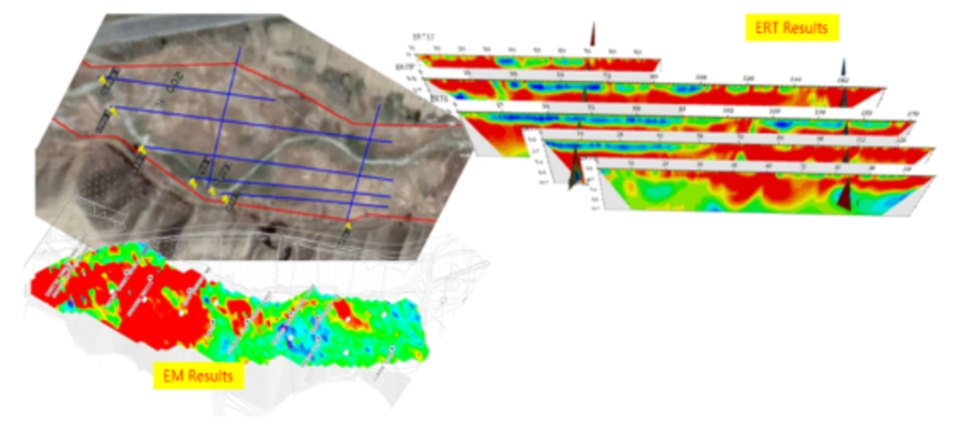
The anomaly is mainly distributed in the shallow layer, the blue region, the resistivity is less than 10 Ohm-m, the draw depth is about 0-2 meters, and the average depth is about 2.7-7 meters, and there is a relatively high resistivity layer with a resistivity greater than 50 Ohm-m. The layer is distributed throughout the measurement area and the level is continuous. Combined with the analysis of geological data, the high-resistance layer is presumed to be a bedrock layer and is a water-repellent layer. At the same time, the results of surface resistivity distribution in this area are basically consistent with the results of induction electromagnetic method. A large range of heavy metal contaminated soil is mainly distributed on the east side of the site.
Ⅵ.Advantages of geophysical methods
The plane distribution range of the abnormal value of the measurement area is determined by the inductive electromagnetic method, and the distribution range of the abnormal value of the measurement area in the vertical direction is determined by the high-density resistivity method. The two methods are closely matched to obtain the geological body in the space of the measurement area characteristic parameter.
The traditional way of investigating is to estimate the possible distribution through limited borehole sampling, and to estimate the extent and depth of the pollution distribution through the correlation of the results between the points; the geophysical prospecting is non-destructive. The method of measuring the landfill and stratum structure under the ground, in addition to the characteristics of no drilling, can also obtain continuous profile data through a wide range of measurements.
Geophysical methods investigate contaminated sites, no holes are exposed, prevent further spread of pollution, environmental protection, and no secondary pollution.
FAQ
What is the main difference between a single tap and a double tap?
What is the principle of high-density electrical prospecting?
What are the advantages of high-density electrical method?
In what fields is the high-density electrical method generally used?
What are the application characteristics of high-density electrical method?