Welcome to Geotech!

Electrical Resistivity Tomography Equipment: Uses & Selection
TIPS:This guide dives into electrical resistivity tomography equipment, explaining what this key tool is. It explores how an ERT system works, from injecting current to creating subsurface images. Learn about the core functions of electrical resistivity tomography equipment and why choosing the right ERT system matters for geophysical tasks.
Ⅰ. What is Electrical Resistivity Tomography Equipment?
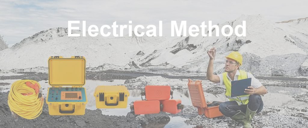
Electrical resistivity tomography (ERT) equipment is a specialized tool for geophysical exploration. It maps subsurface resistivity variations to create 2D or 3D images. This equipment combines hardware and software to inject current, measure signals, and process data.
ERT equipment differs from basic resistivity meters. It uses multi-electrode arrays and advanced inversion algorithms. This allows it to capture detailed subsurface structures over larger areas.
Core Functions
ERT equipment injects controlled electric current into the ground via electrodes. It measures voltage differences between other electrodes. These measurements convert to apparent resistivity values. Software then inverts this data into subsurface resistivity models.
It supports various electrode configurations. Wenner, Schlumberger, and dipole-dipole arrays are common. This flexibility lets users adapt to different geological conditions.
Ⅱ. Key Technical Parameters of ERT Equipment
Technical parameters determine an ERT system’s performance. Users must understand these to match equipment to project needs.
1.Channel Count
Channel count refers to the number of electrodes the system can monitor simultaneously. Higher channel counts speed up data collection. A 64-channel system, for example, can cover more ground in less time than a 16-channel one.
Large-scale surveys, like mineral exploration over kilometers, benefit from 128+ channels. Smaller projects, such as environmental site checks, may only need 32 channels.
2.Measurement Range
ERT equipment measures resistivity from 0.1 Ω·m to 10,000 Ω·m or more. This range must cover the target materials. For example, clay-rich soils (low resistivity) and granite (high resistivity) require a wide range.
Systems with adjustable current output (0.1 mA to 10 A) handle different subsurface conditions. High current penetrates deeper, critical for deep groundwater exploration.
3.Data Acquisition Speed
Speed is measured by samples per second. Faster systems (100+ samples/sec) capture dynamic changes, like groundwater flow. Slow systems work for static subsurface mapping, such as foundation surveys.
4.Inversion Software Capability
Inversion software turns raw data into resistivity models. Advanced software uses 3D inversion algorithms. It reduces noise and improves image clarity. Look for software that integrates with GIS tools for better data visualization.
Ⅲ. How to Choose Electrical Resistivity Tomography Equipment
Selecting ERT equipment requires matching features to project goals. Here’s a step-by-step guide.
1.Define Survey Goals
- Depth: Shallow surveys (0–50m) need equipment with moderate current. Deep surveys (50–500m) require high-current systems.
- Resolution: Environmental projects need fine resolution to detect small contaminant plumes. Mineral exploration may prioritize broader coverage over extreme detail.
2.Evaluate Field Conditions
- Terrain: Wireless systems work best in rough or forested areas. Cabled systems are more stable in flat, open spaces.
- Weather: Rugged, waterproof equipment suits rainy or humid regions. Dustproof designs are key for desert surveys.
3.Compare Manufacturer Support
Reputable brands offer training and technical support. Check if they provide calibration services. Post-purchase support prevents project delays when issues arise.
4.Consider Budget vs. Performance
Balance cost with necessary features. A basic system may suffice for small teams. Large organizations might invest in high-channel, multi-functional equipment for diverse projects.
Ⅳ. Real-World Applications of ERT Equipment
ERT equipment solves practical problems across industries. These case studies show its impact.
1.Environmental Remediation
A team used ERT equipment to map a gasoline spill at a former gas station. The system detected a 30m-wide, 5m-deep plume with low resistivity. This guided targeted excavation, cutting cleanup costs by 40%.
2.Geotechnical Engineering
For a bridge construction project, ERT equipment identified a 10m-thick layer of loose sand under the proposed foundation. Engineers adjusted designs to include pile supports, avoiding potential collapse.
3.Groundwater Management
In a drought-prone region, ERT equipment mapped aquifer boundaries. The 3D images showed a 2km-long, 80m-deep aquifer. This data helped plan sustainable pumping rates.
Ⅴ. Advantages Over Other Geophysical Equipment
ERT equipment outperforms alternatives in key areas.
1.Versus Seismic Equipment
Seismic tools excel at deep bedrock mapping but cost more. ERT equipment is cheaper and better for detecting fluid-filled zones, like groundwater or contaminants.
2.Versus Ground-Penetrating Radar (GPR)
GPR works well for shallow, high-resolution surveys (0–5m). ERT equipment reaches deeper (up to 500m) and performs better in clay-rich soils where GPR signals weaken.
3.Versus Magnetic Surveys
Magnetic equipment detects ferrous minerals but ignores non-magnetic targets. ERT equipment identifies both conductive (e.g., sulfides) and resistive (e.g., limestone) materials.
Ⅵ. Latest Technological Advances in ERT Equipment
Innovation keeps ERT equipment evolving. These advances enhance performance.
1.Wireless and Portable Designs
New systems use Bluetooth or LoRa wireless technology. This eliminates cable tangles in rough terrain. Portable units weigh under 10kg, making them easy to carry in remote areas.
2.AI-Powered Inversion
AI algorithms in modern software reduce data processing time by 50%. They learn from past surveys to improve model accuracy. For example, AI corrects for noise in urban areas with power lines.
3.Multi-Sensor Integration
Some ERT systems combine with pH or temperature sensors. This adds context to resistivity data. In landfill surveys, it links low resistivity to both leachate and acidic conditions.
Ⅶ. Maintenance and Calibration of ERT Equipment
Proper care ensures accurate results and long equipment life.
1.Regular Maintenance
- Clean electrodes after each use to prevent corrosion.
- Inspect cables for cuts or fraying. Replace damaged ones promptly.
- Store batteries in cool, dry places to extend lifespan.
2.Calibration Checks
Calibrate equipment every 6–12 months. Use a calibration resistor box to verify measurement accuracy. Most manufacturers offer on-site calibration services.
3.Troubleshooting Common Issues
- Erratic readings: Check electrode grounding. Moistening dry soil improves contact.
- Slow data transfer: Reset wireless connections or use wired mode as a backup.
Ⅷ. Future Trends in Electrical Resistivity Tomography Equipment
The future holds exciting developments for ERT technology.
1.Miniaturization
Next-gen systems may fit in backpacks. This will let individual researchers conduct small-scale surveys without large teams.
2.Real-Time 3D Imaging
Advances in processing power will enable real-time 3D rendering. Surveyors can adjust electrode placement on-site to focus on anomalies.
3.Integration with Drones
Drones may deploy and retrieve electrodes in hazardous areas, like minefields. This reduces human risk and expands survey access.
Ⅸ. Conclusion
Electrical resistivity tomography equipment is a cornerstone of modern geophysics. Its ability to map subsurface structures non-invasively makes it invaluable for environmental, engineering, and exploration projects.
By understanding technical parameters, choosing the right system, and leveraging new technologies, users can maximize its potential. As innovation continues, ERT equipment will remain a key tool for unlocking the secrets of the subsurface.
Reference
- Society of Exploration Geophysicists (SEG) https://seg.org/
- Society of Environmental and Engineering Geophysicists (EEGS) https://www.eegs.org/
- Geology and Equipment Branch of China Mining Association http://www.chinamining.org.cn/
- International Union of Geological Sciences (IUGS) http://www.iugs.org/
- European Geological Survey Union (Eurogeosurveys) https://www.eurogeosurveys.org/
