Welcome to Geotech!
-1.png)


What Are Electrical Geophysical Instruments?
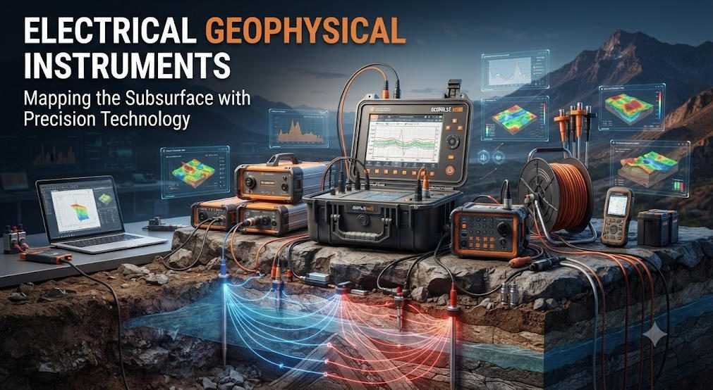
TIPS:Electrical geophysical instruments are core subsurface detection gear for global mining, water and engineering teams. This guide fully explains how electrical geophysical instruments work, core methods like ERT, IP and VES, and compares ERT resistivity meter against GPR/seismic tools. We also break down the industry-leading Geotech GIM ERT resistivity meter, its field application cases, error control and future AI geophysics trends for professional surveyors worldwide.
Ⅰ. Basic Definition of Electrical Geophysical Instruments
1. Core Concept
Electrical geophysical instruments measure underground medium electrical properties. The main detected parameters are subsurface resistivity and polarizability.
These devices send controlled low-frequency DC current into the ground. They capture voltage differences via electrode arrays. Then inversion software generates visual subsurface geological models.
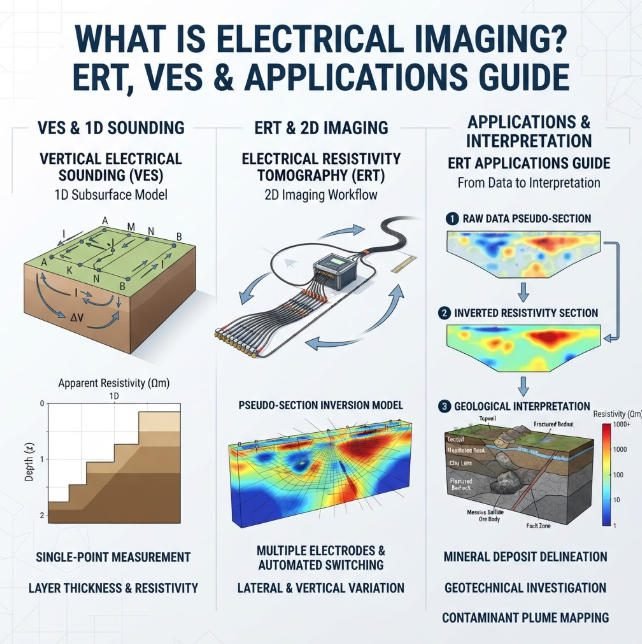
Electrical geophysical instruments cover three mainstream detection methods: ERT, IP and VES. Every professional geophysics team must equip ERT resistivity meter for daily field work.
2. Three Core Detection Methods Breakdown
(1) Electrical Resistivity Tomography (ERT)
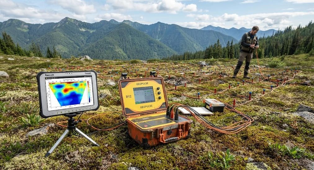
ERT uses multi-electrode surface or borehole arrays. It builds 2D section and 3D volumetric resistivity distribution maps.
Modern ERT hardware supports automated electrode switching. It completes thousands of measuring points in one single layout. Depth coverage ranges from 0.1m shallow road detection to 1,500m deep mineral exploration.
(2) Induced Polarization (IP)
IP tests the underground rock’s charge storage capacity. Metallic sulfide ores, clay and landfill contaminants show obvious IP anomaly signals.
New-generation ERT resistivity meter integrates synchronous IP measuring. Field teams save 40% survey time without separate equipment deployment.
(3) Vertical Electrical Sounding (VES)
VES uses fixed single-point four-electrode layout. It expands electrode spacing step by step to obtain vertical layered resistivity data.
VES fits fast aquifer thickness assessment and bedrock boundary confirmation. It works best as auxiliary matching equipment with ERT.
3. Modern Electrical Instrument Technical Features
- Multi-parameter synchronous collection: Resistivity + IP + self-potential all measured at once; dynamic range reaches 120dB.
- Full depth adaptability: Shallow urban pipeline scan to deep cross-hole geothermal monitoring.
- AI inversion algorithm upgrade: E4D built-in AI reduces imaging error below 5%.
- Extreme environment hardware: IP67 waterproof shell, -20℃ ~ +60℃ stable working temperature.
Ⅱ. Comparison Between Electrical Instruments & Other Geophysical Equipment
1. ERT Resistivity Meter VS Ground Penetrating Radar (GPR)
| Comparison Item | ERT Resistivity Meter | GPR Geological Radar |
|---|---|---|
| Effective Depth | 10m – 1,000m, adjust via electrode spacing | 0.1m – 30m, limited by clay conductive medium |
| Imaging Resolution | Medium (1–5m for 2D, 0.5–2m for 3D) | Ultra-high centimeter-level shallow resolution |
| Best Application Scenarios | Groundwater pollution tracking, karst collapse, deep mineral prospecting | Shallow pipeline locating, archaeological excavation, pavement defect scan |
| Anti-interference Ability | Weak metal pipe signal disturbance | Severe signal attenuation in high-clay soil |
Collaborative Field Case
Landfill leakage monitoring is a classic joint project. ERT resistivity meter maps the overall scope of pollution plumes. GPR pinpoints precise leakage hole positions for drilling verification.
2. VES Electrical Sounding VS Seismic Exploration Instruments
| Comparison Item | VES Vertical Electrical Sounding | Seismic Exploration System |
|---|---|---|
| Detection Physical Parameter | Underground layered electrical resistivity | Rock elastic wave P-wave & S-wave velocity |
| Deployment Cost | Lightweight cables, fast layout, low labor cost | Heavy seismic vibrator source, high transportation & labor expense |
| Advantage Scenarios | Aquifer thickness test, basement rock interface mapping | Deep oil & gas reservoir imaging, large fault tectonic analysis |
Data Fusion Application
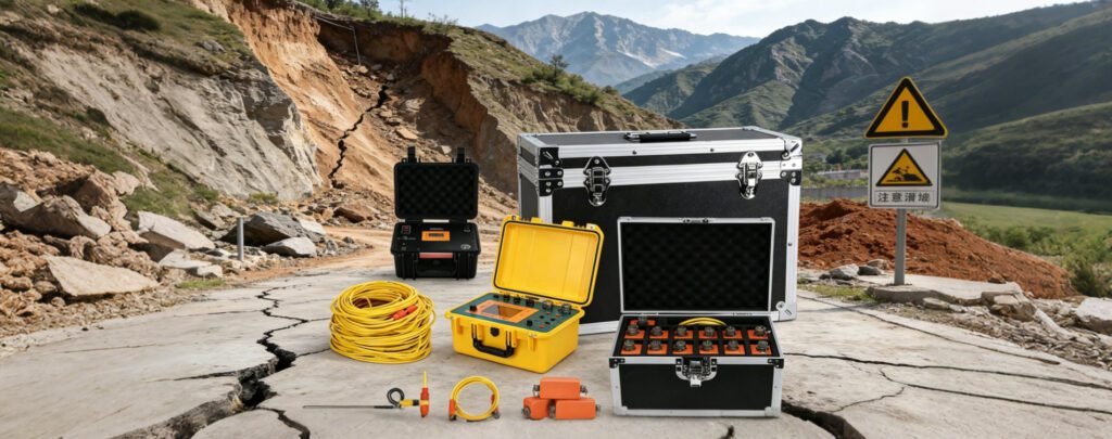
Landslide stability monitoring widely combines VES and seismic wave detection. VES tracks underground water content fluctuation via resistivity change. Seismic surface wave calculates rock shear strength to judge slide risk grade.
Ⅲ. Core Technical Solutions: 2D & 3D High-Density Electrical Survey
1. 2D Linear ERT Survey Technology
2D ERT arranges electrodes along straight survey lines. It outputs continuous vertical resistivity cross-section graphs.
The advantages are low cost and fast construction speed. It suits tunnel hidden fault detection, highway foundation stability scanning.
The limitation is weak lateral resolution for complex 3D geological structures such as karst cave groups.
2. Grid Layout 3D ERT Volumetric Imaging
3D ERT deploys electrodes in rectangular grid. The system collects multi-direction current and potential data to build complete 3D underground volume models.
Geotech GIM Series ERT resistivity meter supports 3D distributed cascading wiring. It breaks traditional single-line measurement limits, perfectly matching karst collapse, underground goaf and geothermal reservoir survey demands.
3. Cross-Hole Deep ERT Exploration Tech
Cross-hole ERT places electrodes inside two or multiple drill holes. It realizes ultra-deep detection beyond surface electrode depth limits.
Ag/AgCl non-polarizable electrodes reduce field noise interference. It becomes standard monitoring equipment for geothermal development and tunnel hidden fault advance prediction.
Real Mine Engineering Case
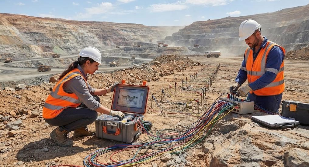
A large northern coal mine adopted Geotech 120-channel 3D cross-hole ERT electrical geophysical instruments. The equipment accurately mapped underground goaf water flow channels, eliminating mine flood hidden dangers in advance.
Ⅳ. Data Inversion Processing & Field Error Control for Electrical Instruments
1. Two Mainstream Inversion Algorithm Comparison
| Inversion Algorithm | Core Advantages | Application Limitations |
|---|---|---|
| Smoothness-Constrained Inversion | Fast computing speed, fit layered horizontal stratum | Blurs sharp boundaries of ore veins and karst cavities |
| Structural-Coupled Joint Inversion | Deep imaging precision boosted via seismic + ERT data fusion | Needs multi-source data calibration, high computing resource consumption |
2. Primary Field Error Sources & Correction Methods
- Electrode contact resistance anomaly: Clean electrode soil contact surface, pre-process raw data to eliminate abnormal potential points.
- Underground anisotropic rock medium: Add anisotropic model correction module inside inversion software.
- External electromagnetic industrial noise: Adopt shielded survey cables, measure at night with low industrial power interference.
Ⅴ. Full-Scenario Industrial Applications of Electrical Geophysical Instruments
1. Environmental Geology: Pollution & Groundwater Monitoring
3D ERT resistivity meter draws underground contaminant plume volume distribution. It supports long-term 4D time-lapse dynamic monitoring of landfill leakage and agricultural chemical pollution.
2. Mineral Exploration: Metal Ore Body Boundary Delineation
IP+ERT joint survey is the preferred solution for sulfide manganese, copper and lead-zinc ore prospecting. High polarizability abnormal zones directly mark ore-bearing rock areas.
Global mining teams widely select Geotech GIM electrical geophysical instruments for manganese deposit IP surveys as shown in 2026 industry news cases.
3. Urban Engineering: Subway & Road Hidden Hazard Detection
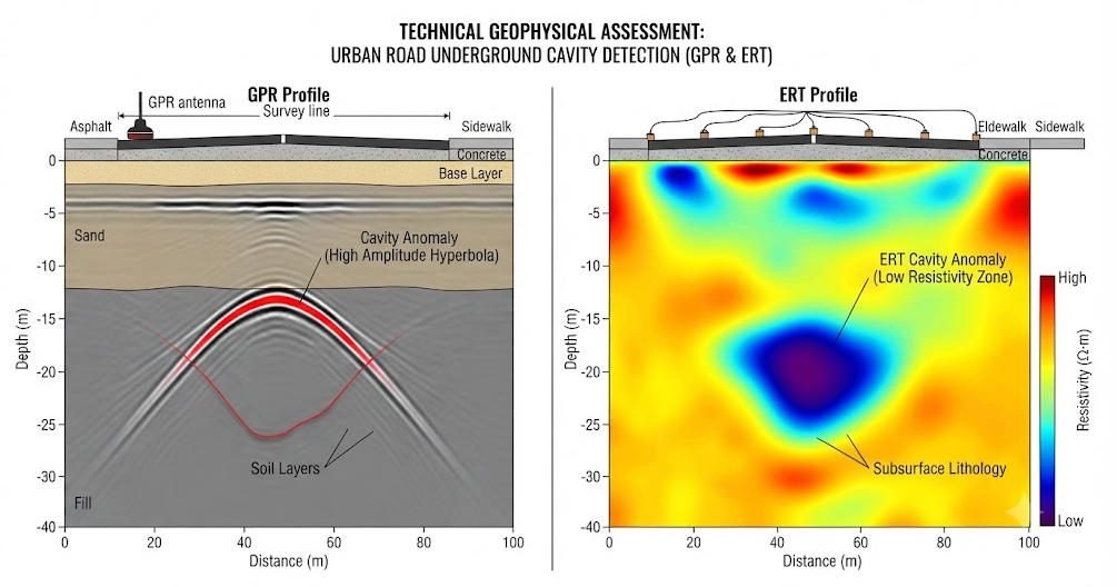
High-density shallow ERT cooperates with GPR to detect underground cavities, pipeline leakage and soft soil layers under urban roads and subway tunnels. It avoids road collapse construction accidents.
4. Hydrological Geology: Water Source & Aquifer Evaluation
VES and ERT match to calculate aquifer depth, thickness and water content distribution. Rural drinking water well positioning, mountain spring resource survey all rely on this electrical detection technology.
5. Geothermal & Oilfield Auxiliary Survey
Cross-hole deep ERT resistivity meter tracks geothermal reservoir fracture distribution. It assists oilfield team to judge stratum fluid content changes during extraction.
Ⅵ. Industry Innovation Trends of Electrical Geophysical Instruments (2026)
1. AI Intelligent Automatic Data Interpretation
CNN neural network built inside inversion software automatically identifies ore body, cavity and water-bearing anomaly zones. Artificial manual interpretation error reduced under 5%.
2. Drone-Borne Lightweight ERT System
Ultra-small low-power electrical geophysical instruments mount on UAVs. They complete fast regional grid survey in rugged mountain, swamp and no-road terrain without manual wiring.
3. 4D Time-Lapse Long-Term Dynamic Monitoring
Continuous automatic ERT data collection tracks seasonal groundwater flow, landslide slip surface movement and mine water inflow dynamic changes over months or years.
4. Geotech GIM Series Flagship ERT Resistivity Meter Core Advantages
As flagship electrical geophysical instruments from Geotech Instrument Co., Ltd., GIM series integrates ERT, IP and natural potential three functions:
- 24-bit high-precision A/D conversion, max 1,500m exploration penetration depth;
- 10-channel synchronous data acquisition, rolling measurement mode improves field efficiency by 60%;
- Export TXT/Excel data format, fully compatible with Res2DInv, EarthImager mainstream inversion software;
- IP67 waterproof, wide temperature working range, stable operation in desert, alpine and coastal saline environments.
Reference Sources
| Institution Full Name | Official Website URL |
|---|---|
| United States Geological Survey (USGS) | https://pubs.usgs.gov/fs/2020/3055/fs20203055.pdf |
| British Geological Survey (BGS) | https://www.bgs.ac.uk/ |
| NOAA National Centers for Environmental Information (NCEI) | https://www.nodc.noaa.gov/ |
| ORFEUS European Seismic Data Infrastructure | http://www.orfeus-eu.org/data/eida/ |
| AGI Geophysics Official Knowledge Base | https://helpdesk.agiusa.com/electrical-resistivity-imaging-field-survey/general-questions-about-eri/ |
FAQ
FAQ 1: What are the main types of electrical geophysical instruments?
Three core types cover all survey demands: ERT resistivity meter for 2D/3D resistivity imaging, IP induced polarization equipment for mineral ore detection, VES vertical electrical sounding device for vertical stratum layered analysis. Integrated all-in-one systems like Geotech GIM combine three functions into single portable host.
FAQ 2: What depth can ERT resistivity meter detect underground?
Shallow high-density ERT reaches 0.1–200m for urban engineering; deep cross-hole ERT matched with high-power cables achieves maximum 1,500m penetration depth for mineral and geothermal exploration. Actual depth depends on electrode spacing and ground rock conductivity.
FAQ 3: ERT or GPR, which equipment fits urban underground cavity detection?
For cavities deeper than 30m: choose ERT resistivity meter (electrical geophysical instruments). For shallow pipelines within 30m: select GPR radar. Best practice is joint deployment of two devices to balance detection depth and resolution.
FAQ 4: Can electrical geophysical instruments work in rainy, low-temperature wild environments?
Modern industrial-grade ERT systems such as Geotech GIM adopt IP67 fully waterproof shell, support stable work at -20℃ to +60℃. Rain, light snow, coastal high-salinity field environments will not damage normal measurement performance.
FAQ 5: What industries need electrical geophysical instruments most?
Top application industries: mineral exploration, urban engineering safety detection, groundwater resource survey, environmental pollution monitoring, geothermal and auxiliary oilfield exploration. Government geological bureaus, mining enterprises, engineering survey companies are core global buyers of ERT resistivity meter.