Welcome to Geotech!

Basic principles and applications of geophysical exploration
I. Introduction to geophysical exploration
What is geophysical exploration?
Geophysical exploration is a method of exploration using physical methods, with the physical property differences between different rocks, ores, and soils (mediums) as the material basis. It uses the principles of physics to observe and study the temporal and spatial distribution of geophysical fields to solve geological problems
(spatial distribution of medium physical properties).
In drilling wells and looking for water, geophysical exploration uses the physical properties of groundwater such as benign conductivity, stimulating effect, and radioactivity to find information such as the location, depth, water level, and water output of groundwater.
II. Electrical exploration
Based on the electrical property differences between rocks, ores, and soils (mediums), it is a method of solving geological problems by observing and studying the temporal and spatial changes of natural and artificial electromagnetic fields.
• Applications: Study geological structures; search for oil and gas fields, coal fields; search for metal and non-metal minerals; solve water resources, engineering surveys, geological environment problems, etc.
• Features: many parameters, many field sources, many methods; wide application space and wide application field
III. Natural electric field – magnetotelluric method
1. Overview
The basic principle of magnetotelluric method is to measure the changes in the natural electromagnetic field of the earth, which is mainly generated by lightning activity in the earth’s atmosphere. When these electromagnetic waves pass through the earth’s surface and enter the underground, they encounter underground media with different resistivities, causing the intensity and phase of the electromagnetic field to change. By arranging receiving electrodes on the surface, the components of the electric and magnetic fields can be measured. These components change with the change of frequency, and the changes of different frequencies reflect the electrical properties of the medium at different depths underground. By analyzing these measurement data, the apparent resistivity and phase information of the underground medium can be obtained, and then the resistivity distribution of the underground can be inferred.
2. Basic principle
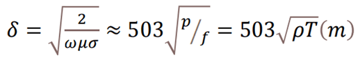
Based on the principle that electromagnetic waves of different frequencies have different skin depths in lossy media, the earth’s electromagnetic response sequence from high frequency to low frequency is measured on the surface, and the electrical structure of the earth from shallow to deep is obtained through relevant data processing and analysis.
Apparent resistivity:
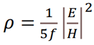
Skin Depth:
3. Advantages of magnetotelluric method
• Not shielded by high-resistance layer, strong resolution for high-conductivity layer;
• Strong lateral resolution;
• Mature data processing and interpretation technology;
• Great exploration depth, low cost, and convenient construction.
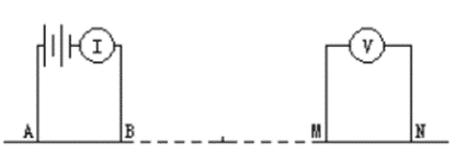
IV. Artificial electric field-resistivity method
1. Overview The resistivity method is an important method in geophysical exploration. It detects underground structures based on the difference in resistivity of underground media. The principle of this method mainly involves electromagnetic field theory, especially the distribution and propagation law of electric current in underground media.
2. Principle of resistivity method
(1) Injection and propagation of current:
In resistivity exploration, current is first injected into the ground through a set of electrodes. When these currents flow in the underground medium, they will be affected by the resistivity of the medium. Different media have different resistivities, so the propagation path and intensity of the current in them will also be different.
(2) Measurement of potential:
The potential difference in the underground medium is measured through another set of electrodes. The size and distribution of the potential difference can reflect the resistivity distribution of the underground medium. The greater the resistance on the path through which the current passes, the greater the potential drop.
(3) Calculation of resistivity:
According to Ohm’s law (V=IR), where V is voltage, I is current, and R is resistance, the resistivity of the underground medium can be calculated by measuring the voltage and the known current. In practical applications, multiple electrode arrangements and measurement methods are usually used to improve the accuracy of the results.
3. Advantages of the resistivity method
• Widely applicable, including dry, wet and water-bearing strata and different rock types and deposit types
• High resolution, can provide high-resolution underground electrical structure images
• Convenient, fast and low cost
Ⅴ. Artificial electric field-induced polarization method (induced polarization method)
1. Overview
Use the polarization characteristics of underground media to detect mineral resources. This method is mainly based on the electrochemical polarization phenomenon of mineral particles, that is, when current passes through rocks containing certain minerals, these minerals will be polarized due to their electrochemical characteristics, and release polarized current after the current is cut off.
The basic principle of induced polarization method is that when current passes through underground media, certain mineral particles will be polarized due to their electrochemical characteristics, generating a secondary electric field. When the excitation current is cut off, these mineral particles will gradually discharge and generate a decaying secondary current. By measuring the decay characteristics of this secondary current, information about the electrochemical properties of the underground medium can be obtained.
2. Principle of induced polarization method
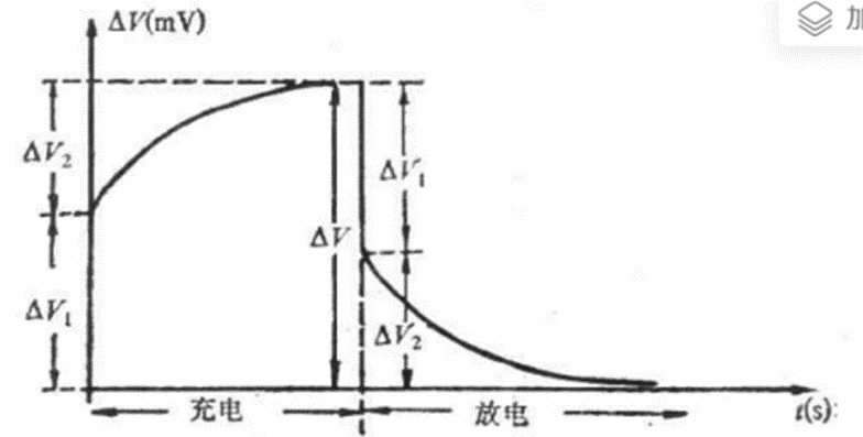
The process of underground electric field increasing over time when power is supplied is usually called charging process, and the process of electric field decaying over time after power is cut off is called discharging process.
•In this charging and discharging process, the phenomenon of additional electric field changing with time due to electrochemical action is called “induced polarization effect”.
3. Basic steps of induced polarization method
(1) Application of excitation current: Apply alternating current (usually a low-frequency sinusoidal waveform) to the underground medium through the ground electrode.
(2) Measurement of polarization response: Measure the electric field or potential difference generated by the underground medium during the application of the excitation current and for a period of time after it is cut off.
(3) Data analysis: Analyze the decay characteristics of the measured potential difference over time and calculate parameters such as polarization rate and charge.
4. Advantages of induced polarization method
• Flexible observation methods, different pole layout methods are selected according to different geological conditions and exploration targets.
• Strong anti-interference ability, strong in overcoming the influence of industrial stray current and natural earth current field.
• Strong applicability, not only can be used for metal mineral exploration, but also for groundwater, engineering and environmental investigations, etc.
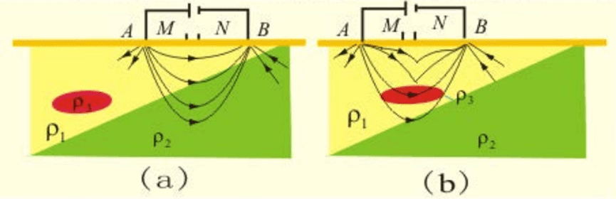
5. Pole layout method
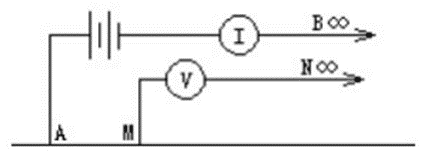
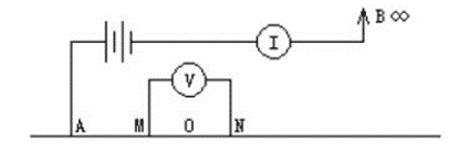
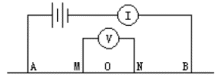
Ⅵ. Pole arrangement recommendations
(1) Terrain conditions
• In areas with flat terrain, an intermediate gradient device or dipole arrangement can be selected because these methods can provide better lateral resolution and shallower detection depth.
• For areas with complex terrain and difficult to conduct conventional ground measurements, the borehole induced polarization method can be considered. It can be measured in boreholes and is suitable for the detection of deep ore bodies.
(2) Geological targets
• For finding shallow ore bodies, a dipole arrangement can be selected because it can provide higher lateral resolution and help identify small-scale geological structures.
• If the target is a deep ore body or a larger geological body needs to be detected, a large-pole array induced polarization method can be selected to increase the detection depth and coverage.
VI. Magnetic exploration
1. Overview
A method of solving geological problems by observing and studying the laws of magnetic field changes based on the magnetic differences between rocks, ores, and soil (medium).
• Applications: Searching for magnetic minerals; searching for various minerals related to magnetic minerals; geological mapping; delineating rock bodies; geological structures, etc.
• Features: mature theory, light, fast, and low cost
• Application: rock mass delineation, fault structure
2. Coordination of magnetic exploration with other technical methods
• Electrical exploration
• Gravity exploration
VII. Gravity Exploration
1. Overview
Based on the density difference between rocks, ores, and soil (medium), a method of solving geological problems by observing and studying the changing laws of the gravity field.
• Applications: geological structure; delineating rock mass; finding minerals with large density differences; hydrological, engineering, and environmental geological problems; aerospace problems.
• Features: mature theory, light and fast
• Applications: groundwater, aquifers, and groundwater flow paths
2. Coordination of magnetic exploration with other technical methods
• Electrical exploration
• Seismic exploration
VIII. Seismic exploration
1. Overview
Based on the elastic difference between rocks, ores, and soil (medium), a method of solving geological problems by observing and studying the temporal and spatial changes of seismic waves.
• Applications: stratigraphic stratification; geological structure; finding oil and gas fields, coal fields; hydrological and engineering geological problems, etc.
• Features: large detection depth and high accuracy
• Seismic exploration classification: refraction wave method, reflection wave method, surface wave method
• Application: stratigraphic division, aquifer
2. Coordination of seismic exploration with other technical methods
• Electrical exploration
• Gravity exploration
• Magnetic exploration