Welcome to Geotech!



Services

What is IP Receiver? A Deep Dive into Modern Electrical Resistivity Imaging
1. Defining Core Concepts IP Receiver (Induced Polarization Receiver) is a geophysical instrument that measures subsurface electrical properties through high-density electrical methods (HDEM). Unlike traditional DC electrical sounding, which uses limited electrodes, modern IP receivers employ multi-channel systems (e.g., 64-128 electrodes) to…
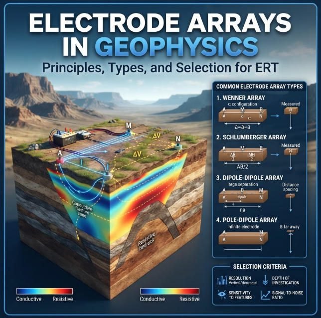
Electrode Arrays in Geophysics: Principles, Types, and Selection for ERT
Overview:Electrode arrays define how current enters the ground and how electrical potential differences are measured. Understanding Electrode Arrays helps survey teams design reliable Electrical Resistivity Tomography (ERT) investigations. This guide explains common configurations, geometric factors, depth sensitivity, and field limitations.…
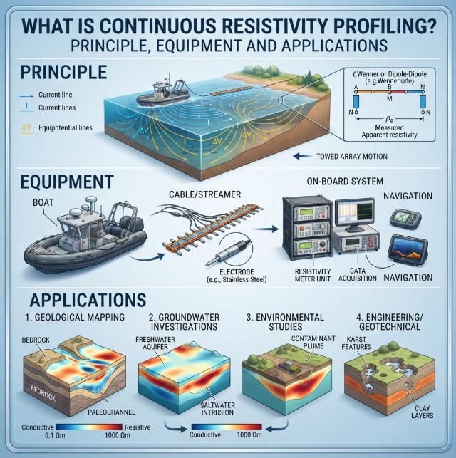
What Is Continuous Resistivity Profiling? Principle, Equipment and Applications
Overview:Continuous resistivity profiling (CRP) is a waterborne geophysical technique that maps sub-bottom electrical resistivity via towed electrode streamers. Continuous resistivity profiling delivers high-efficiency subsurface imaging for estuarine, riverine and lacustrine environments, supporting submarine groundwater discharge detection, sediment characterization and bedrock…
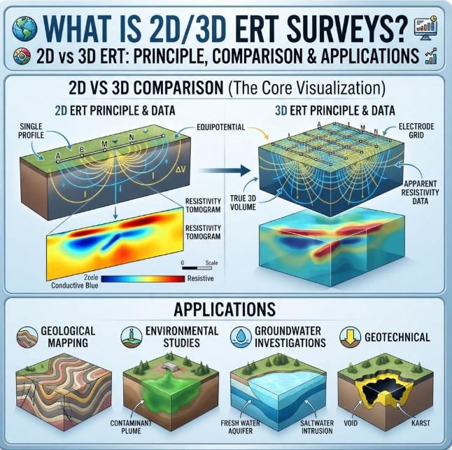
What is 2D/3D ERT Surveys? 2D vs 3D ERT: Principle, Comparison & Applications
Overview:2D electrical resistivity tomography delivers rapid cross-sectional subsurface imaging for linear survey corridors. 3D electrical resistivity tomography provides volumetric resistivity models for complex geological targets. This guide compares 2D electrical resistivity tomography and 3D electrical resistivity tomography across resolution, cost,…
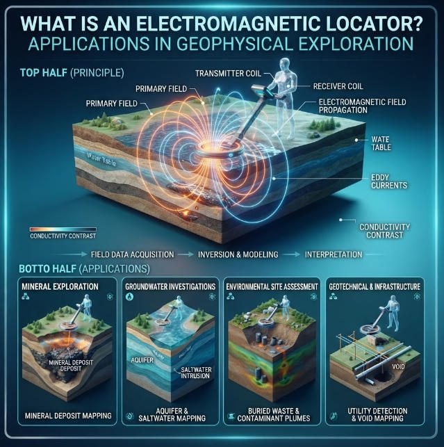
What is an Electromagnetic Locator? Applications in Geophysical Exploration
Overview:An electromagnetic locator detects subsurface targets through electrical property contrasts and electromagnetic field propagation. Electromagnetic locator technologies including ERT, DC sounding and IP deliver non-invasive subsurface mapping for mining, karst and utility engineering projects. Ⅰ. Definition and Core Principles 1.…